

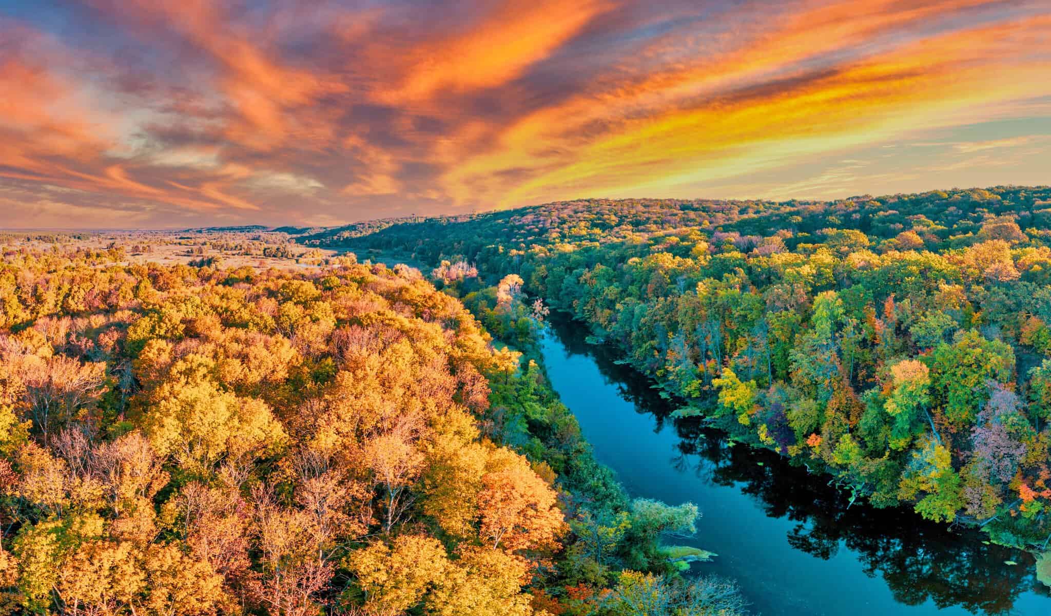
White Sands National Park gives boondockers a shot at camping outside developed campgrounds, right up against some of the most surreal scenery in New Mexico. The best boondocking spots sit just outside the park, on free public lands like Hollimon Lake and BLM-managed dispersed sites. These places offer quiet, no-fee camping in a natural setting, just a stone’s throw from the blindingly white dunes.
Inside the park, there’s limited backcountry camping, so you can sleep under the stars if you’re willing to hike in. If you want a few more comforts but still crave that proximity, state parks like Oliver Lee Memorial offer affordable dry camping nearby.
This area really caters to folks who like rustic, self-sufficient camping near one of the Southwest’s most otherworldly landscapes.
Location And Access
Boondocking near White Sands National Park usually happens on BLM public lands. Baylor Canyon Road Spur is a favorite, sitting close to the park and offering simple camping—no facilities, just you, the canyon views, and maybe a few hikers.
Sierra Vista is another nearby dispersed camping area, known for its peaceful vibe and easy access. People seem to love the quiet.
If you’re up for a bit more of a drive, Lincoln National Forest and the Sacramento Mountains open up more chances for boondocking. You’ll find remote spots tucked among the trees and rugged mountain terrain.
Some free camping areas are just a short drive from the park, but getting there might mean navigating dirt or rough roads. It’s smart to check road conditions before you head out—nobody wants to get stuck.
Oliver Lee Memorial State Park isn’t technically boondocking, but it does offer dry camping with some basic amenities. It’s a solid choice if you’re after a little comfort without straying too far from the dunes.
Backcountry camping inside White Sands is only for those willing to hike over the dunes and snag a permit. That’s more for backpackers than RV folks.
| Location | Type | Notes |
|---|---|---|
| Baylor Canyon Rd Spur | Boondocking (BLM) | No facilities, canyon views |
| Sierra Vista | Dispersed camping | Quiet, 4.7-star rating |
| Lincoln National Forest | Boondocking | Mountain terrain, remote spots |
| Sacramento Mountains | Boondocking | Forest and mountain access |
| Oliver Lee Memorial Park | Dry camping | Basic amenities, paid site |
Directions: How To Get There And What To Expect
White Sands National Park sits in southern New Mexico, east of Las Cruces and Alamogordo. Most folks get there via U.S. Highway 70, which links those two towns.
If you’re coming from Ruidoso or Cloudcroft, take Highway 244 or 82 south, then hop on U.S. 70. The drive’s not bad and gives you glimpses of the Sacramento and Guadalupe Mountains.
The park is near the northern edge of the Guadalupe range, which stretches into Texas. There’s no camping or boondocking allowed inside the park, so you’ll need to camp outside the boundaries.
Popular nearby spots include dispersed camping areas near Alamogordo and Sierra Vista. These spots work well for both RVs and tents.
Nearby towns like Alamogordo and Las Cruces offer basic services—gas, groceries, supplies. The park entrance is clearly marked, and there’s a visitor center for info.
Desert weather rules here: hot days, cool nights. Pack accordingly.
| Starting Point | Route | Distance to Park Entrance |
|---|---|---|
| Las Cruces | U.S. Highway 70 East | About 55 miles |
| Alamogordo | U.S. Highway 70 West | About 15 miles |
| Ruidoso | Highway 48 to 70 | About 90 miles |
| Cloudcroft | Highway 82 South to 70 | About 65 miles |
Plan ahead, since services thin out near the park. Cell coverage can be spotty, especially in the wild areas around White Sands.
Amenities And Activities
Boondocking near White Sands means you’re on your own for amenities. Most dispersed spots don’t have water, power, or restrooms, so come prepared and pack out everything you bring in.
At the park entrance, you’ll find picnic areas near the visitor center and a few more scattered among the dunes. They’re good for a break or a quick meal before you wander off into the sand.
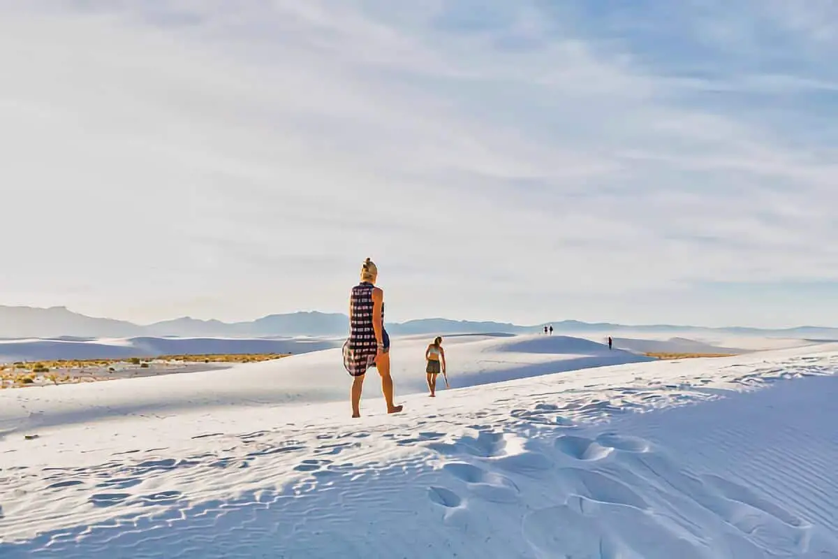
The main draw here is the landscape. The white sand dunes are perfect for hiking and sledding. People love walking or sliding down the soft, bright gypsum sand that goes on for miles.
Oliver Lee Memorial State Park, just outside the dunes, offers more shade under the pines and has designated campgrounds. You get restrooms, picnic tables, and a bit more comfort if you need it.
The Three Rivers Petroglyph Site is a short drive away and draws history buffs with its ancient rock carvings. Not a bad detour if you’re into that sort of thing.
Wildlife pops up all over—lizards, birds, small mammals that somehow thrive in the desert. Wildflowers sometimes bloom in spring or early summer, adding a splash of color to all that white sand.
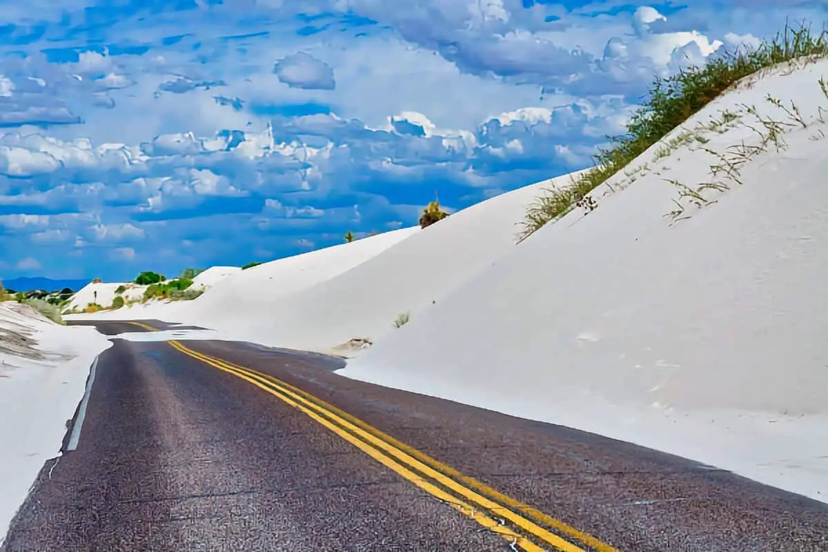
Dunes Drive is an 8-mile paved road that snakes into the park, making it easy to reach different parts of the dunes for hiking or snapping photos.
| Amenity/Feature | Availability Near White Sands |
|---|---|
| Water | Not available at dispersed campsites |
| Restrooms | Only at visitor center and designated areas |
| Picnic Areas | Available near visitor center and dunes |
| Fire Rings | Usually not allowed in boondocking locations |
| Wildlife Watching | Common near dunes and surrounding desert |
| Hiking Trails | Numerous trails on dunes and nearby parks |
Camping Regulations And Restrictions
White Sands National Park only allows backcountry camping. You can’t camp in developed campgrounds or bring your RV inside the park.
Backcountry sites sit away from the main areas, and you’ll need to hike across steep dunes and loose sand to reach them. That’s not for everyone—it takes some effort and decent backpacking skills.
Right now, backcountry camping is closed for site rehab. No word yet on when it’ll reopen, so check for updates before you plan your trip.
Alcohol isn’t permitted in any camping area. Park rules exist to protect the dunes and keep everyone safe.
No open campfires are allowed, so bring a portable stove if you want to cook. Pack out all your trash and waste—no exceptions.
If you need something more accessible, look at campgrounds outside the park. These spots usually take tents and RVs and offer a few more basic facilities.
| Regulation | Detail |
|---|---|
| Camping Type | Only backcountry allowed |
| RV and Car Camping | Not allowed inside the park |
| Fire | No open fires; use portable stoves |
| Alcohol | Prohibited |
| Current Status | Backcountry camping temporarily closed |
Leave No Trace
If you visit White Sands National Park or the Tularosa Basin, stick to Leave No Trace principles. The dunes and plants here are fragile—just a few careless steps can do real damage.
Try not to trample vegetation or disturb wildlife. Walking gently on the sand helps keep the place looking wild for the next folks.
Always pack out your trash. No bins in the dispersed camping areas, so whatever you bring in, you take out.
Campfires are discouraged or flat-out banned in much of the Tularosa Basin. Use a camp stove—it’s safer and better for the environment.
Set up camp on durable surfaces like established sites or bare sand to avoid harming plants and soil.
Following Leave No Trace keeps White Sands clean and beautiful. It’s just the right thing to do if you want future visitors to enjoy this weird, wonderful place too.
Information Resources
National Park Service
Bureau of Land Management (BLM)
NOAA Weather Service
Leave No Trace Center for Outdoor Ethics
Great White Sands National Park Boondocking Locations
16 Springs Canyon Boondocking Location
32.983111, -105.496773
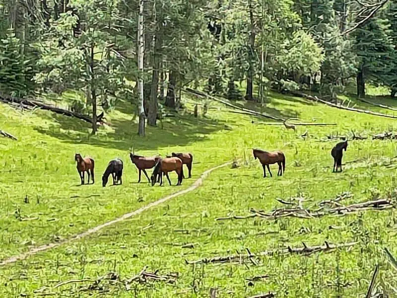
Located within the cool elevations of the Sacramento Mountains in Lincoln National Forest, the 16 Springs Canyon boondocking area is a quiet, forested destination suited for campers seeking a peaceful experience. The spot features a number of dispersed sites tucked among tall pines and mixed conifer, with most campsites situated along 16 Springs Canyon Road. There are no established facilities here—no restrooms, water, or trash services—so campers must come prepared to pack in and pack out.
Things to Do: Hikers will enjoy access to forest trails, including those leading to ridgelines with scenic views. Wildlife like elk, deer, and wild turkeys are common. During warmer months, the shaded environment and higher elevation make it a good escape from desert heat. Birdwatchers and photographers often use this area for quiet observation.
Directions: From Cloudcroft, take US-82 east, then turn north onto NM-130. Continue northeast on 16 Springs Canyon Road (Forest Road 64A). Campsites can be found along the roadside as you ascend.
Vehicle Access: High-clearance vehicles are recommended, especially during or after rainfall. Small RVs and trailers can make it, but larger rigs may have trouble navigating narrow areas or limited turnaround points.

Alamo Peak Road Boondocking Location
32.87325, -105.812037
Alamo Peak Road offers a rugged and secluded boondocking option just outside Cloudcroft. Set at high elevation within Lincoln National Forest, the area provides dispersed pull-off spots along a forest service road that winds through pine, fir, and aspen. No formal amenities are available—no toilets, fire rings, or water—so self-sufficiency is required. The elevation makes it a good summer escape and offers panoramic views in many locations.
Things to Do: Hike the trails nearby or explore the forest roads for scenic driving. Alamo Peak itself offers good photography opportunities. It’s also a good base for exploring Cloudcroft or nearby National Forest areas.
Directions: From Cloudcroft, drive south on NM-130 and look for Forest Road 568 (Alamo Peak Road). Turn onto the forest road and follow it uphill—several small clearings suitable for camping are available along the road.
Vehicle Access: High-clearance vehicles are highly recommended. The road can be narrow, steep, and rocky in sections. Not recommended for long trailers or large RVs due to tight turns and limited space for turning around.

Alamogordo Dry Canyon Boondocking Location
32.945999, -105.882152
Located just a few miles east of Alamogordo in the Lincoln National Forest, Dry Canyon is a convenient dispersed camping area popular among boondockers looking for quick access to nearby hiking and forest roads. The elevation provides a slight break from the desert heat, and the area is surrounded by high desert vegetation and rugged canyon walls.
Things to Do:
Dry Canyon Trailhead is within close reach, offering hiking and mountain biking opportunities. The area is also a good starting point for exploring the Sacramento Mountains. Birdwatchers and photographers will appreciate the sweeping views of the Tularosa Basin.
Directions:
From Alamogordo, head east on US-82 toward High Rolls. After about 4 miles, turn right onto Dry Canyon Road (also signed as County Road B022). Follow the road until it becomes gravel; dispersed campsites will begin to appear shortly thereafter.
Vehicle Access:
Most of the road is accessible by high-clearance vehicles. While small RVs and vans can manage the road during dry weather, low-clearance vehicles should proceed with caution. Avoid the area during or after heavy rains due to potential washouts.

Bailey Canyon Boondocking Location
32.978634, -105.7564
Bailey Canyon is located northeast of Cloudcroft and offers secluded forest camping with direct access to forest roads and hiking paths. This site sits in a mix of pine and fir trees, providing shade and cooler temperatures year-round. There are no amenities, but the area’s peaceful environment makes it a worthwhile stop for dry campers.
Things to Do:
Hiking and horseback riding are common here. Trails lead into deeper parts of the Lincoln National Forest, where wildlife sightings are frequent. It’s also a great area for stargazing due to the lack of light pollution.
Directions:
From Cloudcroft, head north on NM-130, then turn right onto Forest Road 162/568. Follow signage toward Bailey Canyon. Some dispersed spots are available off the forest road, particularly where the terrain flattens out.
Vehicle Access:
Best suited for high-clearance vehicles and small trailers. The roads are generally maintained, but deep ruts and loose gravel can present challenges for low-clearance cars or large rigs.

Barrel Spring/Sand Spring Boondocking Location
32.710895, -105.679884
Located south of the High Rolls area, this remote boondocking location offers rugged and scenic forest surroundings. Named for the nearby springs, it’s a quiet spot best suited for campers looking for solitude and natural beauty. There are no developed facilities or marked campsites, only flat spots cleared by previous visitors.
Things to Do:
The site is close to several lesser-known trails and old logging roads, making it a good base for hiking, exploring, or off-roading. It’s a quiet area for those seeking solitude and a break from more crowded sites near Cloudcroft.
Directions:
From High Rolls, take NM-6563 south until you reach Forest Road 162. Continue on this road southeast, watching for turnouts near Barrel and Sand Springs. Road signage may be minimal, so GPS coordinates are helpful.
Vehicle Access:
High-clearance vehicles are strongly recommended. The road can be rough, especially after storms, with exposed rocks and uneven surfaces. Travel trailers and low-clearance vehicles are not advised unless road conditions are confirmed to be dry and passable.

Bear Canyon Boondocking Location
32.710895 32.843285,
The Bear Canyon boondocking location sits within the Lincoln National Forest, providing access to scenic canyon views and dense pine forest. This dispersed area is secluded and ideal for campers looking to get off the beaten path. There are no developed facilities here—no water, restrooms, or trash service—so all supplies must be brought in. The surroundings offer a peaceful, forested escape with limited foot or vehicle traffic.
Things to Do: Hiking opportunities are available on nearby trails, and the area is popular for wildlife spotting, including elk, mule deer, and a variety of birds. The quiet setting makes it suitable for nature photography and stargazing.
Directions: From the town of High Rolls, head west along NM-82 and turn onto a forest road near the Bear Canyon area. Follow the road into the canyon area where several pullouts offer space for camping.
Vehicle Access: This location is best accessed with high-clearance vehicles due to uneven, sometimes rocky roads. Small trailers and vans are manageable, but longer RVs may struggle with turns and road width.

Cloudcroft Boondocking Location
32.78824, -105.78599
Located close to the mountain town of Cloudcroft, this boondocking location offers access to higher elevation camping surrounded by tall pines and mixed forest. The area features various clearings for dispersed camping along forest roads. There are no developed amenities—no toilets, potable water, or waste disposal—so campers must be self-contained and responsible for clean-up.
Things to Do: Nearby Cloudcroft has small-town shops and restaurants. In the surrounding forest, visitors can hike, mountain bike, or drive scenic routes. Several trails connect to the national forest system, offering forested hikes and elevation gain.
Directions: From Cloudcroft, head east on NM-82 and look for well-traveled forest roads on the north side. Dispersed campsites appear within a few miles and are marked by cleared spaces along the road.
Vehicle Access: Most forest roads are passable by small RVs, vans, and high-clearance vehicles. Wet conditions may create mud and erosion, so travel is not recommended during or after heavy rain without four-wheel drive.
Cloudcroft FR 568 Boondocking Location
32.972182, -105.736017
Forest Road 568, also known as Alamo Peak Road, is a favored route for boondocking near Cloudcroft. The road runs through a high-altitude forest and offers dispersed camping in small clearings and pullouts. No amenities exist here—no water, no bathrooms, and no trash service—making this a primitive but scenic place to camp.
Things to Do: This spot is great for hiking, wildlife viewing, and photography. Alamo Peak is nearby and offers a good vantage point. The forest setting provides shade in summer and colourful views in autumn.
Directions: From Cloudcroft, take NM-130 south and turn onto Forest Road 568. Dispersed sites begin within a couple miles and continue along the road as it climbs toward Alamo Peak.
Vehicle Access: High-clearance vehicles are recommended. The road becomes narrow and rocky in places. Shorter trailers and camper vans can navigate the road with caution. Larger RVs are discouraged due to limited turnaround areas.
Cloudcroft Hornbuckle Hill Boondocking Location
32.711091, -105.769456
Hornbuckle Hill offers a peaceful boondocking option just outside Cloudcroft, surrounded by thick forest and cooler mountain temperatures. This site is located off a lesser-used forest road and offers dispersed camping with no developed facilities. It’s a quiet, shaded spot ideal for campers looking to avoid crowds.
Things to Do: This location is ideal for hiking and wildlife watching. It’s also close enough to Cloudcroft for easy supply runs. The surrounding forest is known for its tall pines and quiet surroundings, suitable for relaxing off-grid.
Directions: From Cloudcroft, take NM-82 west toward the edge of town, then turn onto a forest road that leads toward Hornbuckle Hill. Follow the road uphill until you see suitable pullouts for camping.
Vehicle Access: The access road can be steep and narrow in some parts. A high-clearance vehicle is recommended. Short trailers or vans can work, but long RVs will face difficulty navigating tight sections.

James Canyon Campground Boondocking Location
32.90469, -105.505058
James Canyon offers a combination of formal and dispersed camping options along a scenic stretch of US-82 in Lincoln National Forest. This area includes small pull-through and back-in spots along the creek, most of which are available on a first-come, first-served basis. Though technically more developed than other sites, it still qualifies as primitive with limited amenities—there are vault toilets, but no water hookups or electricity.
Things to Do: Campers can enjoy shaded areas, creekside camping, and easy access to trails. It’s a good base for visiting Cloudcroft or exploring the wider forest. The canyon walls and tall trees offer a relaxing, sheltered atmosphere.
Directions: From Cloudcroft, head east on US-82 for about 5 miles. The James Canyon Campground entrance is well-marked on the right side of the road. Dispersed camping options can also be found along nearby pullouts.
Vehicle Access: Easily accessible by cars, campervans, and small RVs. Larger RVs can fit into some of the more open spots, but space may be limited during peak season.

La Luz Mill Ridge Boondocking Location
32.958174, -105.905814
The Mill Ridge area near La Luz is located on the western edge of the Lincoln National Forest and provides a rugged yet peaceful environment for dispersed camping. This site sits at a higher elevation, offering scenic views of the Tularosa Basin below. There are no developed amenities at this location—no toilets, no potable water, and no trash service. Campers must be fully self-contained and prepared for leave-no-trace practices.
Things to Do: The area is good for hiking, particularly along old logging and forest access roads. Wildlife such as deer, rabbits, and hawks are frequently spotted. Stargazing is also excellent due to low light pollution.
Directions: From La Luz, take La Luz Canyon Road east until it becomes Forest Road 162C. Continue climbing the ridge, and you’ll find pullouts and small clearings along the road suitable for camping.
Vehicle Access: High-clearance vehicles are strongly recommended due to washouts and rocky patches. This road is not suitable for larger RVs or trailers, but truck campers, vans, and SUVs will navigate it more easily.

Mayhill Denny Hill Boondocking Locationnny Hill Boondocking Location
32.839872, -105.530134
The Denny Hill area sits just northeast of Mayhill in the Lincoln National Forest. This dispersed camping site offers seclusion with several flat, forested clearings. The area is surrounded by mixed conifers and sits at an elevation that keeps temperatures cooler during summer. There are no developed amenities, so campers should bring their own water, waste disposal options, and all supplies.
Things to Do: This location is ideal for hiking and birdwatching. It’s also close enough to Mayhill for a short supply run if needed. The surrounding forest provides peaceful walking trails and shaded campsites.
Directions: From Mayhill, take NM-130 northeast, then turn onto Forest Road 162. Continue to Denny Hill Road (also marked FR 206), and watch for accessible clearings.
Vehicle Access: A high-clearance vehicle is recommended. The roads can become narrow and uneven, especially after weather events. Small trailers and vans can access it with care.

Mayhlll Forest Creek Boondocking Location
32.865803, -105.464947
Nestled within the Sacramento Ranger District of Lincoln National Forest, the Mayhill Forest Creek boondocking area offers a serene and accessible camping experience. Located along Miller Flats Road, this free, first-come, first-served site is managed by the U.S. Forest Service. At an elevation of approximately 6,795 feet, campers can enjoy cooler temperatures and the tranquil ambiance of a forested creekside setting. The area is characterized by its natural beauty, with the gentle sounds of the nearby creek enhancing the peaceful atmosphere.
Things to Do: The surrounding forest provides ample opportunities for outdoor activities. Hiking enthusiasts can explore various trails that meander through the diverse terrain, offering glimpses of local wildlife and native flora. Birdwatchers will find the area rewarding, with numerous species inhabiting the region. The proximity to the creek allows for leisurely walks and the chance to observe the ecosystem supported by the waterway. Additionally, the site’s location offers a convenient base for exploring other attractions within Lincoln National Forest.
Directions: From Mayhill, travel east on NM-82 for approximately 2 miles. Turn south onto Miller Flats Road and continue for about 1 mile. Look for suitable pullouts along the road where dispersed camping is permitted. Campers are advised to select previously used sites to minimize environmental impact.
Vehicle Access: The access road to the boondocking area is unpaved but generally well-maintained. Most vehicles, including small RVs and trailers, can navigate the road under normal weather conditions. However, during or after heavy rainfall, the road may become muddy and more challenging to traverse. High-clearance vehicles are recommended in such conditions to ensure safe access. Campers should always check current road conditions before planning their visit.
Please note that there are no amenities at this site. Campers must be self-sufficient, bringing their own water, waste disposal means, and adhering to Leave No Trace principles to preserve the natural environment.

Mayhill Hoosier Canyon Boondocking Location
32.761785, -105.625483
Hoosier Canyon offers a quiet and shaded dispersed camping area just south of Mayhill. Tucked between two ridges, the canyon provides wind protection and privacy. Campers will find several clearings off the dirt road. No amenities are available—there are no toilets, water sources, or trash bins.
Things to Do: The area is popular for hiking, especially along the canyon floor and adjacent slopes. Mule deer and wild turkeys are commonly seen. It’s also a good spot for reading, relaxing, and enjoying the mountain silence.
Directions: From Mayhill, head south on NM-130, then turn onto FR 568 and follow signs to Hoosier Canyon. Stay on this road until reaching suitable camping spots.
Vehicle Access: A high-clearance or 4WD vehicle is advised. The road into the canyon can be narrow and muddy during rainy conditions. Vans and truck campers can access it, but large RVs are discouraged.
Peackock Lane / FR 623 Boondocking Location
32.910645, -105.750734
Peacock Lane, also referred to as Forest Road 623, is a boondocking area northwest of Cloudcroft that offers forested clearings and a relatively quiet place to set up camp. The road runs through a dense section of Lincoln National Forest, providing natural shade and cooler temperatures. No amenities are available, and there are no designated campsites—campers select from existing pullouts along the road.
Things to Do: This location is suited for forest hikes and nature walks. Campers can also enjoy off-road driving in the area, though some side routes are limited to ATVs. The location is close enough to Cloudcroft for day trips and resupply.
Directions: From Cloudcroft, take NM-130 west, then turn north on FR 623. Dispersed camping spots appear a few miles in, often marked by fire rings or well-cleared areas.
Vehicle Access: FR 623 is generally passable by high-clearance vehicles. During dry conditions, vans and small trailers can navigate the road, but longer rigs will have limited maneuverability due to tight turns and tree cover.

Prestridge Hill Road -Mayhill Boondocking Location
32.821001, -105.626559
Prestridge Hill Road is a lightly trafficked forest road near Mayhill that offers dispersed camping with access to a quiet forest setting. The area sits within Lincoln National Forest and features several informal clearings suitable for boondocking. There are no developed facilities—no restrooms, potable water, or trash removal. Campers need to be fully self-contained and follow leave-no-trace guidelines. Shade is moderate due to scattered tree cover, and the elevation keeps temperatures cool, especially overnight.
Things to Do: Hiking is a primary activity, with old forest access roads and unmarked trails offering peaceful routes through mixed pine and oak terrain. Wildlife watching is common, with deer, elk, and a variety of birds in the area. It’s a peaceful location for those seeking solitude or a quiet spot to camp while exploring the broader Mayhill region.
Directions: From Mayhill, take NM-130 south for about a mile, then turn onto Prestridge Hill Road. Follow the road as it climbs into the forest. Dispersed camping sites begin appearing roughly a mile up the road.
Vehicle Access: High-clearance vehicles are recommended. During dry conditions, vans and smaller RVs can reach many of the turnouts, but the road becomes rough and narrow further in. Large trailers are not advised due to limited turnaround space.
 – Wils Canyon Cloudcroft Boondocking Location
32.801436, -105.731968
Wills Canyon lies southwest of Cloudcroft and offers a scenic dispersed camping experience in a forested mountain environment. The road winds through tall pines and opens up to a few flat spots ideal for boondocking. The elevation here is around 8,000 feet, so temperatures remain cool even during summer. There are no amenities, and all campers must be prepared to pack in water and pack out all trash.
Things to Do: The Wills Canyon area is great for hiking and horseback riding. The canyon connects to a network of trails and forest roads, including access to Bailey Canyon and Sacramento Rim areas. Photography, birdwatching, and quiet relaxation are popular here.
Directions: From Cloudcroft, take NM-130 west to FR 90 (Bailey Canyon Road), then turn onto Wills Canyon Road (FR 568). Dispersed sites are available along the roadside, especially where the canyon flattens out.
Vehicle Access: High-clearance vehicles are ideal. Some stretches of the road can become muddy or rutted after rain. Vans and small 4×4 RVs can access the area, but trailers longer than 20 feet may face maneuvering challenges due to tight curves and tree branches.
Great White Sands National Park Paid Campgrounds

Boles Acres – Dog Canyon Campground
32.7442, -105.9306
Located at the base of the Sacramento Mountains, the Dog Canyon Campground near Boles Acres offers boondocking close to the boundary of Lincoln National Forest. This location is more arid than those higher in elevation but provides striking views of the canyon walls. It’s primarily a dry camping site with no developed services—campers must bring their own water and remove all waste. The area is relatively quiet and far enough from main roads to avoid traffic noise.
Things to Do: Dog Canyon Trailhead is nearby, offering a steep but rewarding hike into the Sacramento Mountains. The area is also good for photography, rock formations, and desert wildlife viewing. It’s close enough to Alamogordo for resupply or day trips while still offering a backcountry feel.
Directions: From Alamogordo, head south on US-54 to Boles Acres. Turn east onto Dog Canyon Road and follow it until the pavement ends. Dirt pullouts along the road provide boondocking options.
Vehicle Access: The dirt road is in good shape in dry conditions, allowing access for most vehicles. Low-clearance cars may need to proceed slowly, especially after rain. Small trailers and camper vans are suitable. Larger RVs are possible but should stay closer to the base of the road where space is more available.
Frequently Asked Questions
Camping around White Sands National Park gives you options, from free public land sites to established RV parks nearby. It helps to know the locations, rules, and what to expect before you go.
What are the options for free camping in the vicinity of White Sands National Park?
You’ll find free camping on nearby BLM lands. These dispersed sites don’t have services, but they’re close to the park and let you soak up the scenery. Just bring all your own supplies and follow Leave No Trace.
Are there designated boondocking sites close to White Sands National Park?
There aren’t any official boondocking sites inside the park. But several public land areas nearby are popular for boondocking. You’ll get a remote, desert experience—just don’t count on hookups or amenities.
Can you recommend the best RV camping spots near White Sands National Park?
Boot Hill RV Resort in Alamogordo is the closest full-service RV park. It’s got 50 large sites, some pull-throughs for big rigs, and sits about 22 miles from the dunes.
Is there BLM land available for camping near White Sands National Park?
Yep. BLM lands near the park allow dispersed camping. Baylor Canyon Road Spur is a well-known spot. No facilities, so you’ll need to be self-sufficient.
What are the regulations for boondocking around White Sands National Park?
Boondocking outside the park follows federal and local rules. On BLM land, you can usually stay up to 14 days before moving on. Inside the park, backcountry camping needs a permit and has stricter guidelines to protect the dunes.
How can I find cabins or alternative accommodation near White Sands National Park?
Nearby towns like Alamogordo have cabins and other lodging. It’s a comfy alternative to camping, and you’re still close to the park. Try local rental sites or check with visitor centers for what’s available.