

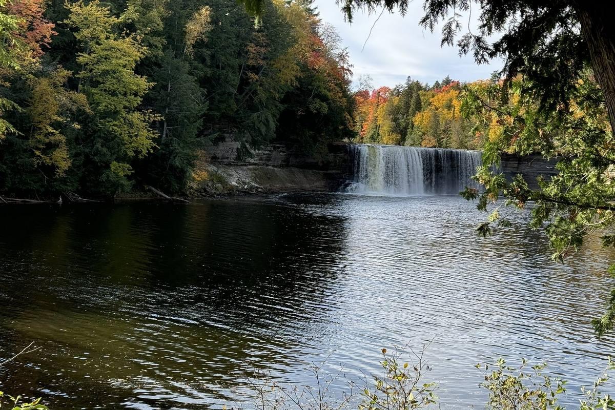
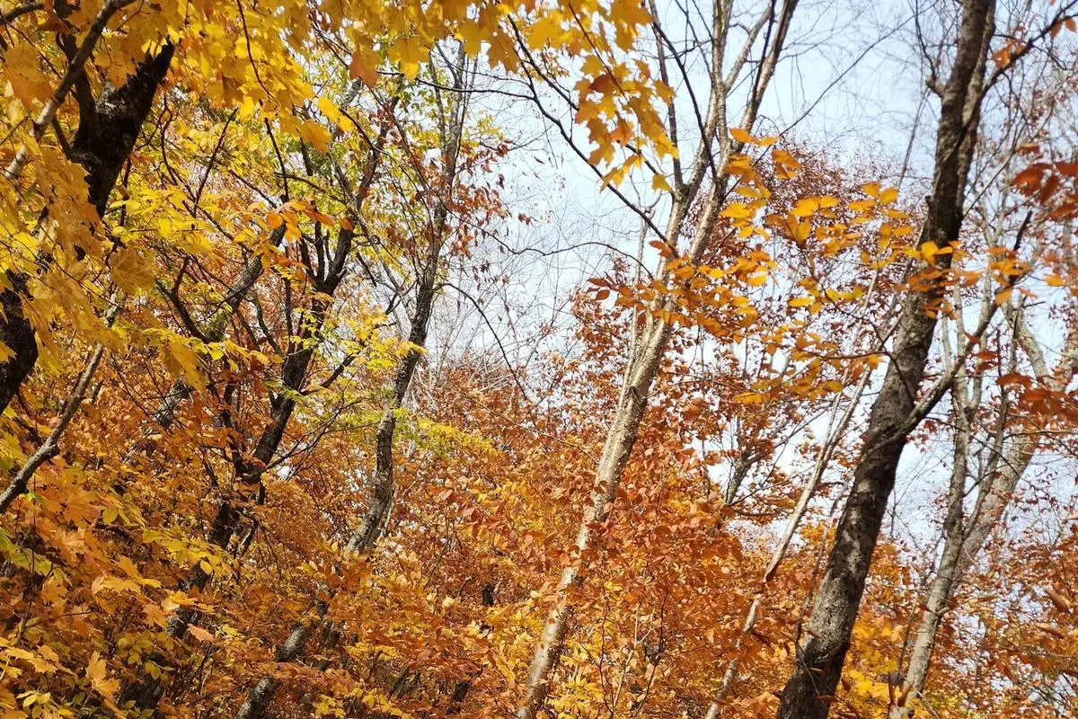
Michigan Up boondocking Michigan Up Boondocking Locations Essential Guide: If you’re heading to Michigan’s Upper Peninsula, boondocking spots aren’t hard to track down, especially in national forests like Hiawatha. These places give you free camping in wild, natural settings, but don’t expect much in terms of facilities.
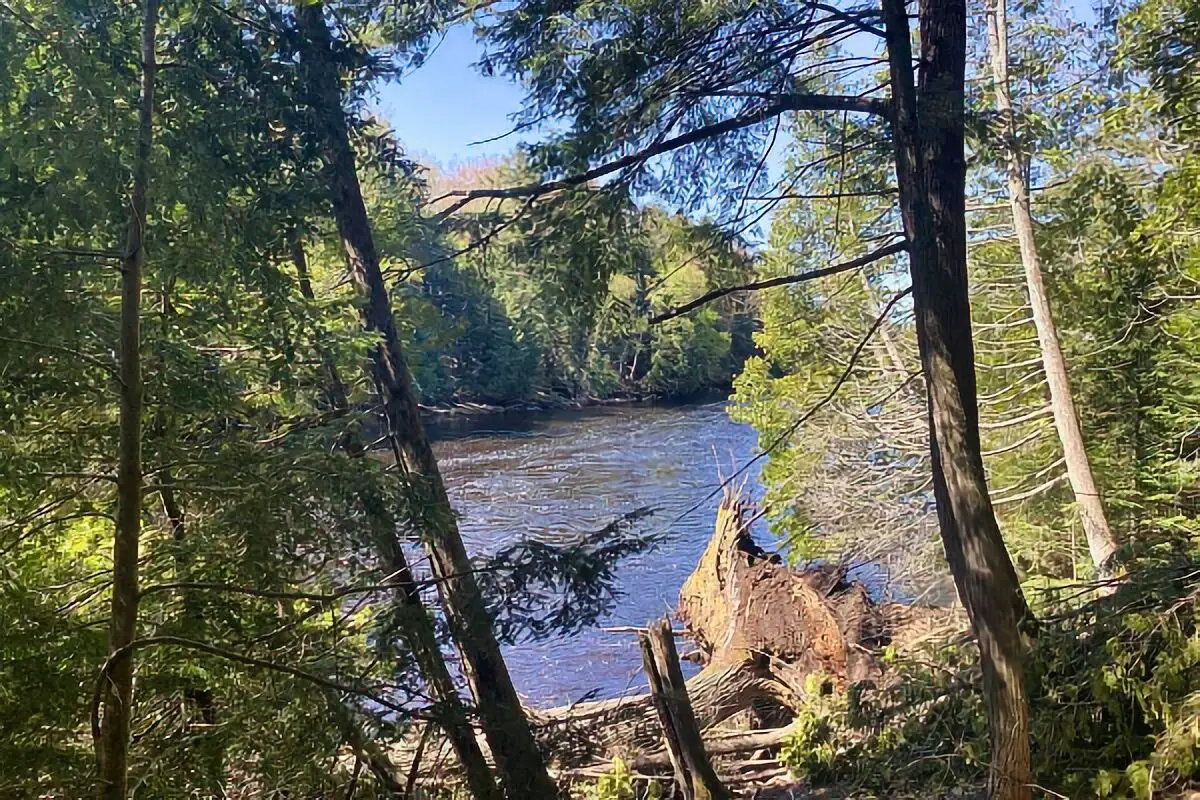
Hovey Lake in Hiawatha National Forest stands out. There are just a few campsites, each with a fire ring and picnic table. Not a ton of spots, but the lake makes it feel pretty peaceful.
We’ve also come across a bunch of options along Forest Road 2473C near Munising. That dirt road leads to several spots where you can park an RV of any size and camp for free. It’s public, managed by the Forest Service, and has a low-key vibe.
Most Michigan Up boondocking sites in the Upper Peninsula don’t have hookups or water, so we always roll in prepared. Some spots, like Hovey Lake, might have a restroom, but don’t count on it everywhere.
A few key things to know about UP boondocking:
- Almost all sites are primitive and free
- Some have picnic tables and fire rings
- Roads can be dirt or gravel
- RV length limits are usually pretty generous, if they exist
- Facilities vary; restrooms are hit or miss
We love these Michigan Up boondocking locations because they let us camp out in the wild, soak up nature, and keep costs almost nonexistent. Just plan ahead, respect the area, and you’ll have a good time.
Location Description
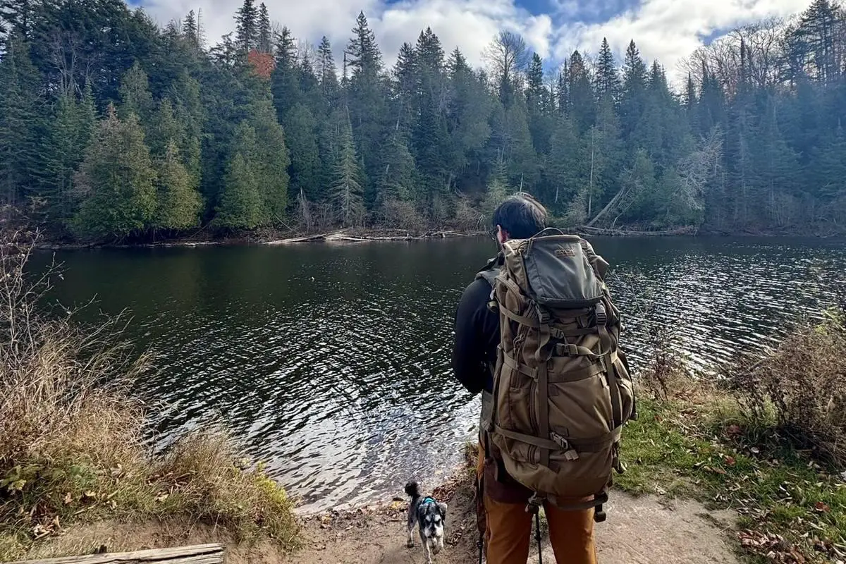
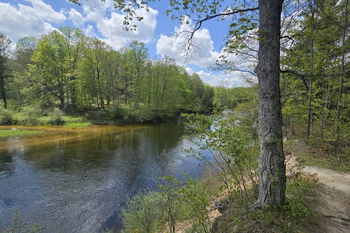
The Upper Peninsula (U.P.) of Michigan is packed with Michigan Up boondocking options for folks who want free, off-grid camping. Most are tucked away in national forests or remote spots, so if you’re after quiet and nature, this is the place.
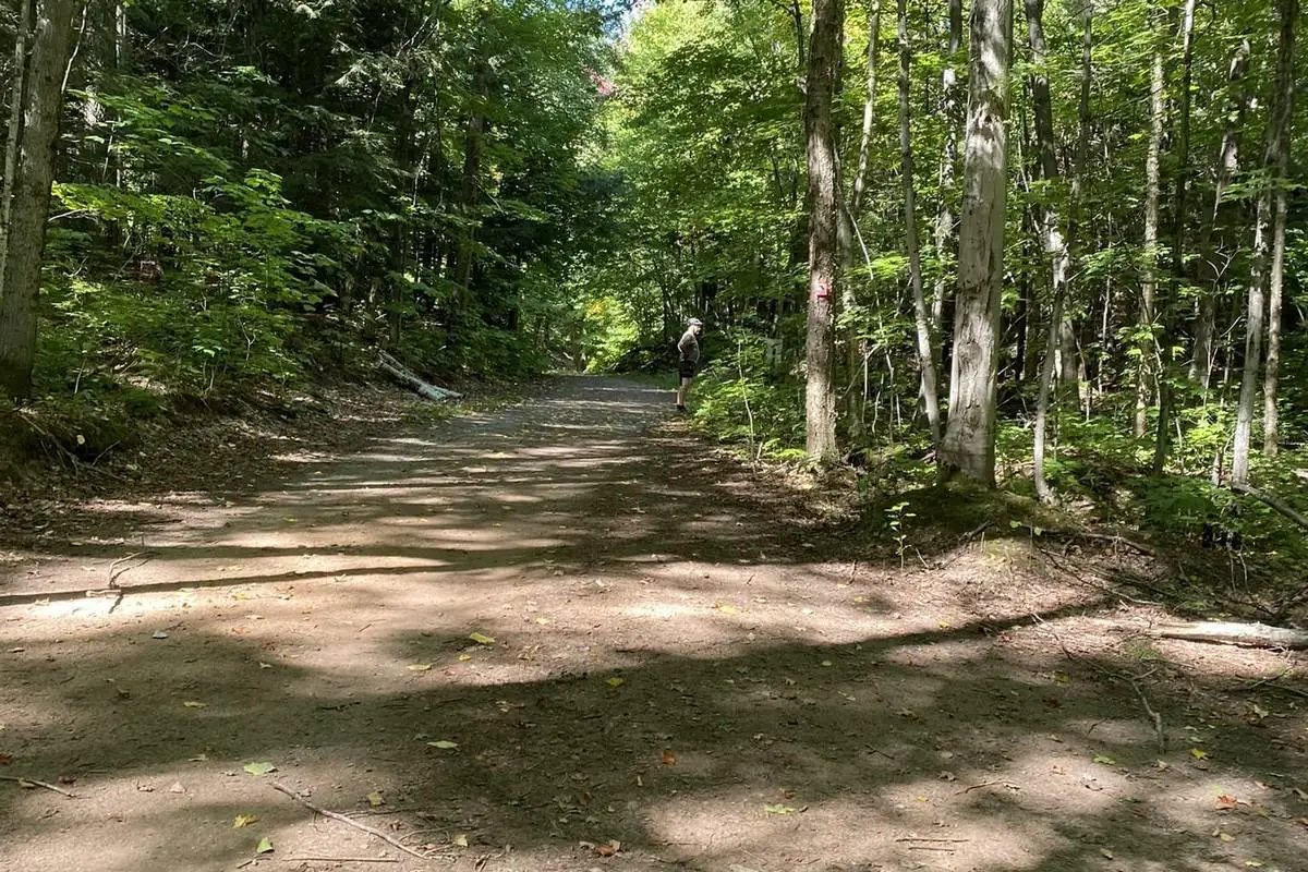
You’ll find a lot of these sites down dirt roads, sometimes miles from any pavement. That means you’ll need a vehicle that can handle a bit of rough driving. With all that seclusion, don’t expect services like water or electric hookups.
Hiawatha National Forest and parts of the Huron-Manistee National Forests are always popular Michigan Up boondocking. They’ve got small, dispersed sites with basics like fire rings and the occasional picnic table. Restrooms pop up here and there—Hovey Lake is one of the few with one.
You’ll get some beautiful views—forests, lakes, rivers. Elevations hover around 800 to 900 feet, and some sites near Munising are right by Lake Superior, so you get that beach-camping bonus.
Most places don’t care how big your RV is, so tents, vans, fifth wheels—it’s all good. Since it’s public land, we stick to Leave No Trace so the next folks can enjoy it too.
Popular Outdoor Activities Or Nearby Attractions
The Upper Peninsula is a playground for anyone who likes the outdoors. Hiking? Absolutely—places like the Nordhouse Dunes Wilderness Area have miles of trails and some gorgeous shoreline along Lake Michigan.
Snowmobiling is huge here. The U.P. has more than 3,000 miles of groomed trails, so if you’re into that, you’re in luck. The Porcupine Mountains are a favorite for winter rides.
Fishing and boating are a given, with all the lakes and rivers around. We spend a lot of time on the water, since freshwater is basically everywhere.
Wildlife watching is easy—deer, bears, birds, you name it. Just wandering the woods, you’ll spot something.
Here’s a quick list of what you can do:
- Hiking
- Snowmobiling
- Fishing
- Boating
- Wildlife watching
Nearby, you’ll find state parks, forests, and beaches—great for picnics, photos, or just relaxing.
One thing: pack for unpredictable weather. It can turn chilly fast, even in summer.
Directions
To get to these Michigan Up boondocking spots, we usually start out on highways like US-2 or M-28. Both run east-west and connect most towns and camping areas.
Most sites are down forest roads or dirt tracks. Forest Road 2473C near Munising is a good example. It’s about two miles from the paved road, so be ready for some rough patches.
Here’s a quick cheat sheet:
| Location | Nearest Highway | Road Type | Notes |
|---|---|---|---|
| Munising area | M-28, US-2 | Dirt forest road | Not a lot of signs, go slow |
| Hovey Lake Campground | M-28 | Dirt road | Small campground, easy to find |
| Other sites in the U.P. | Various | Forest roads | GPS coordinates help a lot |
We always bring a GPS or a phone with offline maps. Cell signal drops out a lot up here, so download maps before you leave.
When you’re on dirt roads, take it slow and watch for rocks, puddles, or random obstacles.
Signs can be sparse, so double-check your coordinates before you drive out. We like to carry a paper map from the National Forest Service or use a camping app.
Best advice? Plan for limited services and don’t rush—take your time getting to each spot.
Vehicle Access And Pricing
Vehicle access in the Upper Peninsula really depends on where you go. Some spots need a 4×4, especially if the road gets rough. Others are fine for most RVs—wide dirt roads, nothing too crazy.
Most sites are two or three miles from pavement, so you’ll want to be comfortable with a bit of off-road driving. Still, plenty are doable in a regular car or camper.
Boondocking here is almost always free, but a few places might ask for a permit or a small fee. For example:
| Permit Type | Cost | Notes |
|---|---|---|
| Michigan Vehicle Pass | $12 | For state residents with vehicle registration |
| State Property Pass | $17 | Anyone can buy, good for state lands |
| Out-Of-State Pass | $34 | Worth it if you’re visiting a while |
Daily park passes are usually $9, but you can skip those with the permits above.
Always check the rules for your chosen spot before you go. Some sites don’t care about RV length, others might. And yeah, even in summer, it gets cold—pack accordingly.
Boondocking’s all about freedom, but you’ve got to be ready for rough roads and the occasional permit.
Bureau of Land Management
Recreation.Gov
National Park Service
Over 10,000 Free Boondocking Locations
Boondocking Recipes for 1000’s Of Camping Meals
Leave No Trace
State Specific Information Links
Michigan Park Service
Michigan Fish and Game
Department of Natural Resources
Boondocking On the Up – Michigans Upper Peninsula

McDonald Lake Park Boondocking in Ironwood, MI
46.390462, -90.013754
McDonald Lake Park in Ironwood, Michigan, is a quiet Michigan Up boondocking spot located within the boundaries of the Ottawa National Forest. It offers a primitive and secluded camping experience. The park features six tent sites—three on the shoreline with tent pads and fire rings, and three more on a nearby island that are only accessible on foot or by small watercraft. This site supports Ottawa National Forest boondocking with a peaceful, natural setting ideal for off-grid stays.
Things to Do:
Campers enjoy activities like fishing and canoeing on McDonald Lake, hiking nearby trails, and relaxing in a tranquil wooded environment. Wildlife sightings and stargazing are common due to low light pollution.
Directions:
From Ironwood, take Lake Road south for 5 miles. Turn onto McDonald Dam Road and follow it east for about 1 mile. The unpaved road is generally accessible by most vehicles, but high-clearance is recommended during wet conditions.
Vehicle Access:
The access road is narrow and unpaved. Small vehicles, SUVs, and pickup trucks can typically reach the sites without issue.
RV and Camping Trailer Information:
This site is best suited for tent camping. Larger RVs and trailers are not recommended due to limited space and lack of turnarounds.
Paid or Permit Sites:
Camping is free and no permits are required. The stay limit is 15 consecutive nights as outlined by Ottawa National Forest regulations for dispersed use areas.
Ottawa NF Boondocking in White Pine, MI
46.70982, -89.76244
This Michigan Up boondocking area near White Pine offers Ottawa National Forest boondocking in a quiet, undeveloped section of forest land. There are no designated campsites, giving campers flexibility in choosing a spot that fits their needs.
Things to Do:
Visitors can explore hiking trails, observe wildlife, and visit the Porcupine Mountains nearby. This area is well-suited for campers who prefer solitude and forest immersion.
Directions:
From White Pine, head east on M-64 for about 2 miles. Turn left onto South Boundary Road and drive approximately 5 miles. Look for forest openings suitable for camping.
Vehicle Access:
The area is accessed via gravel forest roads. Conditions vary with weather. High-clearance vehicles are recommended.
RV and Camping Trailer Information:
Small trailers and camper vans may be used, but the terrain is not suited for large RVs due to limited maneuvering space.
Paid or Permit Sites:
No payment or permits are needed. Campers must adhere to Ottawa National Forest rules including a 16-night stay limit per location.

FR 360 Boondocking in Marenisco, MI
46.66874, -89.61162
FR 360 offers Ottawa National Forest boondocking in a quiet forested area near Marenisco. It includes several small Michigan Up boondocking clearings used as primitive campsites. This area is peaceful and shaded, with informal fire rings and space for tents or small vehicles.
Things to Do:
Nearby Lake Gogebic provides options for fishing and paddling. Hikers can explore local forest roads or seek out trails in the Ottawa National Forest.
Directions:
From Marenisco, drive east on M-64 for 2 miles, then turn left onto FR 360. Follow the road for about 1 mile to find open camping areas.
Vehicle Access:
Forest Road 360 is unpaved and can be rough. High-clearance vehicles are advised, especially during wet weather.
RV and Camping Trailer Information:
The sites are small and suitable for tents or compact campers. Large trailers or RVs are not advised.
Paid or Permit Sites:
Camping is free, and no permits are required. A 16-day limit applies as per Ottawa National Forest boondocking camping rules.

Matchwood Boondocking in Ewen, MI
46.496899, -89.427439
Located in Ewen, Michigan, the Matchwood Michigan Up boondocking is part of the Ottawa National Forest and supports dispersed camping. It is well-suited for Ottawa National Forest boondocking, offering unmarked, natural clearings along forest access roads.
Things to Do:
This remote location is good for quiet camping, walking along forest paths, birdwatching, and stargazing. It is within driving distance of Lake Gogebic for additional outdoor recreation.
Directions:
From Ewen, take M-64 north for 5 miles. Turn right onto Matchwood Tower Road and continue 2 miles into the forest to find open camping spots.
Vehicle Access:
Gravel roads lead into the camping area. Conditions vary seasonally. A high-clearance vehicle is recommended.
RV and Camping Trailer Information:
Matchwood can accommodate small trailers and vans. Large RVs may struggle with space and road access.
Paid or Permit Sites:
Camping is free, and no permit is required. Maximum stay is 16 consecutive nights under Ottawa National Forest policy.

Robbins Pond Boondocking in Bruce Crossing, MI
46.381097, -89.228297
Robbins Pond, located near Bruce Crossing, offers Michigan Up boondocking camping with access to the Ottawa National Forest. The area supports Ottawa National Forest boondocking with unmarked camping spots around a small pond.
Things to Do:
Popular activities include fishing at Robbins Pond, hiking nearby forest trails, and enjoying the quiet surroundings.
Directions:
From Bruce Crossing, head south on M-28 for 1.5 miles. Turn east on a local forest road and follow signs or GPS toward Robbins Pond.
Vehicle Access:
The road to the pond is gravel and may be muddy or rutted. High-clearance vehicles are recommended.
RV and Camping Trailer Information:
This site is appropriate for tents and small trailers. Large RVs may not be suitable due to limited space and access road conditions.
Paid or Permit Sites:
No permits or fees are required. Campers must follow Ottawa National Forest rules, including the standard 16-day stay limit.
Burned Dam Boondocking in Watersmeet, MI
46.313999, -89.053001
Burned Dam is a quiet and remote Michigan Up boondocking spot offering Ottawa National Forest boondocking near the Middle Branch Ontonagon River. The area provides designated campsites with fire rings and picnic tables, while still maintaining a rustic feel. It is tucked deep in the forest and has a scenic river nearby, making it a peaceful location for those seeking off-grid stays.
Things to Do:
Campers enjoy trout fishing in the river, nature walks through the forest, and relaxing by the water. The surrounding woods are also good for birdwatching and photography.
Directions:
From Watersmeet, head north on US-45 for about 4.5 miles. Turn east onto Old US-2, then south on Forest Road 4500 and follow signs to Burned Dam Campground.
Vehicle Access:
The access roads are gravel but manageable for most vehicles in good weather. Low-clearance vehicles should use caution.
RV and Camping Trailer Information:
Small to mid-size trailers and camper vans can access the sites. Large RVs may find turning space limited.
Paid or Permit Sites:
Burned Dam is a free site managed under Ottawa National Forest guidelines. No permit is needed, and the stay limit is 16 consecutive days.

Bond Falls Flowage Boondocking Location in Bruce Crossing, MI
46.408591, -89.129778
Bond Falls Flowage offers one of the more scenic Ottawa National Forest, Michigan Up boondocking spots with lakeside views and quiet, open spaces. Located near a reservoir, this site gives campers a peaceful place to relax and engage in water-related recreation.
Things to Do:
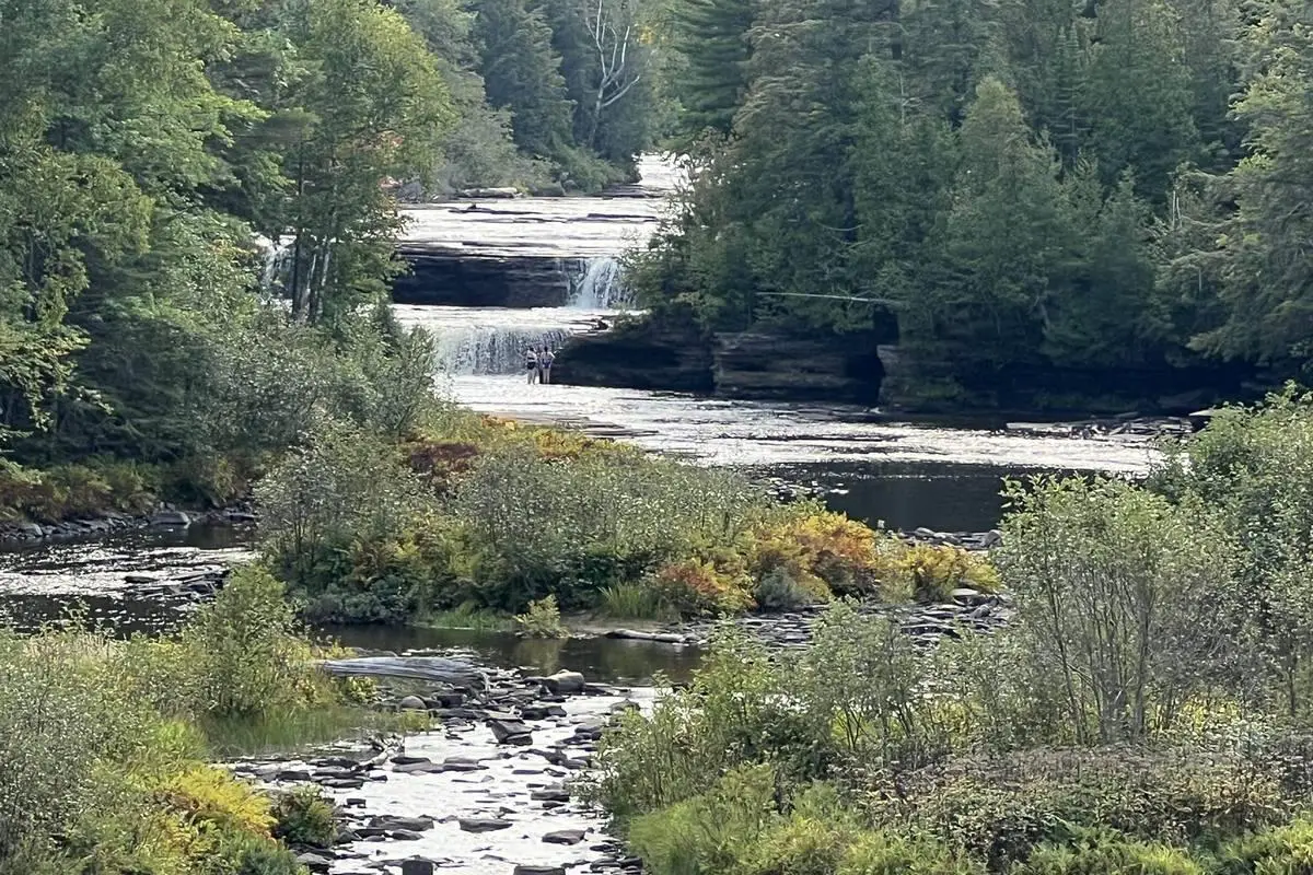
Fishing and kayaking are popular here. The nearby Bond Falls Scenic Site is a short drive away and features a stunning waterfall with accessible walking paths.
Directions:
From Bruce Crossing, take US-45 south to Bond Falls Road, then follow signs toward the boat launch area. Dispersed sites can be found along the edge of the flowage.
Vehicle Access:
The road into the site is mostly gravel and suitable for vehicles with moderate clearance.
RV and Camping Trailer Information:
Small to mid-size RVs and trailers can use the area near the water, though maneuvering space is limited.
Paid or Permit Sites:
Free to use under Ottawa National Forest rules. No permits required. The 16-day stay rule applies to dispersed camping.

Trout Creek Boondocking in Trout Creek, MI
46.4766, -89.013771
Located close to the town of Trout Creek, this Michigan Up boondocking offers Ottawa National Forest boondocking just a short distance off the main road. While semi-primitive, it offers easy access and is suitable for short or overnight stays.
Things to Do:
Local forest trails and creeks provide space for walking, birdwatching, and casual exploration. Trout fishing is also an option in nearby waters.
Directions:
From Trout Creek, drive west on M-28. Look for local side roads leading into the forest about 2 miles out of town.
Vehicle Access:
Easily accessible for most passenger vehicles, even without four-wheel drive, due to improved dirt roads.
RV and Camping Trailer Information:
This site is accessible for small RVs and trailers. There are limited turnaround spots, so large rigs are not advised.
Paid or Permit Sites:
Camping is free and does not require a permit. As part of Ottawa National Forest lands, the stay limit is 16 days.

Sparrow Rapids Boondocking in Trout Creek, MI
46.504776, -88.94735
Sparrow Rapids is a rustic Ottawa National Forest Michigan Up boondocking location set along the East Branch Ontonagon River. It offers both dispersed and designated sites in a shaded, wooded setting. A small bridge crosses the river nearby, making for a scenic camp environment.
Things to Do:
Popular for kayaking, fishing, and walking along the gravel forest roads. The peaceful river adds to the overall appeal.
Directions:
From Trout Creek, head north on M-28, then take Forest Road 16 east. Follow signage for Sparrow Rapids Campground.
Vehicle Access:
Access road conditions vary but are typically drivable with mid-clearance vehicles. Use caution during wet weather.
RV and Camping Trailer Information:
Best for tents and small camper vans. Larger trailers may have difficulty with road width and turning space.
Paid or Permit Sites:
Free camping with no permit required. As with all Ottawa National Forest dispersed camping areas, the stay limit is 16 consecutive days.

Finger Lake Boondocking in Iron River, MI
46.11667, -89.00719
Finger Lake is a serene location ideal for Ottawa National Forest boondocking with lakeside dispersed sites and quiet wooded areas. The lake is small but beautiful, and the surroundings provide privacy and space to set up a peaceful base camp.
Things to Do:
Fishing and canoeing on the lake are popular. Campers also enjoy hiking nearby trails or relaxing at the shoreline.
Directions:
From Iron River, head east on US-2. Turn onto Pentoga Trail, then take a local forest road north toward Finger Lake. Sites can be found around the shoreline.
Vehicle Access:
Forest roads are unpaved and can be rough. High-clearance vehicles are advised for navigating rutted or muddy areas.
RV and Camping Trailer Information:
Small RVs and trailers can be used if conditions are dry. Larger units are not advised due to limited space and road conditions.
Paid or Permit Sites:
Camping is free and no permit is required. Standard Ottawa National Forest rules apply, including a 16-day maximum stay.

Timber Lake Boondocking in Iron River, MI
46.14477, -88.82229
Timber Lake offers a quiet, lakeside setting ideal for Ottawa National Forest and Michigan Up boondocking. The area features dispersed sites near the water with easy access to nature. It’s a peaceful choice for campers who want to stay close to the lake and forest without crowds.
Things to Do:
Boating, fishing, and canoeing are popular on Timber Lake. There are also forest roads for walking or mountain biking.
Directions:
From Iron River, head east on US-2, then take County Road 657 north to FR 2130, which leads toward the lake and nearby sites.
Vehicle Access:
Access roads are mostly gravel and passable for vehicles with average clearance. During wet seasons, some soft spots may appear.
RV and Camping Trailer Information:
Timber Lake can accommodate small to mid-sized RVs and trailers. Maneuvering space is limited near the lake edge.
Paid or Permit Sites:
Camping is free under Ottawa National Forest guidelines. No permit is required, but stays are limited to 16 days per site.

Paint Forks Boondocking in Iron River, MI
46.232197, -88.717903
Paint Forks provides remote access for Ottawa National Forest Michigan Up boondocking near the Paint River. It’s a dispersed site area with wooded surroundings, offering solitude and access to river activities.
Things to Do:
Fishing and kayaking on the Paint River are popular. The area is also good for wildlife spotting and hiking short forest paths.
Directions:
From Iron River, drive northeast along M-189 and then take a forest road toward the Paint Forks area. Signs may be minimal, so maps are recommended.
Vehicle Access:
Forest roads are rough in places, so high-clearance vehicles are recommended. Conditions can change depending on weather.
RV and Camping Trailer Information:
Most suitable for camper vans, truck campers, or small trailers. Large rigs are discouraged due to road conditions and limited space.
Paid or Permit Sites:
Free camping under the Ottawa National Forest regulations. No permits are necessary. A maximum stay of 16 days applies.

Blockhouse Boondocking Location in Iron River, MI
46.267239, -88.651428
Blockhouse is a forested location used for Ottawa National Forest Michigan Up boondocking that offers dispersed camping space tucked away in the woods. While primitive, it provides seclusion and quiet for campers looking to stay off-grid.
Things to Do:
Hiking nearby forest trails and birdwatching are common. It’s also a good area for scouting and relaxing in a natural setting.
Directions:
From Iron River, head northeast on M-189. Then take local forest access roads east toward the Blockhouse location. Signage is limited.
Vehicle Access:
Gravel roads can be uneven. A mid- to high-clearance vehicle is recommended, especially in wet or muddy conditions.
RV and Camping Trailer Information:
Smaller RVs and trailers can manage the terrain if road conditions are dry. Larger vehicles are not advised due to tight turns and forest growth.
Paid or Permit Sites:
The site is free for camping with no permit required. All Ottawa National Forest boondocking rules apply, including a 16-day stay limit.
Paid Campgrounds
Bates Township Park Campground in Iron River, MI
46.129448, -88.589562
Bates Township Park Campground sits on Sunset Lake, offering a maintained site with modern amenities. The park provides a quiet lakeside setting with space for both tents and RVs.
Things to Do:
Visitors can enjoy swimming, boating, and fishing on the lake. A playground, picnic area, and walking trails are also available.
Directions:
From Iron River, head east on US-2, then turn north on Sunset Lake Road to reach the park entrance.
Vehicle Access:
Fully paved roads lead into the campground, making access suitable for all types of vehicles, including large RVs and trailers.
RV and Camping Trailer Information:
RV hookups are available. Most sites support electric and water connections, and some offer sewer.
Paid or Permit Sites:
Camping fees apply. As of recent data, standard campsites are approximately $25 per night. Payment is made onsite or through township contact.
Curry Park Campground in Ironwood, MI
46.46382, -90.18407
Curry Park is a city-run campground offering convenient accommodations close to downtown Ironwood. It is a good stopover for travelers looking for essential services and easy access.
Things to Do:
Nearby attractions include the Iron Belle Trail, historic sites in Ironwood, and small shops and diners. The park itself has open green space and a playground.
Directions:
Located just off US-2 on the east side of Ironwood, the park is easy to locate and access.
Vehicle Access:
Paved roads throughout make the campground accessible to any size vehicle.
RV and Camping Trailer Information:
Full hookups are available. The park accommodates all sizes of RVs and trailers.
Paid or Permit Sites:
Campsites are approximately $20–$25 per night. Fees are payable on-site or via city registration.
Sturgeon River Campground in Covington, MI
46.57012082076913, -88.65650699999999
Sturgeon River Campground is a managed site located near Covington, close to the river, with shaded sites and basic amenities. The location is peaceful, suited for camping and small recreational groups.
Things to Do:
Fishing and paddling on the Sturgeon River are primary attractions. Hikers can explore nearby trails in the surrounding woods.
Directions:
From Covington, head south on local forest roads. Maps or GPS are recommended due to limited signage.
Vehicle Access:
The access road is gravel but passable for most vehicles in dry weather. Some caution is needed after rain.
RV and Camping Trailer Information:
Best for small RVs, trailers, or tents. There are no full hookups, but some sites are level and suitable for overnight RV stays.
Paid or Permit Sites:
Fees apply, generally ranging from $10 to $15 per night. Payment is made at the self-pay station or to an onsite manager.
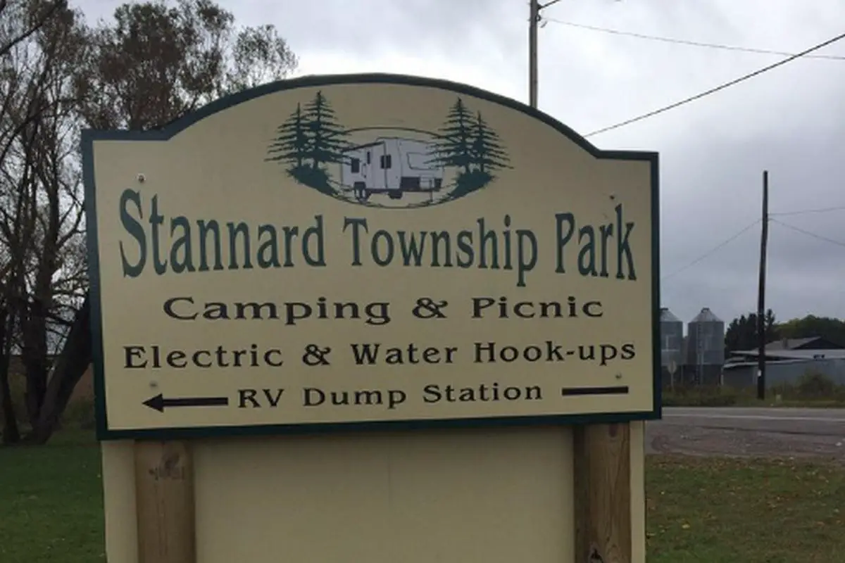
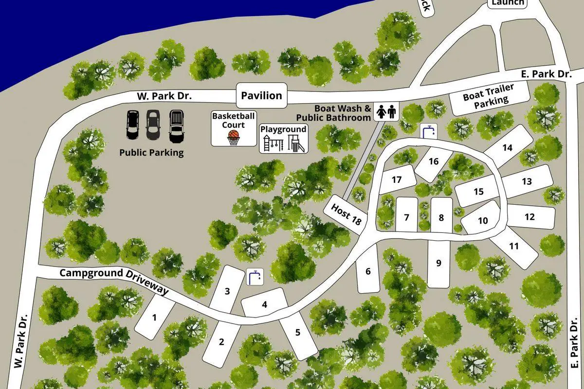
Stannard Township Park Campground in Bruce, MI
46.536342, -89.17774
Stannard Township Park is a basic public campground offering open camping spaces, picnic areas, and limited facilities. It’s often used as a quiet overnight stop in the Bruce Crossing area.
Things to Do:
Picnicking, relaxing, and short walks are the main activities. It’s a low-traffic campground with minimal development.
Directions:
Located just off M-28 in Bruce Crossing, the campground is easy to access with visible signage near the park entrance.
Vehicle Access:
Access is direct from paved roads. Parking areas and campground paths are gravel but manageable for most vehicles.
RV and Camping Trailer Information:
Small to medium RVs and trailers can fit in most sites. There are no full hookups, but water spigots and picnic tables are available.
Paid or Permit Sites:
Fees are generally around $10 per night, payable onsite. The campground operates on a first-come, first-served basis.
Hiawatha East Free Campsites
Boondocking in Cedarville, MI
45.96968, -84.07427
Michigan Up boondocking in Cedarville, MI, located near Cedarville, MI, offers a serene and secluded setting ideal for those seeking a genuine Hiawatha National Forest boondocking experience. Nestled within the lush landscapes of Michigan’s Upper Peninsula, this dispersed camping area provides a tranquil retreat away from the hustle and bustle of city life. The site is characterized by its dense woodlands, offering ample shade and a sense of privacy for campers.
Things to Do:
The surrounding area is rich in outdoor recreational opportunities. Campers can explore numerous hiking trails that meander through the forest, providing chances to observe local wildlife and enjoy the natural beauty of the region. The nearby Les Cheneaux Islands offer excellent kayaking and canoeing experiences, with calm waters and picturesque views. Fishing enthusiasts will find abundant opportunities in the local lakes and streams, teeming with various fish species.
Directions:
From Cedarville, head west on M-134. After approximately 5 miles, turn north onto a designated forest service road. Continue for about 2 miles until you reach the dispersed camping area. The roads are primarily gravel and may have uneven surfaces, so caution is advised.
Vehicle Access:
The access roads are suitable for high-clearance vehicles. During wet conditions, the roads can become muddy and challenging to navigate, so it’s recommended to check weather forecasts and road conditions before traveling.
RV and Camping Trailer Information:
The site accommodates small to medium-sized RVs and trailers. There are no hookups or dump stations available, so campers should be fully self-contained. Leveling blocks are recommended due to the uneven terrain.
Paid or Permit Sites:
This is a free dispersed camping area within the Hiawatha National Forest. No permits are required for stays under 14 days, but campers should adhere to Leave No Trace principles and forest regulations.
Castle Rock Road Boondocking in St. Ignace, MI
45.922312, -84.797911
Castle Rock Road Michigan Up boondocking, located in St. Ignace, MI, is a favored spot for Hiawatha National Forest boondocking enthusiasts. Situated just a short distance from the iconic Castle Rock formation, this dispersed camping area offers both convenience and a rustic outdoor experience. The site is enveloped by towering trees, providing shade and a sense of seclusion, while still being easily accessible from major roadways.
Things to Do:
Campers can hike to the summit of Castle Rock for panoramic views of the surrounding landscape, including glimpses of Lake Huron and Mackinac Island. The nearby North Country Trail offers additional hiking opportunities through diverse terrains. Fishing, birdwatching, and photography are popular activities in the area, thanks to the rich biodiversity and scenic vistas.
Directions:
From I-75, take exit 348 toward Castle Rock. Turn onto Mackinac Trail and continue for approximately 1 mile. Turn left onto Castle Rock Road and proceed past the North Country Trail trailhead. Look for a small lake on the left, where dispersed camping is permitted.
Vehicle Access:
The roads leading to the site are gravel and generally well-maintained, suitable for most vehicles, including small to mid-sized RVs and trailers. However, larger rigs may find maneuvering challenging due to limited turnaround space.
RV and Camping Trailer Information:
The area can accommodate small to medium-sized RVs and trailers. There are no hookups or facilities, so campers must be self-sufficient. The ground is relatively level, but leveling blocks may be necessary.
Paid or Permit Sites:
Camping at this location is free, with no permits required for stays under 14 days. Campers should follow all Hiawatha National Forest guidelines and practice Leave No Trace ethics to preserve the natural environment.
Hiawatha East Paid Campgrounds
Sleepy Hollow Campground in Saint Ignace, MI
46.014534, -84.692767
Located in Saint Ignace, MI, Sleepy Hollow Campground offers a traditional setup for travelers seeking electrical and water hookups. The campground is privately operated and well-maintained, making it a suitable stopover for those traveling through the Upper Peninsula. It’s conveniently situated near I-75 and only minutes away from the Mackinac Bridge, providing quick access to local shops, ferry docks, and downtown Saint Ignace.
Cost to Camp:
Pricing starts at $25 per night for basic tent sites. Sites with electric and water hookups are $35 per night. For full hookups including sewer, rates go up to $45 per night. Weekly rates and senior discounts may be available during off-peak seasons. Cash and major credit cards are accepted.
Things to Know:
This campground offers restrooms, showers, picnic tables, and fire rings at each site. Trash disposal and potable water access are also available. Pets are allowed but must be leashed at all times. Quiet hours are strictly enforced between 10 PM and 7 AM.
Access:
Located just off US-2, the site is easily accessible for RVs, trailers, and passenger vehicles. No special vehicle requirements are needed.
Site Type:
This is a paid campground. Reservations are recommended during summer and holidays. Walk-in availability is limited.
Pickford Township Park in Pickford, MI
46.161667, -84.355556
Pickford Township Park is a small, community-maintained camping and recreation area located in Pickford, MI. This site offers a few designated spaces for overnight parking and is ideal for travelers who prefer a no-frills experience but still want basic amenities. It is operated by the local township and provides easy access to the nearby town and rural surroundings.
Cost to Camp:
The cost is $15 per night, payable via drop box on site. Payments are on the honor system. There are no reservation systems; all sites are first-come, first-served. Fees help with park maintenance and upkeep.
Things to Know:
Basic amenities include a vault toilet, picnic tables, and trash cans. There is no electricity, water, or dump station on site. Visitors must be self-sufficient. The location is quiet and typically not crowded. It’s used mainly by local families and traveling campers looking for an affordable overnight stay.
Access:
The park is easily accessed from M-129. Roads leading in are paved and well-maintained. The sites are suitable for small RVs, vans, or tents.
Site Type:
This is a low-cost, municipally operated site. Campers are expected to follow posted rules. No stay longer than 3 consecutive nights is permitted without township approval.

Ferry Parking in Mackinaw City, MI
45.78113, -84.73409
This site is located near the ferry docks in Mackinaw City, MI and provides paid overnight parking for self-contained vehicles. It is intended mainly for ferry passengers but is also used by campers looking for short stays in a central location. The lot is paved and located within walking distance of Shepler’s and Star Line ferry terminals.
Cost to Camp:
Overnight parking is $20 per night for standard-size vehicles and $40 per night for RVs or trailers. Payment is made via on-site kiosk or mobile app. Rates are posted at the entrance and include up to 24 hours of parking.
Things to Know:
There are no amenities such as water, electricity, or restrooms. This location is suitable for self-contained rigs only. There is light foot traffic nearby and moderate vehicle activity during daylight hours. Overnight security patrols are present. Fires, grills, and tents are not allowed.
Access:
Directly accessible from US-23 and I-75. Entrance is clearly marked. Clearance is sufficient for all vehicle types including Class A motorhomes and trailers.
Site Type:
This is a paved parking area intended for short-term stays. No reservation is needed. Maximum stay is limited to 2 consecutive nights per posted signage.
Hiawatha West Free Campsites
Hanson Creek Boondocking in Rock River, MI
46.43079, -86.93956
Located in Rock River, MI, Hanson Creek Michigan Up boondocking offers a peaceful and secluded environment within the Upper Peninsula’s scenic forest landscape. Tucked deep within the boundaries of the Hiawatha National Forest, this dispersed camping site provides a genuine Hiawatha National Forest boondocking experience for those seeking solitude and immersion in nature. The site is flanked by dense pine woods and a winding creek, which creates a quiet and relaxing atmosphere.
Things to Do:
The area is ideal for hiking, fishing, and birdwatching. Hanson Creek, running through the area, provides access for light fishing and opportunities to spot local wildlife like deer, foxes, and a variety of birds. Hiking trails nearby give campers the chance to explore the diverse terrain of the Hiawatha National Forest. Stargazing is popular here due to the limited light pollution.
Directions:
From Rock River, head west on Forest Highway 13 and continue until you reach a junction with a forest service road leading toward Hanson Creek. Follow this road for approximately 3 miles until the area opens up near the creek.
Vehicle Access:
Access roads are unpaved but manageable by most high-clearance vehicles. After rainfall, conditions may become muddy, so check weather updates beforehand.
RV and Camping Trailer Information:
Smaller RVs and camping trailers can be accommodated, but the terrain is uneven, so leveling blocks are advised. There are no hookups or services, making this best suited for self-sufficient campers.
Paid or Permit Sites:
This is a free boondocking location. No permits are required for camping up to 14 days under Hiawatha National Forest rules. Campers are expected to follow Leave No Trace principles and keep the area clean.
Oakwood Trails Boondocking in Munising, MI
46.28718, -86.7031
Oakwood Trails Michigan Up boondocking in Munising, MI is a secluded forest campsite nestled within the heart of the Hiawatha National Forest. This location is a top pick for campers looking to enjoy the natural tranquility offered by a true Hiawatha National Forest boondocking spot. The surrounding terrain features tall hardwoods, quiet dirt paths, and plenty of open clearings suitable for tents and small rigs.
Things to Do:
Visitors can hike the nearby forest trails or enjoy photography in the thick woodland environment. The site is only a short drive from Munising, which means access to Lake Superior’s shoreline and the famous Pictured Rocks National Lakeshore. Wildlife such as squirrels, raccoons, and the occasional black bear can be spotted in the area. This location is also excellent for mushroom foraging during the right seasons.
Directions:
Take M-28 west out of Munising and turn onto Forest Service Road 2262. Continue for several miles until you reach a clearing marked for dispersed camping. Road conditions can vary, so drive cautiously.
Vehicle Access:
Suitable for high-clearance vehicles. While the roads are passable, deep ruts and uneven sections can be difficult for low-clearance cars.
RV and Camping Trailer Information:
The site can support small trailers and compact RVs. There are no amenities or designated pads, so campers must be fully self-contained. Leveling is necessary in some areas.
Paid or Permit Sites:
This is a no-fee site with no permit requirement for stays of less than 14 days. Follow Hiawatha National Forest guidelines and be respectful of nature.

M28 Boondocking in Shingleton, MI
46.365838, -86.531822
Located right off M28 in Shingleton, MI, this Michigan Up boondocking site offers easy access and a quiet atmosphere ideal for Hiawatha National Forest boondocking. Set back from the highway within a forested section of the national forest, the location provides dispersed camping opportunities with limited noise and great scenery.
Things to Do:
Campers can use this spot as a base for exploring Pictured Rocks National Lakeshore or the various ATV trails nearby. There’s also great fishing and hiking throughout the forest region. The nearby town of Shingleton offers basic amenities for resupply.
Directions:
From the intersection of M-28 and M-94 in Shingleton, drive east on M-28 for about 2 miles. Look for an unmarked forest road on the north side. Follow the road to a clearing suitable for dispersed camping.
Vehicle Access:
This site is suitable for most vehicles, but rainy conditions may create muddy patches. Caution is advised, especially when towing.
RV and Camping Trailer Information:
Small to medium-sized RVs and trailers can use this site. There are no services, hookups, or dump stations, so all campers should be self-reliant. Ground is generally flat but may require minor leveling.
Paid or Permit Sites:
This is a free camping area. Permits are not needed for stays under 14 days in accordance with Hiawatha National Forest regulations.
NF Rd 2251 Boondocking in Shingleton, MI
46.354616, -86.503669
NF Rd 2251 Michigan Up boondocking in Shingleton, MI is a dispersed camping location within the Hiawatha National Forest. It is easily accessible and provides a wooded environment for campers looking to enjoy quiet surroundings. It is one of the more convenient Hiawatha National Forest boondocking options close to a paved route yet still deeply immersed in forest.
Things to Do:
Ideal for hiking, birdwatching, and quiet overnight stays, the location is close to trailheads that lead deeper into the forest. It is also within driving distance of Pictured Rocks National Lakeshore. Deer, owls, and other wildlife are commonly seen in the area. The site itself is quiet, with limited vehicle traffic.
Directions:
From Shingleton, head east on M-28 and turn south onto NF Road 2251. Drive several miles into the forest until reaching an open space where dispersed camping is allowed.
Vehicle Access:
Forest roads are in moderate condition. Suitable for high-clearance vehicles and small rigs. Wet weather can cause slippery or soft patches.
RV and Camping Trailer Information:
There are no designated pads, so only small trailers and RVs should attempt to stay here. No services are provided, and campers must bring their own supplies.
Paid or Permit Sites:
Camping here is free and limited to 14 days without a permit. Campers are responsible for following all Hiawatha National Forest regulations.
Haymeadow Creek Boondocking in Rapid River, MI
46.022655, -86.859605
Haymeadow Creek Michigan Up boondockingin Rapid River, MI is a quiet dispersed camping area offering a peaceful escape within the Hiawatha National Forest. The site is surrounded by mixed hardwoods and follows along Haymeadow Creek, creating a pleasant and shady environment for campers. It’s a perfect spot for those wanting a classic Hiawatha National Forest boondocking stay.
Things to Do:
The creek offers small-scale fishing and the surrounding woods are good for hiking and wildlife observation. The Haymeadow Creek Trail is close by and leads through beautiful terrain filled with wildflowers in spring and summer. This area is also known for birdwatching and is ideal for a digital detox.
Directions:
From Rapid River, take US-2 east and turn north onto County Road 509. Follow signage for Haymeadow Creek Trailhead. The boondocking area is located just before the official trailhead parking.
Vehicle Access:
Roads are passable but narrow in places. Most vehicles can access the site, but caution is recommended during or after heavy rain.
RV and Camping Trailer Information:
Best suited for vans, tents, and small RVs. There are no hookups, and space is limited. Self-contained setups are a must.
Paid or Permit Sites:
This is a free camping location. No permit is needed for stays under 14 days, but all standard Hiawatha National Forest rules apply.
Hiawatha West Paid Campgrounds

Little Bay de Noc Campground in Rapid River, MI
45.841152, -86.984056
Little Bay de Noc Campground is a modest yet scenic camping area situated near the shore of Little Bay de Noc in Rapid River, MI. This location is managed by the Hiawatha National Forest and offers several maintained campsites tucked within a wooded setting. It provides convenient access to both inland forest areas and the bay, making it a practical stop for fishing, hiking, and quiet relaxation.
Cost to Camp:
The nightly camping fee is $10 per site. Payment is made at the self-registration kiosk near the entrance. All sites operate on a first-come, first-served basis. Campers are encouraged to bring exact change as no attendants are present.
Things to Know:
The campground includes pit toilets, picnic tables, fire rings, and a hand-pump for non-potable water. Sites are primitive, with no electric or water hookups available. Campfires are allowed only in designated rings, and campers are responsible for packing out all trash. Wildlife is active in the area, so food storage regulations must be followed.
Access:
The campground is accessed from US-2 via County Road 513, then turning west toward the bay. The gravel road is passable for passenger vehicles and smaller RVs, though low-clearance rigs should exercise caution. There is limited signage, so GPS coordinates are helpful for navigation.
Site Type:
This is a paid primitive campground. The site is best suited for tents, vans, and small RVs. Longer vehicles may have trouble turning around or fitting into spaces during busy weekends.
Flowing Well Campground Rapid River, MI
45.93769878511559, -86.70765271349387
Flowing Well Campground is located along the scenic East Branch of the Whitefish River in Rapid River, MI. Tucked deep into the forest, this tranquil site offers an off-grid experience with well-spaced campsites and access to nature trails and streamside relaxation. The campground is managed by the U.S. Forest Service and offers a quiet environment ideal for those who want to unplug for a few nights.
Cost to Camp:
Campsites are available for $10 per night, payable at a self-service station at the entrance. Fees go toward forest maintenance and campground upkeep. Sites are first-come, first-served and are rarely crowded except on summer weekends.
Things to Know:
Flowing Well has several campsites, each with a picnic table, fire ring, and access to a nearby vault toilet. A hand pump provides non-potable water. There are no hookups or dump stations, and campers should bring all necessary supplies. Trash service is not provided, so pack-in, pack-out practices are required. Fires are only allowed in designated fire rings.
Access:
Reach the site by taking County Road 442 west off US-41 near Rapid River, then following the gravel road into the forest. Roads are suitable for standard passenger vehicles and smaller RVs, but wet conditions may limit access for low-clearance vehicles.
Site Type:
Paid primitive campground with limited amenities. Best suited for tent camping or smaller trailers and campers. Quiet and heavily wooded, this area provides limited cell service, adding to its secluded appeal.
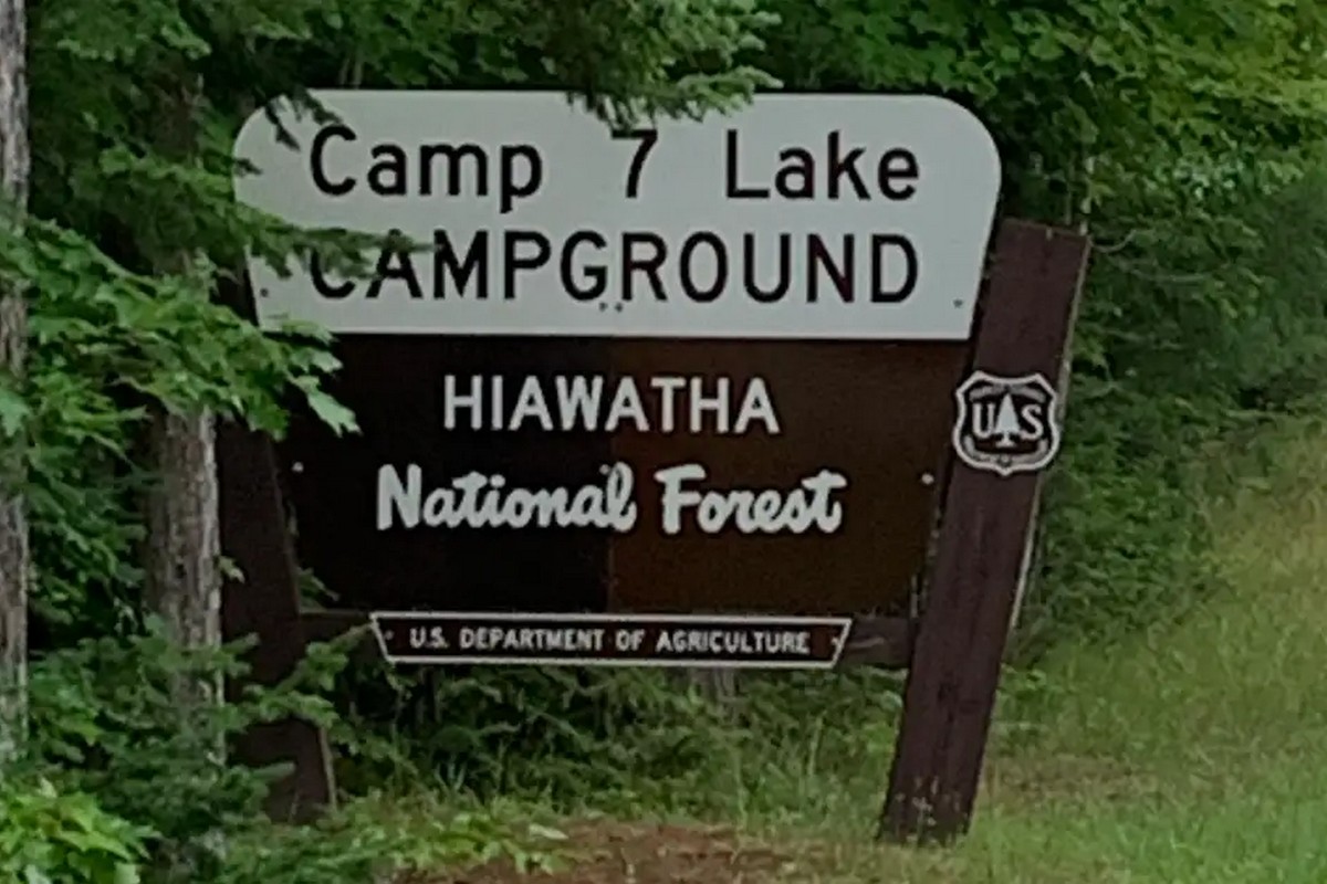
Seven Lake Campground
46.057133, -86.548622
Seven Lake Campground (also referred to as Camp Seven Lake Campground) is a well-established forest campground located in the Manistique area. Nestled in a dense wooded region near a small inland lake, the campground offers numerous recreational opportunities, including paddling, hiking, and birdwatching. Its remote location makes it a peaceful destination for those looking for a retreat in nature.
Cost to Camp:
Campsites are priced at $10 per night, payable at the registration station on-site. No reservations are accepted, and all sites are available on a first-come, first-served basis. Be prepared with cash, as no change is provided.
Things to Know:
The campground includes vault toilets, picnic tables, fire pits, and a boat launch for non-motorized watercraft. No electricity or water hookups are available, but a hand-pump well offers water for basic needs. Campers should bring their own firewood or collect deadfall nearby, as cutting live trees is prohibited. Cell service is spotty, and no Wi-Fi is provided.
Access:
From M-94, head north on County Road 437, then follow signage to Camp Seven Lake. The gravel road is in decent condition but can become muddy after rain. RVs and campers should be cautious, as space is limited in some loops and turning may be difficult.
Site Type:
Primitive paid campground, ideal for tent camping, small trailers, and pop-up campers. The site is popular with anglers and paddlers due to lake access but remains quiet outside of holiday weekends.
Indian River Campground in Manistique, MI
46.154804, -86.403829
Indian River Campground is a quiet, forested site located just off Forest Road 2254 near Manistique, MI. Tucked away from major highways, this small campground provides basic amenities and access to the Indian River for paddling and fishing. The sites are surrounded by dense trees, offering good shade and privacy.
Cost to Camp:
Camping is $10 per night. Fees are paid through a self-registration box located at the entrance. All sites are first-come, first-served, and there is no on-site staff. Campers are encouraged to bring cash and exact change.
Things to Know:
The campground includes vault toilets, picnic tables, fire rings, and a hand pump for non-potable water. There are no electrical hookups, sewer connections, or trash services, so campers must pack out all waste. Mosquito activity can be high during warmer months, and visitors should come prepared. The site is lightly used and generally quiet, making it ideal for tent campers or small trailers.
Access:
From M-94, follow County Road 437 north, then take Forest Road 2254 east. Signage is minimal, so GPS coordinates are useful for locating the campground. The gravel road is usually passable by standard passenger vehicles, though caution is advised after heavy rain.
Site Type:
This location suits small trailers, vans, and tent campers. Due to tight space and limited turning room, it is not recommended for large RVs or fifth-wheel setups.
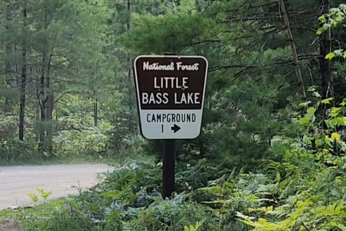
Little Bass Lake Campground in Manistique, MI
46.163002, -86.449856
Little Bass Lake Campground is a small, peaceful spot nestled along the shoreline of Little Bass Lake near Manistique, MI. This lakeside area offers a handful of well-spaced sites surrounded by mixed hardwoods and evergreens, providing campers with a tranquil environment ideal for nature observation and water activities.
Cost to Camp:
A stay at the campground is $10 per night, payable at a self-service station located at the entrance. The campground operates on a first-come, first-served basis, and there are no reservations.
Things to Know:
The site includes vault toilets, picnic tables, fire rings, and a hand pump for non-potable water. Each site has direct or close access to the lake. A small boat launch is available for non-motorized craft. There are no hookups or garbage bins, and visitors must carry out their trash. Fires are permitted in designated rings only.
Access:
From M-94, head north on County Road 437, then take a westbound spur road to reach the campground. Gravel roads are generally in fair condition, and the area is accessible for most passenger vehicles. Low-clearance vehicles should proceed slowly to avoid washouts or ruts.
Site Type:
This is a primitive campground suitable for tents, vans, and small trailers. The road loop and parking areas are tight, making it challenging for longer RVs. The shaded campsites and quiet water make it a popular spot for low-impact campers.

Triangle Lake Campground No2 in Manistique, MI
46.174364, -86.503392
Triangle Lake Campground No. 2 is a rustic forest site located just northwest of Manistique, MI. Situated near the calm waters of Triangle Lake, this remote location is a solid choice for those seeking quiet surroundings and direct access to hiking and water recreation.
Cost to Camp:
The fee is $10 per night, collected at a self-pay station. There are no advanced reservations, and all sites are first-come, first-served.
Things to Know:
The campground includes vault toilets, fire rings, picnic tables, and a hand-pump water source. There are no modern conveniences such as electricity, sewer connections, or trash removal services. Campers should come fully prepared and follow pack-in/pack-out protocols. Each site is well spaced and surrounded by tall trees for shade and wind protection.
Access:
Take County Road 437 north from M-94, then turn west on a well-marked forest road. Continue following the signs to Triangle Lake Campground No. 2. Roads are gravel and suitable for most vehicles in dry conditions. Large RVs may face difficulty due to limited turning areas.
Site Type:
This is a primitive camping area best suited for tents, car campers, and small rigs. The lakeside setting is peaceful, and use is generally light. It is not designed for high-traffic use, making it a quiet place to spend a night or two in solitude.
Cookson Lake Campground in Manistique, MI
46.195345, -86.561385
Cookson Lake Campground is a small wooded site located along the shoreline of Cookson Lake, just outside of Manistique, MI. It offers basic accommodations for campers looking for a remote yet accessible stop in the forest. The lake is calm and relatively undeveloped, making it suitable for paddling, fishing, and relaxing by the water.
Cost to Camp:
Camping here costs $10 per night. There is a self-registration station on-site. Campers should bring exact cash, as change is not available. No reservations are accepted.
Things to Know:
Facilities include vault toilets, picnic tables, fire rings, and a water pump. There are no electrical hookups or dump stations. Cell service is limited or non-existent. Campers must pack out all garbage and follow fire safety protocols. A small gravel launch provides access to the lake for kayaks and canoes.
Access:
From M-94, head north on County Road 437, then take a westward turn onto Cookson Lake Road. Continue along the gravel road until reaching the campground. The route is manageable for passenger vehicles and small trailers in dry weather.
Site Type:
Primitive campground. Best suited for tent campers, vans, and trailers under 25 feet. The campground is lightly used and generally quiet. Due to limited space, longer RVs may struggle to maneuver or find a level spot.
Kewadin Casino in Manistique, MI
45.968983, -86.161591
Kewadin Casino in Manistique offers a paved parking area available for overnight stays. While it is not a formal campground, it provides an option for travelers who need a secure place to park and sleep while visiting the area. The site is located directly off US-2 and provides immediate access to food, restrooms, and entertainment.
Cost to Stay:
Overnight parking is available for a small fee, typically $5 to $10, depending on the night. Fees are paid inside the casino. Check-in at the security desk is recommended for overnight use.
Things to Know:
The casino allows overnight parking in a designated section of the lot. There are no hookups, dump stations, or designated picnic areas. Restrooms are available inside during operating hours. The parking area is paved, level, and well-lit. While not a wilderness location, the convenience of services is a draw for some travelers.
Access:
Located directly on US-2 in Manistique, the site is easy to reach from any direction. The parking lot can accommodate larger vehicles, including motorhomes and fifth wheels. Entry and exit are straightforward, and signage is clear.
Site Type:
Paved overnight parking. This location is best for quick stopovers, not extended camping. RVs, vans, and trailers of all sizes are welcome, though generators should be used courteously. Not a scenic site, but functional for travelers needing rest or access to town services.
Frequently Asked Questions
Boondocking in Michigan’s Upper Peninsula means knowing where you’re allowed to camp, what the rules are, and how to actually find those hidden spots. If you get the maps, legal stuff, and resources down, you’ll have a good time and avoid headaches.
What are the legal requirements for Michigan Up boondocking in Michigan’s Upper Peninsula?
You can camp on public land like national forests if you’re at least 100 feet from roads and water. Sometimes there are fire restrictions, especially if it’s dry. And of course, pack out your trash—nobody likes a messy site.
How can I find Michigan Up boondocking spots in Michigan’s Upper Peninsula?
Most free sites are in national forests or wildlife areas. Look for dirt roads that lead to primitive sites. The local forest service office is a solid resource—they’ll have up-to-date info.
Are there any specific maps useful for locating Michigan Up boondocking?
Definitely. National Forest maps and GPS coordinates are super helpful. Some websites even have free downloadable maps that show boondocking spots, with details like elevation and road type.
Can you boondock in Michigan state parks, and if so, what are the guidelines?
Usually, state parks don’t allow boondocking. They’ve got regular campgrounds with fees. Sometimes, though, a park might have a primitive area, but you’ll need to double-check the rules before you stay.
Where is it legal to camp for free in the Lower Peninsula of Michigan?
You can camp for free in state forests and wildlife areas in the Lower Peninsula, too. There are fewer spots, so check with the Michigan Department of Natural Resources to confirm locations and rules.
What are the best resources to use when searching for Michigan Up boondocking?
I usually start with the official Forest Service websites and state park pages—they tend to have the most up-to-date info. But honestly, I’ve found some of the best spots by scrolling through boondocking apps and forums, where fellow campers swap stories, warnings, and the occasional hidden gem. Those real-world tips can make all the difference.