

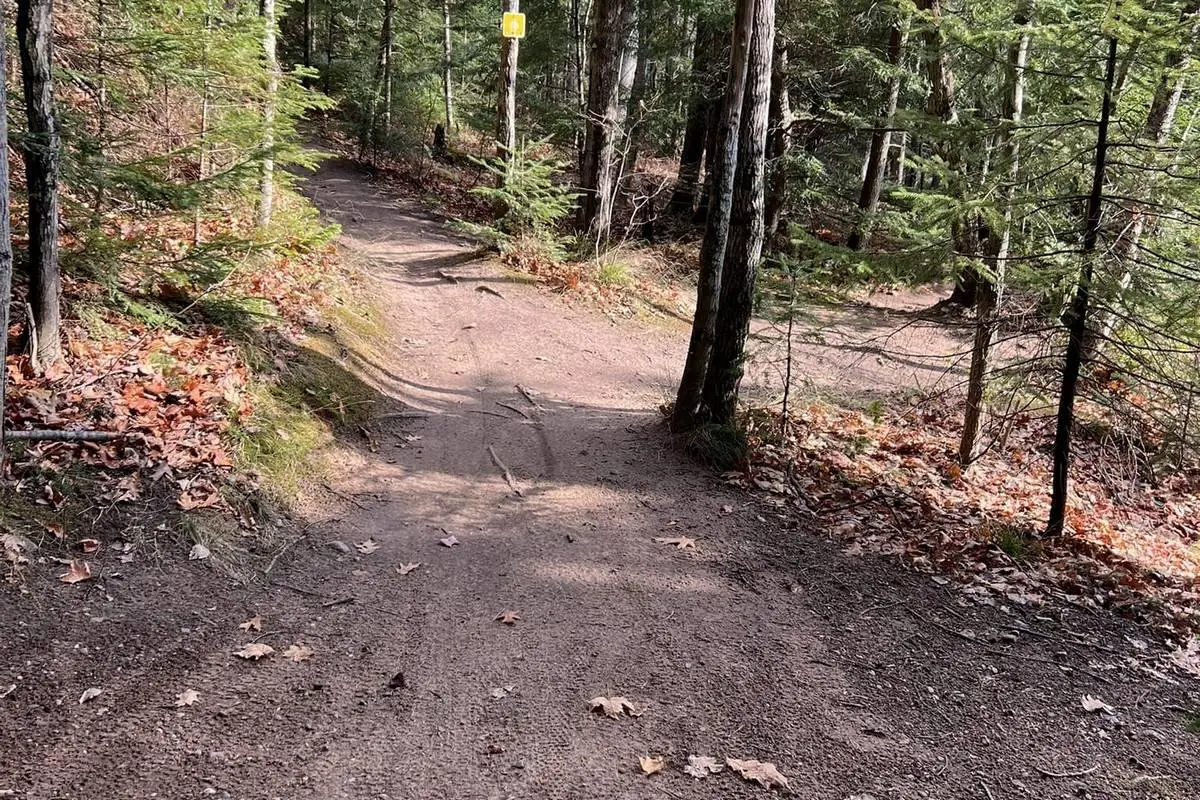
7 Pictured Rocks Boondocking Locations – Guide for Adventure Seekers: Pictured Rocks has some fantastic spots for boondocking, especially if you want to unplug from the crowds and full-hookup RV parks. You’ll find rustic Pictured Rocks boondocking drive-in campgrounds like Little Beaver Lake and Twelvemile Beach where you can roll in, park, and enjoy the basics without a lot of frills. These spots are ideal if you just want to soak up the quiet, breathe the piney air, and still have a vault toilet nearby.
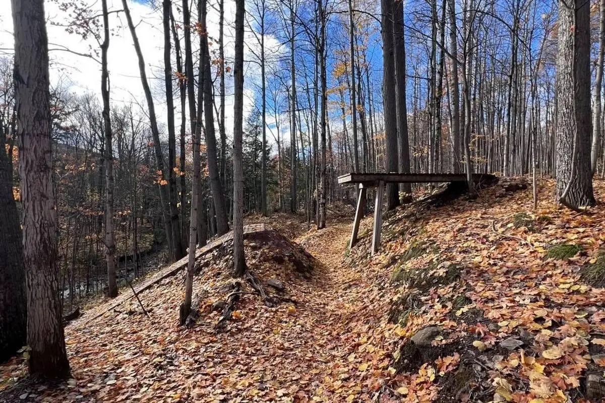
If you’re after something more remote Pictured Rocks boondocking, backpacking campsites along the North Country Trail wind through the park. They’re tiny and tucked away, letting you really settle into the woods and listen to the lake. True dispersed camping isn’t really a thing inside Pictured Rocks, but if you’re willing to venture out a bit, places like North Manitou Island give you a little more freedom to pitch your tent off the grid.
It’s worth figuring out which areas allow vehicles and how to get there before you go. No one likes scrambling for a legal spot at dusk. Knowing your Pictured Rocks boondocking options ahead of time just makes the whole trip smoother.
Key Takeaways
- Rustic drive-in campgrounds let us camp with limited amenities.
- Backpacking sites offer a quieter, more secluded experience.
- Knowing the access rules helps us avoid headaches.
Pictured Rocks Boondocking Locations
Pictured Rocks boondocking comes with rules. Dispersed camping isn’t allowed inside the park. If you set up outside designated spots, you might get ticketed. So, stick to the allowed areas and you’ll be fine.
You’ve got three main rustic drive-in campgrounds to choose from:
- Little Beaver Lake (8 sites)
- Twelvemile Beach (36 sites)
- A few other small sites in the area
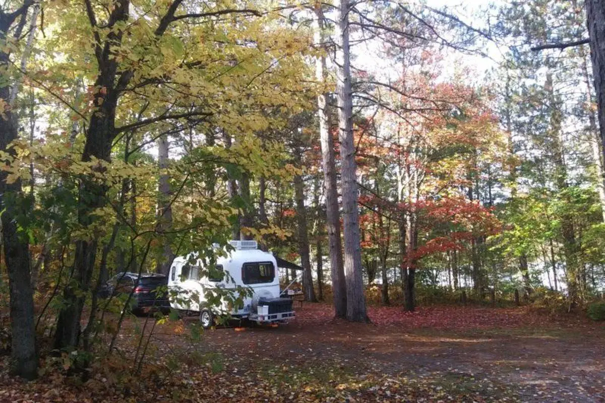
These campgrounds are pretty bare-bones—no hookups, not much in the way of fancy facilities. But they’re quiet, close to the lakeshore, and feel a lot more wild than your average campground.
If you’d rather hike in, the park has about 13 designated backcountry camping areas. Each one is tiny, with only a handful of sites. You’ll want to plan ahead and know which trails lead to which spots.
If you’re craving true boondocking, check out the free or cheap camping just outside the park. Adams Trail Dirt Lot or the Hickey Marsh area are decent bets. You can camp more freely there, though you’ll be outside the official boundary.
Let’s do our part and follow Leave No Trace. It’s not just a slogan—if we want to keep these places wild, we have to take care of them.
Directions
To get to man Pictured Rocks boondocking, most folks take Alger County Road H-58. That’s the main drag through the park, linking up all the must-see spots.
Some of the access roads to campgrounds and boondocking areas are gravel or dirt. If you’re driving something low to the ground, take it easy—some of those washboard roads can sneak up on you.
If you’re aiming for drive-in campgrounds like Little Beaver Lake or Twelvemile Beach, just watch for the signs off H-58. The entrances are marked, and you can’t really miss them.
For dispersed camping spots, look for dirt lots or pull-offs along the trails. Adams Trail Dirt Lot and Hickey Marsh are both solid options if you want some peace and quiet nearby.
A good map or GPS is pretty much essential to find these Pictured Rocks boondocking. Cell service is spotty—sometimes nonexistent—so download offline maps before you lose signal.
Here’s a quick rundown for driving in:
- Alger County Road H-58 is your main route
- Unpaved roads pop up near some dispersed sites
- Slow down on rough or narrow stretches
- Look for signs marking camp areas
- Bring a road map or offline GPS backup
With a bit of planning (and maybe a little patience for the bumps), you’ll find your way to the best boondocking spots at Pictured Rocks.
Pictured Rocks Boondocking Vehicle Access And Pricing
When we think Pictured Rocks boondocking at Pictured Rocks , we usually just drive right up to the campsites. All the drive-in camping spots let us bring our vehicle in, which makes hauling gear and getting settled a lot easier.
Every Pictured Rocks boondocking —even the accessible ones—needs a reservation. There’s nowhere you can just roll up and hope for the best; you’ve got to book in advance.
Camping costs $25 per night, per site. That covers your vehicle and whatever camping setup you’ve got. I know it’s tempting to grumble about fees, but honestly, this money helps keep the place looking good.
If you’re driving into the park, you’ll also need a vehicle pass. It’s $25 and lasts for seven days. That covers everyone in your car, so you can explore the whole lakeshore for a week.
Thinking about backcountry camping? You’ll need a permit to all of these Pictured Rocks boondocking. There’s a $15 non-refundable reservation fee, plus $5 per person for each night you’re out there. Kind of a hassle, but it helps keep those quiet, remote spots from getting trashed.
Here’s a quick list of the main fees to keep in mind:
| Fee Type | Cost | Notes |
|---|---|---|
| Drive-in campsite | $25 per night | Requires reservation |
| Vehicle entry pass | $25 for 7 days | Covers driver and passengers |
| Backcountry camping permit | $15 reservation | Non-refundable |
| Backcountry camping fee | $5 per person | Per night |
Helpful Boondocking Information Links
Bureau of Land Management
Recreation.Gov
National Park Service
Over 10,000 Free Boondocking Locations
Boondocking Recipes for 1000’s Of Camping Meals
Leave No Trace
State Specific Information Links
Michigan Park Service
Michigan Fish and Game
Department of Natural Resources
Pictured Rocks Boondocking Locations
Free Boondocking Locations
Oakwood Trails Boondocking in Munising, MI
46.28718, -86.7031
This Pictured Rocks boondocking within the Hiawatha National Forest near Munising, Michigan, the Oakwood Trails Boondocking site offers a remote, forested camping experience in a dispersed setup along a dirt road. The site is located roughly two miles from the nearest paved highway, tucked into a woodland area dominated by mixed hardwoods and conifers. With 6 to 15 primitive sites available, campers can enjoy a peaceful stay surrounded by natural beauty and minimal human interference. There are no developed amenities at the site—no electricity, water hookups, or dump stations—making it ideal for those prepared for off-grid, self-sufficient camping.
The area is favored by campers looking for solitude, quiet, and immersion in nature. It’s particularly popular with horseback riders, hikers, and those who appreciate simple, scenic surroundings without the bustle of busy campgrounds. The lack of light pollution also makes this a good spot for stargazing on clear nights.
Things to Do:
Oakwood Trails features an 11-mile horse trail system that loops through scenic forest terrain, with red trail markers and locator maps at intersections. The trail crosses oak, maple, and pine stands, and its terrain is mostly level with gentle hills, suitable for horseback riding, day hiking, and trail running.
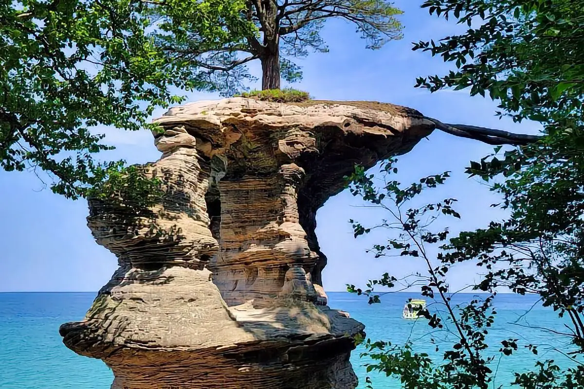
Nearby attractions include Pictured Rocks , located about 10 miles north in Munising. This national treasure is known for its dramatic sandstone cliffs, Lake Superior shoreline, waterfalls, and forest trails. Other outdoor activities in the vicinity include kayaking, boating, trout fishing, and wildlife observation. Munising also offers amenities such as fuel, groceries, and visitor services.
Directions:
From Munising, drive southeast on M-28 for approximately 5 miles. Turn right onto Forest Road 2473C and continue south for about 2 miles. The boondocking sites are located along this dirt road corridor within the forest. Drivers should look for open clearings and existing fire rings to identify potential dispersed sites. Travel slowly and carefully, especially in wet conditions, as the road may become slick or rutted.
Vehicle Access:
The access road is a dirt forest road that can be uneven or muddy, depending on recent weather. It is accessible by standard vehicles, but caution is advised. High-clearance vehicles are recommended, especially for those with trailers. Low-clearance cars may struggle with some washouts or dips after heavy rains. The road is generally manageable during dry conditions, but use discretion and always check local reports before heading in.
RV and Camping Trailer Information:
The maximum RV or trailer length is officially listed as “unlimited,” but due to limited turning space and uneven road surfaces, rigs over 30 feet may have difficulty. Mid-sized RVs, camper vans, and smaller trailers are more likely to find suitable space and turnarounds within the dispersed layout.
Paid or Permit Sites:
Oakwood Trails Boondocking is a Free Site. There are no fees, reservations, or permits required for use of this site. As with all national forest dispersed camping, visitors should follow Leave No Trace principles and use existing clearings to minimise impact.
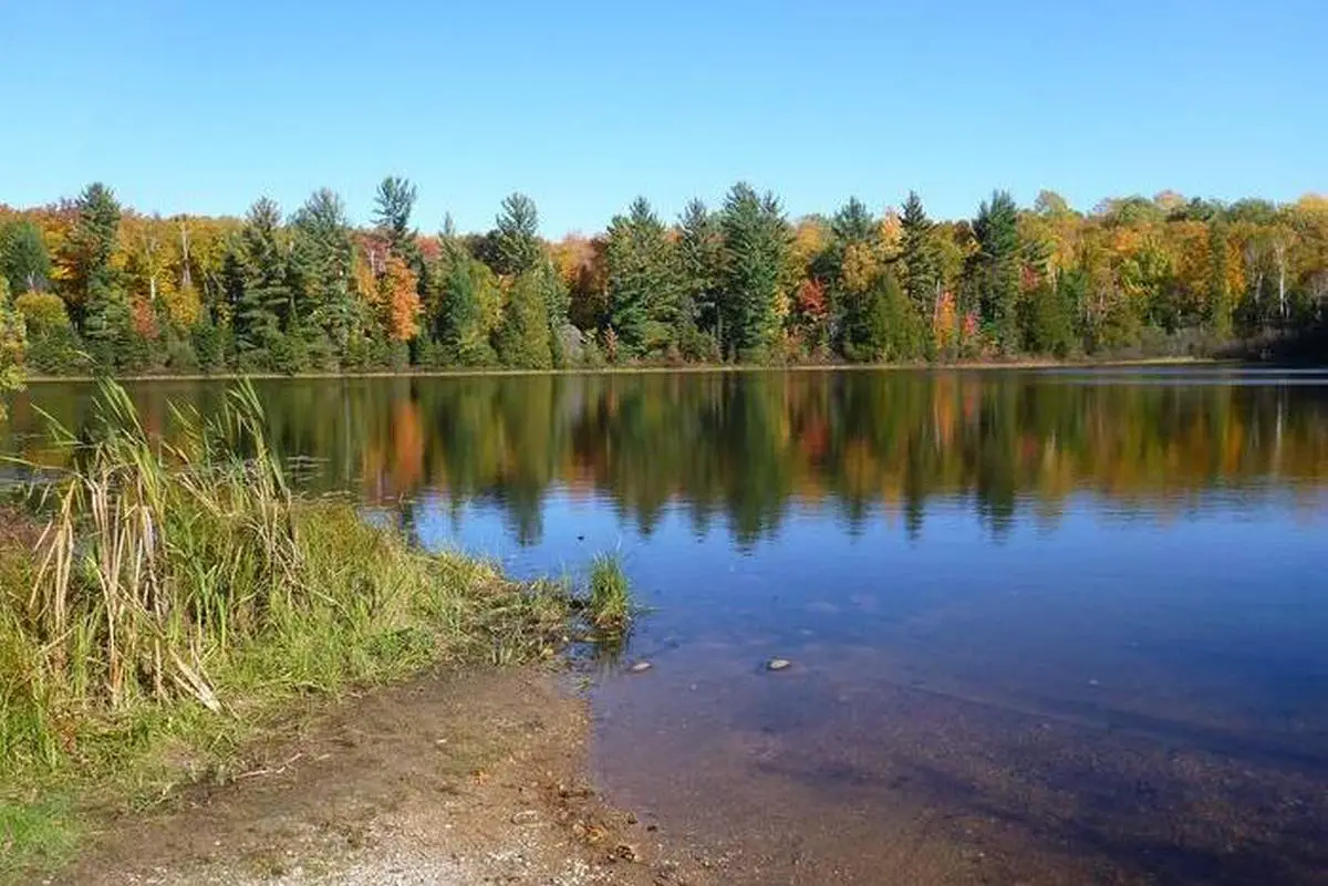
Hovey Lake Boondocking in Wetmore, MI
46.291, -86.700996
Situated within the Hiawatha National Forest near Wetmore, Michigan, Pictured Rocks boondocking at Hovey Lake is a remote and peaceful spot positioned along the east side of Hovey Lake. This location includes a small, rustic campground with four designated campsites, each with a fire ring and picnic table. The environment is wooded and quiet, ideal for individuals seeking solitude and minimal disturbance. No electric hookups or potable water are provided, making it suitable for self-sufficient campers.
Things to Do:
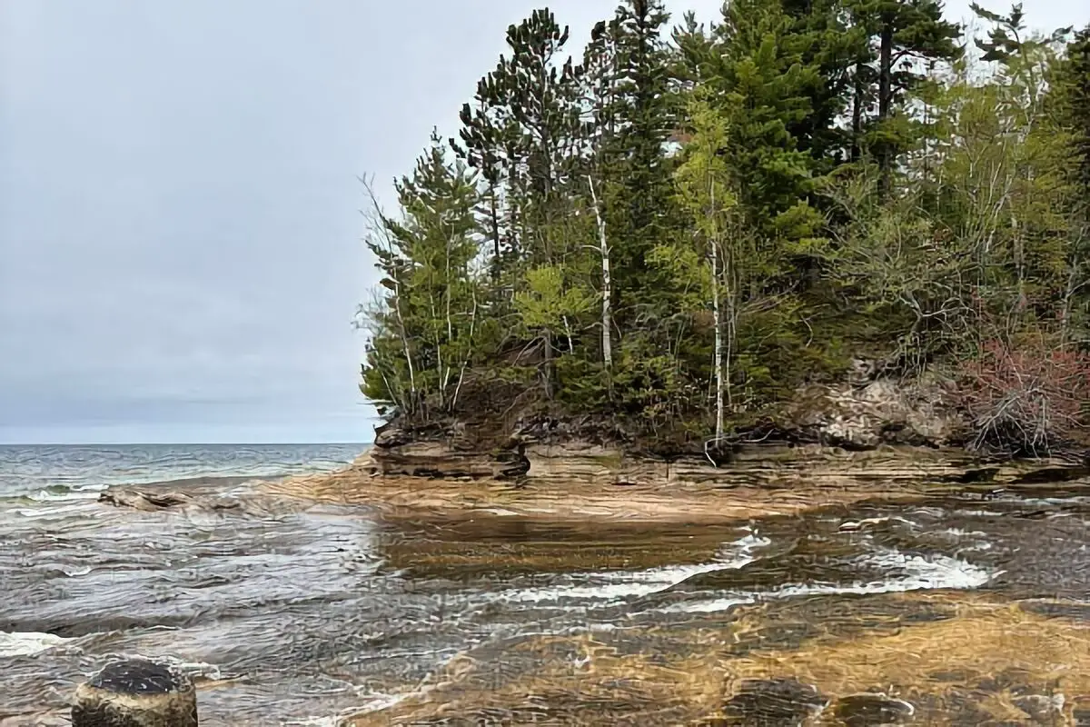
Canoeing and birdwatching are popular activities due to the quiet setting and lake access. Fishing is also available, with northern pike, black bass, and panfish common in the lake. While the lake bottom is too soft and mucky for swimming, its still waters are good for small boats and kayaks. Nearby hiking trails include parts of the North Country National Scenic Trail. Pictured Rocks is within reasonable driving distance, offering cliffside views and additional hiking opportunities.
Directions:
From Wetmore, Michigan, travel southwest on M-94 for approximately 6.4 miles. Turn left onto Forest Road 2254 and proceed for about 4 miles southeast to reach the campsites on the eastern shore of Hovey Lake. Signage may be minimal, and cell service is limited, so offline navigation is recommended.
Vehicle Access:
The forest access roads are narrow, unpaved, and may become muddy in wet weather. High-clearance vehicles are advisable. Compact campers and vans can access the site comfortably, but large rigs may find turning and parking difficult due to the confined layout and tight tree cover.
RV and Camping Trailer Information:
This location is more suitable for RVs and trailers under 25 feet in length. Limited turning space and road clearance may restrict larger setups. There are no dump stations or water hookups available at the site.
Paid or Permit Sites:
Free Site.
NF Rd 2251 Boondocking in Shingleton, MI
46.354616, -86.503669
Situated in the Hiawatha National Forest just outside Shingleton, Michigan, the NF Rd 2251 Pictured Rocks boondocking is a dispersed camping area accessible via a network of forest service roads. This remote spot offers primitive, undeveloped camping along National Forest Road 2251. The landscape features dense woods, clearings, and ample space for self-contained setups. There are no amenities like water, electricity, or restroom facilities. The site provides a quiet, isolated environment ideal for those looking to get away from crowds and enjoy undisturbed natural surroundings.
Things to Do:
This location is well-suited for hiking, wildlife viewing, and off-grid camping. The nearby trails and woods provide opportunities for exploration and backcountry walking. Pictured Rocks , located about 15–20 miles north, offers extensive recreational opportunities including kayaking, hiking, and sightseeing along Lake Superior’s shoreline. Visitors also frequent the Munising area for its waterfalls, such as Munising Falls and Miners Falls. The location’s proximity to Forest Road 13 and other forest trails also makes it appealing for ORV and mountain bike use.
Directions:
From Shingleton, Michigan, head east on M-28 for about 6 miles. Turn right onto Forest Road 2251 (also marked on some maps as FR-2251 or NF-2251). Continue on this gravel road for approximately 2 miles to reach dispersed camping areas. Signage is minimal, so it’s important to rely on GPS coordinates and offline maps if cell signal is poor.
Vehicle Access:
The road to the site is gravel and may contain washboarding or potholes, especially after rain. It is accessible to most vehicles in dry conditions, although high-clearance vehicles are preferable. Travel trailers and fifth-wheels must proceed with caution due to limited turnaround space and narrow road conditions.
RV and Camping Trailer Information:
Travel trailers and RVs under 30 feet in length can generally access this location, but careful navigation is required due to the tight forest roads. Larger rigs may have difficulty turning around or navigating tree-clearance. There are no dump stations or fresh water fill-ups on site.
Paid or Permit Sites:
Free Site.

M28 Boondocking in Shingleton, MI
46.365838, -86.531822
Located just off Michigan State Route M-28 near Shingleton, this boondocking location provides dispersed roadside camping in a forested setting. Nestled within Hiawatha National Forest, the site is not formally developed but is frequently used by campers looking for short stays or simple overnight parking. There are no marked campsites or infrastructure. Campers typically use pull-offs or small clearings adjacent to forest roads. The atmosphere is quiet with natural pine cover, suitable for campers seeking simplicity and seclusion.
Things to Do:
This Pictured Rocks boondocking is close to Munising, where attractions include Pictured Rocks , Munising Falls, and Sand Point Beach. Forest trails in the area are suitable for hiking and off-road vehicle use. While the campsite itself has no structured amenities, its proximity to Highway M-28 makes it a practical base for visiting area lakes, rivers, and backwoods trails.
Directions:
From Shingleton, drive east on M-28. Just past the town, look for forest road turn-offs and clearings along the highway on either side. Most campers access dispersed sites between mile markers near 46.36°N latitude and 86.53°W longitude. These pull-offs are unmarked and may be used on a first-come, first-served basis. A reliable GPS and offline map are recommended for locating clearings.
Vehicle Access:
The access from M-28 is relatively straightforward and paved up to the point of pull-off. However, many clearings are dirt or grass-based and may be muddy during or after rain. Suitable for passenger cars, vans, and smaller RVs. Large trailers may find limited space, especially in busier seasons.
RV and Camping Trailer Information:
Best for trailers or RVs up to 25 feet due to limited maneuverability in narrow or brush-filled clearings. No designated pads or flat gravel surfaces are provided, so leveling may be needed.
Paid or Permit Sites:
Free Site.
Snow Mobile Parking Boondocking Area in Shingleton, MI
46.52724, -86.22137
Situated in the Upper Peninsula near Shingleton, Michigan, the Snow Mobile Parking Boondocking Area is a large gravel lot primarily used in winter for snowmobile staging. However, during warmer months, the area is used for boondocking by RVers and van campers due to its accessibility and wide-open space. The lot is part of the Hiawatha National Forest system and offers no structured camping amenities. Surrounded by woods but largely cleared, it provides a safe and level spot for overnight or extended stays.
Things to Do:
Located within reach of multiple recreational routes, this area provides access to forest trails for hiking and ATV use. Visitors often explore the Hiawatha National Forest’s numerous lakes and rivers, which offer canoeing, kayaking, and fishing. The site is within driving distance of Munising and Pictured Rocks , offering scenic hikes and rock formations. While the parking lot has no formal recreation itself, it serves as a great staging area for outdoor exploration.
Directions:
From Shingleton, travel east on M-28 for about 14 miles. Turn north onto NF-13 and then take a right onto County Road 440. Continue until you reach the large gravel lot near the coordinates 46.52724, -86.22137. The site is identifiable by its wide open area and trail signs marking snowmobile routes.
Vehicle Access:
This is one of the most accessible Pictured Rocks boondocking locations in the area. The gravel surface is level and suitable for all vehicle types, including larger RVs, Class A motorhomes, and fifth-wheel trailers. Road conditions are generally good year-round, except during heavy snowfall.
RV and Camping Trailer Information:
Suitable for all sizes of RVs and camping trailers. There is plenty of space for parking, turning, and maneuvering. No hookups, dumping stations, or water fill areas are available, so all users must be self-contained.
Paid or Permit Sites:
Free Site.
Paid Campgrounds
Little Beaver Lake Campground in Shingleton, MI
46.557922, -86.362348
Situated within the Pictured Rocks near Shingleton, Michigan, Little Beaver Lake Campground offers a rustic camping experience in a serene, forested setting. The campground features eight campsites nestled along the shores of Little Beaver Lake, providing a peaceful environment for campers seeking solitude and natural beauty. Each campsite is equipped with a picnic table, fire ring with grill grate, and tent pad. Vault toilets and well water are available, but there are no electric, water, or sewer hookups. The campground is accessible via a narrow, winding, and hilly road, making it more suitable for smaller vehicles and trailers. The area is known for its tranquility, with limited cell phone reception and a strong emphasis on preserving the natural environment.
Campers can enjoy a variety of outdoor activities, including hiking, fishing, canoeing, and kayaking. A 1.5-mile trail connects the campground to Lake Superior and the North Country Scenic Trail, offering scenic views and opportunities for wildlife observation. Only electric motors are permitted on Little Beaver Lake and Beaver Lake, preserving the quiet atmosphere. Nearby attractions include Miner’s Castle, Miner’s Beach, and other features of the Pictured Rocks .
Directions:
From Munising, head east on Alger County Road H-58 for approximately 20 miles. Turn north onto Little Beaver Lake Road and continue for about 3 miles to reach the campground. The access road is narrow and winding, so caution is advised, especially for larger vehicles.
Vehicle Access:
The access road to the campground is narrow, twisting, and hilly, making it unsuitable for large RVs or trailers. Vehicles should be under 36 feet in length, with a combined vehicle-trailer length not exceeding 42 feet. High-clearance vehicles are recommended, and drivers should be prepared for limited maneuvering space.
RV and Camping Trailer Information:
Due to the small campsites and challenging access road, the campground is best suited for tents, small trailers, and camper vans. Large motorhomes and trailers are not recommended. Campers should be self-sufficient, as there are no hookups or dump stations available.
michigan.org
Paid or Permit Sites:
Camping at Little Beaver Lake Campground requires a reservation and a fee. Reservations can be made through the National Park Service’s official reservation system. The campground operates on a reservation-only basis, with no first-come, first-served sites available.
Kewadin Casino in Christmas, MI
46.437519, -86.70594
Situated in Christmas, Michigan, just west of Munising along M-28, the Kewadin Casino offers a convenient boondocking option in its west parking lot. This location provides 12 back-in RV sites equipped with electrical hookups, including 30 and 50-amp services. The sites are located on the outer edge of the casino’s parking area, offering a level surface for parking. While the sites are narrow, they are suitable for smaller RVs and vans. The area is well-lit and monitored, providing a sense of security for overnight stays. There are no water or sewer hookups available, and no dump station on-site. Campers should be self-contained and prepared for dry camping conditions. The casino is within walking distance, offering dining and entertainment options.
Things to Do:
The Kewadin Casino itself offers gaming, dining, and entertainment options. Nearby attractions include Pictured Rocks , Munising Falls, and Sand Point Beach, all within a short drive. Outdoor enthusiasts can enjoy hiking, kayaking, and sightseeing in the surrounding areas. The proximity to Lake Superior provides opportunities for beachcombing and photography.
Directions:
From Munising, head west on M-28 for approximately 5 miles to reach Christmas, Michigan. The Kewadin Casino is located on the left side of the highway. The RV parking area is situated in the west lot of the casino. Signage for RV parking is present, but it’s advisable to check in with the casino upon arrival for specific parking instructions.
thedyrt.com
Vehicle Access:
The parking lot is paved and accessible for most vehicles. However, the RV sites are narrow, making them more suitable for smaller RVs, vans, or trailers without slide-outs. Larger rigs may find maneuvering and parking challenging due to space constraints.
campendium.com
RV and Camping Trailer Information:
The RV sites are best suited for vehicles up to 30 feet in length. Due to the narrow width of the sites, slide-outs may not be feasible. Campers should be prepared for dry camping, as no water or sewer hookups are available.
Paid or Permit Sites:
The cost for RV parking is $20 per night. This fee includes electrical hookups. No reservations are accepted; sites are available on a first-come, first-served basis.