

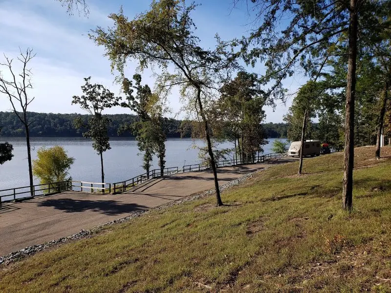
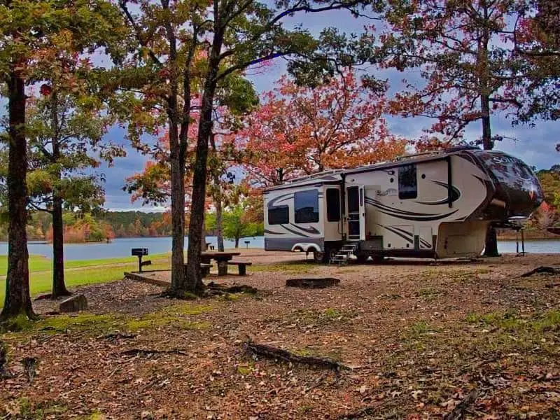
If you’re searching for peaceful, free camping spots near the Ouachita National Forest in Arkansas, dispersed camping is a solid way to go. There are 31 boondocking locations where you can skip the crowds, get some privacy, and really sink into nature. These spots let you park your RV, set up a tent, or roll out a pop-up without worrying about hookups or paying fees.
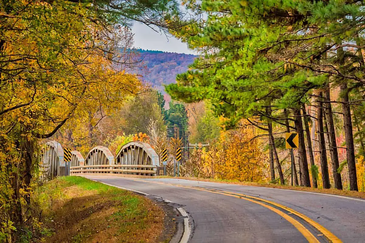
The Ouachita National Forest sprawls across rolling hills, lakes, and a whole lot of trees. You’ll come across several dispersed sites along forest roads like Blue Knob Road and in areas near Mena, Arkansas. If you know how to find these places and plan for boondocking, you’re in for a chill, quiet stay.
About This Location
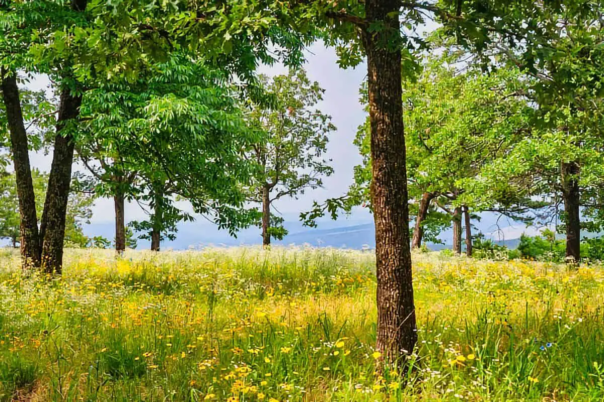
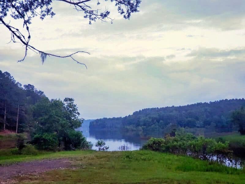
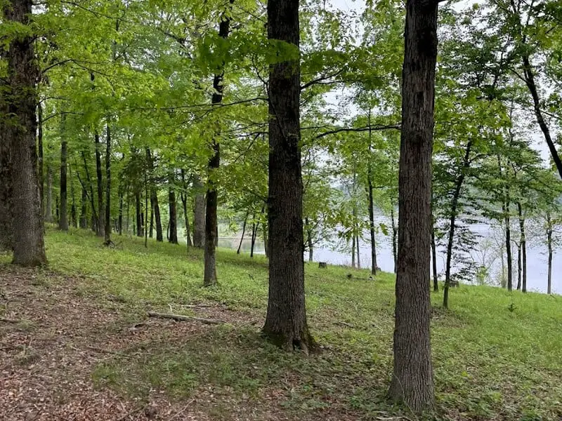
You’ll find the Ouachita National Forest stretching over parts of Arkansas and Oklahoma, famous for its hills and wild scenery. The forest gives you loads of camping options, including off-grid boondocking spots—no hookups, no developed pads, just you and the woods.
Staying here puts you close to plenty of hiking trails. The Ouachita Trail is a local favorite, winding through all kinds of terrain. Not far off, you’ve got the Ozark National Forest and Buffalo National River for even more outdoor exploring.
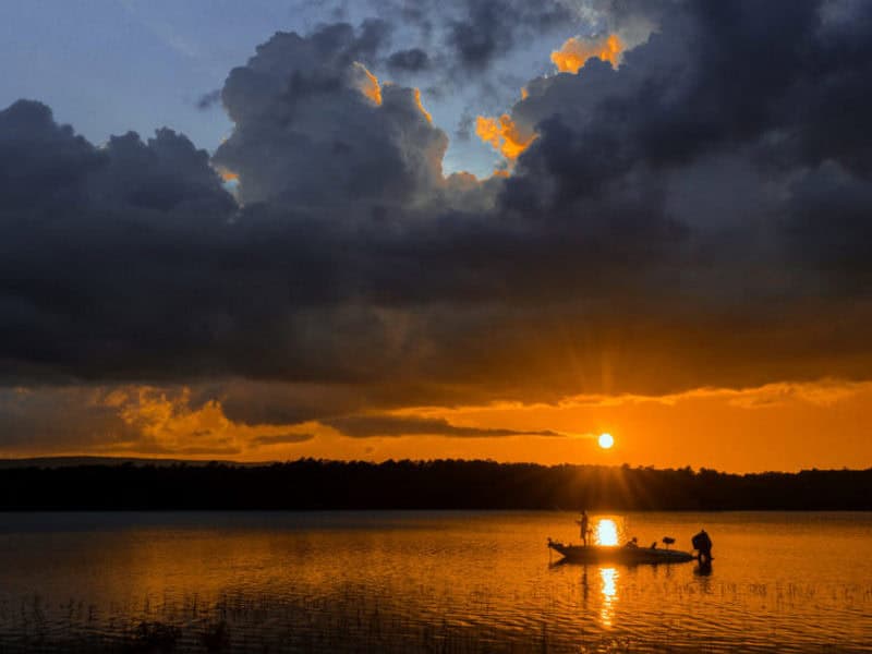
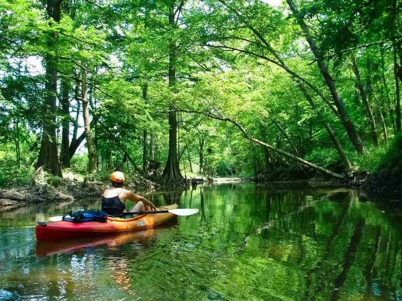
You’re also pretty close to big waterways like the Arkansas River and White River. Those rivers are great for fishing, kayaking, or just hanging out by the water.
Boondocking here means fewer rules and a quieter vibe. Some sites are tucked near trailheads or along lonely forest roads, so you get that back-to-nature feel without all the noise.
Keep in mind, these spots don’t have services. Bring your own water, food, and a plan for waste. It’s primitive camping, so you get the real deal—no frills, just forest.
Location And Access
You’ll find all 31 boondocking locations scattered throughout Ouachita National Forest in Arkansas and Oklahoma. Most of these are off the grid, deep in the woods.
Getting there usually means driving on unpaved forest service roads. Some of those roads get rough, so it’s smart to bring a high-clearance or four-wheel-drive vehicle, especially if it’s been raining. Always check the latest road updates before heading out.
Some spots sit near popular places like Hot Springs and Mill Creek. If you’re after waterfalls or Big Springs, stick to the western side. That way, you’re close for day trips.
Hurricane Creek and the Mulberry River are close to a few sites too. Both offer fishing, swimming, and some pretty sweet views. If you camp by water, remember to follow state fire and waste rules.
Need to stock up or use a real bathroom first? Cedar Lake Recreation Area has some basic amenities, and from there, you can branch out to dispersed sites along the forest roads.
Here’s a quick table with key access points and what’s nearby:
| Location | Nearby Feature | Road Type | Vehicle Recommended |
|---|---|---|---|
| Hot Springs Area | Hot Spring, Falls | Dirt/Gravel | High-clearance 4WD |
| Western Ouachita | Big Springs, Waterfalls | Forest Service Road | 4WD or SUV |
| Hurricane Creek | Creek, Fishing | Gravel | High-clearance |
| Mulberry River | River, Swimming | Dirt/In places rocky | 4WD suggested |
| Cedar Lake Rec Area | Lake, Camping Base | Paved + dirt | Regular vehicle |
Plan ahead. Pick your spots based on your rig and what you want to do. Many locations don’t have signs, so bring a map or GPS.
Directions: How To Get There And What To Expect
To reach the 31 Ouachita NF boondocking sites, grab a reliable GPS or a good app. You’ll be driving on forest service roads—mostly gravel or dirt. Standard vehicles can usually make it, but always check road conditions before you roll out.
Most dispersed campsites don’t have official addresses. Instead, use GPS coordinates from guidebooks or camping forums. Save them before you lose signal in the woods.
Expect narrow, twisty roads with almost no signs. Keep your eyes open and stick to the speed limit. After a rain, things can get muddy—slow down and a higher-clearance vehicle definitely helps.
Cell service? Don’t count on it. Download offline maps before you leave home. Bring a paper map too, just in case.
At each site, you won’t find water, toilets, or trash bins. Bring everything you need and pack out your garbage. Some places let you park right at your tent spot; others, you might need to walk in a bit or sling a hammock.
Quick checklist for getting there:
| Step | Detail |
|---|---|
| GPS Use | Plug in coordinates before you lose service |
| Roads | Mostly gravel/dirt; check if muddy |
| Signage | Rare; look for forest service markers |
| Maps | Bring offline and paper backups |
| Vehicle | 2WD often works; 4WD helps after rain |
Just stay prepared and follow the Forest Service rules. You’ll get there fine.
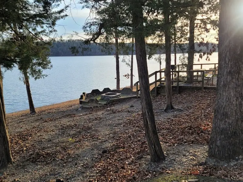
Amenities And Activities
If you pick boondocking spots in Ouachita National Forest, don’t expect many amenities. Most are dispersed sites—no hookups, no restrooms. A few campgrounds have basics like restrooms and showers, but the true boondocking areas are pretty primitive.
There’s a ton to do, though. Hiking and bushwhacking through trails and wild areas are super popular. Like water? Some places have natural swimming holes for cooling off.
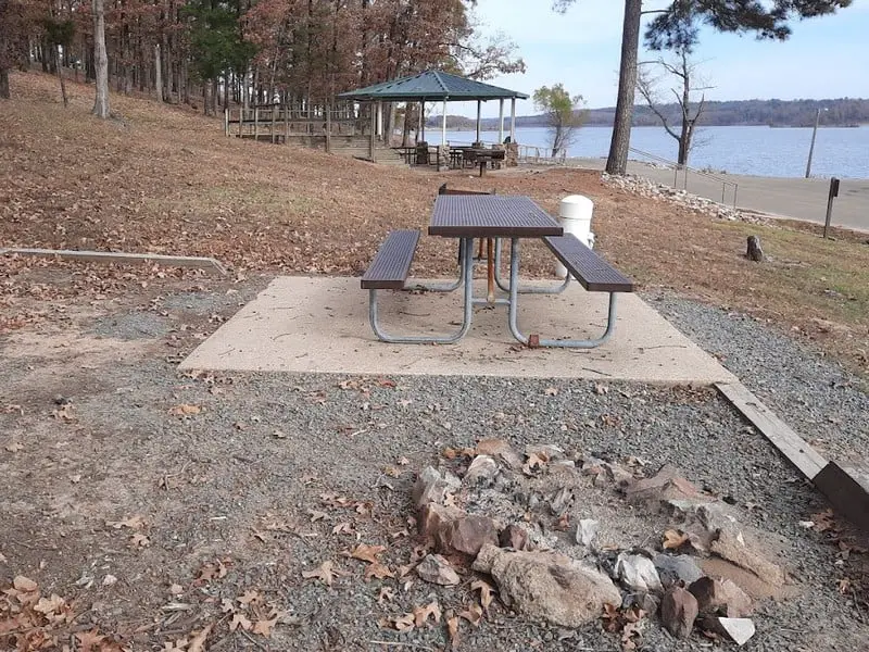
If you’re rolling in an RV or trailer, a handful of campgrounds have electric and water hookups. You might also find a dump station or picnic tables here and there. Into boating or fishing? A few spots offer boat ramps.
The forest is packed with recreational areas for biking, horseback riding, and wildlife watching. Fishing and hunting are allowed in certain zones. Whether you’re after a quiet boondocking site or something with a few more comforts, Ouachita National Forest has you covered.
Camping Regulations And Restrictions
Camping in Ouachita National Forest comes with a few important rules. You can set up in dispersed areas, meaning outside developed campgrounds.
You can stay at one dispersed spot for up to 30 consecutive days. After that, you’ve got to move at least 5 road miles before you settle in again.
There aren’t any hookups, so plan to be self-sufficient. Use only dead wood for your campfires, and build in an existing fire ring if you can. Always check for fire restrictions before lighting up.
Pack out all your trash—seriously, don’t leave a trace. Don’t damage trees or plants. Camping near water is fine, but keep your distance to protect the water.
Private land and restricted zones are off-limits. Watch for posted signs and respect property lines.
Some areas might have extra rules or seasonal closures. Check with the local ranger before you go.
| Rule | Details |
|---|---|
| Maximum stay in one spot | 30 consecutive days |
| Move distance after 30 days | At least 5 road miles |
| Fires | Use dead wood, follow bans |
| Trash | Pack it out, no littering |
| Water sites | Keep your distance |
Stick to these rules and everyone gets to enjoy Ouachita National Forest for years to come.
Leave No Trace
Camping in Ouachita National Forest? Stick to Leave No Trace. It’s the only way to keep this place wild and beautiful.
Always pack out everything you bring in—food wrappers, scraps, even bottle caps. Every little thing matters.
If you build a fire, use existing fire rings. Don’t make new pits. Keep your fire small and put it out completely before you leave.
Set up camp at least 200 feet from water. That keeps rivers and lakes clean for everyone (and every critter).
Watch wildlife from a distance; don’t feed them or mess with their homes.
Handle human waste right. Use restroom facilities if you find them, or dig a hole at least 6 inches deep and 200 feet from water and trails.
If you follow these steps, you’re doing your part to keep Ouachita National Forest healthy. It’s worth it, honestly.
Information Resources
USDA Forest Service – Ouachita National Forest
Arkansas State Parks
National Forest Foundation
Ouachita National Forest Boondocking Locations

Elm Creek Rest Stop
35.0272, -94.12066
Things to Do: Elm Creek Rest Stop is a small roadside pullover located along U.S. Highway 71. While not a developed campground, it serves as a quick overnight boondocking option for travelers heading through the area. The stop provides a few shaded picnic tables, trash receptacles, and a decently sized paved parking area. This location is mostly used by RVers, vanlifers, and long-haul drivers needing a break in a safe and generally quiet setting. With light traffic overnight, this stop allows for restful sleep with minimal disturbance. While not scenic or remote, it is reliable for short stays.
Directions: From Mansfield, Arkansas, travel north on U.S. Highway 71. The Elm Creek Rest Stop is located just over 4 miles north of town on the west side of the road. Watch for standard rest area signage as you approach.
Vehicle Access: Suitable for all vehicle types, including large RVs and fifth wheels. The parking area is paved and generally level. There are no hookups, no water, and no dump station. Overnight stays are typically allowed, but travelers should always check posted signs or local regulations for updates. This location is not intended for multi-night stays.
Rock Creek Lake Greeson
33.822383, -109.810801
Things to Do: Rock Creek at Lake Greeson is a dispersed camping area near the water, popular for its peaceful setting and access to outdoor activities. The lake is known for fishing, with bass, catfish, and crappie regularly caught. Visitors also enjoy kayaking, paddleboarding, and swimming in the coves. A number of hiking trails and ATV paths surround the area, offering a chance to explore the forested hills nearby. While this site lacks amenities, its seclusion and water access make it an ideal stop for boondockers wanting a quieter, nature-oriented stopover.
Directions: From Murfreesboro, Arkansas, take AR-27 north for about 6 miles, then turn west onto a forest road toward the lake. Follow GPS coordinates to the Rock Creek access area. Some paths are not well-marked, so pre-load your maps or GPS in advance.
Vehicle Access: Gravel and dirt roads lead into the Rock Creek area. Higher-clearance vehicles are strongly recommended. Larger rigs may have difficulty turning around or accessing spots near the lake during wet weather. There are no restrooms, water sources, or trash services. This is a true dispersed camping area—be fully self-contained and follow Leave No Trace guidelines.
Lake Wilhelmena
34.599, -94.357
Things to Do: Lake Wilhelmena is a quiet lake located near the Arkansas-Oklahoma border, offering secluded boondocking opportunities. The lake and surrounding area are used for fishing, small boating, and nature observation. Shoreline access allows for casting from the bank, with local anglers reporting catches of bass and bream. Though there are no developed recreation facilities, the area is popular for dispersed camping. Hikers and off-road enthusiasts use surrounding forest service roads and trails. It’s an excellent spot to disconnect in a forested, low-traffic setting.
Directions: From Mena, Arkansas, take AR-8 west. As you approach the state line, look for access roads heading toward Lake Wilhelmena. The coordinates lead to a commonly used access point on the south end of the lake.
Vehicle Access: Access roads are unpaved and may be rough or muddy after rain. While passenger vehicles can access it in dry conditions, high-clearance is advised. RVs and trailers should use caution and scout ahead where possible. There are no services—no water, toilets, or trash bins—so pack in and pack out. This location is best for boondockers prepared for off-grid camping.
Fourche Mountain RA
Fourche Mountain Recreation Area offers dispersed camping in a remote and elevated section of the Ouachita National Forest. Located just off Forest Road 74, this boondocking area sits near the Fourche Mountain Trailhead, a popular stop for equestrian users, ATV riders, and hikers alike. There are no formal camping pads, but there is ample space for tents, smaller RVs, and camper vans. The terrain is mostly gravel and dirt, with shaded spots tucked under tall pines and hardwoods.
Campers will find no developed amenities—no toilets, water, or electricity—so it’s necessary to come fully self-contained. This is a true off-grid setup, offering peace, privacy, and access to some of the Ouachita Mountains’ best trail systems. The nearby Fourche Mountain Trail connects with multiple forest service roads and other trail spurs, making it ideal for long hikes or rides.
The access road is generally in fair condition, but it can be rough or muddy during wet weather. Cell coverage is spotty to nonexistent. This site is best for campers looking to unplug entirely. Given its popularity with trail users, campers should be mindful of shared access areas and practice Leave No Trace principles.
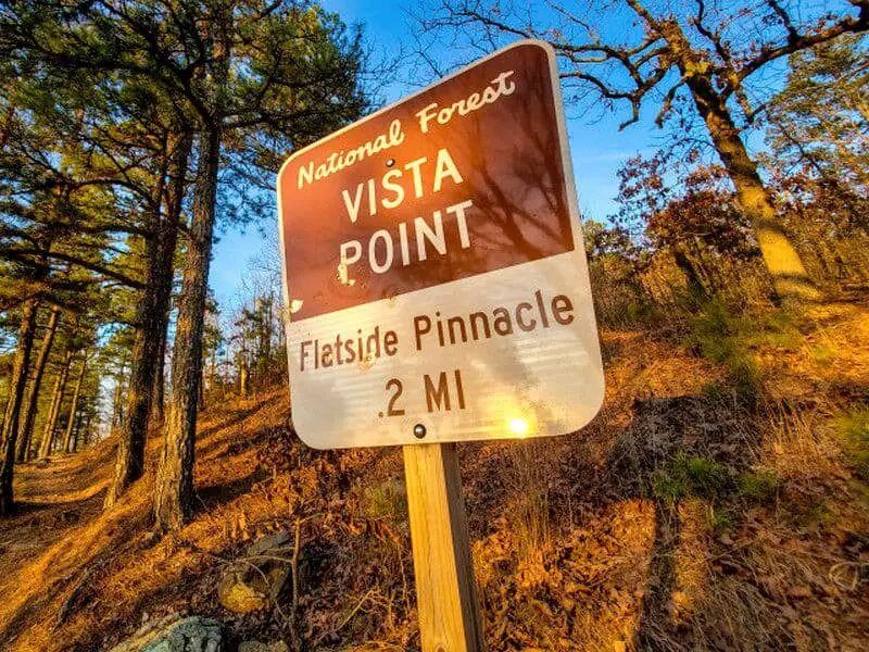
Flatside Pinnacle Boondocking
34.875383, -92.903849
The Flatside Pinnacle area offers dispersed camping with panoramic views of the Ouachita Mountains. Located near the Flatside Wilderness, this site is ideal for campers looking for solitude and hiking access. There are no designated campsites, but flat clearings can be found along the gravel roads near the trailhead.
Things to Do: Hiking the Flatside Pinnacle Trail is the main draw here, with a short hike leading to an impressive vista. Birdwatching, photography, and stargazing are also popular due to the remote setting.
Directions: From Highway 9, head west on Forest Road 132. Follow signs for Flatside Pinnacle. The best camping spots are near the trailhead or pull-offs along the road.
Vehicle Access: The gravel road is usually accessible to most vehicles but may be rough in places. There are no services, toilets, or water, so campers must be fully self-sufficient. The views and quiet make this a rewarding spot for experienced boondockers.
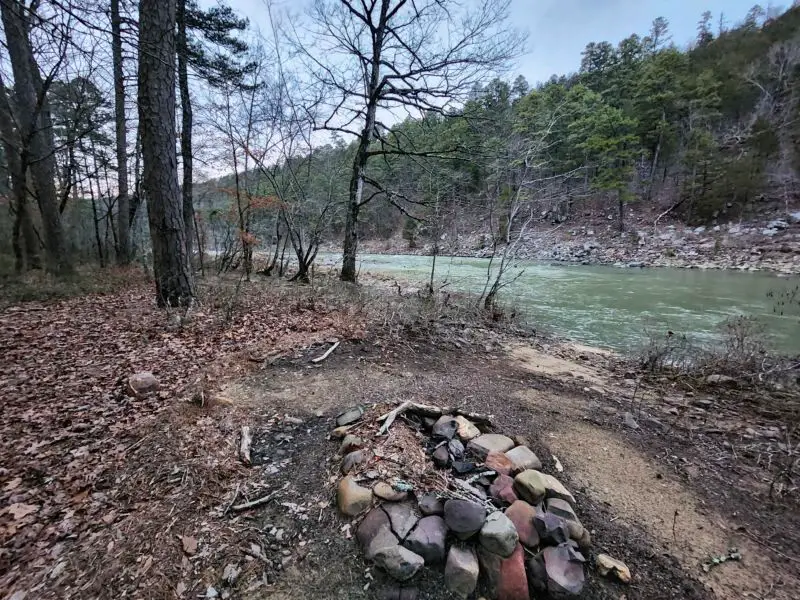
FR 849 Long Caney Riverside Boondocking
34.92353, -93.0517
The FR849 Long Caney Riverside Campsite is a remote, riverside boondocking location within the Ouachita National Forest. It sits alongside the South Fourche La Fave River and offers dispersed camping in a scenic, wooded setting. This is a primitive site with no amenities, best suited for tents or small campers.
Things to Do: Fishing, hiking, and relaxing by the river are the primary activities at this site. The surrounding forest is home to a range of wildlife, and the river provides peaceful surroundings for outdoor recreation.
Directions: From Jessieville, take Highway 7 south to Forest Road 849. Travel west along FR849 until you reach the river access and camping area.
Vehicle Access: The forest road is gravel and may require high-clearance vehicles, especially in wet conditions. There are no restrooms, water, or services, so visitors must pack in all necessary supplies and pack out waste. The area is quiet and offers a true off-grid experience.
Rocky Shoals Float Camp is a primitive campsite located near the Ouachita River in the Ouachita National Forest. This float-in and drive-in site is intended primarily for paddlers navigating the river, but it can also be accessed by vehicle. It is one of several float camps along the Ouachita River Trail, offering basic accommodations for overnight stays during multi-day canoe trips. The site is equipped with a fire ring and a few open tent spots.
Things to Do: Canoeing and kayaking are the main activities at Rocky Shoals. The Ouachita River provides gentle current conditions that are ideal for beginner and intermediate paddlers. Fishing is also popular, with species such as bass, perch, and catfish present in the river. Wildlife is often seen in the surrounding area, and hikers can explore nearby forest trails for additional outdoor recreation.
Directions: From Mount Ida, head west on Highway 270. Turn south onto Forest Service Road 143 and follow the signs toward the float camp. The site is located near a bend in the Ouachita River, providing easy access for launching or landing canoes.
Vehicle Access: Forest Service roads are gravel and may be rough in spots. While accessible by most vehicles in dry conditions, high-clearance is recommended during or after rainfall. No water or services are provided, so campers must bring all essentials and pack out all waste.
Buckville Boondocking
34°36’46.7″N 93°20’31.8″W
Buckville Boondocking is located near the northern shoreline of Lake Ouachita, accessible via Buckville Road (CR-59) and adjacent to the Buckville Use Area. While the formal Buckville campground requires fees and reservations, the surrounding forest lands offer dispersed camping opportunities without amenities. Boondockers often set up along nearby forest service roads or at informal clearings outside the developed area.
This area is a popular launch point for boating, fishing, and swimming on Lake Ouachita. A nearby boat ramp makes lake access easy for kayaks, canoes, or motorized watercraft. Most dispersed sites here are shaded and flat, suitable for tents and small rigs. Campers should be self-contained, as there are no hookups, potable water, or designated waste areas outside the pay sites.
Access roads are generally in good shape, though they may narrow and become less maintained further from the main entry. Cell service is variable; AT&T and Verizon users may find patchy signals. This is a peaceful option for boondockers who want proximity to the water without paying campground fees. As always, follow Leave No Trace ethics and avoid encroaching on any fee-based or signed-use zones.
Fourche Mountain RA Boondocking
34.895136, -93.392865
Fourche Mountain Recreation Area offers dispersed camping in a remote and elevated section of the Ouachita National Forest. Located just off Forest Road 74, this boondocking area sits near the Fourche Mountain Trailhead, a popular stop for equestrian users, ATV riders, and hikers alike. There are no formal camping pads, but there is ample space for tents, smaller RVs, and camper vans. The terrain is mostly gravel and dirt, with shaded spots tucked under tall pines and hardwoods.
Campers will find no developed amenities—no toilets, water, or electricity—so it’s necessary to come fully self-contained. This is a true off-grid setup, offering peace, privacy, and access to some of the Ouachita Mountains’ best trail systems. The nearby Fourche Mountain Trail connects with multiple forest service roads and other trail spurs, making it ideal for long hikes or rides.
The access road is generally in fair condition, but it can be rough or muddy during wet weather. Cell coverage is spotty to nonexistent. This site is best for campers looking to unplug entirely. Given its popularity with trail users, campers should be mindful of shared access areas and practice Leave No Trace principles.
Ice Blue Swimming Hole Boondocking
34.75662, -93.4565
The Ice Blue Swimming Hole is a hidden gem located within the Ouachita National Forest in Arkansas. Known for its crystal-clear waters and serene surroundings, this spot offers a unique boondocking experience for campers seeking a refreshing retreat.
The area is characterized by its natural swimming hole, which is fed by a cool, spring-fed stream. The water’s striking blue hue and the surrounding rock formations create a picturesque setting perfect for relaxation and photography. The site is popular among locals for swimming and picnicking during the warmer months.
Camping here is primitive, with no developed facilities or designated campsites. Campers must be fully self-sufficient, bringing in all necessary supplies and packing out all waste. The site is best suited for tent campers and those with high-clearance vehicles, as access roads can be narrow and rugged.
Activities include swimming, sunbathing, and exploring the surrounding forest trails. Due to its remote location, cell service is likely to be unreliable. Visitors should inform someone of their plans and expected return time. As always, practicing Leave No Trace principles is essential to preserve the site’s natural beauty for future visitors.
Washita Primitive Area Boondocking
34.649702, -93.531217
Located near Story, Arkansas, the Washita Primitive Camping Area offers a tranquil setting along the shores of Lake Ouachita. This free, first-come, first-served site is managed by the U.S. Army Corps of Engineers and provides a rustic camping experience. The area features several designated sites equipped with picnic tables and fire rings. While amenities are minimal, visitors appreciate the clean flush toilets and showers available on-site, offering a touch of comfort in an otherwise primitive setting.
The campground is known for its beautiful lake views and proximity to a swimming area, making it ideal for water enthusiasts. A boat ramp is also available for those looking to explore the lake. The surrounding area offers excellent hiking trails, kayaking, and canoeing opportunities. The peaceful atmosphere and natural beauty make it a great place to unwind and connect with nature.
Access to the campground is via a well-maintained gravel road suitable for most vehicles. However, larger RVs should exercise caution due to limited maneuvering space. Cell service is variable, so it’s advisable to plan accordingly. Visitors are encouraged to practice Leave No Trace principles to preserve the site’s natural beauty for future campers.
Big Fir Boondocking
34.605873, -93.413841
Big Fir Boondocking is situated near the Big Fir Campground in the Ouachita National Forest, southwest of Jessieville. While the established Big Fir Campground may charge fees, boondocking is allowed on adjacent forest lands and along Forest Road 48. These sites are typically primitive clearings or pullouts surrounded by tall pine stands and mixed hardwoods.
The area is quiet and wooded, popular with both campers and equestrians using nearby trails. Most sites are accessible via gravel roads and can accommodate tents or camper vans. Larger RVs may struggle with maneuverability depending on the exact pullout location. There are no restrooms, water, or trash services in the dispersed areas, so campers need to be fully prepared for self-sufficiency.
Trailheads such as Brushy Mountain and Irons Fork are within short driving distance, making this location convenient for outdoor recreation. Wildlife is frequently seen in the area, and the dense tree canopy offers relief from the sun. Cell coverage is weak or absent. Visitors should bring a map or GPS and be ready to navigate without digital support. All users should leave the site clean and undisturbed for future visitors.
Avant Boondocking
34.636602, -93.383119
Avant Boondocking is located near the community of Avant, Arkansas, off Forest Service roads that branch from AR-298. This remote area of the Ouachita National Forest offers dispersed camping on flat, forested ground. It’s ideal for those who want a peaceful, backcountry experience with minimal human traffic.
The terrain consists of mixed pine and hardwood forest with several natural clearings large enough to accommodate tents or small trailers. There are no formal campsites, and amenities are nonexistent—no toilets, water, or trash services—so all campers must be self-sufficient and practice responsible waste management.
Access is via gravel roads that vary in quality. After heavy rain, these routes can become rutted or slick, so a vehicle with good ground clearance is recommended. The solitude of the area attracts wildlife like deer, wild turkey, and small mammals, making it a good destination for nature observation and photography.
There are no marked trails directly at the site, but the surrounding forest roads provide opportunities for hiking and exploration. Cell reception is typically unreliable, so campers should not depend on mobile service. Always inform someone of your plans and leave the site in the same or better condition than you found it.
Irons Fork Boondocking
34.686321, -93.372695
Irons Fork Recreation Area is a primitive camping site located on the north end of Lake Ouachita in Jessieville, Arkansas. This free camping area is managed by the U.S. Army Corps of Engineers and offers a peaceful retreat for campers seeking a natural setting with basic amenities.
The campground features several flat spots suitable for camper vans and small RVs. Each site is equipped with picnic tables, fire rings, and grills. Pit toilets are available, and a boat ramp provides easy access to the lake. The calm waters of Lake Ouachita are perfect for kayaking, fishing, and swimming.
Access to Irons Fork is via a maintained gravel road, which can be slippery when wet and dusty when dry. The road is generally passable for most vehicles, but caution is advised during adverse weather conditions. The area is big-rig friendly, but larger RVs should verify road and site conditions before attempting access.
Cell service is variable, with some reports of limited AT&T and T-Mobile coverage. Campers should plan accordingly and be prepared for limited connectivity. The site is pet-friendly, and visitors are encouraged to practice Leave No Trace principles to preserve the area’s natural beauty.
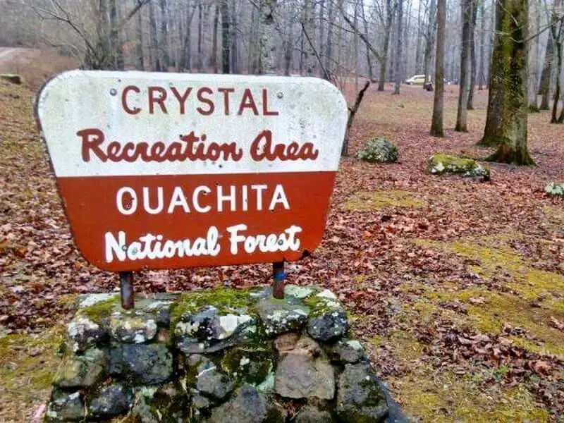
Crystal Recreation Area
34°28’56.6″N 93°38’16.8″W
Crystal Recreation Area is a remote and lightly developed site located in the Ouachita National Forest near the banks of Crystal Springs. Surrounded by dense pine and hardwood forest, the area offers a peaceful setting for dispersed and tent camping with minimal disturbance. This recreation area includes a small parking lot, some picnic tables, and a boat ramp providing access to Lake Ouachita, making it a convenient stop for those looking to spend time near the water.
Things to Do: Lake Ouachita is known for its clear waters, and this site provides direct access for fishing, swimming, and paddling. Anglers come for largemouth bass, crappie, and catfish. Canoeing and kayaking are ideal on the calm waters near the boat ramp. Wildlife observation and birding are common, and the forested surroundings provide quiet hiking opportunities. This is a good place to unwind away from more developed recreation areas.
Directions: From Mount Ida, drive east on Highway 270. Turn north on Crystal Springs Road (County Road 59) and follow it for several miles until you reach signs for Crystal Recreation Area.
Vehicle Access: The paved road transitions to gravel near the site, but it’s manageable for most vehicles. There are no hookups, dump stations, or potable water. Primitive vault toilets may be available, but visitors should bring all necessary supplies and pack out trash.
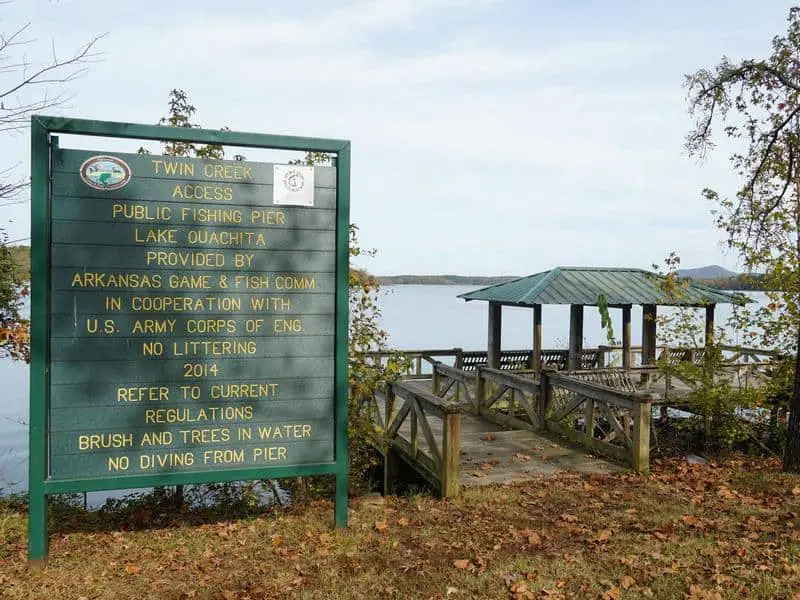
Twin Creek Campground
34.550313, -93.511047
Twin Creek Campground is located on the western side of Lake Ouachita, near Mount Ida in the Ouachita National Forest. Managed by the U.S. Army Corps of Engineers, this developed campground provides a more structured camping experience with amenities, but the surrounding forest area also allows for limited boondocking opportunities outside the fee zones.
Within the campground, there are designated sites suitable for tents and RVs. Most sites are paved or gravel and include picnic tables and fire rings. Vault toilets and drinking water are available, along with a boat ramp that provides direct access to the lake. The area is especially popular with anglers targeting bass and crappie in the clear waters of Lake Ouachita.
Outside the formal camping area, some forest service roads and pull-offs offer dispersed camping potential. These spots are primitive with no services and should only be used by campers who are fully self-contained. The forest canopy offers shade, and the proximity to the water makes it a relaxing option.
The roads leading in are gravel but manageable for most vehicles. Cell reception varies but is generally weak. Whether using the official campground or camping nearby in the forest, be sure to check posted signs and respect any use restrictions.
Great Ouachita National Forest Campgrounds
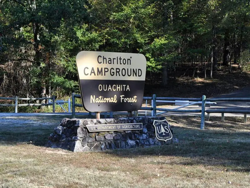
Charlton RA Campground
34.532002, -93.384003
Charlton Recreation Area Campground is a developed U.S. Forest Service site located off Highway 270 between Mount Ida and Hot Springs. It sits along Walnut Creek and includes a spring-fed swimming area, making it one of the more established campgrounds in the Ouachita National Forest.
The campground has paved loops and includes standard sites with picnic tables, fire rings, tent pads, and access to flush toilets and drinking water during the main season. A few walk-in tent sites are also available. Although there are no electrical hookups, the paved sites are suitable for RVs. Reservations are not always required, but they are available for peak times.
The main draw is the large stone-lined swimming hole fed by a natural spring, which remains cool and clear throughout the warmer months. Day-use visitors also frequent the site for picnicking and creek access. The area is heavily shaded, and hiking trails are accessible from the site.
Cell service is limited depending on the carrier. Quiet hours are enforced, and the site is patrolled seasonally. Charlton RA is ideal for family camping, swimmers, and those looking for a maintained site with reliable access and water features in a natural setting.

Star Of the West Campground
34.239029, -93.82518
Star Of the West Campground is a small, forested lakeside campground on Lake Greeson, ideal for anglers and boaters seeking a quiet escape. The area is managed by the U.S. Army Corps of Engineers and provides a handful of primitive sites without electric or water hookups. While the site is not heavily advertised, it’s a favourite among locals for its peaceful shoreline and easy lake access.
Things to Do: Activities include fishing, swimming, and boating. The quiet cove setting makes it ideal for paddle sports and bank fishing. The surrounding woods also offer wildlife viewing and short, informal trails for nature walks. Its location makes it a convenient base for exploring nearby Daisy State Park or other parts of Lake Greeson.
Directions: From Daisy, Arkansas, take Highway 70 west to the Star of the West Road and follow the signs toward the lake. The last stretch is gravel but typically passable by most vehicles.
Vehicle Access: Suitable for vans, small trailers, and truck campers. The road into the site can be narrow and rutted, especially after rains. There is limited turnaround space, so it’s not recommended for large RVs or fifth wheels. Quiet and low-traffic, it’s a solid off-grid location.
Shady Lake
34.362836, -94.027769
Things to Do: Shady Lake offers a well-forested, peaceful environment for both developed and dispersed camping. While there is an official Shady Lake Campground managed by the U.S. Forest Service, there are also nearby areas used for boondocking and short-term dispersed stays outside the fee zones. The lake is ideal for non-motorised boating, fishing, and light swimming. There’s a scenic stone dam, small beach area, and hiking trails including the River Walk Trail that follows the lakeshore. Visitors often come for the serenity and natural beauty, with thick pine cover and seasonal wildflowers.
Directions: From U.S. Highway 71 in Vandervoort, take AR-246 east for approximately 12 miles. Watch for signage to Shady Lake Recreation Area. Follow forest service roads near the lake for dispersed pullouts. The coordinates mark an access point used by dispersed campers.
Vehicle Access: Forest roads in this area are typically gravel and can become rough during rainy conditions. Passenger cars can usually access it in dry weather. RVs under 30 feet may fit in some dispersed pull-offs, but scouting is recommended. There are no services in the dispersed zone—no water, restrooms, or trash—so be fully self-sufficient.
Pikeville RA (Recreation Area)
34.169224, -93.729213
Things to Do: Pikeville Recreation Area is a small, lesser-known site that allows dispersed camping near forest roads and open space. It’s commonly used by boondockers seeking a quiet, low-traffic location for overnight or weekend stays. Activities include hiking, wildlife viewing, and basic trail exploration. While there are no official services or campgrounds, the flat terrain and wooded cover make it a good location for tent campers and small rigs. It’s also close to the Caddo River, which can be accessed with short drives.
Directions: From Glenwood, Arkansas, take AR-8 west to AR-84, then south along county and forest service roads toward the Pikeville area. The location is rural, so confirm GPS routes before arrival. The coordinates point to a common boondocking area just off a main gravel access road.
Vehicle Access: Roads to the area are gravel and passable under dry conditions for most vehicles. Larger RVs may struggle with turnarounds. The area has no facilities—no potable water, toilets, or trash collection—so pack accordingly. Short-term stays are ideal here, especially for campers looking for a low-key stop between destinations.
Little Pines RA (Recreation Area)
34.868284, -94.268241
Things to Do: Little Pines Recreation Area is a dispersed-use forest location popular among hunters, off-roaders, and campers looking for a private experience. The surrounding terrain is wooded and moderately hilly, with primitive roads leading to several small clearings that are suitable for camping. It offers minimal traffic, plenty of shade, and opportunities to explore Arkansas backcountry. While not a developed site, the area is commonly used during deer and turkey seasons and has fire rings and signs of regular use by outdoors enthusiasts.
Directions: From Waldron, Arkansas, head west on AR-248, then turn south onto forest service roads leading to the Little Pines area. The GPS coordinates bring you to a known dispersed site commonly used for overnight stays. Cellular service may be limited in this area.
Vehicle Access: Best accessed by high-clearance vehicles. Roads are dirt or gravel and can be muddy during wet conditions. Small trailers and campervans can use the site if weather permits. There are no services—no water, toilets, or trash bins—so campers must be fully self-contained. Good for weekend getaways or quick stops off the main route.
Cedar Fourche Campground
34.662646, -93.283600
Cedar Fourche Campground is a small, primitive camping area located on the southern shore of Lake Ouachita. Managed by the U.S. Army Corps of Engineers, it is a fee-free, non-reservable site that offers basic, undeveloped campsites with direct lake access. It lies just west of the more developed Brady Mountain area.
The campground includes a gravel loop road with several pull-off sites, most of which are shaded by pine and hardwood trees. There are no electrical or water hookups, and no dump station. Vault toilets may be present, though availability and condition can vary. Each site typically includes a picnic table and fire ring.
The area is primarily used for fishing, kayaking, and quiet lakeside camping. A small boat launch is nearby, but not suited for large watercraft. The campground is best suited for tents or small rigs; large RVs are not recommended due to space constraints and uneven terrain.
Because of its remote setting, cell phone coverage is limited. Visitors should be prepared for self-sufficiency—bring water, firewood, and a waste disposal plan. Cedar Fourche is ideal for those looking to camp close to the water without campground crowds or service infrastructure.
Lena Landing Campground
34.668663, -93.231077
Lena Landing Campground is a small, maintained U.S. Army Corps of Engineers site on the eastern shore of Lake Ouachita, near Hot Springs, Arkansas. It provides lakeside camping options with basic amenities, making it a suitable choice for both tent campers and RV users. The campground is directly accessible via Lena Landing Road, just off Highway 290.
Campsites are spaced moderately apart and typically include gravel pads, picnic tables, fire rings, and nearby vault toilets. While the site is maintained, it does not offer electrical or water hookups, and there is no dump station. It is considered a low-traffic area compared to larger campgrounds nearby, which makes it appealing to campers looking for quiet lakeside camping with fewer visitors.
The adjacent boat ramp provides direct access to Lake Ouachita, making this a popular location for boating and fishing. Visitors commonly target bass, bream, and catfish in the area. Swimming is permitted in the lake, but there is no designated swim area at the campground. Cellular reception is weak to moderate depending on provider. Firewood gathering is allowed within reasonable limits. This site is best for campers seeking peace, lake access, and a minimalist experience close to nature without large crowds.
Little Fir Campground
34.633195, -93.472313
Little Fir Campground is situated along the northern shore of Lake Ouachita, near Mount Ida. This developed campground is operated by the U.S. Army Corps of Engineers and offers maintained campsites with basic amenities and direct lake access. It is popular among anglers and paddlers due to its proximity to quiet coves and open water.
The campground features gravel pads for tents and RVs, picnic tables, fire rings, and vault toilets. Drinking water is available seasonally, and there’s a boat ramp for launching small and mid-sized vessels. Most campsites are shaded by mature hardwoods and pines, offering some relief during summer months.
Though boondocking is not permitted within the managed site, forest service roads nearby (such as FS 47 or FS 401) may offer primitive, dispersed camping options for those looking to camp without fees or amenities. These forest roads often feature pull-off clearings where tents or small rigs can be set up, but they lack water, toilets, or trash services.
Road access to Little Fir is mostly gravel but well maintained. Cell reception is limited, so plan ahead for navigation. The site is peaceful and quiet—ideal for those seeking a no-frills lakeside stay. All campers, especially boondockers, should follow posted regulations and Leave No Trace guidelines.
Laurel Creek Campground
34.187036, -93.706763
Laurel Creek Campground is a low-key, forested campsite tucked into a cove on Lake Greeson. This Corps of Engineers site offers primitive camping with picnic tables and fire rings, but no electrical hookups. Vault toilets are typically available depending on the season. The area sees light use, even in summer, and the shaded sites near the water make it ideal for low-impact camping.
Things to Do: Fishing is a major draw here, with catfish and bass commonly caught from the banks. There’s a small gravel launch for kayaks or canoes. Hiking options are limited to nearby forest service roads and informal paths. The wooded surroundings offer good shade and privacy between sites.
Directions: Access Laurel Creek via Highway 70, turning south onto Laurel Creek Road. Continue until the road forks near the campground entrance. A small sign marks the turn.
Vehicle Access: Best for vans, truck campers, or small RVs. Larger units may be restricted due to narrow roads and limited turnaround space. The ground can get soft after rains, so check conditions ahead. Quiet and peaceful, it’s a good stop for lake campers looking to avoid crowds.
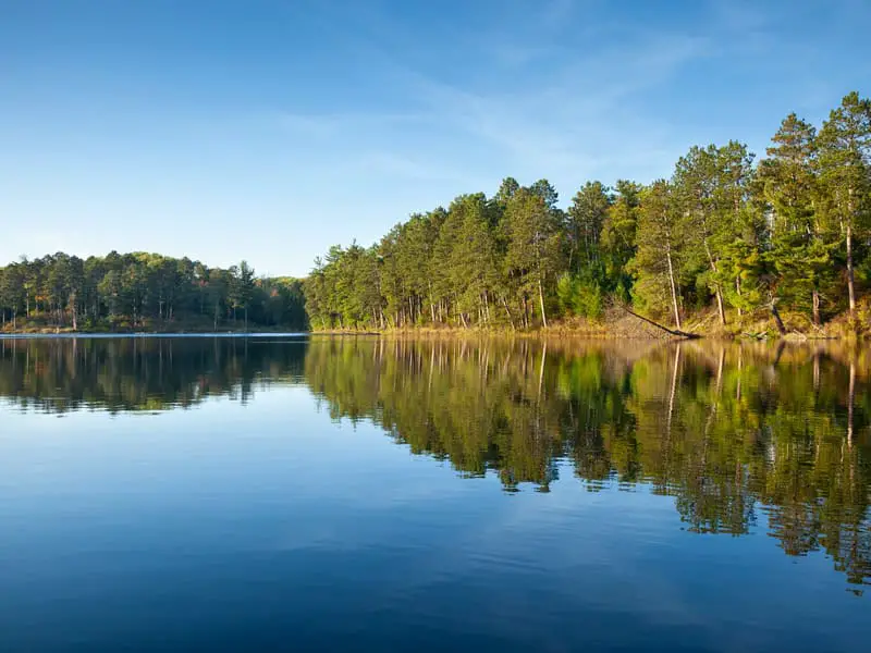
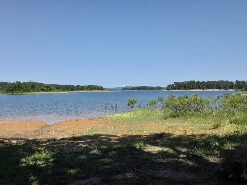
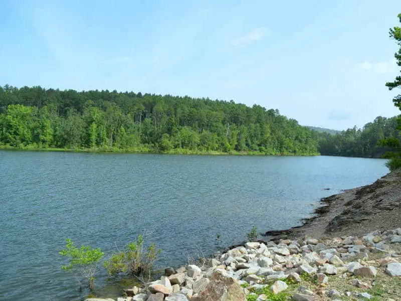
Beautiful calm northern Minnesota lake under blue sky with trees along the shore in afternoon sunlight
Buckhorn Campground
34.178606, -93.730694
Buckhorn Campground is located along the southern shoreline of Lake Greeson and is maintained by the U.S. Army Corps of Engineers. It offers a combination of primitive and developed sites with picnic tables, fire rings, vault toilets, and access to the lake. While some sites can accommodate RVs, most are better suited for tents or small trailers.
Things to Do: The lake is ideal for boating, fishing, and swimming. There’s a boat ramp nearby and plenty of shore access for anglers. The area is known for its scenic sunsets, abundant pine cover, and peaceful atmosphere. Trails and gravel paths offer short hikes through forested sections, and it’s not uncommon to spot deer or bald eagles in the area.
Directions: From Daisy, take Highway 70, then follow Buckhorn Road south toward the lake. The final section is a gravel road with some mild grades.
Vehicle Access: Suitable for small RVs, vans, and trailers. Larger RVs should verify road and site conditions before attempting access. Most sites are shaded and relatively level. The campground tends to stay quiet even during warmer seasons, making it a reliable option for lakefront camping.

Bear Creek Lake Greeson
34.785461, -93.160629
Bear Creek Recreation Area lies on the eastern shores of Lake Greeson and offers basic lakefront camping for those who want solitude and proximity to water. This is a primitive, dispersed-style area with no hookups, formal pads, or facilities. Campsites are loosely defined and situated under tall trees with intermittent views of the lake.
Things to Do: The lake provides excellent fishing, particularly for striped bass and crappie. Visitors can swim or launch small watercraft from shore. There are opportunities for hiking along unmarked paths and open access to shoreline areas for nature watching. It’s a good site for those seeking minimal human activity and low noise.
Directions: Access is from Murfreesboro via Highway 19, turning onto Bear Creek Road. The road eventually transitions to gravel and follows the lake’s edge.
Vehicle Access: Best for high-clearance vehicles, camper vans, or tents. Large RVs may struggle with the narrow access road and limited space for turning around. There are no facilities, so bring all necessary supplies and pack out all waste. The lakefront setting makes this a rewarding stop for those prepared for primitive conditions.

Bear Creek Equestrian Camp Campground
34.785461, -93.160629
Bear Creek Equestrian Camp is designed for horse riders and offers large, open camping areas with access to extensive riding trails. Located in the Ouachita National Forest, this primitive campground includes tie posts, picnic tables, and vault toilets, making it suitable for both equestrian and non-equestrian campers.
Things to Do: Horseback riding is the main attraction, with marked trails winding through forested hills and creek crossings. The area is also good for hiking and wildlife observation.
Directions: From Jessieville, take Highway 7 south to Forest Road 47. Follow FR47 to the Bear Creek area, where signage leads to the equestrian camp.
Vehicle Access: The site is accessible by gravel road and suitable for trucks and trailers. There are no hookups or potable water, so campers must come prepared. The campground is quiet and offers ample space for group camping with horses.

Cove Lake
35.224794, -93.624097
Cove Lake is a quiet, forested campground located in the Ozark National Forest near Mount Magazine in Logan County, Arkansas. Nestled beside the small yet picturesque Cove Lake, this spot offers a mix of tent sites, RV-accessible areas, and adjacent dispersed camping options. Its location near the base of Mount Magazine makes it a popular stopping point for those exploring the tallest point in Arkansas.
Things to Do: Visitors can enjoy swimming, kayaking, fishing, and picnicking around the lake. There are designated hiking trails nearby, including connections to trails leading up Mount Magazine. The wooded setting provides good shade and a quiet atmosphere, ideal for bird watching or simple relaxation by the water.
Directions: From Paris, Arkansas, take AR-309 south toward Mount Magazine. Turn east onto Cove Lake Road and follow it to the campground and surrounding areas near the provided coordinates.
Vehicle Access: Access is possible with most vehicle types, though the roads may become narrow or uneven in places. The campground includes improved sites, but those looking to boondock can find clearings or gravel areas near the lake. Best suited for vans, small trailers, or tents. High-clearance vehicles are recommended if going off the main roads.
Frequently Asked Questions
You’ll need to know a few things to camp in Ouachita National Forest. Picking a spot, finding maps, and camping safely makes the whole experience better.
What are the rules for dispersed camping in the Ouachita National Forest?
If your group is bigger than 75, you’ll need a special use permit. Stick to government land and don’t wander onto private property.
Pack out all your trash and be gentle with the trees and plants. Keep fires under control and follow any fire bans.
Are there any designated boondocking sites within the Ouachita National Forest?
Most boondocking here is dispersed—no official sites, no amenities. A few areas might have some services or require permits, but generally, you can camp almost anywhere allowed by forest rules if you leave no trace.
Where can I find a map showing boondocking locations in the Ouachita National Forest?
You can pick up maps at forest offices or order them online. Some websites and apps also have user-shared spots marked.
Always check for updated maps and road info before you go.
Is boondocking permitted year-round in the Ouachita National Forest?
Yes, you can camp year-round, but weather and access change with the seasons. Some roads or areas close in winter or after heavy rain.
Check local forest service updates for closures or fire restrictions before you plan your trip.
How can I ensure I’m following the Leave No Trace principles while boondocking in Ouachita NF?
Pack out all your trash and food scraps. Camp at least 200 feet from water.
Don’t cut live trees, and stick to durable surfaces like gravel or dirt roads.
What are the best practices for safety when dispersed camping in the Ouachita National Forest?
Let a friend or family member know where you’re headed and when you plan to be back. Pack a map, compass, or GPS—just make sure you actually know how to use them.
Take more food and water than you think you’ll need, and toss in some extra layers for those surprise weather shifts. Wildlife’s out there, so give animals plenty of space and don’t try to get too close.