

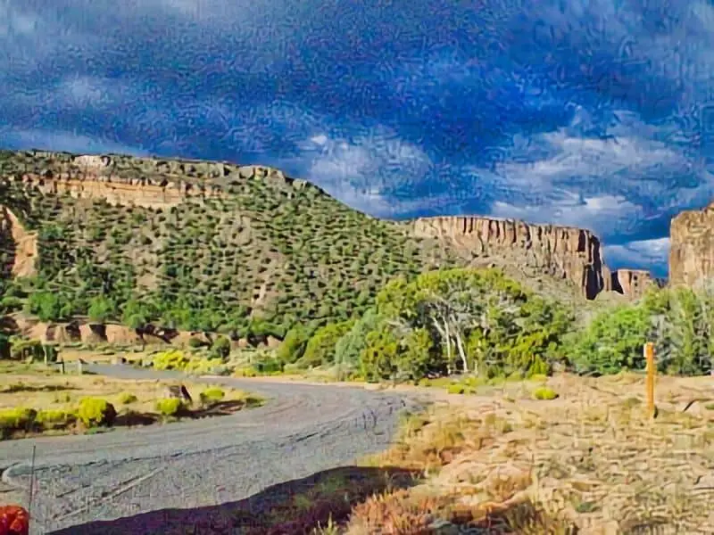
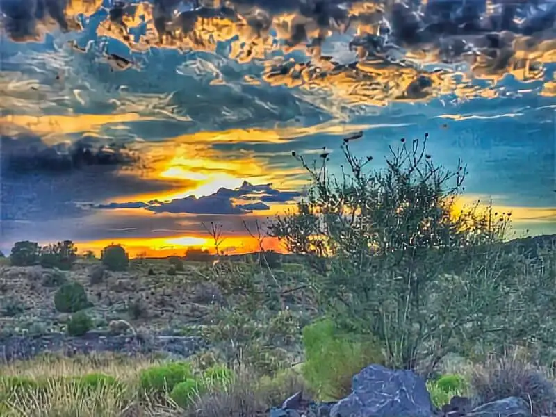
When looking for a unique adventure, La Cieneguilla Petroglyphs offers excellent boondocking locations near Santa Fe, New Mexico. This site is not just about ancient rock art; it also provides beautiful views of the surrounding landscape and opportunities to connect with nature. Whether you’re an experienced boondocker or trying it for the first time, finding the right spot can enhance your experience.
Many campers appreciate the dispersed camping options available near the petroglyphs, particularly along County Road 62 and Forest Road 102. These areas allow you to set up camp in a peaceful setting while being close to historic sites.
I’ll share some tips on how to select the best boondocking spots and what to expect when camping in this scenic region.
Exploring the La Cieneguilla Petroglyphs is also a chance to learn about the rich history of the area. With numerous trails leading to the petroglyphs, campers can enjoy hiking while taking in the natural beauty around them. This combination of history and adventure makes it a perfect destination for outdoor enthusiasts.
Location And Access
I found the La Cieneguilla Petroglyphs located near Santa Fe, New Mexico. This site is easily accessible and is a great spot for boondocking.
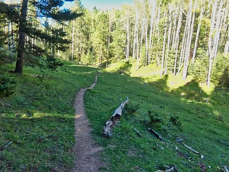
To reach the petroglyphs, follow a marked trail. The hike takes about 5 to 10 minutes. Along the way, I enjoyed the scenery of the surrounding basalt cliffs.
Directions
- Start in Santa Fe: Head southeast from the city center.
- Follow the signs: Look for trail markers indicating the way to the petroglyph site.
- Park nearby: There are areas close to the trailhead for parking.
Trail Information
- Distance: The trail is short and manageable, making it suitable for most visitors.
- Difficulty: It’s generally considered easy to moderate.
- Views: The cliffs provide a scenic backdrop and excellent views of the petroglyphs.
For those looking to camp, there are free overnight options available nearby. It’s a peaceful place to unwind after exploring. Just remember to bring blackout curtains if you prefer a dark sleeping environment.
Directions
To get to the La Cieneguilla Petroglyphs, follow these steps:
- Start from Santa Fe: Head south on I-25.
- Exit 276: Take the exit for Highway 599.
- Turn Right: After the exit, turn right onto Highway 599.
Continue west for about 3.3 miles on Airport Road.
Once you reach the intersection, look for signs pointing to the petroglyph site.
For boondocking locations, I suggest checking areas just outside the Santa Fe city limits. These spots often allow for free overnight camping.
If you want to hike, I recommend the La Cieneguilla Loop. This 2.7-mile trail offers beautiful views and access to the petroglyphs as well.
Make sure to bring blackout curtains if you plan to sleep in your vehicle. This can help you rest better.
Stay aware of local camping regulations to ensure a hassle-free experience.
Camping Regulations And Restrictions
When camping near La Cieneguilla Petroglyphs, I need to follow specific regulations to protect the area and ensure a good experience.
Dispersed Camping
- I can camp in dispersed areas along County Road 62 and Forest Road 102.
- It’s important to keep my RV close to the road to avoid damaging the land.
Camping Duration
- I can stay in a dispersed area for up to 30 days.
- If I plan to camp longer, I need to look for alternative options.
Permit Requirements
- For groups larger than 75 people, you need a special use permit.
- Make sure to check with local authorities if you are unsure about permit needs.
- I must practice Leave No Trace principles.
- This means cleaning up after myself and minimizing my impact on the environment.
Fires and Wildlife
- Campfires may be restricted due to fire safety.
- You need to verify current bans and respect wildlife by not feeding them.
Information Resources
Bureau of Land Management – La Cieneguilla Petroglyph Site Overview
National Register of Historic Places La Cieneguilla Petroglyphs
New Mexico Wildlife Information
National Weather Service New Mexico Climate Information
Santa Fe Historical Society – Petroglyph Background
 Free La Cieneguilla Boondocking Locations

Pajarito Spring Boondocking Location – Los Alamos
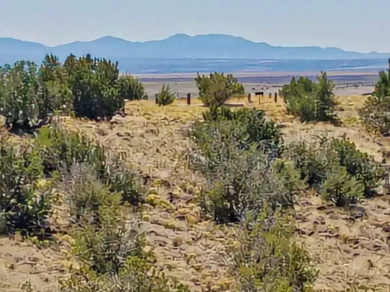
Pajarito Spring offers dispersed camping within the Santa Fe National Forest, approximately 3 miles east of Los Alamos along NM-4. The access road is dirt and situated about 1.4 miles from the nearest paved road, making it more suitable for high-clearance vehicles; large RVs may find the terrain challenging.
The area provides 6–15 campsites without amenities, so campers must be self-sufficient, bringing their own water and supplies. The sites are well-spaced, offering privacy, and the location provides scenic views toward Los Alamos and NM-4.
Nearby attractions include Bandelier National Monument and the Valles Caldera National Preserve, both offering hiking and exploration opportunities. Cell service is generally available, but it’s advisable to verify coverage with your provider.
Diablo Canyon Boondocking Location
Diablo Canyon Recreation Area, managed by the Bureau of Land Management (BLM), is located near the Rio Grande and is renowned for its dramatic vertical cliffs, making it a popular destination for hiking and rock climbing.
Primitive, dispersed camping is permitted along the eastern side of the canyon. Facilities are minimal, with a vault toilet available but no potable water; campers must bring their own supplies. The area includes a defined trailhead and parking area, and the canyon trail is approximately 7.5 miles out and back, ending at the Rio Grande.
Access to Diablo Canyon is via Veterans Memorial Highway (NM-599) to Camino La Tierra Road, then onto Old Buckman Road, a dirt road that can become impassable during inclement weather. While the road is bumpy, it is generally passable with 2WD vehicles under dry conditions.
The nearest amenities, including food, water, and gas, are located in Santa Fe, approximately 16 miles away. Campers can stay for up to 14 days, adhering to BLM regulations.Bureau of Land Management

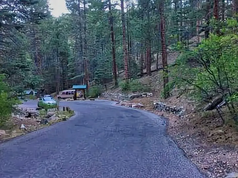
Camp May Boondocking Location
Camp May is situated near the summit of Pajarito Mountain, close to the Pajarito Mountain Ski Area. The campground offers a tree-lined setting with amenities such as campfire pits, picnic tables, and pit toilets.
The access road to Camp May is paved, but it’s advisable to assess the road conditions before attempting to bring large RVs, as the area may have limitations for larger vehicles. The campground provides scenic views of the surrounding mountains and valleys, and its proximity to Los Alamos makes it convenient for accessing local attractions.
Aspen Basin Boondocking Location
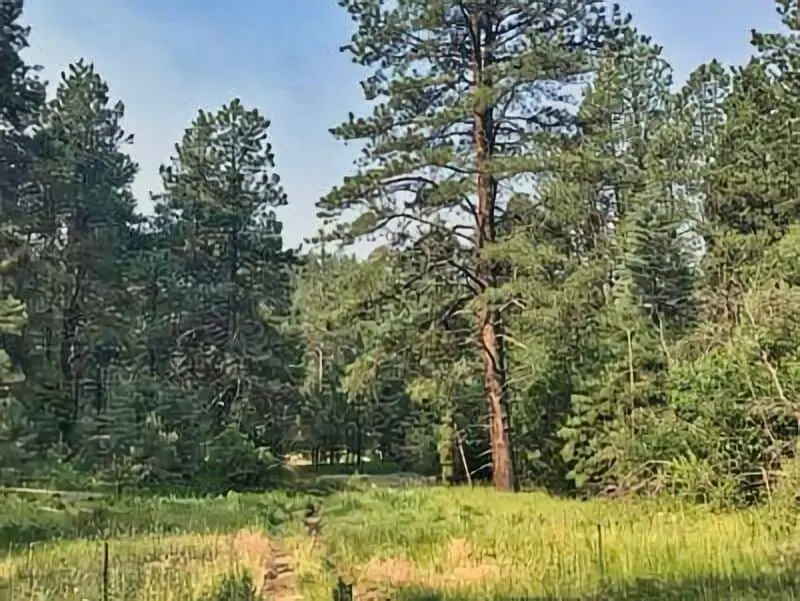
Aspen Basin Campground is located in the Santa Fe National Forest, offering a forested setting ideal for tent camping. The campground provides basic amenities, including picnic tables and fire rings. Due to its location and road conditions, it’s more suitable for smaller vehicles and tents rather than large RVs.
The area is known for its hiking opportunities and scenic beauty, particularly during the aspen foliage season. Campers should be prepared for primitive camping conditions and bring necessary supplies, as amenities are limited.

American Spring Boondocking Location
American Spring offers dispersed camping within the Santa Fe National Forest, accessible via a dirt road off NM-4. The area provides free camping with no facilities, so campers must be self-sufficient. The roads can be rough, with large rocks and deep ruts, making them more suitable for 4×4 vehicles.
Despite the challenging access, the area offers beautiful views, especially during sunrise, and is close to attractions like the Valles Caldera and Bandelier National Monument. Cell service is generally available, but it’s advisable to verify coverage with your provider.
Big Tesuque Boondocking Location
Big Tesuque Campground is located in the Santa Fe National Forest and offers a forested setting suitable for tent camping. The campground provides basic amenities, including picnic tables and fire rings. Due to its location and road conditions, it’s more suitable for smaller vehicles and tents rather than large RVs.
The area is known for its hiking opportunities and scenic beauty, particularly during the aspen foliage season. Campers should be prepared for primitive camping conditions and bring necessary supplies, as amenities are limited.

La Cieneguilla Campgrounds
Tetilla Peak Campground
Tetilla Peak Campground is situated on the eastern shore of Cochiti Lake within the Pueblo de Cochiti Indian Reservation. The campground comprises two loops: Cholla Loop, offering 36 sites with electric hookups, shelters, picnic tables, and grills; and Coyote Loop, featuring 10 non-electric sites with similar amenities. Water spigots are located throughout the campground, but water availability may be seasonal. A dump station and restrooms are available; however, showers may be temporarily closed.
Recreational activities include boating, fishing, and wildlife viewing. The campground is accessible via I-25 north from Albuquerque to exit 264, then west on State Road 16 to the Tetilla Peak Recreation Area turnoff. The roads are paved, accommodating most vehicles, including RVs.

Bandelier Juniper Campground
Located near the entrance of Bandelier National Monument, Juniper Family Campground offers 53 individual sites suitable for tents, RVs, and trailers, as well as two group sites for tent camping. Each site includes a picnic table, fire ring with grill, and food locker. Comfort stations with restrooms and potable water are centrally located; however, there are no showers or hookups. An RV dump station is available, with water turned off during winter months.
The campground is accessible via NM-4, with paved roads suitable for most vehicles. During peak season (mid-May to mid-October), a shuttle service operates from the campground to Frijoles Canyon, as private vehicle access is restricted during this period.
Cochiti Lake Campground
Cochiti Lake Campground is located on the western shore of Cochiti Lake, offering a range of campsites with amenities such as electric hookups, picnic tables, and shelters. Restrooms and showers are available, though availability may vary seasonally. The campground provides access to recreational activities including boating, fishing, and hiking.Recreation.gov
Access is via I-25 to exit 264, then west on NM-16 and north on NM-22 to the lake. The roads are paved, accommodating various types of vehicles, including RVs.

Los Alamos – Sunrise RV Park
Sunrise RV Park is located in Los Alamos, offering full hookup sites for RVs. Amenities include restrooms, showers, laundry facilities, and Wi-Fi. The park is conveniently situated near local attractions and services. Access is via NM-502, with paved roads suitable for all vehicle types.
Black Canyon Campground
Black Canyon Campground is nestled in the Santa Fe National Forest along NM-475, approximately 8 miles from Santa Fe. The campground offers single and double sites equipped with picnic tables and grills. Vault toilets are available; however, there is no electricity or water on-site. A dump station is accessible at nearby Hyde Memorial State Park for a nominal fee. US Forest Service
A one-mile loop trail originates from the campground, providing hiking opportunities. The campground is accessible via paved roads, accommodating most vehicles, though larger RVs may find maneuvering challenging due to the forested terrain.
Frequently Asked Questions
I often get questions about boondocking near the La Cieneguilla Petroglyphs. Here are some common inquiries and answers to help with planning your visit.
What are the best boondocking spots near La Cieneguilla Petroglyphs?
Some of the best spots for boondocking are along the roads leading to the petroglyphs. Look for flat, dry areas that provide easy access to the site. It’s important to have a vehicle that can handle rough terrain if you choose a more remote location.
Are there any designated boondocking sites close to the La Cieneguilla Petroglyphs?
There are no officially designated boondocking sites near La Cieneguilla Petroglyphs. Most camping options in the area are informal. Always check for signs or rules to ensure you’re in a legal spot.
Can you boondock overnight in the vicinity of La Cieneguilla Petroglyphs?
Yes, you can boondock overnight as long as you find a suitable spot. Be mindful of local regulations, as some areas may have restrictions. It’s a good idea to arrive early to secure a good location.
What should I know before boondocking near La Cieneguilla Petroglyphs?
Before you go, ensure you have enough supplies, including water and food. Be prepared for a lack of amenities. Familiarize yourself with the area’s wildlife and be respectful of the environment and local cultural sites.
How close to the La Cieneguilla Petroglyphs can one legally boondock?
It’s best to camp at least a short distance away from the petroglyphs themselves. This helps in protecting the site and ensures you don’t disturb the petroglyphs or the surrounding area. Always look for designated off-road areas.
Are there any resources for finding boondocking locations around La Cieneguilla Petroglyphs?
I recommend checking online forums and camping apps that focus on boondocking. Websites like FreeCampsites or Campendium often list user-recommended spots. Local visitor centers can also provide valuable information about nearby boondocking sites.