


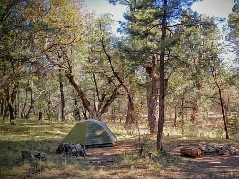
If you’re looking to experience the Chiricahua National Monument in a more rugged and natural way, boondocking offers a great option. Boondocking means camping without hookups or facilities, often in remote areas where you can enjoy solitude and the outdoors.
The Chiricahua Mountains have several spots where you can set up your campsite away from crowded developed campgrounds. Among the 14 known boondocking locations, areas like Rucker Canyon Road give you access to scenic views and quiet nights.
These dispersed camping sites are usually on a first come, first served basis and have limits on how long you can stay, so it’s important to plan ahead. You won’t find hotels or services nearby in the mountains, so being prepared for self-sufficient camping is key.
The closest towns, like Willcox, are about 45 minutes away, where you can stock up on supplies before you head out into the wilderness.
About This Location
Chiricahua National Monument is in southeastern Arizona. It is known for its large rock formations and unique landscapes formed by volcanic activity.
You can explore trails that take you through these impressive spires and balanced rocks. Near Chiricahua, you will find Cave Creek Canyon.
This area offers good dispersed camping spots, including boondocking locations. Herb Martyr Road leads you into Cave Creek Canyon, where you can camp without fees.
The area is close to the Gila National Forest and Gila Cliff Dwellings. The Gila Cliff Dwellings show ancient homes built into canyon walls.
Exploring nearby forest lands adds more space for camping and hiking in a natural setting. If you plan to stay near the monument, dispersed camping is an option when the main campgrounds are full.
Piney Canyon Road has several free spots for tent camping. These sites offer a quieter experience away from developed campgrounds.
Keep in mind, these boondocking locations often do not have water, trash, or hookups. You should bring your own supplies and be prepared for basic conditions.
Location And Access
The Chiricahua National Monument is located in southeastern Arizona, near the small town of Willcox. You will find the monument approximately 90 miles east of Tucson.
This area is known for its unique rock formations and quiet natural settings. Most boondocking spots are accessed via gravel or forest service roads.
For example, Herb Martyr Road at the end leads into Cave Creek Canyon, a popular dispersed camping area. You should be prepared for rough driving conditions on some roads, especially after rain.
The monument sits close to the Coronado National Forest. Many camping areas are spread along forest roads like Piney Canyon Road and Madera Canyon Road.
These routes provide access to free and quiet spots where you can set up a tent or park an RV. You should bring enough supplies since services near these dispersed camping areas are limited or unavailable.
Cell phone coverage may be spotty. It’s best to check local maps and road conditions before you go.
Quick access overview:
| Road Name | Access Type | Notes |
|---|---|---|
| Herb Martyr Road | Gravel | Leads to Cave Creek Canyon |
| Piney Canyon Road | Forest Road | Several free camping spots |
| Madera Canyon Rd | Forest Road | Near Coronado National Forest |
To reach these areas from Tucson, take I-10 east toward Willcox, then follow local roads north to the monument and nearby dispersed camping sites.
Directions: How To Get There And What To Expect
To reach Chiricahua National Monument, start from Willcox if you are coming from the west. Take Highway 186 south for about 32 miles.
At the end of Highway 186, turn left onto Highway 181. The park entrance is just 4 miles ahead.
If coming from the south or southwest, you might approach via Sunizona, where Highway 191 meets Highway 181. From there, follow Highway 181 north to the park.
For boondocking spots, many are accessed via Rucker Canyon Road (Forest Road 74). This dirt road extends west from Highway 80 near Tombstone.
Be prepared for rougher terrain and slower driving on this road. You can also explore areas around Apache Pass and Onion Saddle.
Apache Pass Road offers routes to more remote sites but may require a high-clearance vehicle. Silver City is farther away but can serve as another point if you are coming from New Mexico.
From there, head west to reach the park through connecting highways. Expect a mix of paved and dirt roads.
The main routes provide paved access, but many boondocking spots will require driving on unpaved forest roads. Always check your vehicle and equipment as some roads can be difficult after rain.
There are no major services inside the park, so bring fuel, water, and supplies with you.
Amenities And Activities
At Chiricahua National Monument, you will find 23 developed campsites at Bonita Canyon Campground. Each site includes a picnic table, raised grill, tent pad, and a food storage box to keep wildlife away.
The campground has toilets, but there is no public Wi-Fi or cellular service available. If you travel in an RV or motorhome, be aware that the campground can accommodate smaller rigs, but there is no full RV park with hookups.
You should bring your own water and supplies as the sites have limited amenities. You can enjoy hiking on several trails that showcase unique rock formations.
Popular hikes include Massai Point and Echo Canyon Trail. Birding is also popular because the area hosts many bird species.
Make sure to bring binoculars and a bird guide if you want to spot different types. You can find dispersed camping spots near Chiricahua, such as along Piney Canyon Road.
These free sites usually have fewer facilities, so you should be prepared for primitive camping. The park is managed by the Forest Service and offers picnic areas where you can relax.
Many visitors enjoy exploring nearby state parks, but Chiricahua’s natural setting provides quiet and fewer crowds. Be sure to pack firewood or a camp stove since open fires may be restricted.
Camping Regulations And Restrictions
When camping near Chiricahua National Monument, you must follow specific rules to protect the area and other visitors. Overnight camping inside the monument is only allowed at the Bonita Canyon Campground.
No camping is permitted outside these sites within the park boundaries. If you choose dispersed camping on nearby public lands like Coronado National Forest, you will find more flexibility.
Dispersed camping means there are no designated sites, water, or restrooms. You camp in undeveloped areas, often along roads like Pinery Canyon Road.
Dispersed camping rules include:
- First come, first served.
- You can stay up to 14 days within a 60-day period.
- No camping within 100 feet of water sources, trails, or developed recreation areas.
- Pack out all trash and leave no trace of your stay.
Pinery Canyon Road offers gravel roads for dispersed camping, but be prepared for limited resources. You should bring your own water and supplies, as there are no facilities.
Always check for fire restrictions and weather updates before camping. Following these rules helps keep the area safe and natural for everyone.
Leave No Trace
When boondocking near Chiricahua National Monument, you must follow Leave No Trace principles. These help protect the land and keep it clean for others to enjoy.
Always pack out everything you bring in. This includes trash, leftover food, and any packaging.
Do not bury or burn your waste on site. Use established fire rings if you build a fire.
Keep fires small and never leave them unattended. When finished, fully put out the fire with water or dirt.
Solar power is a great option for your camping gear. It lets you run small devices without needing generators, which can disturb wildlife and other campers.
Stay on designated roads and campsites to prevent damage to plants and soil. Avoid driving or parking off road, especially in soft or wet areas.
Respect wildlife by watching from a distance. Do not feed or approach animals.
Keep your food stored securely to avoid attracting them. Use biodegradable soaps and wash dishes or yourself at least 200 feet away from water sources.
This prevents pollution in streams and lakes. By following these rules, you help keep Chiricahua’s wilderness healthy and beautiful.
Helpful Information Links
Bureau of Land Management
Recreation.Gov
National Park Service
Arizona Park Service
Arizona Trust
Arizona Fish and Game

Chiricahua National Monument Boondocking Locations
Chiricahua Main Gate Boondocking

Chiricahua Main Gate Boondocking refers to dispersed camping just outside the entrance of Chiricahua National Monument on Bonita Canyon Road. Located in southeastern Arizona, this area offers convenient access to the monument while still being on public land managed by the U.S. Forest Service or Bureau of Land Management. It’s a popular overnight option for those visiting the national monument but seeking a free camping option nearby.
Things to Do:
Camping here gives easy access to the trails and viewpoints inside Chiricahua National Monument, such as the Echo Canyon Trail and Massai Point. Visitors often enjoy hiking, wildlife viewing, and photography within the monument’s unique volcanic rock formations. The proximity to paved roads makes it ideal for early starts to hiking or sightseeing inside the park.
Directions:
Use GPS coordinates 32.0019, -109.3652. From Willcox, take AZ-186 southeast for about 32 miles. Turn right onto Bonita Canyon Drive, which leads to the national monument. Look for pullouts and flat areas on BLM land just before the official entrance sign. Camping is not permitted within the monument boundaries but is allowed on surrounding public lands.
Vehicle Access:
The area is accessible by standard vehicles, including small RVs and camper vans. Some dirt pullouts may be uneven or narrow. There are no amenities, water sources, or trash facilities, so campers must be self-reliant. Fires may be prohibited during dry seasons, so check current fire restrictions.
John Hands Hike In Boondocking

John Hands Hike-In Boondocking is a remote, hike-in backcountry camping spot located along the John Hands Trail in the Chiricahua Mountains. This area is within the Coronado National Forest and is suited for experienced hikers and backpackers looking for solitude and a backcountry experience. It is not vehicle-accessible and requires hiking to reach suitable camp spots.
Things to Do:
The trail offers a challenging hike through mountainous terrain, with access to forested canyons and panoramic ridge views. Birdwatching and wildlife tracking are major attractions, and the trail connects to deeper parts of the Chiricahua Wilderness. Photography opportunities are excellent, particularly at higher elevations. This area is especially attractive in spring and fall when temperatures are moderate.
Directions:
Use GPS coordinates 31.8730, -109.1952. From Portal, take Forest Road 42 into Cave Creek Canyon and park at the trailhead for the John Hands Trail. The trail begins near the Sunny Flat Campground area and climbs into higher elevations. Boondocking is allowed along the trail in accordance with forest regulations.
Vehicle Access:
There is no vehicle access to the camping spots themselves—this is a hike-in only area. A high-clearance vehicle is recommended to reach the trailhead. Backpackers must be fully self-contained, including food, water, and waste disposal supplies. Campfires may be restricted depending on the season. Check local fire and backcountry regulations before planning an overnight stay.
Herb Martyr Road Boondocking

Herb Martyr Road Boondocking is a dispersed camping area located near Portal, Arizona, and close to the Cave Creek Canyon section of the Coronado National Forest. This quiet, wooded area offers camping along a dirt road with access to hiking trails and flowing streams. It sits at the base of the Chiricahua Mountains and is one of the most biologically diverse areas in Arizona.
Things to Do:
Herb Martyr Road provides access to several hiking trails, including the South Fork Trail and the Herb Martyr Trail, which are popular among birders and botanists. Visitors often spot wildlife such as mule deer, coatimundi, and a wide range of birds. Cave Creek and seasonal creeks in the area provide additional interest and help support the lush vegetation. The Coronado National Forest here is part of a Sky Island ecosystem, making it a hotspot for rare species.
Directions:
Use GPS coordinates 31.8882, -109.1659. From Portal, take Forest Road 42 south, then turn onto Herb Martyr Road (Forest Road 42A). The road continues for a few miles and offers multiple pullouts for camping.
Vehicle Access:
The road is narrow, steep in places, and may become rough during wet weather. A high-clearance vehicle is highly recommended. Longer RVs are not suitable for this road due to limited space and tight turns. There are no facilities, so campers must be self-sufficient and follow Leave No Trace practices.
West Turkey Creek Boondocking

West Turkey Creek Boondocking lies in the western portion of the Chiricahua Mountains within the Coronado National Forest. It’s a remote and scenic dispersed camping location nestled among canyons and dense forest cover. The site sits near West Turkey Creek and is surrounded by oak and pine woodlands. It is relatively quiet due to its more rugged access, attracting campers seeking solitude and nature.
Things to Do:
The area is ideal for hiking, wildlife viewing, and birdwatching. Nearby trails such as the Morse Canyon Trail and Turkey Creek Trail allow for deep exploration of the Chiricahua Mountains. The region supports a variety of wildlife including deer, black bear, and coati. It’s also known for sightings of rare birds like the Mexican Chickadee.
Directions:
Use GPS coordinates 31.8387, -109.3883. From the town of Sunsites, take Ironwood Road south to Forest Road 41 (West Turkey Creek Road). Follow the road southeast into the Coronado National Forest. Campsites are scattered along the road as it follows the creek.
Vehicle Access:
The road is gravel and unmaintained in places. High-clearance and four-wheel drive vehicles are recommended, especially after rain. Limited turnaround space may make it unsuitable for large RVs. No amenities are available. Campers must pack in water and pack out trash. Weather can change quickly, so checking road conditions ahead of time is advised.
Pinery Canyon Road Boondocking

Pinery Canyon Road Boondocking is located along Forest Road 42 in the Coronado National Forest, providing access to the east side of the Chiricahua Mountains in southeastern Arizona. The road traverses high desert terrain with oak, juniper, and pine forests. This area is managed by the U.S. Forest Service and allows free dispersed camping. It’s especially popular with those heading to the Chiricahua National Monument from the east.
Things to Do:
Camping here provides access to hiking, birdwatching, and scenic drives. The road passes through the Chiricahua Wilderness and connects to several trailheads, including access to trails leading toward Rustler Park. The area is well known among birders for sightings of Mexican species such as the Elegant Trogon. Photography is also common due to the panoramic mountain views and seasonal wildflowers.
Directions:
Use GPS coordinates 31.9132, -109.2643. From Portal, Arizona, take Forest Road 42 west (also known as Pinery Canyon Road). The road climbs gradually and winds through forested terrain. Several turnouts and clearings along the road offer suitable spots for dispersed camping.
Vehicle Access:
High-clearance vehicles are recommended. The road is unpaved and may become rough, narrow, or muddy, particularly after monsoon rains or snowfall. Trailers and larger RVs may find the switchbacks and grades difficult. No water, toilets, or trash services are available. Campers must bring their own supplies and pack out all waste.
Kukendall Cutoff Coronado National Forest Boondocking
Kukendall Cutoff is a dispersed boondocking site located within the Coronado National Forest in southeastern Arizona. Positioned in the Dragoon Mountains, this site provides excellent access to hiking trails, rock formations, and wildlife in a quiet and uncrowded environment. It sits at a moderate elevation, making it more comfortable during the hotter months compared to lower desert regions.
Things to Do:
Kukendall Cutoff is well-positioned for hiking, birdwatching, and photography. Nearby trails provide access to stunning rock formations and views of the surrounding valleys. The area is part of the Sky Island mountain range and is known for its ecological diversity. Rock climbers and geology enthusiasts will enjoy the boulder-strewn landscape, while wildlife watchers may encounter deer, hawks, and even coatimundis in the right season.
Directions:
Use GPS coordinates 31.8991, -109.9610 to find the boondocking area. From Tombstone, take Davis Road southeast, then turn north on Forest Road 687. After a few miles, turn onto Kukendall Cutoff Road (FR 687A). The road winds through forested terrain and leads to several pullout areas suitable for camping.
Vehicle Access:
Access requires a high-clearance vehicle due to rocky and uneven road conditions. The road may be impassable after rain. There are no designated campsites or services, but numerous flat areas are available for tents and smaller RVs. There is no water or restroom access, so full self-sufficiency is necessary. This remote setting is ideal for campers seeking peace, solitude, and a more rugged outdoor experience.

Rucker Canyon Road Boondocking
Rucker Canyon Road Boondocking is a dispersed camping area nestled in the Coronado National Forest near the Chiricahua Mountains of southeastern Arizona. This high-desert location offers shade from oak and juniper trees, along with cooler temperatures due to its elevation. The site is popular with birdwatchers and hikers looking to explore the nearby wilderness areas.
Things to Do:
Outdoor activities include hiking, horseback riding, and birding. The Rucker Canyon area is known for its rich biodiversity and access to trails such as the Rucker Trail and access to the South Fork of the Rucker Creek. Wildlife is abundant, with frequent sightings of wild turkeys, deer, and a wide variety of birds. The area is also popular during migration seasons for spotting rare species.
Directions:
Use GPS coordinates 31.7818, -109.3784 to locate the site. From Douglas, head north on US-191, then take Rucker Canyon Road (Forest Road 74) heading west into the mountains. The road gradually climbs in elevation and passes several suitable pullouts and flat areas for camping.
Vehicle Access:
Rucker Canyon Road is mostly gravel and dirt, generally passable with high-clearance vehicles. After rains, the road can become slick or washed out in sections, so caution is advised. Campsites are informal but often shaded by trees. There are no amenities, so campers should pack in everything they need, including water and waste containers. A few areas may be suitable for medium-sized RVs, but the road narrows further into the canyon.

Lordsburg BLM Boondocking
Lordsburg BLM Boondocking is a quiet, open-space camping area located just outside of Lordsburg, New Mexico. Though technically in New Mexico, it lies close to the Arizona border and is a common overnight stop for travelers heading through the Southwest. The site is on Bureau of Land Management land and offers vast desert views, solitude, and wide-open skies.
Things to Do:
This location is mostly used as a peaceful overnight stop or a base for exploring the surrounding desert terrain. It’s ideal for walking, stretching out after long drives, or enjoying sunsets over the horizon. With minimal light pollution, this area offers excellent conditions for stargazing. While there are no established trails, nearby dirt roads can be used for off-road cycling or light exploration.
Directions:
Use GPS coordinates 32.3624, -108.7081 to reach the boondocking site. From I-10, take exit 22 toward Lordsburg. Look for suitable turnoffs on the BLM land west or south of town. Roads leading into the open desert vary in quality and are best approached cautiously.
Vehicle Access:
The area is best suited for RVs, vans, and trucks with good clearance. Dirt roads can be soft or rutted, especially during wet weather. There are no amenities, so it’s important to arrive fully stocked with water and supplies. The open landscape provides many level spots for setting up camp, but wind can be an issue, so anchoring tents and gear is recommended.

Lordsburg BLM Boondocking refers to dispersed camping opportunities on Bureau of Land Management (BLM) lands surrounding Lordsburg, New Mexico. These areas offer campers the chance to experience the expansive desert landscapes characteristic of the region. Access to these sites is typically via dirt roads branching off from major highways, with some areas requiring high-clearance vehicles due to varying road conditions. It’s advisable to check local BLM guidelines and road statuses before planning your visit.
Fort Bowie Boondocking
Fort Bowie Boondocking is a dispersed camping area situated near the entrance of Fort Bowie National Historic Site in southeastern Arizona. Nestled within desert shrublands and low hills, this remote spot offers peace and historical context for campers looking for quiet surroundings and scenic views of Apache Pass. The land is managed by the Bureau of Land Management and is open for free overnight stays.
Things to Do:
The primary attraction here is the Fort Bowie National Historic Site. Visitors can hike the 3-mile round trip trail to the historic ruins and cemetery, learning about the fort’s role in the Apache Wars. The area also offers hiking opportunities, wildlife observation, and stunning desert photography. The trail to the fort is filled with interpretive signs detailing the region’s history and natural features. Birdwatchers often spot species like phainopeplas, cactus wrens, and roadrunners.
Directions:
Use GPS coordinates 32.1513, -109.4463 to locate the boondocking area. From Bowie, take Apache Pass Road southeast for about 13 miles. The access point to the Fort Bowie trailhead and surrounding BLM land suitable for boondocking is marked. Road conditions vary depending on weather, but they are generally passable with most high-clearance vehicles.
Vehicle Access:
The area is accessible by dirt roads which may become rough in wet conditions. While smaller RVs, vans, and truck campers will find suitable spots, longer RVs should proceed with caution due to limited turnaround space. There are no services or facilities here, so campers must be prepared to pack in and pack out all necessities and waste.
Indian Bread Rocks Boondocking

Indian Bread Rocks Boondocking is a dispersed camping area located in the Dos Cabezas Mountains of southeastern Arizona, near the small town of Bowie. Set within the Bureau of Land Management (BLM) land, this site is known for its massive granite boulders and desert landscapes, offering a peaceful and scenic escape. The area is popular among RVers, tent campers, and vanlifers looking for free and quiet overnight spots with sweeping desert views.
Things to Do:
Indian Bread Rocks is ideal for hiking, photography, and rock scrambling. There are no formal trails, but the terrain invites casual exploration around the granite outcrops. Wildlife viewing is also common, with sightings of hawks, lizards, and desert jackrabbits. The area’s remoteness and lack of light pollution make it excellent for stargazing. History enthusiasts may appreciate its proximity to Fort Bowie National Historic Site, which offers a glimpse into 19th-century frontier life.
Directions:
Use GPS coordinates 32.2785, -109.4858 to locate the camping area. From I-10, take exit 362 at Bowie and head south on Apache Pass Road. After about 10 miles, turn left onto Indian Bread Rocks Road, a well-maintained dirt road. The boondocking area lies about a mile down, near the base of the rock formations.
Vehicle Access:
Access to Indian Bread Rocks is via graded dirt roads that are typically suitable for most vehicles. However, after rain, the roads may become muddy or rutted. There are multiple flat spots for RVs and campers to park, though no amenities are provided. There is no water, electricity, or trash disposal, so campers must be fully self-sufficient and follow Leave No Trace principles.
 Chiricahua National Monument Campgrounds
Idlewild Campground

Idlewild Campground is tucked into the upper elevations of the Chiricahua Mountains within the Coronado National Forest. This small, primitive site is located along Forest Road 42, offering a cooler retreat during the summer months. Set in a wooded area with a mix of pine and oak, it’s an excellent spot for a quiet and less-crowded camping experience.
Things to Do:
Idlewild provides access to nearby hiking trails and is within driving distance of Cave Creek Canyon and Rustler Park. The peaceful setting makes it popular with bird watchers and campers looking for a place to unwind. Due to its elevation, temperatures remain mild even in peak summer, making it a great seasonal escape.
Directions:
Use GPS coordinates 31.9255, -109.2567. From Portal, travel west on Forest Road 42 (Pinery Canyon Road). Roads are gravel and narrow in places but manageable for most vehicles in good weather.
Vehicle Access:
Idlewild supports tents, vans, and small trailers. There are no hookups or water sources. Facilities include picnic tables and vault toilets. There’s typically a $10/night fee (check with the Forest Service for confirmation). It operates on a first-come, first-served basis with limited sites, so arrive early during weekends.
Sunny Flat Campground

Sunny Flat Campground is located in Cave Creek Canyon, near the town of Portal in southeastern Arizona. This popular campground is known for its dramatic canyon walls, lush riparian setting, and excellent birding opportunities. It’s part of the Coronado National Forest and lies at the base of the Chiricahua Mountains, offering a scenic and accessible escape.
Things to Do:
The campground is widely regarded as one of the best birding spots in the southwestern United States. Species like elegant trogons and hummingbirds draw enthusiasts year-round. The Cave Creek Nature Trail and South Fork Trail are within walking distance. Photography, hiking, and wildlife viewing are all top activities.
Directions:
Use GPS coordinates 31.8917, -109.1685. From Portal, take Forest Road 42 west to the campground. The road is paved or well-maintained gravel up to the site.
Vehicle Access:
The site accommodates tents, camper vans, and small RVs. Amenities include picnic tables, vault toilets, and fire rings. There is no potable water on-site. As of the most recent information, the nightly fee is $10. First-come, first-served camping is the norm, especially outside of busy seasons.
Rustler Park Campground

Rustler Park Campground is perched high in the Chiricahua Mountains, around 8,500 feet in elevation. Surrounded by towering ponderosa pines and conifer forest, this cooler climate destination is a popular spot for summer camping and wildlife observation. The campground is located within the Coronado National Forest and is known for its scenic views, access to hiking trails, and excellent birding opportunities.
Things to Do:
This campground offers immediate access to multiple trailheads including the Crest Trail, which provides panoramic views and connects to other routes across the high country. The area is excellent for photography, with seasonal wildflowers, fall foliage, and diverse wildlife. Stargazing is also notable due to the remote and dark sky location.
Directions:
Use GPS coordinates 31.8979, -109.2761. From the town of Portal, head west up the Pinery Canyon Road. Roads are mostly gravel but are typically passable for most vehicles in dry conditions. The climb is steep and winding, so large rigs are not advised.
Vehicle Access:
Sites are accessible for tents, vans, and small campers. Amenities include picnic tables, fire rings, and vault toilets. There’s a $10/night fee (as of the most recent data). Bring your own water and firewood, as services are minimal.
Pinery Canyon Campground
Pinery Canyon Campground sits on the western edge of the Chiricahua Mountains in southeastern Arizona. Located within the Coronado National Forest, this rustic campground is surrounded by pine and oak trees, offering a peaceful base for exploring nearby mountain trails and scenic drives. Though relatively small and remote, it provides an ideal retreat for campers seeking a quieter forested setting without full hookups.
Things to Do:
Campers can access the nearby Pinery Canyon Road, which winds through high-elevation terrain with great views and access to various hiking trails. Bird watchers frequent the area due to its rich habitat, and it’s common to see deer and wild turkeys. This location is also a gateway to higher elevations of the Chiricahuas, including trails leading into the national monument region.
Directions:
Use GPS coordinates 31.9078, -109.2979 to reach the campground. Pinery Canyon Road (FR 42) is a gravel route, generally accessible to most vehicles in dry conditions, but high-clearance is recommended during wet weather.
Vehicle Access:
This site is suitable for tents, vans, and small to mid-size RVs. There are no electric hookups or potable water available, so campers should be fully self-contained. Sites are typically free or require a small fee (if enforced seasonally) on a first-come, first-served basis.
Frequently Asked Questions
You need to know specific rules for camping outside designated sites near Chiricahua National Monument. Knowing where to camp for free, how to book spots within the monument, and nearby towns for supplies helps you plan well.
Accessibility for RVs and boondocking near other nearby areas matters for your convenience.
What are the regulations for dispersed camping near Chiricahua National Monument?
Dispersed camping is allowed outside the monument boundaries, usually on public lands. You must camp at least 100 feet away from water sources and roads.
Fires may be restricted during dry seasons, so check local fire rules.
Are there any free camping areas close to Mount Lemmon?
Yes, there are several free dispersed camping spots near Mount Lemmon. These are mostly found in National Forest areas where no reservations are needed.
Make sure to follow all forest service rules.
How do I secure camping reservations at Chiricahua National Monument?
Camping inside the monument is limited and often requires a reservation. You can book spots through the official National Park Service site or recreation.gov.
Check availability well in advance, especially during peak seasons.
What is the closest town with amenities to Chiricahua National Monument for supplies?
Willcox, Arizona, is the nearest town with gas stations, grocery stores, and other services. It is about 30 miles north of the monument, making it the most convenient place to stock up.
Can you suggest some RV-friendly camping spots in proximity to Chiricahua National Monument?
Campsites with full RV hookups are limited near the monument. Look for RV parks in Willcox or commercial campgrounds south toward Douglas, Arizona.
These offer better access and services for larger rigs.
Are there any boondocking locations near Madera Canyon with good accessibility?
Yes, Madera Canyon has dispersed camping sites on forest service roads that are accessible in most weather.
These spots allow you to camp for free but may have limited amenities and require a high-clearance vehicle.