Boondocking Thumb Butte Loop – Prescott
| ADDRESS |
|---|
| Prescott, Arizona GPS: 34.534459, -112.548964 Elevation: 6300′ |
| MANAGEMENT |
| Public – Forest Service (Official) This is a FREE campsite. |
About This Location
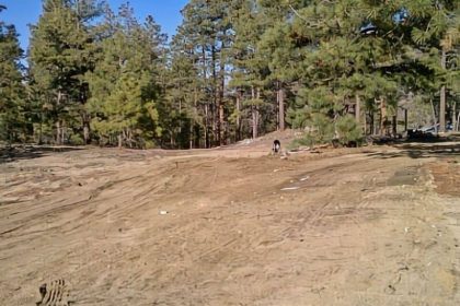
here are more than 20 numbered dispersed campsites along a dirt mountain road that goes west of Thumb Butte, and they’re pretty close to downtown Prescott. You can stay for 7 days out of 30 in the Prescott Basin. The road is really steep and bumpy in some spots, so it’s better for smaller cars. The road in is Dirt and 1.5 miles from a paved road. There are 16-29 campsites at this location and the maximum RV length is 25 feet. You may stay 7 days at Thumb Butte Loop Dispersed Campsites.
The picnic site is equipped with 12 picnic tables, 1 serving table, a covered picnic shelter, four charcoal grills and one campfire ring. There is designated parking (gated area) for 26 standard size vehicles. Guests have the convenience of restrooms with flush toilets and drinking water. The area is lighted after dark, and electric outlet(s) (20 amp maximum) are provided.
From Phoenix, Arizona: Traveling Northbound on I-17 take Exit 262 onto Hwy 69 North to Prescott and continue on Hwy 69 for 41 miles. Once you have arrived in Prescott, continue to go west on Hwy 69 which turns into Gurley St., which then becomes the Thumb Butte Road, and travel 2.2 miles to the picnic area entrance.
Alternate route from Flagstaff, Arizona: Traveling Southbound on I-17 take Exit 278 onto Westbound Highway 169 and continue for 15 Miles until reaching the junction of Hwy 69, turn right onto Northbound Hwy 69 and continue for 15 miles until arriving in Prescott. Once you have arrived in Prescott, continue to go west on Hwy 69 which turns into Gurley St, which then becomes the Thumb Butte Road, and travel 2.2 miles to the picnic area entrance.
| AMENITIES: | ACTIVITIES: |
|---|---|
| Fire Ring | OHV Hiking RV Parking Tent Camping Wildlife Viewing |
Have you been to this location?Please help us and future travelers by putting in your personal review of this camping site. |
