

Table Rock Lake Boondocking Locations: If you’re looking to camp near Table Rock Lake without dealing with a busy campground, boondocking gives you a quieter, often free way to enjoy the outdoors. Boondocking locations around Table Rock Lake let you camp with minimal services, but you’re still close to the water and all the outdoor fun. These spots let you soak in the lake area with way more freedom and usually fewer people around.
There are plenty of places for boondocking in the nearby state parks and national forest areas. Most don’t have hookups, so come ready for self-sufficient camping. Whether you like being tucked away in the woods or want easy access to hiking and fishing, you’ll find a spot that fits your vibe.
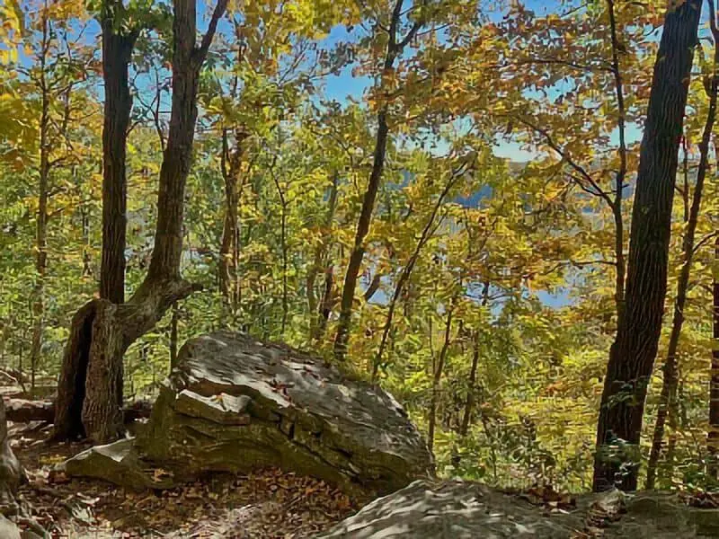
Your spot really depends on how much privacy or space you’re after. Some boondocking areas sit right by the lake, others are deeper in the forest. Knowing your options helps you pick the right place to really connect with the outdoors—on your own terms.
Location And Access
You’ve got a few choices for boondocking around Table Rock Lake. The Hercules-Glades Wilderness Area is a favorite for dispersed camping if you want a more remote experience, far from the crowds and campgrounds.
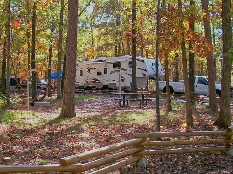
Table Rock State Park has two main campgrounds with basic and electric sites, and you can reach them easily from the main roads near Branson. These aren’t true boondocking spots, but they’re close by if you want a few more comforts.
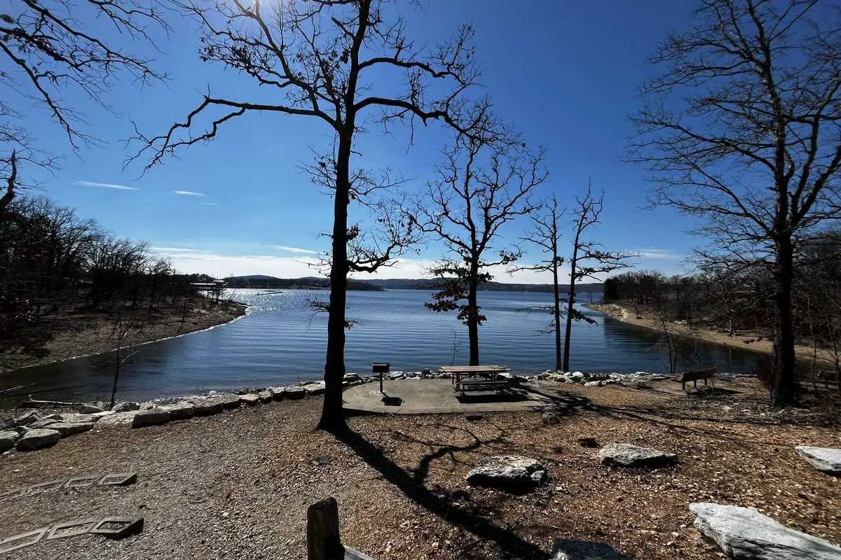
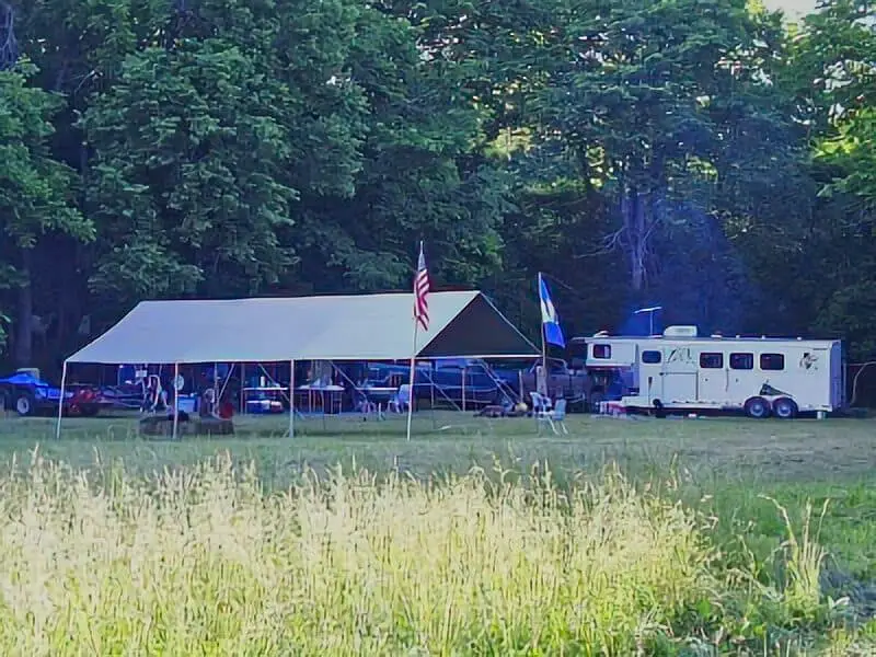
There are 16 public campgrounds managed by various agencies around Table Rock Lake. Many sit right on the shoreline, so you get easy access to the water. Some are near marinas and RV parks, which is handy if you need to stock up or use extra services.
The Indian Point Campground is another option near the White River arm of the lake. It’s wooded, roomy, and supports different camping styles. The access roads to these campgrounds are in good shape—most vehicles should be fine.
If you’re set on boondocking, look for dispersed sites on less-developed trails or tucked away in the woods. You’ll need a vehicle that can handle rougher roads, since some spots are off the main paved routes.
Quick Access Points:
| Location | Access Type | Notes |
|---|---|---|
| Hercules-Glades Wilderness | Dispersed Camping | Remote, no services |
| Table Rock State Park | Developed Campgrounds | Roads suitable for all vehicles |
| Indian Point Campground | Developed Campground | Near marina, wooded sites |
Don’t forget to check local rules about camping permits and fire restrictions before you head out.
Directions: How To Get There And What To Expect
To get to Table Rock Lake, hop on Highway 44 and then switch over to Highway 65. It’s a pretty straightforward drive, and you can get there from a lot of places. The park sits a few hours from St. Louis.
Before heading out to boondocking sites, get your vehicle ready. Some roads near campsites are rough, with the occasional creek crossing. A high-clearance or 4WD/AWD vehicle is a good idea.
When you arrive, expect campsites close to the lake, but don’t count on hookups—some might have electric, but most don’t. Be ready for dust and dirt, especially if you’re tackling the less maintained roads.
Here’s a quick checklist to help you get ready:
| Item | Notes |
|---|---|
| Vehicle | High-clearance or 4WD recommended |
| Food and water | Bring your own; limited services |
| Camping gear | Prepare for no hookups |
| Permits or fees | Check local park requirements |
Camping areas are managed by different agencies, so the rules can bounce around a bit. It’s smart to call the park or local offices to check the latest road and site conditions.
Amenities And Activities
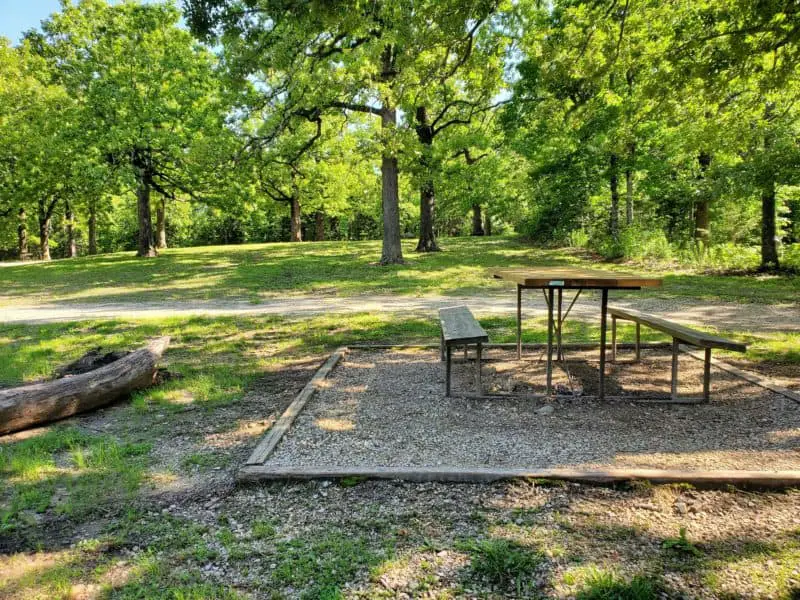
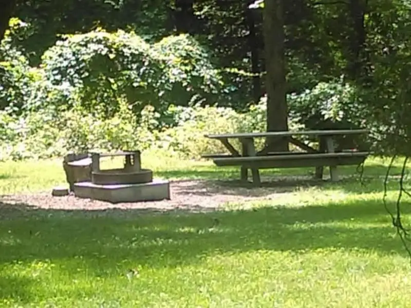
Boondocking near Table Rock Lake, you’ll find a few basic comforts to make your stay easier. Most areas have fire pits and picnic tables—perfect for cooking and hanging out. Some sites offer drinking water, but honestly, it’s safer to bring your own.
You can camp in a tent or an RV. Full hookups like electric or sewer are rare in dispersed areas, so plan accordingly. If you want extras—electric hook-up, dump stations, showers, or flush toilets—you’ll need to stay at a developed campground.
The lake’s a playground for outdoor activities. You can fish, boat, or just sit by the water. On land, there are trails for hiking, nature walks, and bird watching. Some places even have a beach or playground for families.
If you’re staying overnight, bring your own firewood—not every site provides it. Dispersed camping means fewer built-in amenities than developed campgrounds, so pack for self-sufficiency.
Here’s a quick look at common amenities:
| Amenity | Availability |
|---|---|
| Fire pit | Usually available |
| Picnic table | Usually available |
| Drinking water | Limited, bring your own |
| Electric hook-up | At developed campgrounds |
| Dump station | At developed campgrounds |
| Showers/toilets | At developed campgrounds |
| Tent camping | Widely available |
| RV camping | Available, some sites better |
Camping Regulations And Restrictions
Boondocking near Table Rock Lake comes with a few rules to keep the place nice and safe. You can camp for 15 days within any 30-day period at a single park or site—after that, you’ll need to move on so others get a chance.
Always camp at least 100 feet from water. This helps protect plants and keeps the water clean. Try to use bare soil rather than camping on grass or plants.
Pets are usually fine, but stick to two dogs per site. Keep them on a leash and clean up after them. Nobody wants a messy campsite.
Campfires might be allowed in some dispersed sites, like Blair Ridge Road, but check for burn bans first. Always follow fire safety rules.
Park rangers make regular rounds. They’ll enforce the rules and can answer questions. If they ask, be ready to show your camping permit or registration.
You’re in charge of packing out all your trash and waste. Leave your site cleaner than you found it. It’s just good manners and makes the experience better for everyone.
Leave No Trace
Camping near Table Rock Lake means sticking to Leave No Trace principles. It’s not just a rule—it’s how we keep the place awesome for everyone.
Pack out every bit of trash and leftover food. Don’t leave anything behind, even if it seems minor.
Don’t mess up the plants and trees. Use established campsites or camp on durable surfaces like rock or gravel if you can.
Be smart with campfires. Use existing fire rings, keep flames under control, and don’t ever leave a fire burning while you’re away. Make sure it’s cold before you go.
The wind gets pretty wild near the lake sometimes. Tie down your tent and gear to keep things from blowing away. Don’t cut branches for firewood—bring your own, and leave the trees alone.
Watch wildlife from a distance. Don’t feed them or mess with their space.
Keep the noise down. It’s nicer for everyone, and you’ll hear more nature that way.
Stick to these habits and Table Rock Lake will stay beautiful for years to come.

Table Rock Lake Boondocking Locations

Drury-Mincy Conservation Area
36.55397, -93.10839
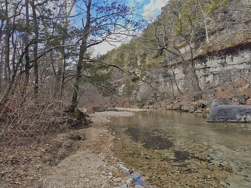
Drury-Mincy Conservation Area is located just southeast of Branson, Missouri, and offers over 5,600 acres of forested hills, glades, and stream corridors. Managed by the Missouri Department of Conservation, this area is open to dispersed camping in designated parking lots and open spaces. There are no developed campgrounds, hookups, or restroom facilities, making it suitable for self-contained camping only. It’s one of the most ecologically diverse regions in the state and features sweeping views, especially in the eastern ridgelines.
Things to Do: This area is popular among hunters, hikers, and birdwatchers. Several marked trails and service roads provide access to deep woodlands and high overlooks. Wildlife is abundant, and quiet campers may spot deer, wild turkey, or various species of hawks and owls. The area is closed to vehicles beyond certain points, so be prepared for some hiking.
Directions: From Branson, head south on Highway 65 and turn east onto Highway J. Follow the signs to the conservation area. Most access roads are gravel, and there are several marked parking areas for public use.
Vehicle Access: Gravel roads are generally accessible to cars, vans, and small trailers in dry conditions. Larger rigs should proceed with caution. Roads can become rough and rutted after heavy rain.

Winkle Creek Boondocking
36.672303, -93.024831
Winkle Creek Boondocking lies within the Mark Twain National Forest, just east of Bradleyville, Missouri. This site is popular for its proximity to the Glade Top Trail National Scenic Byway. The area is primitive, with no amenities, but provides a good spot for overnight parking and quiet camping. The spot is a gravel clearing near Winkle Creek Road, surrounded by oak and pine forest, making it well-shaded and relatively secluded.
Things to Do: The nearby Glade Top Trail provides scenic driving opportunities, with several pull-offs offering panoramic views of the Ozarks. Hiking and horseback riding are also common in the surrounding national forest. There are no marked trails from Winkle Creek, but the road system offers informal access for nature walks and wildlife observation.
Directions: From Bradleyville, take Highway 76 east, then head south on Highway 125. Turn east onto Winkle Creek Road (Forest Road 566). Look for a wide gravel turnout near the creek suitable for boondocking.
Vehicle Access: The site is accessible by standard vehicles in dry weather. Vans, small campers, and truck campers are best suited. Larger RVs may struggle with limited space and tight curves on forest roads.
Coy Bald TH
36.685171, -92.959638
Coy Bald Trailhead, often abbreviated as Coy Bald TH, serves as an access point to the Hercules Glades Wilderness in the Mark Twain National Forest. This site is commonly used by backpackers and horseback riders, and it allows overnight parking and primitive camping. There are no developed campsites, but dispersed camping is permitted in surrounding areas near the trailhead. A vault toilet is available, but there is no potable water or trash removal service.
Things to Do: From Coy Bald Trailhead, hikers can access a network of trails through rugged terrain that includes waterfalls, scenic overlooks, and remote glades. The area is known for its challenging hikes and solitude. Backpackers often use this trailhead to begin multi-day trips into the wilderness area. Horseback riding and wildlife viewing are also popular.
Directions: From Bradleyville, take Highway 76 east, then turn south on N Highway. Continue until you see Forest Road 566 and follow it to the signed Coy Bald Trailhead. Road conditions may vary depending on weather.
Vehicle Access: The gravel road is manageable for most vehicles in dry weather. Vans, SUVs, and small trailers can navigate the route. Large RVs are not recommended due to narrow road sections and limited parking.
Hercules Lookout Tower Boondocking
36.685029, -92.883017
The Hercules Lookout Tower Boondocking site is located near the former fire lookout tower site in the Hercules Glades Wilderness region. This remote area provides a cleared, flat space suitable for free camping. The site itself is a gravel clearing used historically for fire watch access and has become a known spot among national forest boondockers. There are no amenities, so campers must bring all necessary supplies and pack out waste.
Things to Do: This is a good spot for stargazing, hiking, and enjoying the remote setting of the Ozark Plateau. Informal trails and forest roads branch out from the site, offering access to wilderness viewpoints and wildlife-rich zones. Quiet campers may hear barred owls at night or see whitetail deer moving through the brush.
Directions: From Ava, Missouri, take Highway 5 south, then turn west onto Highway 95. Look for Forest Road 155, which leads toward the Hercules Glades Wilderness and the old tower site. Road signs may be limited, so GPS navigation is helpful.
Vehicle Access: Best suited for vans, SUVs, and truck campers. Gravel access roads can be rough, particularly after heavy rains. Large trailers or motorhomes are not recommended due to limited turnaround options.
Bar-K Wrangler Camp
36.86, -93.01
Bar-K Wrangler Camp is a designated equestrian campground located within the Mark Twain National Forest, near the town of Chadwick. It is designed specifically for horseback riders, with hitching posts, corrals, and direct access to miles of horse-friendly trails. While originally built for equestrian use, the campground is open to all visitors. Basic amenities include vault toilets, picnic tables, and fire rings. There is no potable water on-site, so campers should bring their own supply.
Things to Do: This camp serves as a hub for riders accessing the extensive Chadwick trail system, which includes both multi-use and horse-only trails. Hiking and mountain biking are also permitted on designated paths. Wildlife is commonly seen along the trails, and the forested setting provides a peaceful environment.
Directions: From Chadwick, take Highway 125 south, then turn east onto Forest Road 143. Follow signs to Bar-K Wrangler Camp. Road conditions are generally good but may become muddy after rain.
Vehicle Access: Designed with horse trailers in mind, the campground can accommodate large rigs and RVs. There are several pull-through spots and wide areas for parking. Ground is gravel and dirt—firm in dry conditions but may become slick in wet weather.
Busiek State Forest
36.862311, -93.225724
Busiek State Forest and Wildlife Area is located along U.S. Highway 65 between Springfield and Branson, Missouri. It offers over 2,700 acres of public land, open for hiking, mountain biking, horseback riding, hunting, and primitive camping. Dispersed camping is allowed in designated areas, but there are no formal campsites or developed facilities. Campers must be self-sufficient and follow Leave No Trace principles.
Things to Do: This site features more than 18 miles of multi-use trails that cross streams, climb ridges, and loop through scenic hollows. Wildlife viewing is common, and the area supports a healthy population of deer, turkey, and various small mammals. The South Fork of the Little Sac River runs through the area, providing water access and scenic spots for picnicking or cooling off.
Directions: From Springfield, take Highway 65 south. The entrance to Busiek is just off the highway near the Christian/Taney County line. A gravel parking area provides access to trailheads and dispersed camping.
Vehicle Access: The forest roads are suitable for passenger vehicles, vans, and truck campers. There are a few large gravel pull-offs near trail access points where overnight parking is possible. Large RVs may find the space limited.
Table Rock Lake Campgrounds
Cobb Ridge Campground
36.889922, -93.100925
Cobb Ridge Campground is part of the Mark Twain National Forest and caters to off-road vehicle (ORV) users. Located near Chadwick, Missouri, this developed site includes several individual and group campsites, picnic tables, fire rings, and vault toilets. The campground is especially popular with ATV, UTV, and dirt bike riders thanks to its direct access to the Chadwick ORV trail system. There is a small fee for camping and trail use.
Things to Do: The main attraction here is trail riding. The surrounding trail network offers over 80 miles of marked off-road vehicle paths, with various levels of difficulty. Hiking and mountain biking are allowed in certain areas. The campground also has shaded spots and is surrounded by dense forest, making it suitable for tent campers and smaller RVs.
Directions: From Chadwick, take Highway 125 south, then turn onto Cobb Ridge Road (Forest Road 143). Follow the signs to the campground. Roads are gravel but generally maintained.
Vehicle Access: Suitable for small to mid-size RVs, vans, and trailers. Larger rigs should plan ahead as turning space can be tight during busy weekends. All vehicles must display a valid trail pass if using ORV routes.
Shadowrock Park Campground
36.682187, -93.103037
Shadowrock Park Campground sits along the banks of Bull Creek in Forsyth, Missouri, just east of Branson. This city-managed campground offers a peaceful riverside setting with basic amenities. Sites include picnic tables, fire rings, and access to restrooms. A small fee is required for camping, and reservations are not typically needed for short stays. The park is especially popular in summer months due to easy water access and shade from mature trees.
Things to Do: Visitors enjoy fishing, kayaking, and swimming in Bull Creek and nearby Lake Taneycomo. There are open grassy areas for games and gatherings, as well as playgrounds and walking paths. Local events are occasionally held in the adjacent community spaces. The park is pet-friendly and family-friendly, offering a laid-back environment for campers who prefer less isolation.
Directions: From Branson, head east on Highway 76 to Forsyth. Follow local signage to Shadowrock Park. The campground is on the east side of the river, with a well-marked entrance.
Vehicle Access: The roads through the park are paved and can accommodate all vehicle sizes, including large RVs. Pull-through and back-in sites are available, and most are level. Wet conditions may limit access to a few of the lower-lying sites near the river.
Viney Creek Campground
36.564682, -93.676111
Viney Creek Campground is located on the western arm of Table Rock Lake, near Golden, Missouri. Managed by the U.S. Army Corps of Engineers, the campground offers developed campsites with picnic tables, fire pits, restrooms, and drinking water. Though closed for several seasons, it has been reopened for public use and continues to attract lake visitors for camping, fishing, and boating.
Things to Do: This campground provides direct access to Table Rock Lake, a major recreation destination known for boating, jet skiing, and bass fishing. A boat ramp is located on-site, and the protected cove allows for easy launching. Swimmers enjoy the small pebble beach areas. Shoreline hiking and wildlife observation are possible in surrounding wooded areas.
Directions: From Golden, Missouri, take Route J south and turn onto Viney Creek Road. Follow signs to the campground. The entrance is marked, and the access road is paved most of the way.
Vehicle Access: Suitable for most vehicle types, including motorhomes and travel trailers. Sites vary in size, so larger RVs should scout ahead or check site dimensions when possible. Most roads and parking pads are paved, though a few loop areas are gravel or compacted dirt.
Frequently Asked Questions
Boondocking near Table Rock Lake brings up a lot of questions about where to camp, what’s allowed, and how to find the best spots.
What are the recommended boondocking spots around Table Rock Lake?
Check out areas near Table Rock State Park—it’s close to Branson and has easy lake access. Other dispersed sites around the lake are less developed and quieter. Always check current conditions before heading out.
Is it permitted to camp anywhere on Table Rock Lake’s shoreline?
Nope. You can’t just camp anywhere along the shoreline. Many spots are private or protected. Use designated or established dispersed sites, and pay attention to posted signs and local rules.
Where can I find a map of boondocking locations at Table Rock Lake?
Look for campground maps and dispersed camping areas on the official Missouri State Parks website. Visitor centers and ranger offices sometimes have paper maps. You can also find updated maps online from other campers.
Can I use a private dock while boondocking on Table Rock Lake?
No, private docks are off-limits unless you’re a property owner or their guest. Stick to public launch areas or campsites with water access.
What are the best practices for boondocking responsibly at Table Rock Lake?
Take out all your trash and waste. Don’t damage plants or wildlife. Use established campsites or clear areas. Keep fires small and under control. Respect other visitors and follow local rules—it keeps the area wild and open for everyone.
Are there any Corps of Engineers campgrounds near Table Rock Lake suitable for boondocking?
You’ll find that the U.S. Army Corps of Engineers runs a handful of campgrounds around Table Rock Lake, and some do offer primitive camping. These spots usually come with minimal amenities—sometimes just the basics—which can actually be perfect if you’re after a more dispersed, off-grid experience. It’s best to check their official site or even give a local office a call to get the latest on fees and whatever rules might pop up.