

The map ID you have entered does not exist. Please enter a map ID that exists.
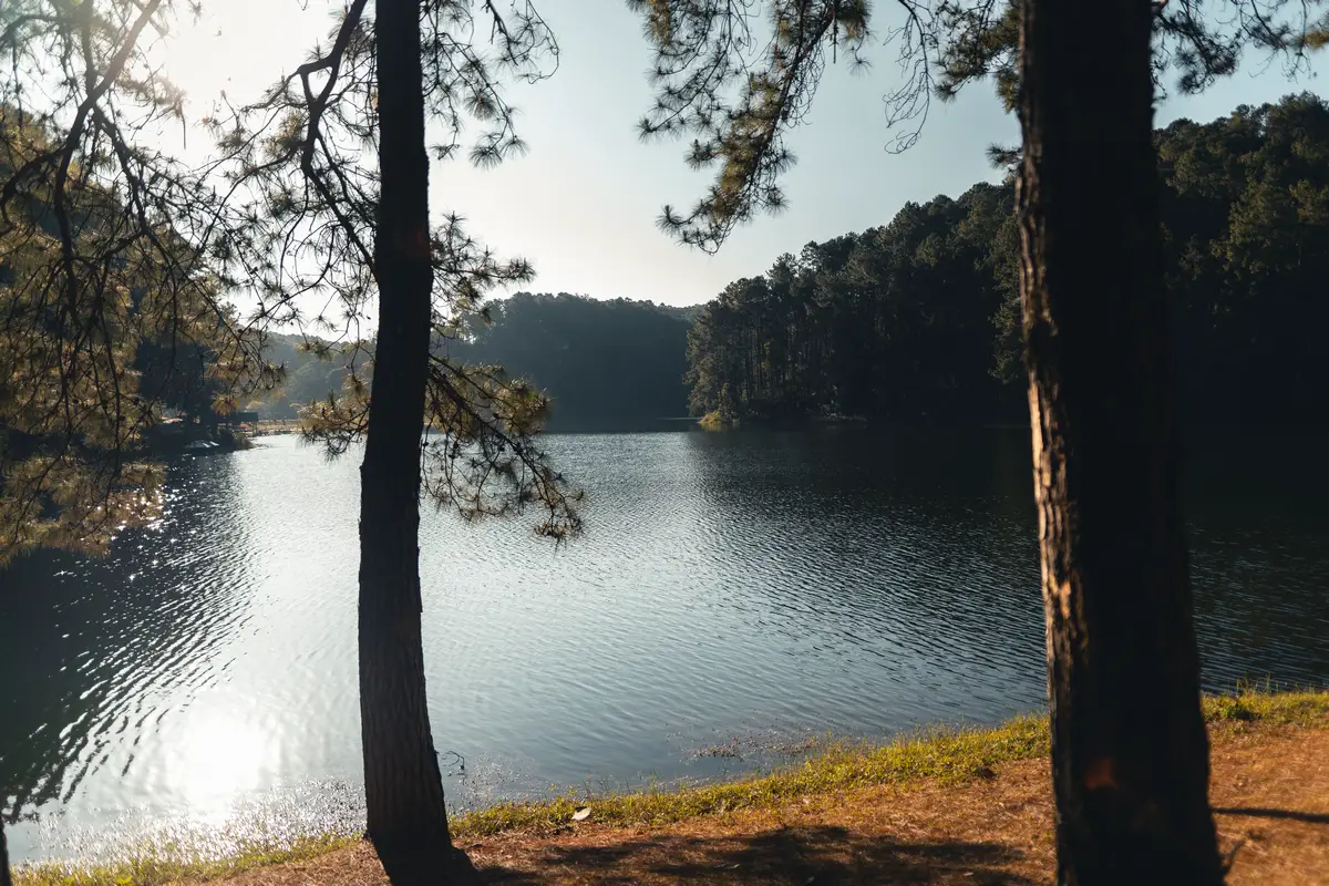
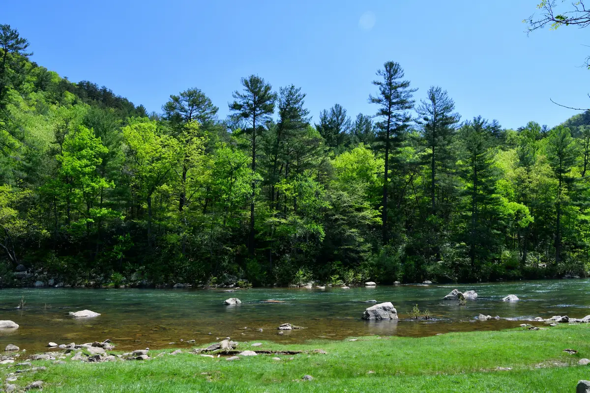
Mark Twain National Forest at GPS 37.69150176980993, -91.08013621886052 lets you step right into a huge slice of natural beauty in Missouri. You get access to dense woods, winding hiking trails, and quiet spots that are perfect for camping or fishing.
If you’re into outdoor activities, you’ll find lakes for fishing and plenty of trails for hiking or biking. The forest covers a massive area, so there’s space to really get away from city noise.
You can soak up the peaceful wilderness and explore streams or watch for wildlife. It works for a quick day trip or a longer, unplugged adventure—whatever you’re in the mood for.
Location And Access
Mark Twain National Forest sits in southeastern Missouri. The GPS coordinates 37.6915, -91.0801 drop you near the forest’s central section.
You can drive in using highways like US Route 60 or Interstate 44. These roads connect the forest to towns like Rolla and West Plains.
There are a few main entrances:
- Phelps County Access off US Route 63
- Wayne County Entrance from Missouri Route 34
- Oregon County Entry near Missouri Route 19
If you’re aiming for a specific trail or campground, check local maps for the best way in. Many forest roads are gravel or dirt, so a car with decent clearance definitely helps.
You can also get into parts of the forest by hiking, biking, or horseback riding on marked trails. Trail signs are important—don’t ignore them or you might end up somewhere you didn’t mean to be.
Public transportation is basically nonexistent out here. You’ll need to drive, and it’s smart to fill up on gas and stock up on water and snacks before heading into the backcountry.
Most trailheads and recreation areas have parking, though some charge small fees for parking or permits. Not every spot is paved—expect plenty of gravel lots.
Directions: How To Get There And What To Expect
To reach Mark Twain National Forest at GPS 37.6915, -91.0801, you’ll probably start from Rolla or Salem, Missouri. Use a GPS or your favorite map app—these roads can be twisty and sometimes confusing.
From Rolla, take Highway 72 east, then follow local roads into the forest. If you’re coming from Salem, head west on State Route 19 toward the forest boundary.
You’ll find parking at most trailheads and visitor areas. Some lots are paved, but a lot are just gravel or dirt. Bring a vehicle that can handle rural roads—especially if it’s rained recently.
Inside the forest, the roads switch between paved and unpaved. After storms, the dirt roads can get rough, so don’t rush and check your route ahead of time.
There are hiking trails, picnic spots, and places to camp. You won’t find many gas stations or stores once you’re in, so bring what you need.
Weather changes fast. Carry water, snacks, and clothes for whatever the sky throws at you. Cell service can vanish in the woods, so don’t count on your phone for everything.
Things to bring:
- Water and snacks
- Map or GPS
- Comfortable shoes
- Weather gear
Rules to remember:
- Stay on marked trails
- Leave no trash
- Follow fire regulations
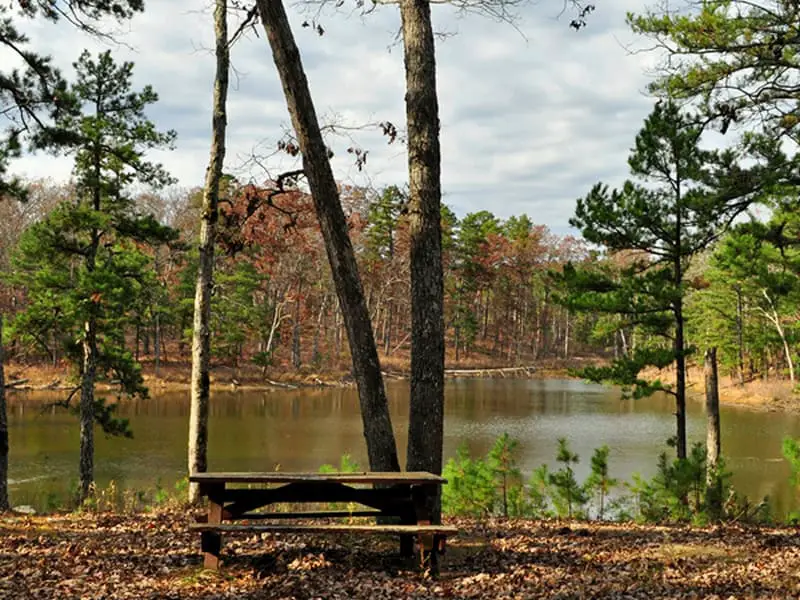
Amenities And Activities
At Mark Twain National Forest near GPS 37.6915, -91.0801, you’ll find plenty to do. There are hiking trails for all skill levels, from easy strolls to longer treks deep into the woods.
Camping options are solid. You can pick from developed campgrounds with facilities or primitive sites if you want something quieter.
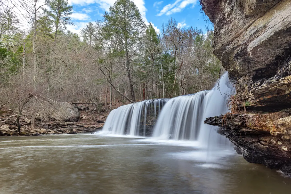
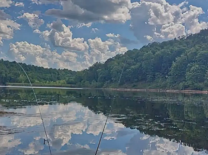
Fishing is a big draw. The forest’s streams and lakes are full of fish, but don’t forget to check fishing regulations first.
Some lakes have boat ramps, so you can bring a kayak or canoe for a relaxing paddle.
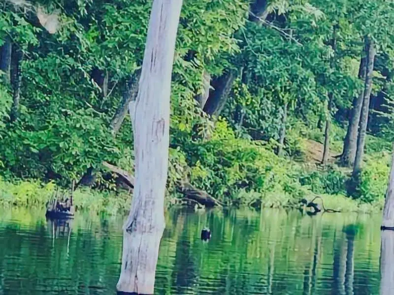
Wildlife is everywhere—deer, birds, maybe even a fox if you’re lucky. Bring binoculars for bird watching or just to see what you can spot.
Here’s a quick look at the amenities:
| Amenity | Details |
|---|---|
| Hiking Trails | Marked, easy to tough |
| Camping | Developed and primitive options |
| Fishing | Streams and lakes |
| Boating | Some lakes have ramps |
| Picnic Areas | Tables and shelters |
| Wildlife Viewing | Lots of birds and animals |
You’ll also find restrooms and picnic tables in the main areas. They make it easier to kick back and enjoy your time outside.
Camping Regulations And Restrictions
Camping in Mark Twain National Forest comes with a few important rules. You can stay in designated campgrounds or at dispersed sites, but only up to 14 days within any 30-day stretch.
Build campfires only in established fire rings or spots set up for that purpose. Never leave a fire burning unattended, and always douse it completely before you go. If it’s been dry, check for fire bans before you light anything.
There’s no trash service in the backcountry. Bring trash bags and pack out everything—food wrappers, cans, all of it.
Pets are allowed, but keep them on a leash no longer than 6 feet. Clean up after them so everyone can enjoy the place.
Generators and loud music shouldn’t be used after 10 PM. Quiet hours run from 10 PM to 6 AM, so keep things peaceful at night.
Here’s a quick rule sheet:
| Rule | Requirement |
|---|---|
| Camp time limit | 14 days in 30 days |
| Fires | Only in fire rings or designated spots |
| Trash | Pack out everything |
| Pets | Leash, max 6 feet |
| Quiet hours | 10 PM to 6 AM |
| Generators and music | Not after 10 PM |
Stick to these basics and your stay will be smoother for everyone.
Leave No Trace
When you visit Mark Twain National Forest, stick to Leave No Trace principles. It’s the best way to keep the forest healthy for everyone.
Pack out everything—trash, food scraps, gear—whatever you brought in. Don’t leave anything behind, even if it seems harmless.
Stay on marked trails. Wandering off can damage plants and make erosion worse.
If you build a fire, use established fire rings. Always make sure your fire is out cold before you leave.
Watch wildlife from a distance. Don’t feed animals or mess with their homes.
Use restrooms if you see them. If not, bury human waste at least 6-8 inches deep and 200 feet from water.
Here’s a checklist for Leave No Trace:
| Action | Why It Matters |
|---|---|
| Pack out all trash | Keeps the place clean |
| Stay on trails | Protects plants and soil |
| Use fire rings | Reduces wildfire risk |
| Respect wildlife | Keeps animals safe |
| Properly dispose of waste | Protects water and health |
It’s not hard—just a little effort makes a big difference.
Resource Information Sources
Bureau of Land Management
Missouri Climate Data – U.S. Climate Data
Recreation.Gov
Camping in Missouri – New Missouri State Parks
Free Mark Twain National Forest Boondocking Location

Berryman Trail
37.931, -91.061997
Berryman Trail is a popular multi-use trail system located in the Mark Twain National Forest near Potosi, Missouri. This 24-mile loop is well-known among mountain bikers, hikers, and horseback riders. It features a variety of terrain including ridge lines, creek crossings, and forested valleys, offering moderate elevation changes and scenic views of the Ozark landscape. Dispersed camping is available in the surrounding area, especially near the Berryman Trailhead. While this is not a developed campground, the forest road leading to the trailhead typically supports small RVs and vans depending on conditions.
Things to Do: The trail itself is the main attraction and is maintained for mountain biking events, including portions of the Ozark Trail. Hikers will enjoy the wooded paths, seasonal wildflowers, and the opportunity to spot local wildlife like deer and turkeys. There are also access points to creeks for water filtration or cooling off during warmer months.
Directions: From Potosi, head west on MO-8. Look for signs marking the Berryman Trailhead between the towns of Potosi and Steelville. Forest roads lead into the trailhead area.
Vehicle Access: Best for cars, vans, or smaller RVs. Larger rigs may struggle with the narrow forest access roads or lack of turnaround space at the trailhead.

Little Scotia Campground Boondocking
37.529007, -91.330353
Little Scotia Campground Boondocking is a lesser-known dispersed camping spot located off forest roads in the southern section of the Mark Twain National Forest. This area is primarily wooded, quiet, and not part of a formal campground, making it suitable for those looking for solitude. The terrain is moderately sloped with scattered clearings among dense pines and oaks. There are no amenities, so pack in water, trash bags, and any supplies you’ll need.
Things to Do: The surrounding forest offers opportunities for hiking, wildlife viewing, and quiet evenings. While there are no marked trails from the site, adventurous hikers may find game trails and unmarked paths to explore. The area is also close to other natural attractions like the Eleven Point River for those willing to drive a short distance.
Directions: Located off a spur of Scotia Road, take local forest roads west of Highway 19 near Winona. GPS is recommended due to unmarked turns and limited cell service in the area.
Vehicle Access: Suitable for high-clearance vehicles, camper vans, or small trailers. The road in can be rough and may become impassable after heavy rain. There are limited turnaround points, so scouting ahead on foot is recommended for longer rigs.
Scotia Pond Road Boondocking
37.536129, -91.323303
Scotia Pond Road Boondocking lies in the vicinity of Little Scotia and offers a more open area for dispersed camping along forest roads. This site sits near small forest ponds and wide clearings, offering easy access to flat, level spots for setting up tents or campers. It is entirely primitive with no facilities, so preparation is essential.
Things to Do: Visitors can enjoy peaceful evenings, light hikes through the forest, or visit nearby public lands. The pond itself is small and seasonal, more of a visual feature than a fishing destination. Wildlife like deer and birds are common in the area.
Directions: Located off a spur of Scotia Pond Road, west of Highway 19. Follow logging and forest service roads. These routes are not always marked, so using GPS coordinates and offline maps is essential.
Vehicle Access: Generally suitable for vans, SUVs, and smaller campers. The road surface can be uneven and muddy in poor weather. Larger rigs should approach cautiously and be prepared for limited room to turn around.

Indian Trail CA Boondocking
37.693193, -91.340377
Indian Trail CA Boondocking is part of the Missouri Department of Conservation’s Indian Trail Conservation Area. This region features over 13,000 acres of forest and glades, with opportunities for hiking, backpacking, hunting, and camping. Boondocking is permitted in designated areas along gravel roads and open forest areas. While no formal sites or facilities are present, the conservation area provides a scenic and secluded space for nature-based camping.
Things to Do: Popular activities include backpacking on the Indian Trail, a 12-mile trail that winds through rugged hills and offers scenic views of the Ozark landscape. Hunting and birdwatching are also common, especially during appropriate seasons. Campers are advised to follow conservation area guidelines and seasonal restrictions.
Directions: From Salem, take Highway 19 south and turn onto County Road 6510, which leads to the conservation area. Follow signs for trailheads or consult MDC maps for designated camping areas.
Vehicle Access: Gravel roads are usually in decent condition but may become slick or rutted during wet weather. Best suited for high-clearance vehicles, smaller campers, and vans. Not ideal for large motorhomes due to limited turnaround areas and narrow roads.
Council Bluff
37.723003, -90.938644
Council Bluff is a developed campground located next to Council Bluff Lake in the Mark Twain National Forest. This lake is the largest in the forest and provides a central hub for recreation, camping, and water-based activities. The campground includes paved parking areas, restrooms, picnic tables, and water access. Some sites are shaded, while others have views of the lake. This is one of the more developed and popular camping areas in the region.
Things to Do: The 440-acre Council Bluff Lake supports boating, swimming, and fishing, with largemouth bass and bluegill among the common catches. A 12-mile trail loops around the lake and is suitable for hiking and mountain biking. There’s also a swim beach and boat ramp.
Directions: From Potosi, take Highway 8 west, then Route DD south to Council Bluff Lake Road. The entrance is clearly marked and maintained.
Vehicle Access: Well-suited for tents, travel trailers, and RVs. The paved access roads and looped campground design make it accommodating for larger rigs. Reservations are recommended during peak summer months due to the campground’s popularity.

Hazel Creek CG
37.838001, -91.016998
Hazel Creek is a dispersed camping area located in the Mark Twain National Forest, west of Potosi, Missouri. Though not a developed campground, Hazel Creek is well-known among boondockers and those seeking a quiet forest setting. The area includes access to gravel roads that lead through wooded hills, with some wide pull-offs and small clearings suitable for camping. There are no amenities, so campers need to be fully self-sufficient.
Things to Do: Hiking and horseback riding are common along the forest trails in this area. The Hazel Creek Trail, part of the Ozark Trail system, offers scenic routes through hardwood forests, crossing creeks and ridgelines. It is also a good place for spotting deer, wild turkeys, and native birds. Small creeks and shaded glades make this a comfortable spot during spring and fall.
Directions: From Potosi, take Highway 8 west to Route Z, then follow gravel Forest Road 2070 to the area. Navigation tools are helpful due to limited signage.
Vehicle Access: Best suited for high-clearance vehicles, vans, and small campers. Some road sections may be narrow or soft after rain. Not ideal for large RVs due to limited space for turning and uneven terrain.
Mark Twain National Forest Paid Campgrounds

Red Bluff Campground
37.816391, -91.16639
Red Bluff Campground is located along the Huzzah Creek in Crawford County, Missouri, within the Mark Twain National Forest. The campground is named after the striking red bluffs that rise along the creek, providing scenic views and natural interest. Red Bluff offers developed campsites, vault toilets, picnic tables, and fire rings. Some sites are located near the water, which can fluctuate during heavy rain.
Things to Do: Swimming and wading in the creek are popular during summer. Fishing is another common activity, with sunfish and smallmouth bass often caught in the shallow waters. There are short walking paths along the bluff and creek, and nearby forest roads provide access to further exploration.
Directions: From Davisville, take Route V north to Red Bluff Road. The campground is signed and follows a gravel route into the site.
Vehicle Access: Suitable for tents, vans, and small trailers. While some rigs can access the campground, the narrow road and limited turnaround space make it less ideal for large RVs. Creekside sites are picturesque but may be prone to seasonal flooding—check conditions before arrival.
Loggers Lake Campground
37.388228, -91.260454
Loggers Lake Campground is located within the Mark Twain National Forest and sits beside a 22-acre lake in Shannon County. This campground includes basic amenities such as vault toilets, picnic tables, fire rings, and a boat ramp. There are a handful of designated sites, mostly shaded by mature trees. The lake is non-motorized, creating a peaceful setting for canoeing and kayaking. It is a quiet and relatively lesser-used site.
Things to Do: Popular activities include fishing for bass, bluegill, and catfish, as well as swimming in designated lake areas. There is a short loop trail around the lake, which is ideal for leisurely walks and wildlife spotting. Birdwatchers often visit for the diversity of forest birds.
Directions: From Bunker, take Highway 72 west, then turn onto Forest Road 2193, which leads directly to the lake and campground. The access road is gravel and maintained.
Vehicle Access: The road and campsites are accessible for small RVs, camper vans, and tents. While the road is passable, it may become rough in wet conditions. Larger rigs should use caution due to sharp turns and limited space for parking.
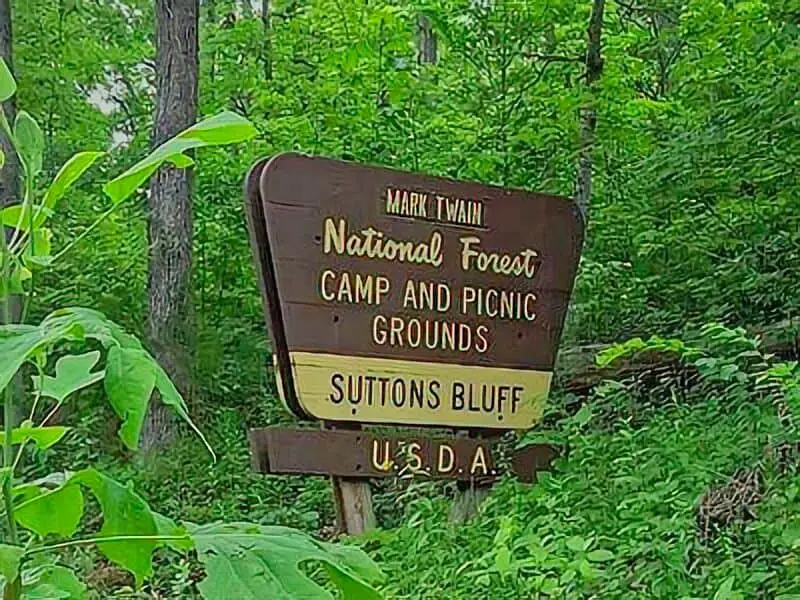
Sutton Bluff Campground
37.475586, -91.006592
Sutton Bluff Campground is located along the West Fork Black River in Reynolds County, Missouri. This campground lies within a popular ATV and OHV trail system and includes 36 designated campsites. Amenities include vault toilets, picnic tables, and potable water during the main season. This site is managed by the Forest Service and sees frequent use from both trail riders and tent campers.
Things to Do: OHV riding is the main draw, with trails directly accessible from the campground. Other activities include fishing, swimming, and tubing in the river, especially in late spring through early fall. There are scenic rock formations and clear pools that attract campers looking for a quiet but activity-filled location.
Directions: From Centerville, take Highway 21 south, then head west on County Road 907. Signs for Sutton Bluff mark the entrance. The final stretch follows a gravel road into the forest.
Vehicle Access: The campground is accessible for all types of vehicles, including large RVs and toy haulers. There are pull-through and back-in sites with enough room for trailers and tow vehicles. Roads are gravel but usually well maintained, though dust can be an issue in dry weather.
Frequently Asked Questions
You’ll find all sorts of things to do at Mark Twain National Forest. There are options for camping, hiking, fishing, and more.
What are the permitted activities in Mark Twain National Forest?
You can hike, camp, fish, go horseback riding, and use off-road vehicles on certain trails. Hunting is allowed in some areas during the right season, but always check posted rules and keep an eye out for wildlife.
Are there any campgrounds available, and do they require reservations?
Yes, there are several campgrounds. Some need reservations, especially during busy times, but others work on a first-come, first-served basis.
What are the best trails for hiking in Mark Twain National Forest?
The Ozark Trail segments and the Rock Pile Mountain Trail are both popular. They offer scenic views and a range of difficulty levels.
Is fishing allowed in the forest, and what regulations must be followed?
Fishing is allowed in streams and lakes. You’ll need a valid Missouri fishing license, and you have to follow local fishing limits and seasons.
What is the best time of year to visit for outdoor recreation?
Spring through early fall has the best weather for hiking, camping, and fishing. Winters can get pretty cold and aren’t as good for most activities.
How can one obtain a map of Mark Twain National Forest?
You can grab maps online through the U.S. Forest Service website. Local ranger stations and visitor centers usually have them too.
These maps lay out trails, campgrounds, and different facilities. Super handy if you want to plan ahead or just wander a bit.