

Looking for a quiet, wild spot to park your rig near Moosehorn National Wildlife Refuge? There are a handful of boondocking options worth checking out. Moosehorn’s got a mix of secluded areas, hiking trails, and wildlife views, so it’s perfect if you crave some peace, nature, and a break from crowded campgrounds. Just be ready to rough it—services are sparse to nonexistent.
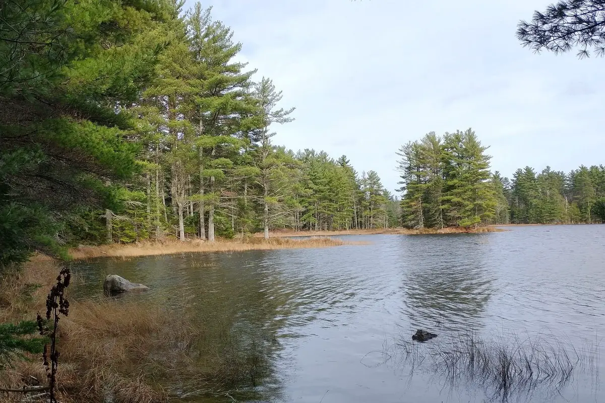
The refuge sprawls over nearly 30,000 acres in northeastern Maine, with a patchwork of rolling hills and forests. There are several dispersed camping spots along the edges and nearby roads. You’ll get to soak in the wilderness but still be within reach of the refuge’s main draws.
About This Location
Moosehorn National Wildlife Refuge covers close to 30,000 acres in northeastern coastal Maine. You’ll see wetlands, forests, rocky shorelines, and hills. This variety makes it a solid place for wildlife watching and outdoor fun.
Over 4,500 acres are wetlands, home to loads of birds—especially waterfowl. Depending on when you visit, you might spot ducks, geese, and other migratory birds.
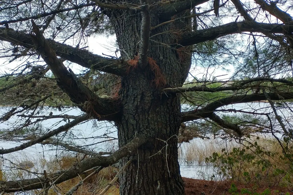
The refuge has more than 50 miles of dirt trails winding through forests and along the water. Most of these paths are pretty quiet, so you’ll often have them to yourself.
There’s also 7,392 acres of designated National Wilderness inside the refuge. These areas stay wild and untouched, which is awesome if you want to get away from roads and people.
You’ll find 18 miles of rocky shoreline along Dennys and Whiting Bays, plus 7 miles on Meddybemps Lake. These spots are important for wildlife and, honestly, the views aren’t bad either.
Location And Access
You’ll find Moosehorn National Wildlife Refuge in eastern Maine, right by the town of Baring. The place splits into two main sections: the northern part near Baring and the southern one near Edmunds.
To get to the headquarters, take Charlotte Road off Route 1 and watch for signs—the roads can get a little narrow and empty. The southern division sits off Route 1 in Edmunds, and it’s pretty easy to reach by car.
Inside the refuge, you’ll see several trailheads and parking lots. These are your gateways to boondocking spots and hiking trails. Many camping areas are remote, so a map or GPS is a good idea.
Some boondocking spots hug small lakes or wetlands. Moosehorn Lake is one, close to a campground at a higher elevation. It adds a little variety to your camping experience.
Cell service can get spotty. Plan for a primitive camping trip and bring what you need. Stick to refuge rules—they’re there to protect this fragile place.
| Access Point | Location Details | Notes |
|---|---|---|
| Headquarters | Off Charlotte Road from Route 1 | Main visitor center |
| Southern Division | Near Edmunds, Maine on Route 1 | Easier vehicle access |
| Moosehorn Campground | By Moosehorn Lake | Higher elevation, scenic view |
Directions: How To Get There And What To Expect
To get to Moosehorn National Wildlife Refuge, start out on Route 1 near Calais, Maine. From there, turn onto Charlotte Road and follow the signs to Refuge Headquarters.
The southern division is in Edmunds, also off Route 1. It’s well marked, so you shouldn’t have much trouble finding it.
When you arrive, you’ll notice it’s pretty peaceful—natural environment everywhere. You’ll see hills, woods, lakes, and ponds, plus some open spots and rocky ledges.
Roads inside are mostly service roads. They’re usually easy to drive and get you to different boondocking areas.
Wildlife is everywhere. You’ll probably spot birds and maybe some other critters. Hiking and photography are popular here too.
Services are few and far between. There’s not much for cell signal or stores, so bring everything—water, food, fuel, all of it. Respect the place and stick to the rules, so it stays nice for the next folks.
Here’s a quick checklist before you roll out:
| Item | Notes |
|---|---|
| Navigation | Use Route 1 and Charlotte Road |
| Supplies | Water, food, fuel, camping gear |
| Vehicle | Suitable for service roads |
| Activities | Wildlife viewing, hiking |
Amenities And Activities
When you boondock at Moosehorn, don’t expect much in the way of amenities. There aren’t really any restrooms or hookups for water and power. Bring everything you’ll need for a self-sufficient stay.
But there’s plenty to do. You can walk hiking trails through woods, wetlands, and marshes. Good chance you’ll see wildlife and some beautiful scenery.
Fishing’s popular in the local streams and lakes. If you’re into it, pack your gear and try your luck.
Wildlife watching and photography are big here. With so many different habitats, you’ll have lots of opportunities for birdwatching and animal spotting.
You can hunt during certain seasons, but you’ve got to follow all the refuge rules and get the proper permits.
| Activity | Notes |
|---|---|
| Hiking | Trails of varied length and difficulty |
| Fishing | Available in lakes and streams |
| Wildlife Viewing | Expect birds, deer, and small mammals |
| Photography | Scenic views and animal shots |
| Hunting | Allowed seasonally with permits |
Don’t forget food, water, and camping gear. Cell service is iffy, so plan for that.
Camping Regulations And Restrictions
If you’re camping at Moosehorn National Wildlife Refuge, there are some important rules. Overnight camping isn’t allowed inside the refuge boundaries. No tents, no RVs overnight—sorry, that’s just how it is.
Campfires and fireworks? Nope, not allowed. That’s to keep the risk of wildfires down and protect the habitat. Don’t bring firewood or fire-starting stuff.
Blueberry picking is fine, but there’s a limit. You can collect up to 2 quarts per person, per day. Stick to that so there’s enough for the animals and other people.
Here’s a quick look at the main rules:
| Rule | Details |
|---|---|
| Overnight Camping | Not allowed inside the refuge |
| Campfires & Fireworks | Prohibited |
| Berry Picking | Up to 2 quarts per day/person |
Check for any temporary fire restrictions or updates before your trip, especially if you’re camping near the refuge or at Moosehorn Campground. Following the rules keeps things safe and pleasant for everyone.
Leave No Trace
Camping at Moosehorn? Stick to Leave No Trace basics. These guidelines keep the place nice for everyone.
Pack out everything you bring. Trash, food scraps, all of it—don’t leave anything behind. Bring reusable containers if you can.
Try not to mess with plants or wildlife. Stay on marked trails and campsites. It’s better for the land.
Campfires aren’t allowed in most areas. Double-check the rules before you light up a stove or anything. A portable stove is your best bet.
Keep things quiet. Don’t stress the animals or bug other campers. If you’ve got pets, keep them under control.
Here’s a simple checklist:
| Action | What to Do |
|---|---|
| Trash | Carry out all trash and litter |
| Restrooms | Use designated bathrooms or dig a small hole away from water sources |
| Campfires | Use stoves or fire rings when allowed |
| Stay on Trails | Avoid creating new paths |
| Respect Wildlife | Do not feed or approach animals |
| Noise | Keep sound to a minimum |
Doing your part helps keep Moosehorn wild and beautiful for the next folks who wander through.
Information Resources
Acadia National Park, National Park Service (NPS)
U.S. Geological Survey (USGS)
Visit Boondocking Locations for over 10,000 boondocking opportunites in the United States.
Moosehorn National Wildlife Refuge Boondocking Locations

Machias River Corridor Third Machias Lake Boondocking
45.089645, -67.863284
Third Machias Lake is situated within the Machias River Corridor Public Reserved Lands in Washington County, Maine. This remote and tranquil location offers a pristine natural setting, making it an ideal spot for boondocking enthusiasts seeking solitude and a connection with nature. The lake serves as a common starting point for paddlers embarking on the Machias River canoe trip, which spans approximately 76 miles and features Class I–III whitewater sections. The surrounding landscape is characterized by dense forests, pristine waterways, and abundant wildlife, providing a serene backdrop for campers.
Things to Do:
Canoeing and kayaking are popular activities on the Machias River, with the lake serving as a launch point for multi-day trips. Anglers can enjoy fishing for native species in the lake and river. The area is also excellent for wildlife observation, with opportunities to see moose, black bears, and various bird species. Hiking and exploring the surrounding forested areas offer additional recreational options.
Directions:
From Route 9 in Beddington, take the Little River Road north for approximately 4 miles. Turn left onto a side road leading to the boat launch at Third Machias Lake. The access roads are gravel and may require careful navigation, especially during wet conditions.
Vehicle Access:
The site is accessible via gravel logging roads; high-clearance vehicles are recommended. The area is suitable for tents and small RVs. No services are available; campers must be self-sufficient and practice Leave No Trace principles.

Log Landing Boondocking
44.9574, -67.8727
Log Landing Boondocking is a primitive, riverside camping location situated near the Machias River in eastern Maine. Known for its connection to Maine’s logging history, the area provides peaceful overnight options for campers travelling through Washington County. This spot is suitable for those seeking a quiet basecamp near the Downeast Lakes region or paddling routes along the Machias River Corridor.
Things to Do:
The nearby Machias River offers canoeing, kayaking, and opportunities for freshwater fishing. The surrounding forests are home to deer, beavers, eagles, and songbirds. Hikers can explore sections of the Machias River canoe trail or access logging roads for nature walks and wildlife viewing. This site is also used by hunters and anglers during season.
Directions:
Use GPS coordinates 44.9574, -67.8727. The site is accessed from Route 9 via logging roads that may be unsigned. Conditions vary depending on weather—be prepared for remote travel and bring a printed map or GPS with offline access.
Vehicle Access:
The site is reachable by dirt and gravel roads. Best suited for high-clearance vehicles, truck campers, and small RVs. No amenities are present—bring your own water, sanitation supplies, and firewood. Open fires may be permitted with caution. Follow Leave No Trace principles and check if access fees apply. No cell service should be expected in the area.

Machias River Corridor PRL Rt 9 Boondocking
44.905921, -67.836207
The Machias River Corridor Public Reserved Land (PRL) along Route 9 in Maine offers free, dispersed camping in a remote and scenic setting. This area is part of a 76-mile canoe route featuring Class I-III whitewater, making it a popular destination for paddlers and outdoor enthusiasts. The corridor encompasses over 60,000 acres, with the Maine Bureau of Parks and Lands managing approximately 14,000 acres centered around First, Second, and Third Machias Lakes
Things to Do:
Campers can enjoy fishing for smallmouth bass, trout, and other species in the Machias River. The area is also excellent for wildlife observation, with opportunities to see moose, deer, and various bird species. Hiking and exploring the surrounding forested lands offer additional recreational opportunities. The corridor is part of a larger conservation effort that began in the 1990s and culminated in 2008 with the completion of the third phase of the Machias River Project .
Directions:
Use GPS coordinates 44.905921, -67.836207 to reach the site. Access is via gravel logging roads that are generally passable from June to October but require careful driving and a detailed map . The area is accessible from Route 9, with several campsites located along the river.
Maine
Vehicle Access:
The area is accessible via gravel roads; suitable for tents and small RVs. No amenities are available; campers must be self-sufficient and adhere to Leave No Trace practices. Camping is free and operates on a first-come, first-served basis .
This boondocking site offers a peaceful environment for campers seeking solitude and a connection with nature. The proximity to the river and surrounding forested lands makes it an ideal spot for various outdoor activities.

Mud Landing Boondocking
44.856901, -67.447008
Mud Landing is a dispersed camping site located near Rocky Lake in Whitneyville, Maine. The area offers a walk-in campsite and a trailerable boat launch, providing access to the lake and its surrounding natural beauty. The site is managed by the Maine Bureau of Parks and Lands and is known for its tranquil setting and opportunities for outdoor recreation.
Things to Do:
Visitors can enjoy boating and fishing on Rocky Lake, with the boat launch facilitating easy access to the water. The area is also suitable for wildlife observation, as it supports a rich array of bird species and other wildlife. Hiking and exploring the nearby forested areas provide additional recreational options.
Maine
Directions:
From the intersection of Routes 1 and 191 in East Machias, drive north on Route 191. To reach Mud Landing, proceed past Diamond Match Road just over a mile and turn left on Mud Landing Road. That road ends at the trailerable boat launch and campsite by Northern Inlet, a feeder stream of Rocky Lake.
The Dyrt
Vehicle Access:
The site is accessible via gravel roads; suitable for tents and small RVs. No amenities are available; campers should be self-contained and practice Leave No Trace principles.

Machias Bad Little Falls Boondocking
44.71357, -67.4591
Machias Bad Little Falls offers dispersed boondocking in a scenic area near downtown Machias, Maine. The falls are part of the Machias River and are known for their rocky, fast-flowing waters. The site is adjacent to Bad Little Falls Park, which has walking paths and overlooks that allow for clear views of the falls and river. The area is quiet and provides a blend of natural features with nearby town conveniences.
Things to Do:
Visitors can explore the park and watch the rapids from the viewing platforms. The Down East Sunrise Trail is nearby and offers hiking and biking opportunities. The Machias River supports fishing and wildlife viewing, and the town of Machias includes historical sites, such as the Burnham Tavern, tied to early Revolutionary War events.
Directions:
Use GPS coordinates 44.71357, -67.4591 to reach the site. The area is easily accessible from U.S. Route 1. Be prepared to drive on local town roads near the falls.
Vehicle Access:
Access is possible for small RVs and vans. There are no services, and campers must be self-contained. The site is near an urban area but retains a natural feel. Campers should follow Leave No Trace guidelines.

Chase Mills Rd Boondocking
44.756951, -67.361403
Chase Mills Road offers dispersed camping opportunities in a remote setting near the Machias River in East Machias, Maine. The area provides a peaceful environment for campers seeking solitude and a connection with nature. The proximity to the river and surrounding forested lands makes it an ideal spot for various outdoor activities.
Things to Do:
Campers can engage in fishing, canoeing, and kayaking on the Machias River. The area is also excellent for wildlife observation, with chances to see moose, deer, and a variety of bird species. Hiking and exploring the surrounding forested lands offer additional recreational opportunities.
Directions:
Specific directions are not provided; it’s recommended to use GPS coordinates and local maps for navigation. Access is likely via gravel roads; drive carefully and be prepared for remote conditions.
Vehicle Access:
Accessible via gravel roads; suitable for tents and small RVs. No amenities are available; campers must be self-sufficient and adhere to Leave No Trace practices.

Cutler Public Land Boondocking
44.69859, -67.15801
Cutler Coast Public Reserved Land, located in Washington County, Maine, offers a unique boondocking experience along the state’s Bold Coast. This 12,334-acre expanse features dramatic cliffs, maritime forests, and peatlands, providing a wilderness experience for campers seeking solitude and a connection with nature.
Things to Do:
Campers can explore over 10 miles of hiking trails, including the Coastal Trail, which offers stunning views of the Bay of Fundy. Wildlife enthusiasts may observe nearly 200 bird species, including warblers and chickadees. The area is also excellent for whale watching during the summer months. Hiking and exploring the surrounding forested lands offer additional recreational opportunities.
Directions:
From Route 191 in Cutler, Maine, access the trailhead parking area. Campsites are located 3 to 5 miles from the parking lot within the Coastal Section of Cutler Coast. Use GPS coordinates 44.677895, -67.150738 to reach the Black Point Cove campsite. Roads are unpaved and may be rutted in wet conditions.
Vehicle Access:
The area is accessible via paved roads to the trailhead parking lot. Campsites are hike-in only and not accessible by vehicle. No amenities are available; campers must be self-sufficient and adhere to Leave No Trace practices. Camping is free and operates on a first-come, first-served basis.
Frequently Asked Questions
Got questions about boondocking at Moosehorn? Permits, hunting rules, trails, fishing spots, and wildlife viewing all come into play. Here’s what folks usually want to know:
What are the rules for boondocking at Moosehorn National Wildlife Refuge?
You’ve got to camp only in designated areas and always “pack in, pack out.” There may be limits on how long you can stay. Fires and generators are usually restricted to protect the area.
Can I hunt within the Moosehorn National Wildlife Refuge, and what permits are required?
Hunting’s allowed in certain spots and only during specific seasons. You’ll need a state hunting license and any special refuge permits. Always check the latest rules before you go.
Are there designated fishing areas in Moosehorn National Wildlife Refuge?
Fishing’s fine in some rivers and lakes within the refuge. You’ll need a valid state fishing license. Make sure you know the local seasons and catch limits.
What types of trails are available at Moosehorn National Wildlife Refuge for hiking?
There are short hiking trails and a scenic driving loop. Trails range from easy to moderate. They’re great for birdwatching and just soaking up nature.
How do I find maps for the National Wildlife Refuges, including Moosehorn?
You can grab maps from the official U.S. Fish and Wildlife Service website, or stop by the visitor center for a paper copy. Downloadable maps usually show trails and camping spots.
What kind of wildlife viewing opportunities are there at Moosehorn National Wildlife Refuge?
You’ll spot deer, moose, and a variety of birds if you’re lucky. The place is packed with wetlands and forests, which draw in all sorts of creatures. Honestly, if you want the best chance, try heading out early in the morning or just before dusk.