
6 Moosehead Lake Boondocking Locations: If you’re hoping to camp near Moosehead Lake without crowds or big fees, boondocking might be your best bet. There are more than 90 primitive sites scattered around the Moosehead Lake Shoreline Public Lands, and most are just simple spots with a fire ring and a picnic table. You get a quiet, natural setting—no reservations, no fees, just you and the woods.
You’ll find drive-up campsites near Spencer Bay and water-access-only spots if you’d rather paddle in. West Forks and some of the more remote shoreline sites give you a shot at true solitude. Want to camp right by the water? Or would you rather tuck yourself deep in the trees? Moosehead Lake’s got a little of everything.
About This Location
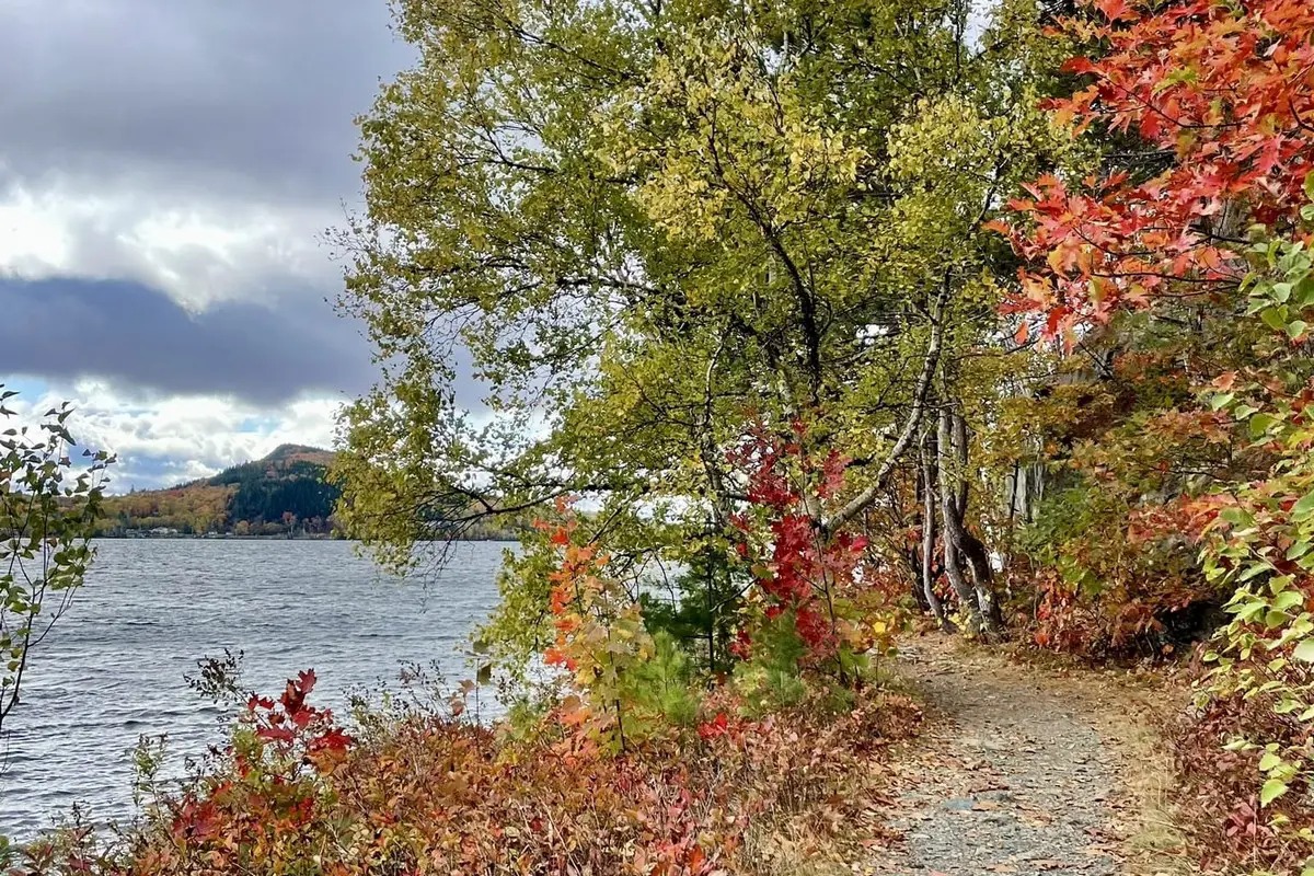
Moosehead Lake is Maine’s largest lake, and it’s surrounded by clear water and wild natural scenery. It’s a quiet spot for boondocking—just don’t expect much in the way of amenities.
There are over 90 primitive campsites on the Moosehead Lake Shoreline Public Lands. They’re free, and most just have a fire ring and a picnic table. You’ll get there either by boat or on gravel roads.
Drive-to sites and water-access-only sites both exist. Spencer Bay, Cowan Cove, and Kelly Wharf are some of the more popular choices if you want to be near the lake but not in the thick of things.
Boondocking here means you’re on your own for supplies. No hookups, no services—bring your own food, water, and whatever else you need.
If you want a little more comfort, Moosehead Family Campground in Greenville is just south of the lake. But if you’re after a remote experience, stick with the primitive sites.
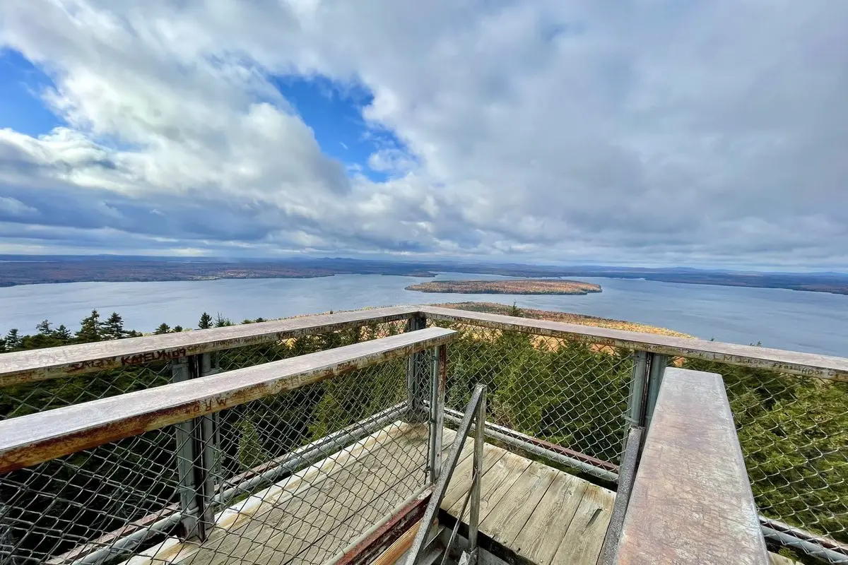
You’ll get forest and mountain views, and there’s always a good chance you’ll spot wildlife. Hiking, fishing, and kayaking are all right at your doorstep.
Location And Access
Moosehead Lake has loads of boondocking options on public lands that ring the lake. Most of the 90+ primitive sites come with just a fire ring and a picnic table.
Some campsites, like those on Spencer Bay, are drive-to and pretty easy to reach by car—often near gravel boat launches. If you’re aiming for the water-access-only sites, you’ll need a boat. Mt. Kineo, Farm Island, and Sugar Island fall into that category.
Closest public boat launches are at Rockwood and Lily Bay. Lily Bay State Park is a favorite for launching, since it’s got easy access to the lake.
The public lands around Moosehead are managed to protect the area, so keep your camping simple and follow the rules to keep things clean.
Quick access breakdown:
| Location | Access Type | Notes |
|---|---|---|
| Spencer Bay | Drive-to | Near gravel boat launches |
| Mt. Kineo | Water-access only | Boat required |
| Farm Island | Water-access only | Boat required |
| Sugar Island | Water-access only | Boat required |
| Rockwood Boat Launch | Public launch | Entry point for water access |
| Lily Bay State Park | Drive-to & boat launch | Popular starting location |
Think about whether you want to drive in, paddle in, or maybe a bit of both.
Directions: How To Get There And What To Expect
Most folks start from Bangor International Airport in Maine. From there, it’s about a 1.5-hour drive northwest. Take Godfrey Blvd, turn left onto Union Street, and follow signs toward Greenville—that’s the gateway town for Moosehead Lake.
Once you’re near the lake, you’ll spot several boondocking spots. For Day’s Academy Grant lands, drive a mile past the Roach River crossing in Kokadjo, then hang a left onto Spencer Bay Road. The roads are mostly dirt, and facilities are pretty much non-existent, so be ready for rustic.
You’ll be surrounded by wilderness. Much of Moosehead Lake is still undeveloped, so it’s quiet and natural. Roads to places like Big Moose are rough and unpaved—go slow, especially if it’s been raining.
Here’s a quick directions cheat sheet:
| Location | How to Get There | Road Type | Notes |
|---|---|---|---|
| Day’s Academy Grant | 1 mile past Roach River crossing, turn left | Dirt road | Primitive, no services |
| Big Moose Point Road | Head west from Greenville Junction, then north | Dirt road | Remote, expect rough terrain |
| General Moosehead Lake | Accessible via Greenville and Kokadjo | Mix of paved & dirt | Mostly wilderness, sparse facilities |
Bring everything you need—services are few and far between. Water and cell signal can be hit or miss. If you’re looking for that “off-grid” feeling, you’ll find it here.
Amenities And Activities
Camping at Moosehead Lake is basic, but you’ll find some helpful touches. Some sites have fire rings, picnic tables, and tent pads. Water’s usually nearby, but you should bring your own just in case.
There’s plenty to do. Fishing’s big—lots of trout and bass to chase. Boating is easy, whether you’re launching from gravel ramps or paddling to a water-only site. Snowmobiling is possible in winter, if that’s your thing.
Hiking trails crisscross the area. Some are short and easy, others are longer if you’re feeling ambitious. Wildlife is everywhere—watch for deer, birds, and whatever else wanders by, especially at dawn or dusk.
If you’re bringing an RV, don’t expect hookups. You’ll need to be self-sufficient. If you want electricity or water, you’ll have to head to a developed campground nearby.
There’s a bit of everything here—relax by the fire, get out on the lake, or wander the woods. It’s up to you.
Camping Regulations And Restrictions
Camping around Moosehead Lake comes with some rules. Most boondocking spots are dispersed camping areas, so don’t expect much in the way of facilities. You’ll need to be ready to camp without running water or toilets.
You can usually stay for up to two weeks at a site. This helps protect the land and keeps things fair for everyone. Stick to designated areas or marked spots to avoid damaging the environment.
Most sites allow up to eight people and two motorized vehicles. Depending on the spot, you can have one RV or camper and a couple of tents.
Fire rings are common, but always check for fire bans. Use existing rings, keep fires small, and make sure they’re out cold before you leave.
Some sites have a rustic picnic table, but don’t count on pit toilets everywhere. Areas like the Maine Island Trail might not have any facilities at all, so plan ahead.
Follow Leave No Trace—pack out your trash, don’t mess with the plants or wildlife, and respect your neighbors. It’s the only way Moosehead Lake stays awesome for everyone.
Leave No Trace
Camping at Moosehead Lake means you have to look after the place. Stick to the Leave No Trace basics—keep it clean for everyone and for the animals.
Pack out all your trash. Don’t leave garbage, even tiny stuff like wrappers or butts. Animals will find it, and it’ll end up in the water.
If you build a fire, use the ring that’s there. Keep it small, only burn dead wood, and drown it out before you leave.
Stay on the trails and camp in established spots. Don’t trample new paths or set up a new site—let the plants and soil recover.
Watch wildlife, but give them space. Don’t feed them or leave scraps—nobody wants a campsite full of bold raccoons.
Use biodegradable soap, and do it away from the water. Let’s keep the lake clean.
If nature calls, bury waste at least 200 feet from water, trails, or camp. If there’s no toilet, pack out your TP in a sealed bag.
Take care of Moosehead Lake and it’ll be just as wild the next time you visit.
Information Resources
Acadia National Park, National Park Service (NPS)
U.S. Geological Survey (USGS)
Visit Boondocking Locations for over 10,000 boondocking opportunites in the United States.
Moosehead Lake Campgrounds
Hay Brook Camping
45.483942, -69.27507
Hay Brook Camping is a remote backcountry site located near the Gulf Hagas area within the KI Jo-Mary Multiple Use Forest in Piscataquis County, Maine. This location sits near the West Branch of the Pleasant River and provides a simple gravel clearing used by campers exploring Gulf Hagas and the Katahdin Iron Works region. The area is surrounded by dense mixed hardwoods and clear-running brooks.
Things to Do:
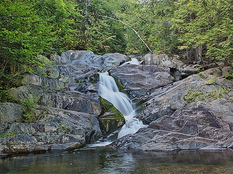
Visitors can hike to Gulf Hagas, known as the “Grand Canyon of Maine,” or fish in nearby streams. The Appalachian Trail passes through this region, offering long and short hikes. Moose, loons, and black bears are common wildlife sightings. The area offers solitude and access to remote natural features.
Directions:
From Brownville Junction, follow Route 11 north, then turn west onto the KI Road. Continue for approximately 9 miles to reach Hay Brook. The site is marked on some printed forest maps but not signed. Use GPS for best results.
Vehicle Access:
The road is gravel and may be gated seasonally. Access requires a high-clearance vehicle. There are no services or facilities; campers must bring all necessities and remove all waste. Dispersed camping is free and first-come, first-served.

Penobscot River Omaha Beach
45.941443, -69.808814
Penobscot River Omaha Beach is a primitive dispersed camping area located along the West Branch of the Penobscot River in northern Maine. This riverfront site provides peaceful surroundings for paddlers, anglers, and campers looking for solitude and natural scenery. It’s part of the greater North Maine Woods region, which is known for its extensive forest lands and remote recreation opportunities. The area operates under a pay-per-use system managed by North Maine Woods, Inc.
Things to Do:
This site provides access to canoeing and kayaking on the West Branch of the Penobscot River, a popular waterway known for whitewater paddling and fishing. Anglers will find trout and landlocked salmon in the river. Wildlife viewing is excellent, with frequent sightings of moose, eagles, and deer. Trails nearby allow for hiking and exploration of the surrounding forest. The area is ideal for those looking to unplug and enjoy raw nature.
Directions:
Use GPS coordinates 45.941443, -69.808814 to reach the site. Access is via logging roads off Golden Road. Visitors should carry printed maps and be prepared for remote conditions with no cell service. Drive cautiously and watch for logging trucks, especially during weekdays.
Vehicle Access:
The site is accessible by high-clearance vehicles via gravel logging roads. It offers level areas for tents and small RVs. There are no developed facilities—campers must pack in all essentials and remove all waste. Fires may be allowed depending on local conditions. Follow all posted rules and Leave No Trace principles. A camping permit or access fee may be required at a nearby gate checkpoint.

Penobscot River Seven Mile Hill
45.90882512089373, -69.83910055660375
Penobscot River, situated in the heart of Maine’s expansive wilderness. Located upstream of the Ripogenus Dam, this site is frequently used by whitewater paddlers and fly fishers. The name refers to the proximity from established river launches and serves as a quiet and scenic overnight location for travelers navigating the backroads of the North Maine Woods.
Things to Do:
The West Branch offers some of the best paddling in the state, and this spot provides a base for day runs or overnight river trips. Anglers will find excellent fishing for salmon and trout. The area is also suitable for wildlife photography and light hiking. Surrounded by thick forest, the site feels isolated and wild—ideal for those who prefer quiet natural surroundings over developed campgrounds.
Directions:
Use GPS coordinates 45.90882512089373, -69.83910055660375. Access is via Golden Road and a network of gravel forest roads. A detailed North Maine Woods map is strongly recommended. The area has no cell coverage, and travel may be impacted by weather or logging activity.
Vehicle Access:
Accessible by gravel roads suitable for trucks and smaller RVs with good clearance. There are no facilities, and campers should be entirely self-sufficient. Firewood must be gathered locally or brought in, and open fires may be restricted. Pack out all trash. A North Maine Woods access fee is typically required at the gate. Always follow Leave No Trace

Penobscot River Nulhedus Gravel Pit
45.89012, -69.884191
The Nulhedus Gravel Pit site is a primitive riverside boondocking area near the Penobscot River’s West Branch, used by paddlers and hunters alike. It offers dispersed camping in a rugged, undeveloped setting. While the name may suggest industrial use, it serves as a flat, open area that allows overnight stays for self-contained campers. Surrounded by dense forest and river sounds, it’s a peaceful location for short stays.
Things to Do:
Ideal for staging paddling trips or fishing along the river. The gravel pit’s proximity to the water allows easy launch and recovery for small watercraft. Wildlife is common, especially in the early morning and late evening. Some light hiking trails may be nearby, and the area provides a good starting point for deeper excursions into the North Maine Woods.
Directions:
Use GPS coordinates 45.89012, -69.884191. Travel via Golden Road, then continue on unpaved side roads. Conditions vary by season; during wet months, access may be muddy or rutted. Carry maps and be aware of limited services.
Vehicle Access:
Open gravel surface suitable for pickup trucks, SUVs, and rugged RVs. No developed campsites, water, or restrooms. Fires permitted where allowed and conditions are safe. Always pack out waste and leave the site clean. An access fee may be collected by North Maine Woods personnel.

Penobscot River Kings High Landing
45.871964, -70.000556
Kings High Landing is a backcountry riverside site located on the West Branch of the Penobscot River. This camping spot is often used by those embarking on or finishing paddling trips through Maine’s northern waterways. While primitive, it offers a wide open area for tents and parking, with easy access to the riverbank. Its name likely comes from nearby historic references to logging camps and old transport routes.
Things to Do:
Fishing, canoeing, and kayaking are the main attractions here. The river offers both flat stretches and light rapids, depending on water levels. The surrounding woods host a variety of wildlife, including moose, foxes, and raptors. It’s also a good site for stargazing due to the lack of light pollution. Visitors often use this site as a launch or stopover point on multi-day river trips.
Directions:
Use GPS coordinates 45.871964, -70.000556. The site is accessed from Golden Road and additional gravel roads. Signage may be minimal, so bring detailed maps and confirm routes at the North Maine Woods gate. Limited to no cell service in this region.
Vehicle Access:
Gravel roads lead to an open clearing by the river. High-clearance vehicles recommended. There are no amenities, so campers must be fully self-contained. Fires permitted depending on current conditions. A North Maine Woods permit is typically required for access. Leave the area as found and respect riverbank integrity.

Penobscot River Canada Falls Campground
45.871964, -70.000556
Canada Falls Campground is a designated remote camping area near the Penobscot River’s headwaters, located close to Canada Falls Lake. This site offers access to whitewater rafting sections of the river and is used by paddlers and outdoor groups during rafting season. It is more organized than other dispersed sites but still retains a rustic, wilderness feel. Managed as part of the North Maine Woods network, the area supports minimal impact camping.
Things to Do:
Canada Falls Lake and the nearby Penobscot headwaters offer canoeing, kayaking, and Class IV whitewater rafting during scheduled releases. Fishing and hiking are also popular. The surrounding forestland is home to diverse wildlife, and the area sees less traffic than southern Maine sites. Campers enjoy access to water-based activities and off-grid solitude.
Directions:
Use GPS coordinates 45.871964, -70.000556. Accessed from Golden Road and connected gravel paths. Road conditions vary, so 4WD is recommended. Stop at a North Maine Woods gate for maps and camping info. No cell service expected.
Vehicle Access:
The campground accommodates small RVs, camper vans, and tents. Gravel pads may be available depending on location. There are no hookups, though some primitive toilet facilities may be nearby. Fires are allowed when permitted. Carry in water and all supplies. A North Maine Woods fee is required. Leave the site clean and undisturbed.
Frequently Asked Questions
You’ll find both remote and drive-to camping spots around Moosehead Lake. Most sites are first come, first served. Amenities vary, and some places are trickier to reach—especially if you’re aiming for a lakeside or backcountry site.
Are there designated free camping areas around Moosehead Lake?
Yep, there are free boondocking spots on public lands near Moosehead Lake. They’re usually pretty barebones and first come, first served. Always double-check local rules before you set up.
What are the best boondocking spots in Moosehead Lake for RV camping?
Spots near Spencer Bay and the gravel boat launches work well for RVs. West Forks and some off-Route 201 spots are quieter. Just remember, there aren’t any hookups, so you’ll need to be self-contained.
Is there a map available that shows camping locations around Moosehead Lake?
Yes—Maine.gov has official maps for both drive-to and water-access campsites. Recreation.gov covers some state parks. The maps show site types and access points to help you plan.
Can you legally boondock in Maine, particularly near Moosehead Lake?
Boondocking’s allowed on some public lands near Moosehead, but private property and state rules still apply. Camp only in designated areas or where it’s clearly permitted, or you could end up with a fine.
Is winter camping available at Moosehead Lake, and what are the conditions?
Winter camping’s possible, but it’s tough. Conditions are cold and snowy, and only experienced campers with the right gear should even think about it.
What amenities are available at Moosehead Lake’s boondocking sites?
Most boondocking spots around Moosehead Lake keep things pretty simple—think fire rings, maybe a pit toilet, and the occasional picnic table if you’re lucky. If you end up at one of the more remote sites, especially those along the Maine Island Trail, you might not find much of anything. Honestly, it’s smart to pack in your own water and a way to handle your waste, just in case.