

22 Sunset Crater Volcano National Monument Boondocking Locations: Looking to boondock near Sunset Crater Volcano National Monument? Your options are a bit limited, but you’ve still got some solid choices. There aren’t any official campgrounds inside the monument itself, and camping there is off-limits. That said, you’ll find free, dispersed camping nearby in Coconino National Forest—especially in areas around Bonito Campground and other forest spots.
The most reliable boondocking locations are just a short drive from the monument, where you can camp for free on Forest Service land. These spots put you close to the volcanic scenery without the fees of developed campgrounds. Conditions are primitive, so you’ll need to come prepared—bring your own water, handle your waste, and stock up on supplies.
It’s important to know exactly where you can park and set up camp legally. Check the latest rules and maps so you don’t accidentally land somewhere you shouldn’t be. That way, you get to enjoy the volcanic landscape and the hiking trails without worrying about tickets or closures. For more details, check out trusted camping resources for the area.
Description And Information About This Location
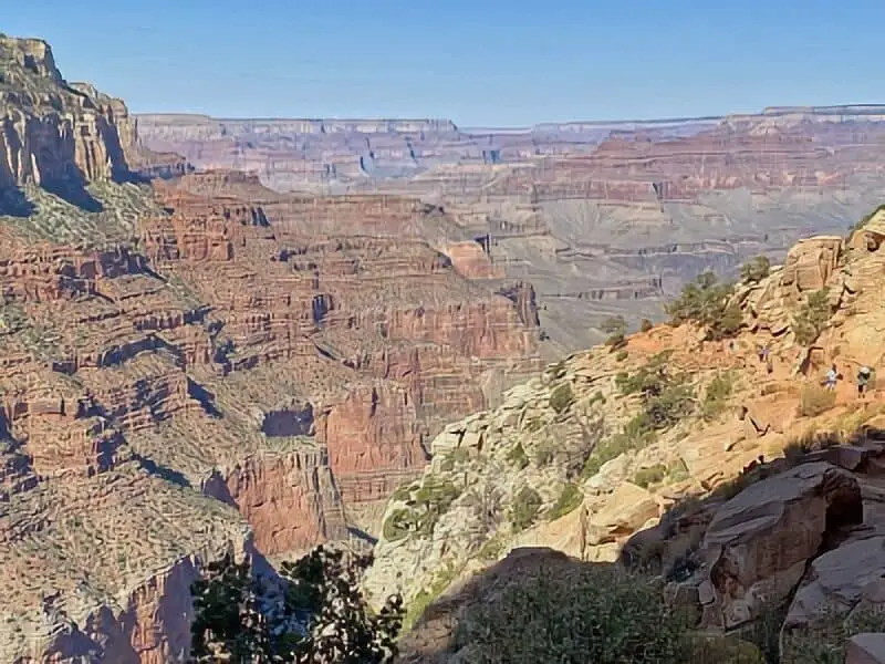
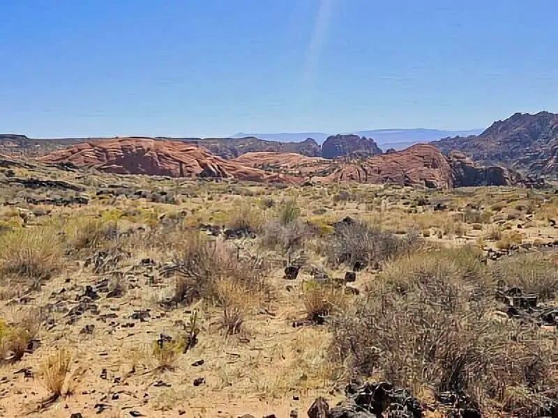
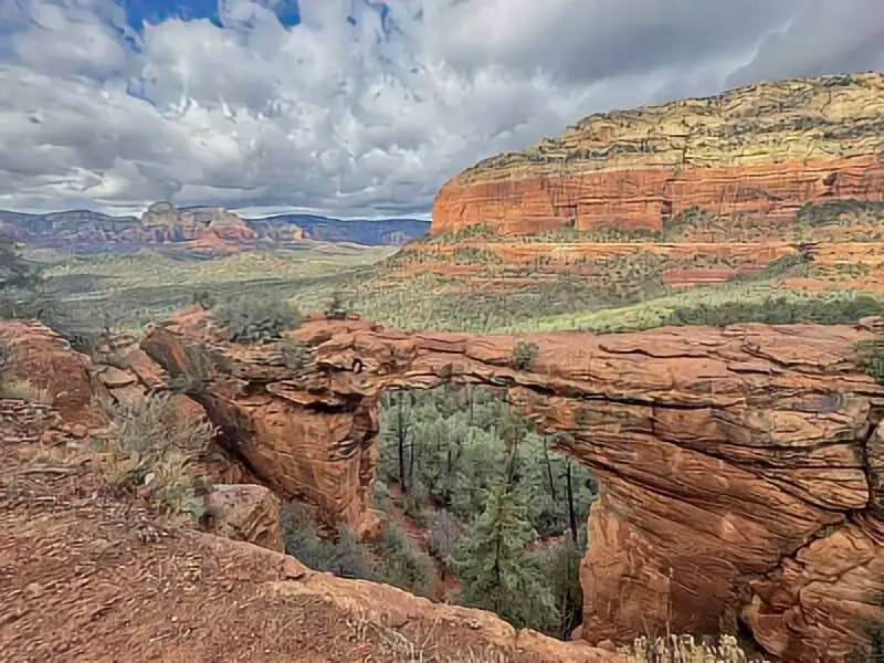
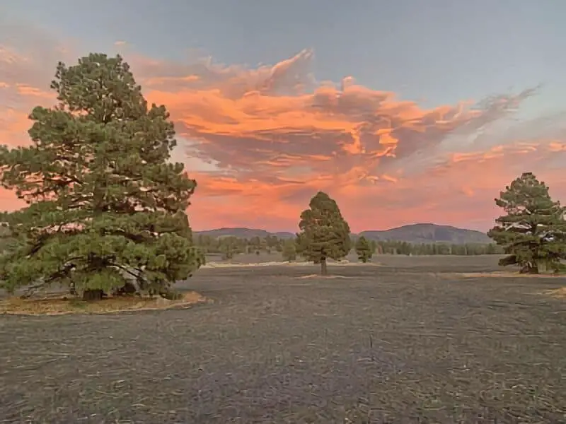
Sunset Crater Volcano National Monument sits in a landscape shaped by a volcanic eruption about a thousand years ago. You’ll see the black lava rocks and the distinctive cone of Sunset Crater, which really changed the local environment. It’s part of Arizona’s national parks system, and you can find quiet boondocking spots close to the volcano.
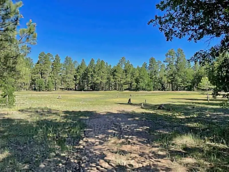
Camping here gives you views of red rocks and Ponderosa Pine forests. At 6,900 feet elevation, the air is cooler than in the nearby desert lowlands. You’re not far from other cool places like the San Francisco Peaks or even the North Rim of the Grand Canyon.
You can swing by Wupatki National Monument or Canyon de Chelly while you’re in the area. Elk sometimes wander through, and you might spot them if you’re lucky. Services are sparse, so don’t forget to bring everything you’ll need.
Here’s a quick rundown:
| Feature | Details |
|---|---|
| Location | Near Flagstaff, Arizona |
| Elevation | About 6,900 feet |
| Camping type | Dispersed boondocking, free |
| Nearby Attractions | Grand Canyon North Rim, San Francisco Peaks, Canyon de Chelly |
| Wildlife | Elk, various birds, small mammals |
You’ll want to come prepared for remote conditions and stick to Leave No Trace practices to keep the area healthy. Sunset Crater Volcano National Monument is a great pick if you’re after some peace, natural beauty, and a dose of volcanic history. For more info, here’s the official page.
Location And Access
Sunset Crater Volcano National Monument sits about 12 miles north of Flagstaff, Arizona. To get there, head north on US Highway 89 from Flagstaff. After 12 miles, take a right onto the Sunset Crater-Wupatki Loop Road and follow it for 2 miles to reach the visitor center.
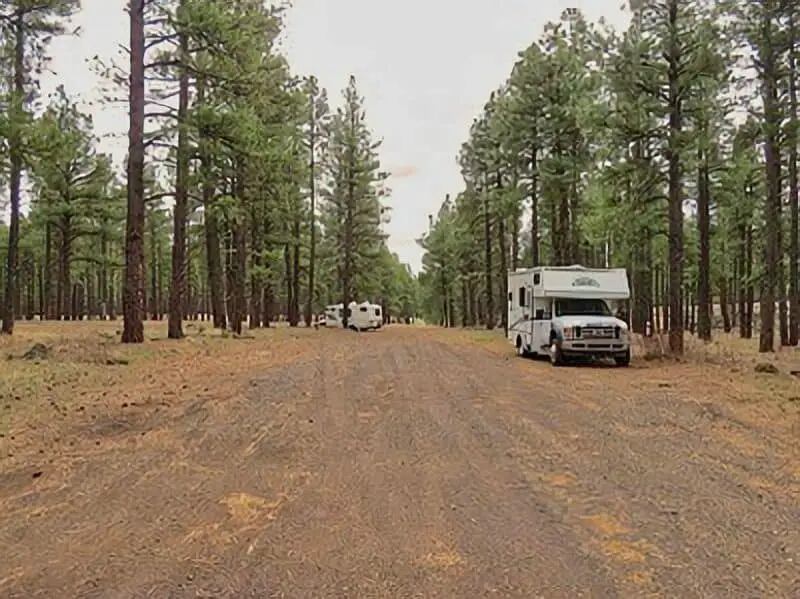
Since the monument is inside Coconino National Forest, you get access to plenty of dispersed camping options in the woods nearby. You’ll find both designated boondocking sites and areas where you can set up camp off the beaten path.
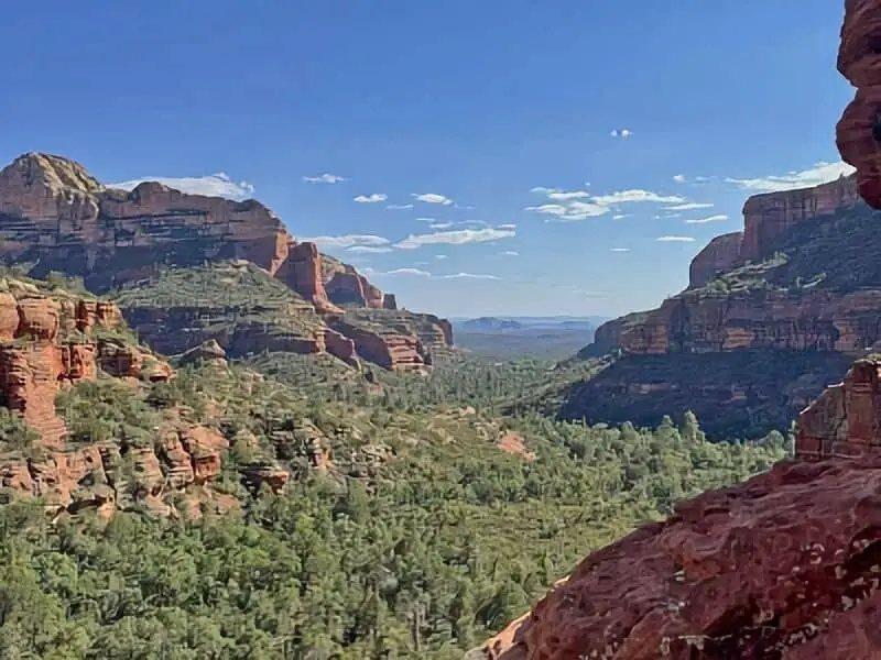
You’re close to other landmarks like Wupatki National Monument and Walnut Canyon National Monument, both within a reasonable drive. Staying near Sunset Crater puts you in a good spot to check out Arizona’s volcanic and Native American history.
Bonito Campground is just east of Sunset Crater, about 2 miles in on the loop road. It’s handy if you want some facilities while still camping close by. The whole area’s pretty remote, so don’t expect a lot of services.
Most of the access roads are paved up to the main spots, with well-maintained forest roads beyond that. Definitely keep a map handy and double-check local forest rules before you head out into the more secluded areas.
Directions: How To Get There And What To Expect
Start in Flagstaff, Arizona. Take U.S. Highway 89 north for about 12 miles. Then, make a right onto Sunset Crater-Wupatki Loop Road. The visitor center sits about 2 miles down that road.
If you’re coming from Interstate 40 (I-40), exit at Flagstaff and follow signs for U.S. Highway 89 north. The drive from I-40 to the monument usually takes about 20 minutes, give or take.
Once you’re on the loop road, look for signs pointing you to boondocking and camping spots. The 34-mile scenic loop winds through both Volcano and Wupatki National Monuments, with several pull-offs and primitive camping areas. There aren’t any hookups or developed campgrounds, so plan accordingly.
What to expect:
- Not much in the way of facilities
- You’ll need to bring plenty of water, food, and whatever else you need
- Awesome views of volcanic landscapes and old lava flows
- Visitor center with maps and info (open seasonally)
Some of the dirt roads can get rough, so make sure your vehicle can handle it if you want to explore off the main loop. Cell service is spotty at best, so download your maps or info ahead of time.
For more details, check the official directions and transportation page.
Amenities And Activities
Camping near Sunset Crater Volcano National Monument means you’ll mostly be looking at dispersed camping spots, which don’t require permits. Amenities are pretty minimal, so plan to be self-reliant. A few areas have pit toilets, but that’s about it.
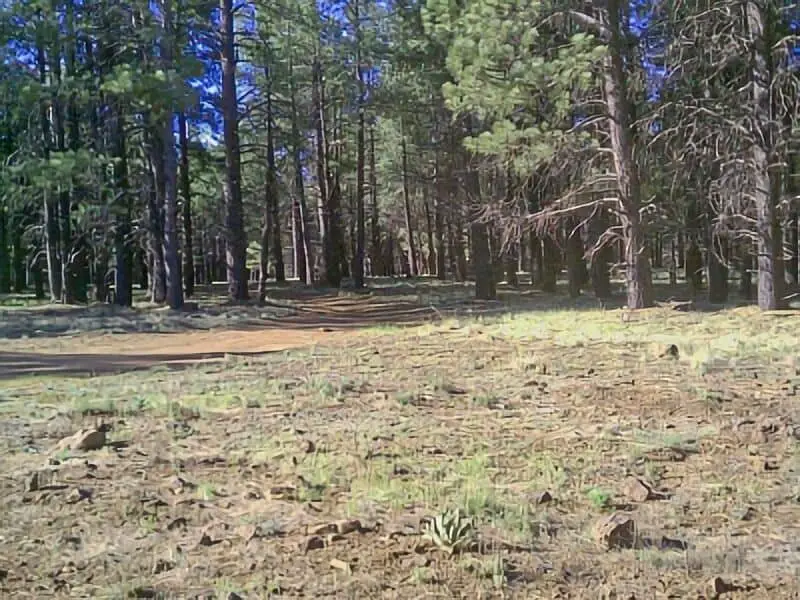
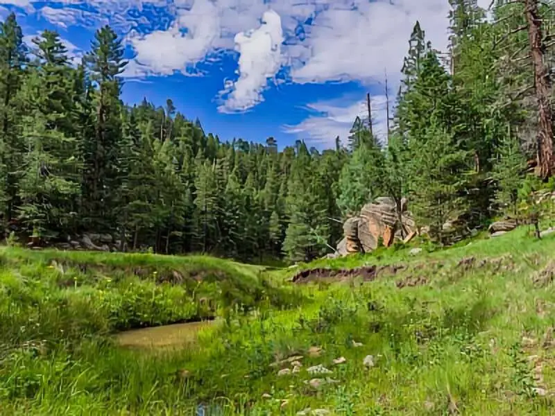
If you’re after a few more comforts, Bonito Campground in Coconino National Forest has picnic tables, fire rings, and restrooms. The elevation (nearly 7,000 feet) keeps things cooler, and you’ll get some welcome shade from the pines and junipers.
There are plenty of hiking trails in the area, especially around the Bonito Lava Flow. You’ll get a close look at volcanic features and native plants. Wildlife’s around too—keep an eye out for birds, small critters, and the occasional reptile.
You’ll be close to both the monument and the surrounding forest, so if you want a quieter spot, check out dispersed campsites on BLM or national forest land. Just remember to haul in your own water and supplies.
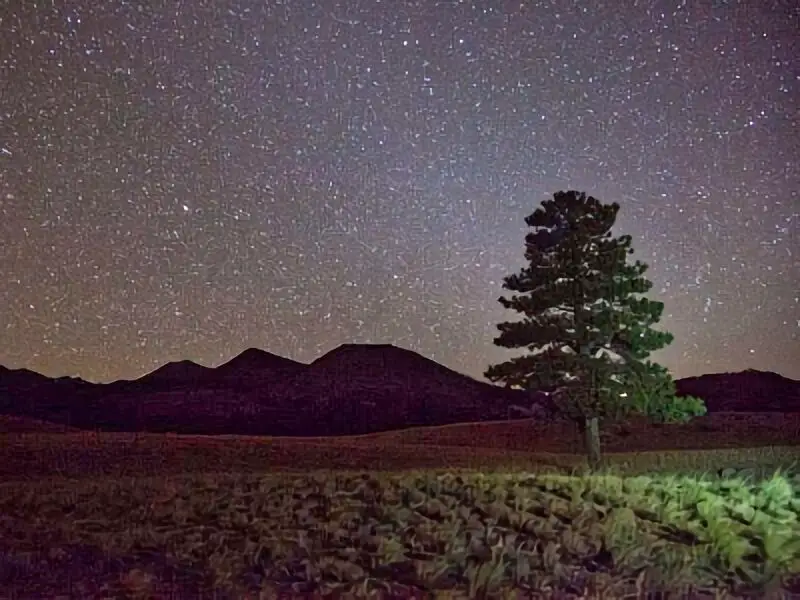
You can wander through lava rock fields, watch for birds, or just enjoy the night sky. Quick heads-up: Lenox Crater volcano is currently closed due to fire damage, so check for updates before you go.
For more on camping options and tips, see Dispersed Camping around Sunset Crater Volcano NM and Bonito Campground.
Camping Regulations And Restrictions
You can’t camp inside Sunset Crater Volcano National Monument itself—the National Park Service prohibits camping within the monument boundaries. If you want to camp nearby, you’ll need to use areas outside the monument.
Dispersed camping is available throughout the surrounding Coconino National Forest. This is classic boondocking—no facilities, just you and the woods. But during fire restrictions, campfires and charcoal fires are off-limits in these camping areas. This includes both Stage 1 and Stage 2 restrictions, so always check the current fire status before you even think about lighting a fire.
Bonito Campground, run by the U.S. Forest Service, is a popular choice close to the monument. Sites run $30 per night and allow up to eight people and one vehicle. You can reserve 22 sites, and 21 are first come, first served. Bringing a second vehicle? That’s $8 extra per night.
A few other rules: Park only in designated zones. Off-highway vehicles are limited to marked trails, and don’t block roads or other campsites.
Stick to Leave No Trace principles—pack out all your trash, don’t damage plants or trees, and keep the peace during quiet hours. It’s just good camping etiquette.
If you want more details about camping rules, check the National Park Service regulations and Bonito Campground info.
Leave No Trace
Boondocking near Sunset Crater Volcano National Monument? You really need to follow Leave No Trace principles to keep the place protected. Basically, leave the site clean and natural for whoever comes after you.
Pack out everything you bring—trash, food scraps, whatever. Don’t bury or burn garbage.
If fires are allowed, use established fire rings. Keep them small and never leave them burning when you’re gone. Douse them completely before you leave.
Try not to damage plants or trees. Camp on durable surfaces like rock, gravel, or dry grass, and stick to existing roads and trails.
Take care of human waste properly. If there’s no toilet, dig a small hole at least 200 feet from water and trails, and cover it up after.
Don’t feed the wildlife or leave food out. Store your food securely so you don’t attract critters.
Keep noise down and respect other campers. That’s what helps keep the peaceful environment around Sunset Crater.
If you follow these habits, you’ll help keep this volcanic landscape clean and beautiful for everyone. Responsible camping benefits the land and all future visitors.
Want more info on dispersed camping near Sunset Crater? Check out camping options around the monument.
Helpful Information Links
Bureau of Land Management
Recreation.Gov
National Park Service
Arizona Park Service
Arizona Trust
Arizona Fish and Game
Over 10,000 Free Boondocking Locations
Boondocking Recipes for 1000’s Of Camping Meals

Sunset Crater Volcano National Monument Boondocking Locations
Marshall Lake
35.113169, -111.534233
Situated within the Coconino National Forest southeast of Flagstaff, Marshall Lake offers a primitive boondocking experience near the east side of the lake. This area provides exceptional views of the San Francisco Peaks from pine-sheltered locations. The lake is a small marshy body of water, generally full of coots and other waterfowl. During wet cycles, it may be stocked with trout by the Arizona Game and Fish Department; however, in dry years, it may temporarily disappear.
Things to Do:
Marshall Lake is managed in partnership by Ducks Unlimited and the Arizona Game and Fish Department, making it a valuable wildlife habitat. The area is excellent for bird watching, with opportunities to see elk, wintering bald eagles, and resident ospreys. Nearby attractions include Lower Lake Mary and Upper Lake Mary, which are just a short drive away and offer fishing, boating, and other water activities.
Directions:
From Flagstaff, drive 9 miles south on Forest Highway 3 (Lake Mary Road). Turn east (left) on Forest Road 128 and continue about 3 miles to the lake. The last mile or so is unpaved and may be impassable at times due to wet conditions.
Vehicle Access:
The access road is usually at least moderately bumpy and rutted, and at times, it’s seriously rough. High-clearance vehicles are recommended. The area is suitable for the largest sized rigs, but the road in may be challenging for some vehicles.

Boondocking Walnut Canyon East
35.18314, -111.428182
Situated east of Flagstaff along Walnut Canyon Road, this boondocking site offers dispersed camping within a high desert environment characterized by open spaces and minimal tree cover. The area provides a rustic setting with no formal amenities, appealing to campers seeking solitude and stargazing opportunities.
Things to Do:
Nearby attractions include the Walnut Canyon National Monument, known for its cliff dwellings and hiking trails. The proximity to Flagstaff allows for easy access to urban amenities and cultural sites such as the Lowell Observatory.
Directions:
From Flagstaff, head east on I-40 and take exit 204. Turn south onto Walnut Canyon Road and continue for approximately 1 mile to reach the dispersed camping areas.
Vehicle Access:
The access road is primarily packed dirt, suitable for most vehicles. However, some spots may be challenging for larger rigs due to uneven terrain.
Shultz Pass
35.259432, -111.66291
Situated north of Flagstaff along Shultz Pass Road, this boondocking site offers dispersed camping within a forested environment. The area provides a natural setting with no formal amenities, appealing to campers seeking tranquility and proximity to hiking trails.
Things to Do:
The surrounding Coconino National Forest offers numerous hiking and biking trails. The nearby Arizona Snowbowl provides skiing opportunities during the winter months.
Directions:
From Flagstaff, head north on US-180. Turn right onto Shultz Pass Road and continue for approximately 2 miles to reach the dispersed camping areas.
Vehicle Access:
Shultz Pass Road is a gravel road accessible to most vehicles. However, conditions may vary with weather, and larger rigs should exercise caution.
Fort Valley
35.2502, -111.6886
Situated northwest of Flagstaff near Fort Valley Road, this boondocking site offers dispersed camping within a mixed environment of open meadows and forested areas. The location provides a serene setting with no formal amenities, attracting campers seeking a balance of solitude and accessibility.
Things to Do:
The area is close to the San Francisco Peaks, offering hiking and mountain biking opportunities. The Museum of Northern Arizona is also nearby, providing cultural and historical exhibits.
Directions:
From Flagstaff, take US-180 northwest for approximately 7 miles. Turn left onto Forest Road 164B to access the dispersed camping areas.
Vehicle Access:
Access roads are primarily dirt and gravel, suitable for most vehicles in dry conditions. Wet weather may make roads challenging for low-clearance vehicles.

FSR 522 Site 6
35.292032, -111.677885
Situated along Forest Service Road 522, this boondocking site offers dispersed camping within a forested environment. The area provides a secluded setting with no formal amenities, ideal for campers seeking solitude and immersion in nature.
AZ Camp Guide
Things to Do:
The surrounding Coconino National Forest offers hiking and wildlife viewing opportunities. The proximity to Flagstaff allows for easy access to urban amenities.
Directions:
From Flagstaff, head north on US-180. Turn right onto Forest Road 522 and continue for approximately 3 miles to reach Site 6.
Vehicle Access:
Forest Road 522 is a dirt road accessible to most vehicles in dry conditions. Larger rigs should assess road conditions before proceeding.

FS Road 222
35.269627, -111.759182
Situated in the Coconino National Forest near Bellemont, FS Road 222 offers dispersed camping along a dirt road surrounded by ponderosa pine forests. This area provides a rustic camping experience with no formal amenities, appealing to campers seeking solitude and a natural setting. The site is suitable for tents, campers, and recreational vehicles, with several pull-through sites available.
Things to Do:
The surrounding forest offers opportunities for hiking, wildlife viewing, and photography. Nearby attractions include the Arizona Snowbowl for skiing and snowboarding during winter months, and the city of Flagstaff, which offers dining, shopping, and cultural experiences.
Directions:
From Flagstaff, take US-180 west for approximately 10 miles. Turn right onto FS Road 222 and continue for about 1 mile to reach the dispersed camping areas.
Vehicle Access:
FS Road 222 is a dirt road that is generally accessible to most vehicles in dry conditions. However, the road can become muddy and challenging during wet weather. Larger rigs should exercise caution and scout ahead if possible.
Wing Mountain
35.27212, -111.761271
Situated southwest of the San Francisco Peaks along Forest Roads 222 and 171, Wing Mountain offers dispersed camping in a forested environment. The area provides a peaceful setting with no formal amenities, attracting campers seeking tranquility and proximity to nature. The site is suitable for tents, campers, and recreational vehicles.
Things to Do:
The nearby Coconino National Forest offers numerous hiking and biking trails. The Arizona Snowbowl is also nearby, providing skiing opportunities during the winter months.
Directions:
From Flagstaff, take US-180 northwest for approximately 6 miles. Turn left onto Forest Road 222 and continue for about 1 mile to reach the dispersed camping areas.
Vehicle Access:
Forest Roads 222 and 171 are dirt roads that are generally accessible to most vehicles in dry conditions. However, the roads can become muddy and challenging during wet weather. Larger rigs should exercise caution and scout ahead if possible.
Road to Lava Tube Cave
35.263239, -111.833533
Situated along Forest Road 171 near the Lava River Cave, this boondocking site offers dispersed camping in a forested environment. The area provides a rustic setting with no formal amenities, appealing to campers seeking solitude and proximity to unique geological features. The site is suitable for tents, campers, and recreational vehicles.
Things to Do:
The nearby Lava River Cave offers a unique spelunking experience, allowing visitors to explore a mile-long lava tube. The surrounding Coconino National Forest provides opportunities for hiking, wildlife viewing, and photography.
Directions:
From Flagstaff, take US-180 northwest for approximately 14 miles. Turn left onto Forest Road 245 and continue for about 3 miles. Turn left onto Forest Road 171 and continue for approximately 1 mile to reach the dispersed camping areas.
Vehicle Access:
Forest Roads 245 and 171 are dirt roads that are generally accessible to most vehicles in dry conditions. However, the roads can become muddy and challenging during wet weather. Larger rigs should exercise caution and scout ahead if possible.
Flagstaff National Forest
35.255727, -111.85063
Situated within the Coconino National Forest near Flagstaff, this boondocking site offers dispersed camping in a forested environment. The area provides a natural setting with no formal amenities, appealing to campers seeking tranquility and proximity to outdoor recreation. The site is suitable for tents, campers, and recreational vehicles.
Things to Do:
The surrounding forest offers numerous hiking and biking trails, as well as opportunities for wildlife viewing and photography. Nearby attractions include the Arizona Snowbowl for skiing and snowboarding during winter months, and the city of Flagstaff, which offers dining, shopping, and cultural experiences.
Directions:
From Flagstaff, take US-180 northwest for approximately 10 miles. Turn left onto Forest Road 245 and continue for about 2 miles to reach the dispersed camping areas.
Vehicle Access:
Forest Road 245 is a dirt road that is generally accessible to most vehicles in dry conditions. However, the road can become muddy and challenging during wet weather. Larger rigs should exercise caution and scout ahead if possible.
FR 245 Flagstaff
35.337772, -111.799446
Situated along Forest Road 245 near Flagstaff, this boondocking site offers dispersed camping in a forested environment. The area provides a peaceful setting with no formal amenities, attracting campers seeking solitude and proximity to outdoor recreation. The site is suitable for tents, campers, and recreational vehicles.
Things to Do:
The surrounding Coconino National Forest offers numerous hiking and biking trails, as well as opportunities for wildlife viewing and photography. Nearby attractions include the Arizona Snowbowl for skiing and snowboarding during winter months, and the city of Flagstaff, which offers dining, shopping, and cultural experiences.
Directions:
From Flagstaff, take US-180 northwest for approximately 10 miles. Turn left onto Forest Road 245 and continue for about 2 miles to reach the dispersed camping areas.
Vehicle Access:
Forest Road 245 is a dirt road that is generally accessible to most vehicles in dry conditions. However, the road can become muddy and challenging during wet weather. Larger rigs should exercise caution and scout ahead if possible.
FR 794 Flagstaff
35.34944, -111.78976
Situated within the Coconino National Forest near Flagstaff, Forest Road 794 offers dispersed camping amidst a dense ponderosa pine forest. This area provides a rustic camping experience with no formal amenities, appealing to campers seeking solitude and a natural setting. The site is suitable for tents, campers, and recreational vehicles, with several pull-through sites available.
Things to Do:
The surrounding forest offers opportunities for hiking, wildlife viewing, and photography. Nearby attractions include the Arizona Snowbowl for skiing and snowboarding during winter months, and the city of Flagstaff, which offers dining, shopping, and cultural experiences.
Directions:
From Flagstaff, take US-180 northwest for approximately 10 miles. Turn left onto Forest Road 794 and continue for about 1 mile to reach the dispersed camping areas.
Vehicle Access:
Forest Road 794 is a dirt road that is generally accessible to most vehicles in dry conditions. However, the road can become muddy and challenging during wet weather. Larger rigs should exercise caution and scout ahead if possible.
Kendrick Mt
35.377106, -111.804805
Situated near Kendrick Mountain within the Coconino National Forest, this boondocking site offers dispersed camping in a forested environment. The area provides a peaceful setting with no formal amenities, attracting campers seeking tranquility and proximity to nature. The site is suitable for tents, campers, and recreational vehicles.
Things to Do:
The nearby Kendrick Mountain Trail offers a challenging hike to the summit, providing panoramic views of the surrounding area. The surrounding forest offers opportunities for hiking, wildlife viewing, and photography.
Directions:
From Flagstaff, take US-180 northwest for approximately 15 miles. Turn left onto Forest Road 171 and continue for about 5 miles. Turn right onto Forest Road 190 and continue for approximately 2 miles to reach the dispersed camping areas near Kendrick Mountain.
Vehicle Access:
Forest Roads 171 and 190 are dirt roads that are generally accessible to most vehicles in dry conditions. However, the roads can become muddy and challenging during wet weather. Larger rigs should exercise caution and scout ahead if possible.
Coconino NFR 9125F
35.384382, -111.592798
Situated along Forest Road 9125F within the Coconino National Forest, this boondocking site offers dispersed camping in a forested environment. The area provides a rustic setting with no formal amenities, appealing to campers seeking solitude and proximity to nature. The site is suitable for tents, campers, and recreational vehicles.
Things to Do:
The surrounding forest offers opportunities for hiking, wildlife viewing, and photography. Nearby attractions include the Arizona Snowbowl for skiing and snowboarding during winter months, and the city of Flagstaff, which offers dining, shopping, and cultural experiences.
Directions:
From Flagstaff, take US-89 north for approximately 10 miles. Turn left onto Forest Road 9125F and continue for about 1 mile to reach the dispersed camping areas.
Vehicle Access:
Forest Road 9125F is a dirt road that is generally accessible to most vehicles in dry conditions. However, the road can become muddy and challenging during wet weather. Larger rigs should exercise caution and scout ahead if possible.

Coconino National Forest Road 418
35.39307, -111.6778
Situated along Forest Road 418 within the Coconino National Forest, this boondocking site offers dispersed camping in a forested environment. The area provides a peaceful setting with no formal amenities, attracting campers seeking tranquility and proximity to nature. The site is suitable for tents, campers, and recreational vehicles.
Things to Do:
The surrounding forest offers opportunities for hiking, wildlife viewing, and photography. Nearby attractions include the Arizona Snowbowl for skiing and snowboarding during winter months, and the city of Flagstaff, which offers dining, shopping, and cultural experiences.
Directions:
From Flagstaff, take US-180 northwest for approximately 10 miles. Turn right onto Forest Road 418 and continue for about 5 miles to reach the dispersed camping areas.
Vehicle Access:
Forest Road 418 is a dirt road that is generally accessible to most vehicles in dry conditions. However, the road can become muddy and challenging during wet weather. Larger rigs should exercise caution and scout ahead if possible.
Coconino National Forest 545B
35.38429, -111.56112
Situated along Forest Road 545B within the Coconino National Forest, this boondocking site offers dispersed camping in a forested environment. The area provides a rustic setting with no formal amenities, appealing to campers seeking solitude and proximity to nature. The site is suitable for tents, campers, and recreational vehicles.
Things to Do:
The surrounding forest offers opportunities for hiking, wildlife viewing, and photography. Nearby attractions include the Arizona Snowbowl for skiing and snowboarding during winter months, and the city of Flagstaff, which offers dining, shopping, and cultural experiences.
Directions:
From Flagstaff, take US-180 northwest for approximately 10 miles. Turn left onto Forest Road 545 and continue for about 2 miles. Turn right onto Forest Road 545B and continue for approximately 1 mile to reach the dispersed camping areas.
Vehicle Access:
Forest Roads 545 and 545B are dirt roads that are generally accessible to most vehicles in dry conditions. However, the roads can become muddy and challenging during wet weather. Larger rigs should exercise caution and scout ahead if possible.

East Old Walnut Canyon Rd
35.18314, -111.428182
Located just east of Walnut Canyon National Monument, East Old Walnut Canyon Road offers dispersed camping within the Coconino National Forest. This area provides a rustic environment with no formal amenities, making it ideal for campers seeking solitude and a natural setting. The terrain is characterized by a mix of ponderosa pine forest and open meadows, offering a peaceful retreat for nature enthusiasts.
Things to Do:
The nearby Walnut Canyon National Monument features ancient cliff dwellings built by the Sinagua people, accessible via a scenic hiking trail. The area is also suitable for wildlife viewing, birdwatching, and photography. The proximity to Flagstaff allows for easy access to urban amenities and additional recreational opportunities.
Directions:
From Flagstaff, take I-40 East to Exit 204 for Walnut Canyon Road. Drive approximately 2.5 miles south to the intersection with East Old Walnut Canyon Road. Proceed east on the dirt road, which is open year-round and accessible to most vehicles in dry conditions. The road may become challenging during wet weather, so larger rigs should exercise caution and scout ahead if possible.
Vehicle Access:
East Old Walnut Canyon Road is a dirt road that is generally accessible to most vehicles in dry conditions. However, the road can become muddy and challenging during wet weather. Larger rigs should exercise caution and scout ahead if possible.
Coconino National Forest Flagstaff Boondocking Location (Arizona)
Situated within the Coconino National Forest near Flagstaff, this boondocking area offers dispersed camping amidst a dense ponderosa pine forest. The environment is tranquil, with no formal amenities, appealing to campers seeking solitude and a natural setting. The area is accessible via various forest roads, providing a rustic camping experience.
Things to Do:
The surrounding forest offers opportunities for hiking, wildlife viewing, and photography. Nearby attractions include the Arizona Snowbowl for skiing and snowboarding during winter months, and the city of Flagstaff, which offers dining, shopping, and cultural experiences.
Directions:
From Flagstaff, take US-180 northwest for approximately 10 miles. Turn left onto Forest Road 222 or Forest Road 171 and continue for about 1 to 5 miles to reach the dispersed camping areas. The roads are generally accessible to most vehicles in dry conditions, but can become challenging during wet weather.
Vehicle Access:
The forest roads leading to this boondocking area are dirt roads that are generally accessible to most vehicles in dry conditions. However, the roads can become muddy and challenging during wet weather. Larger rigs should exercise caution and scout ahead if possible.

Coconino National Forest 553
35.355505, -111.589746
Located along Forest Road 553 within the Coconino National Forest, this boondocking site offers dispersed camping in a forested environment. The area provides a rustic setting with no formal amenities, appealing to campers seeking solitude and proximity to nature. The site is suitable for tents, campers, and recreational vehicles.
Things to Do:
The surrounding forest offers opportunities for hiking, wildlife viewing, and photography. Nearby attractions include the Arizona Snowbowl for skiing and snowboarding during winter months, and the city of Flagstaff, which offers dining, shopping, and cultural experiences.
Directions:
From Flagstaff, take US-180 northwest for approximately 10 miles. Turn left onto Forest Road 553 and continue for about 2 miles to reach the dispersed camping areas. The road is generally accessible to most vehicles in dry conditions, but can become challenging during wet weather.
Vehicle Access:
Forest Road 553 is a dirt road that is generally accessible to most vehicles in dry conditions. However, the road can become muddy and challenging during wet weather. Larger rigs should exercise caution and scout ahead if possible.

Cinder Hill OHV 1
35.328054, -111.523053
Situated within the Coconino National Forest near Flagstaff, Arizona, the Cinder Hill OHV 1 boondocking site is located at coordinates 35.328054, -111.523053. This area is part of the larger Cinder Hills Off-Highway Vehicle (OHV) Area, known for its volcanic cinder terrain and expansive open spaces. The environment is characterized by rolling hills of volcanic cinder, sparse vegetation, and panoramic views of the San Francisco Peaks. Camping here is dispersed and primitive, with no formal amenities such as water, restrooms, or designated campsites. Campers are expected to follow Leave No Trace principles, packing in and out all necessities and waste. The area is favored by campers seeking a rugged, off-grid experience, particularly those interested in off-road vehicle recreation and solitude in a unique geological setting.
The primary attraction of the Cinder Hill OHV 1 area is its extensive network of off-highway vehicle trails, suitable for ATVs, dirt bikes, and 4×4 vehicles. The volcanic cinder terrain provides a challenging and enjoyable experience for off-road enthusiasts. Beyond OHV activities, visitors can explore nearby natural landmarks such as Sunset Crater Volcano National Monument, which offers hiking trails and educational exhibits about the region’s volcanic history. The proximity to Flagstaff allows for easy access to urban amenities, as well as additional outdoor activities like hiking, mountain biking, and wildlife viewing in the surrounding national forest.
Directions:
From Flagstaff, take U.S. Highway 89 north for approximately 7 miles to Forest Road 776. Turn east (right) onto FR 776 and continue for about 2 miles to reach the Cinder Hills OHV Area. The boondocking site is located within this area, and campers should look for suitable spots along the designated routes. It’s important to stay on established roads and trails to protect the fragile volcanic landscape.Arizona State Parks
Vehicle Access:
Access to the Cinder Hill OHV 1 boondocking site is via unpaved forest roads composed of volcanic cinder and dirt. These roads are generally passable for most vehicles in dry conditions, but they can become challenging during wet weather due to the loose and potentially muddy surface. High-clearance vehicles are recommended, especially for those towing trailers or driving larger RVs. While some larger rigs have accessed the area, it’s advisable to scout ahead to ensure the chosen spot is suitable for your vehicle’s size and capabilities. There are no services or facilities, so campers must be fully self-contained and prepared for primitive conditions.

Cinder Cones Volcanic Ash
35.330736, -111.494888
Situated in the Coconino National Forest near Flagstaff, Arizona, the Cinder Cones Volcanic Ash boondocking area is located around coordinates 35.330736, -111.494888. This site lies within a volcanic landscape characterized by cinder cones and deposits of volcanic ash, creating a unique terrain for camping. The environment is rugged and dry, with sparse vegetation mostly consisting of junipers and scattered ponderosa pines. This dispersed camping area offers no formal amenities such as water, toilets, or designated fire rings. Campers are expected to be self-sufficient and pack out all waste. The terrain is open enough to allow multiple camping spots with room for tents, smaller RVs, and vans, though sites are primitive. It is favored by campers seeking a quiet, natural experience surrounded by unusual geological features and a peaceful atmosphere. The area appeals to those who appreciate solitude, nature, and a backcountry feel without crowded campgrounds.
Things to Do:
The primary draw of the Cinder Cones Volcanic Ash area is its volcanic geology, offering hikers and explorers the chance to see impressive volcanic cones and black cinder ash fields. This geological site is part of the San Francisco volcanic field, which includes over 600 volcanoes, with Sunset Crater Volcano National Monument located nearby. Visitors can enjoy hiking trails around the cones, birdwatching, and photography. The area also provides opportunities for off-road vehicle recreation on nearby trails. For those looking to explore further, the city of Flagstaff is about 15 miles away, offering amenities, restaurants, and cultural sites. Outdoor activities such as mountain biking, hiking in Coconino National Forest, and visiting nearby natural landmarks like Walnut Canyon and Sunset Crater are popular among visitors.
Directions:
To reach the Cinder Cones Volcanic Ash boondocking area, start in Flagstaff, Arizona. Head northeast on US-180 for approximately 10 miles. Turn right onto Forest Road 595, also known as Kachina Trail, and continue for about 3 miles. Then take a left onto Forest Road 144. Drive approximately 2 miles until reaching the volcanic ash fields near the cinder cones. The roads are unpaved and may require cautious driving. Follow signage for dispersed camping areas and look for flat, open spaces suitable for camping. GPS coordinates 35.330736, -111.494888 can be used for precise navigation.
Vehicle Access:
The roads to the Cinder Cones Volcanic Ash camping area are primarily unpaved dirt and gravel forest roads. They are generally accessible to most passenger vehicles during dry conditions but can become challenging in wet weather due to mud and erosion. Drivers of larger rigs or trailers should proceed with caution and consider the turning radius limitations and road narrowness. High-clearance vehicles or four-wheel-drive vehicles are recommended, especially if exploring farther into the volcanic terrain or off-road trails. There is ample space for maneuvering and parking smaller RVs or campers near the camping spots, but large fifth-wheels or long trailers may have difficulty on tighter turns and less maintained sections of the forest roads. Campers should be prepared for primitive conditions with no hookups or facilities.
Cinder Hill OHV Area 2
35.363738, -111.478631
Situated in the Coconino National Forest near Flagstaff, Arizona, the Cinder Hill OHV Area 2 at coordinates 35.363738, -111.478631 is a designated off-highway vehicle (OHV) recreation and dispersed camping site. This area is characterized by volcanic cinder hills and rough terrain shaped by volcanic activity. The environment consists mostly of open, rocky hills with sparse vegetation, including junipers and small shrubs. There are no developed amenities, so camping is primitive with no water, restrooms, or electrical hookups available. The area is ideal for campers and OHV enthusiasts who want to combine camping with recreational vehicle riding on numerous trails within the forest. It attracts campers seeking a rugged outdoor experience, freedom to camp off-grid, and access to off-road trails.
Things to Do:
Cinder Hill OHV Area 2 is popular for off-highway vehicle riding on its network of dirt trails winding through volcanic cinder hills and forest. Riders can explore varying trail difficulties, from easier paths to more technical sections, appealing to dirt bike, ATV, and 4×4 enthusiasts. Hiking and wildlife viewing are other activities possible in the area, where campers may spot mule deer, coyotes, and various bird species. Nearby natural features include volcanic cinder cones and lava fields that can be explored on foot. The city of Flagstaff lies about 12 miles away, providing access to restaurants, supplies, and cultural attractions. Visitors may also use the area as a base to visit the San Francisco Peaks, Sunset Crater Volcano, and Walnut Canyon.
Directions:
From Flagstaff, take US-180 northeast for approximately 9 miles. Turn right onto Forest Road 595 (Kachina Trail) and continue for around 4 miles. Turn left onto Forest Road 149 and drive about 1.5 miles until reaching the marked OHV area near Cinder Hill OHV Area 2. The forest roads are unpaved and can be rough, so proceed with care. GPS coordinates 35.363738, -111.478631 will help with exact navigation. Look for dispersed camping spots near the OHV trailheads.
Vehicle Access:
The roads to Cinder Hill OHV Area 2 are primarily dirt and gravel forest roads that can be rough and uneven. High-clearance vehicles or 4WD are recommended for accessing the area, especially after rain or snow when conditions worsen. Passenger vehicles may reach the site during dry conditions but should drive cautiously. The area is suited to OHVs and smaller camping rigs. Larger RVs and trailers may find the roads challenging due to narrow turns and rough surfaces. Parking space near the camping sites is adequate for smaller vehicles, but large rigs should consider parking in more accessible nearby areas and using OHVs for trail access. Campers should be self-sufficient and prepared for no services or facilities.
Frequently Asked Questions
You’ll find designated spots for boondocking near Sunset Crater Volcano, but most camping is dispersed. Maps can help you find these areas, and a few nearby spots offer basic amenities. There are some important rules to follow, and you can always look into other camping options close by.
What are the official boondocking locations near Sunset Crater Volcano National Monument?
The forest around Sunset Crater has several official dispersed camping sites. These let you camp without hookups or developed facilities. You need to camp only in designated spots to keep your impact low.
Is there a map available that shows boondocking sites around Sunset Crater Volcano National Monument?
Yep! You’ll find maps with free camping sites and dispersed camping locations on sites like freecampsites.net. They even include photos and user reviews to help you choose a good spot near the volcano.
What amenities are available at the Sunset Crater Volcano visitor center for boondockers?
The visitor center has picnic tables and restrooms, but don’t expect food services. There are picnic areas at the Lava Flow parking lot and Painted Desert point if you want to make a meal or just take a break.
How close to Wupatki National Monument can you legally boondock?
Dispersed camping is allowed in parts of Coconino National Forest near Wupatki National Monument. Just follow local rules and camp in designated areas to avoid trouble.
Are there any restrictions on boondocking near Sunset Crater Volcano National Monument?
Yes—no camping directly on the volcano or inside protected monument areas. Fires and vehicle use might be limited depending on the season and conditions. Always check with the visitor center for current rules.
What alternative camping options are available in the vicinity of Sunset Crater Volcano National Monument?
You’ve got a few choices beyond dispersed camping. The Forest Service runs several developed campgrounds in the area, and there are some private campgrounds and RV parks sprinkled around too. If you’re not sure which spot to pick, browsing through Tripadvisor reviews might help you zero in on something that actually fits what you’re looking for.