

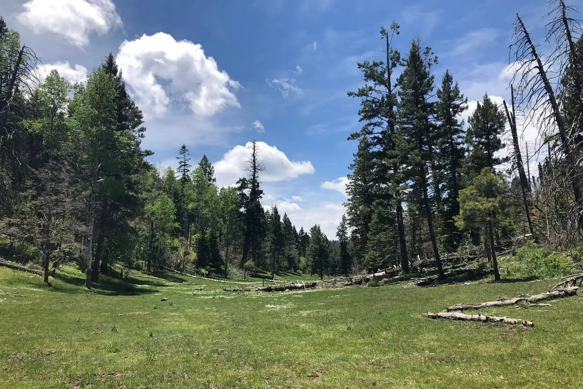
Lincoln National Forest Boondocking Locations: Looking to camp far from the crowds and chaos? Lincoln National Forest has a bunch of great boondocking spots where you can really get away from it all.
These sites let you soak up nature with barely any fees—sometimes none at all. 21 dispersed camping areas are scattered across the forest, from Dog Canyon to Raptor Lake, so you can set up in a peaceful, natural spot.
Most of these places don’t offer water or electricity, so you’ll need to bring your own supplies and be ready to rough it a little. Some are tucked near Cloudcroft or Lower Karr Canyon, so you can pick your favorite landscape.
If you know where these campsites are, planning your trip gets a whole lot easier. You’ll be able to find a quiet place to sleep under the stars.
Location And Access
The 21 boondocking sites are spread throughout Lincoln National Forest. Most sit along dirt Forest Service roads, so you don’t need a monster truck to get there—just a regular vehicle will do for most.
You can drive up to 300 feet off these roads to park and set up camp. That’s plenty of space to find your own little corner.
Many of the spots are close to the Village of Ruidoso or near Cloudcroft. Pines Group Campground isn’t dispersed camping, but it’s a helpful reference point with 24 structured sites.
Some roads are smooth and well-kept, while others get pretty rough. If you want to venture further from the main drag, a high-clearance vehicle helps, though it’s not always a must.
Here’s a quick rundown:
- Road type: Mostly dirt Forest Service roads
- Distance off road: Up to 300 feet for parking
- Nearby towns: Ruidoso, Cloudcroft
- Vehicle recommendation: High clearance is handy, but not strictly required
Before you go, double-check local maps and weather. Some routes close after storms or during certain seasons.
Stick to Leave No Trace principles and only park in allowed areas—let’s keep the forest healthy.
Directions: How To Get There And What To Expect
To get to Lincoln National Forest, just head out from towns like Ruidoso or Cloudcroft. Most boondocking spots are off dirt Forest Service roads, so make sure your car can handle some bumps and dust.
When you arrive, you’ll usually be able to drive up to 300 feet off the road to find a camping spot. That means you can get a little privacy but still stay close enough for an easy exit.
Facilities are pretty much nonexistent at these dispersed sites—no bathrooms, water, or trash cans—so you’ll need to bring everything you need and take all your trash with you.
A map or GPS with Forest Service road numbers is a lifesaver. Cell service? Sometimes it’s there, sometimes not—so plan ahead.
Here’s what you’ll want to pack:
- Water and food
- Camping gear (tents, RV stuff, whatever you like)
- Trash bags
- Navigation tools (maps, GPS)
You’ll be camping in a wild, undeveloped spot. That means more privacy, but also more responsibility to leave it as you found it.
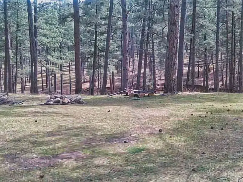
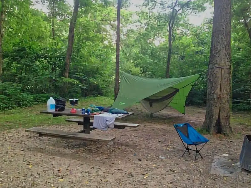
Amenities And Activities
Amenities at Lincoln National Forest boondocking sites really depend on where you land. Some have basic features like fire rings or a picnic table, maybe a vault toilet nearby, but most don’t have running water or power.
You can usually park right by your camping spot, since you’re allowed to drive up to 300 feet off the road. It’s rustic, but that’s the appeal, right?
There’s plenty to do. Hiking and wildlife watching are big draws—there’s a surprising amount of animal life out here, and the trails are gorgeous. If you’re into mountain biking or just want to kick back and listen to the wind in the trees, you’re in luck.
Here’s what you might find:
| Amenity | Availability |
|---|---|
| Fire rings | Common at many sites |
| Picnic tables | Found at some locations |
| Vault toilets | Available at few spots |
| Trashcans | At select campgrounds |
| Drinking water | Rare; bring your own |
Bring your own water and supplies. The forest’s natural setting offers a peaceful place for both adventure and downtime.
Camping Regulations And Restrictions
Camping in Lincoln National Forest comes with a few important rules. You can camp in dispersed areas for up to 16 days. After that, you’ll need to move at least 5 miles away before you set up again.
Don’t camp on private land or within city or village limits. And don’t drive across creeks or fragile ground—let’s not wreck the place for the next folks.
Water is scarce, so always bring your own. Most dispersed sites don’t have toilets or water, so plan ahead.
You can usually have a campfire, but always check for restrictions first. Use existing fire rings if you can, and make absolutely sure your fire is out before you leave.
Take all your trash with you and keep the noise down for your neighbors.
A quick summary:
| Rule | Details |
|---|---|
| Maximum stay | 16 days per dispersed area |
| Move distance | At least 5 miles before camping again |
| No camping locations | Private property, city, or village limits |
| Water availability | Limited, bring your own |
| Fires | Allowed with restrictions |
| Environmental care | No driving over creeks, pack out trash |
Leave No Trace
Whenever you’re boondocking in Lincoln National Forest, following Leave No Trace is a must. It’s about keeping the place wild for everyone who comes after you.
Pack out all your trash—even the tiny stuff like food wrappers or cigarette butts. Don’t burn or bury it.
If there’s a fire ring, use it. If not, maybe skip the fire to protect the ground.
Stick to the roads and designated parking areas. Off-roading can mess up roots and cause erosion.
Keep it quiet out there. Not just for other campers, but for the animals, too.
If you’re washing dishes or yourself, use biodegradable soap and stay at least 200 feet from streams. Water is precious out here.
For waste, follow the rules. If there’s no toilet, dig a hole at least 6 inches deep and 200 feet away from water, trails, and campsites.
Respect wildlife—watch from a distance, don’t feed them, and don’t mess with their homes.
A few reminders:
| Leave No Trace Rule | Why It Matters |
|---|---|
| Pack out all trash | Keeps forest clean and safe |
| Use established camp spots | Protects plants and soil |
| Keep fires controlled | Prevents wildfires and damage |
| Respect wildlife distance | Maintains animal health and safety |
| Dispose of waste properly | Protects water and soil quality |
Information Resources
Lincoln National Forest – U.S. Forest Service
New Mexico Tourism Department – Lincoln National Forest
U.S. National Forests: Lincoln National Forest
New Mexico Department of Game and Fish
Ruidoso Chamber of Commerce – Outdoor Recreation in Lincoln National Forest
Free Lincoln National Forest Boondocking Locations
16 Springs Canyon Boondocking Location
32.983111, -105.496773
16 Springs Canyon offers a peaceful and remote boondocking experience in the Lincoln National Forest, just northeast of Cloudcroft. This location is tucked into a scenic canyon surrounded by tall pine trees, with open clearings perfect for dispersed camping. The area is known for its cool summer temperatures, making it a refreshing escape from the desert heat. The forested surroundings offer seclusion, quiet, and stunning natural beauty, ideal for those looking to disconnect and enjoy the outdoors.
Things to Do: Campers at 16 Springs Canyon can explore the nearby hiking and horseback riding trails that weave through the canyon. Birdwatching and wildlife sightings are common due to the dense forest cover. The area is also popular for ATV riding and mountain biking. While remote, it’s a favourite spot for those seeking serenity, fresh air, and starlit nights.
Directions: From Cloudcroft, take US-82 east to NM-130, then continue on 16 Springs Canyon Road. The road is unpaved but manageable with high-clearance vehicles. Weather conditions can affect access, especially during rain, so check before heading out.
Vehicle Access: Access is best suited for smaller RVs, vans, and high-clearance vehicles. Larger rigs may have difficulty due to narrow and uneven roads. Campsites are dispersed, allowing for privacy, but there are no amenities or services on-site.

Alamo Peak Road Boondocking Location
32.87325, -105.812037
Alamo Peak Road provides a high-elevation boondocking experience with panoramic views of the Tularosa Basin and surrounding mountains. Located in the Sacramento Mountains, this dispersed camping area is known for its cooler climate and scenic landscape. The road itself is a forest service road that winds upward through pine forests, offering multiple pull-offs and flat clearings suitable for camping. This is a quiet location ideal for those looking to enjoy nature without the crowds.
Things to Do: Hiking is the main activity in the area, with several trails accessible from the road or nearby forest service areas. Wildlife is plentiful, with deer, elk, and a variety of birds spotted regularly. Photography and stargazing are also popular due to the area’s elevation and minimal light pollution. This spot is especially appealing to campers who enjoy solitude and scenic drives.
Directions: From Cloudcroft, head west on US-82, then take NM-6563 to Alamo Peak Road. The road is gravel and can be steep in places. It’s best to drive slowly and be prepared for tight turns and narrow lanes as you ascend.
Vehicle Access: Best suited for vans, SUVs, and small trailers. Larger RVs are not recommended due to the steep grade and limited turnaround spots. The area has no amenities, so campers should be fully self-sufficient.

Alamogordo Dry Canyon Boondocking Location
32.945999, -105.882152
Dry Canyon near Alamogordo offers a convenient yet scenic dispersed camping option close to town. This boondocking site lies just outside the Lincoln National Forest boundary, giving visitors easy access to both mountain terrain and city amenities. The area features wide open clearings and desert vegetation, with surrounding cliffs and views of the Sacramento Mountains. It’s a quiet location, well-suited for overnight stays or a few days of peaceful rest.
Things to Do: The canyon is great for hiking and exploring, especially around the rocky outcrops and desert washes. Nearby Lincoln National Forest offers extended trail networks and pine-covered mountain terrain for day trips. The area is also known for beautiful sunsets and nighttime skies, making it a solid choice for photography and stargazing.
Directions: From Alamogordo, head east on US-82 toward the mountains, then turn onto Dry Canyon Road. The area has a wide pull-off and dirt clearings where you can set up camp. It’s only a few miles from the highway, making access easy.
Vehicle Access: Suitable for all vehicle types, including RVs and trailers. The roads are unpaved but relatively smooth. There are no hookups, restrooms, or water, so campers must bring their own supplies.

Bailey Canyon Boondocking Location
32.978634, -105.7564
Bailey Canyon offers a forested, shaded boondocking spot in the Cloudcroft area, within the Lincoln National Forest. The site sits at a higher elevation, providing cool temperatures and relief from the heat, especially in summer. This canyon location is more secluded than some nearby sites, and the towering trees provide privacy and shelter from wind. The terrain is rugged but offers several flat clearings ideal for dispersed camping.
Things to Do: Hikers and nature lovers will appreciate the trails accessible from the canyon and nearby forest roads. Wildlife watching is common, with sightings of elk, wild turkey, and even black bears reported. This area is also suitable for horseback riding, off-roading, and quiet evenings around the campfire. Its natural setting makes it perfect for campers who prefer minimal noise and maximum nature exposure.
Directions: From Cloudcroft, take NM-130 west and then turn off toward Bailey Canyon. The route is marked by forest roads that require cautious driving. Depending on weather, parts of the road can become rough or muddy.
Vehicle Access: Best for high-clearance vehicles, trucks, and small RVs. Larger rigs may face tight access points. There are no developed sites or facilities, so campers should pack in all essentials and be ready to dry camp.

Barrel Spring/Sand Spring Boondocking Location
32.710895, -105.679884
Barrel Spring and Sand Spring are neighbouring dispersed boondocking locations set within the Lincoln National Forest, southeast of High Rolls. These sites sit along forest roads that provide access to wide clearings with ample space for dry camping. Surrounded by piñon and juniper, the area offers a blend of open desert landscape and mountainous terrain. It’s a quiet spot with very few visitors, making it well-suited for campers seeking solitude in a rugged natural setting.
Things to Do: Hiking and wildlife viewing are popular here, as the terrain offers a mix of hills, arroyos, and desert flora. Off-road trails and forest roads are also accessible for those with high-clearance vehicles or ATVs. The site is not far from the Rim Trail system, allowing for day hikes into the higher elevations of the Sacramento Mountains. Sunrise and sunset views are particularly striking due to the site’s openness.
Directions: From High Rolls, head southeast on NM-506, then take forest roads toward Barrel Spring or Sand Spring. GPS is helpful, as signage is limited in the area.
Vehicle Access: High-clearance vehicles are recommended. The roads can be rough and narrow in spots, not ideal for large RVs. There are no services, so campers must bring all supplies, including water and waste disposal options.

Bear Canyon Boondocking Location
32.843285, -105.566286
Bear Canyon is a tucked-away boondocking spot located in the Sacramento District of the Lincoln National Forest. Situated east of Cloudcroft, it provides a forested setting with shaded areas under tall pines and firs. The elevation keeps temperatures cooler throughout the warmer months, making it a popular summer escape. Campsites are dispersed along forest roads and canyon edges, offering seclusion without being far from nearby outdoor recreation.
Things to Do: Bear Canyon offers access to nearby trails, wildlife habitats, and scenic forest drives. Hiking is the main draw, with several unmarked trails leading deeper into the forest. It’s also a quiet place for birding, photography, and nature walks. The peaceful atmosphere is ideal for reading, resting, or simply enjoying the forest sounds.
Directions: From Cloudcroft, head east on NM-130, then take forest road spurs toward Bear Canyon. The area is accessible by gravel roads that are manageable with proper clearance.
Vehicle Access: Best suited for vans, trucks, and small RVs. Larger vehicles may have trouble navigating the narrower forest roads. The area is fully undeveloped—no water, toilets, or trash facilities are available—so campers must pack in and out responsibly.

Cloudcroft Boondocking Location
32.78824, -105.78599
This Cloudcroft-area boondocking site provides a mix of forested pull-offs and open areas for dispersed camping, all located near the town of Cloudcroft. The elevation at nearly 9,000 feet means temperatures stay cool even in summer, and the surrounding pine forests offer shade, privacy, and mountain air. This location is one of the more accessible boondocking spots in the region and is often used by those who want to be close to amenities while still dry camping.
Things to Do: Cloudcroft is known for hiking, mountain biking, and scenic byways. The Rim Trail, one of the most well-known trail systems in the area, is nearby and offers miles of hiking through forested terrain with sweeping views. Off-roading, wildlife viewing, and visits to Cloudcroft’s small shops and cafes are all within short driving distance.
Directions: From the center of Cloudcroft, several forest roads lead to dispersed camping areas just outside town. These include parts of FR 568 and nearby pull-offs.
Vehicle Access: Suitable for a range of vehicles, from cars and vans to medium-sized RVs. Roads are typically well-maintained but may have ruts or soft areas after rain. No facilities are available, so self-contained camping is required.

Cloudcroft FR 568 Boondocking Location
32.972182, -105.736017
Cloudcroft FR 568 Boondocking Location (Lincoln National Forest, NM)
Forest Road 568 near Cloudcroft offers dispersed camping in a forested and elevated setting just a short drive from the town. This road runs along ridgelines and through wooded areas, providing a range of pull-offs with privacy and excellent shade. The elevation exceeds 8,500 feet, so the area remains cool and breezy, even in midsummer. With direct access to trailheads and scenic drives, it’s a prime location for boondockers looking to stay close to town while enjoying remote camping.
Things to Do: FR 568 connects to multiple forest trails, including the Rim Trail and various cross-country routes suitable for hiking and mountain biking. Wildlife is abundant, with chances to see deer, wild turkeys, and the occasional elk. Off-road driving and dispersed exploration are common. The views from sections of the road include forest valleys and distant desert plains.
Directions: From Cloudcroft, head north or east toward FR 568, which branches off several access points. The road is gravel with occasional narrow sections, so slow driving is recommended.
Vehicle Access: Best for small to medium RVs, vans, and high-clearance vehicles. Long trailers may face difficulties on tighter turns. There are no developed campsites or facilities, so campers must bring everything they need for dry camping.
Cloudcroft Hornbuckle Hill Boondocking Location
32.711091, -105.769456
Hornbuckle Hill is a peaceful boondocking location located just south of Cloudcroft, offering a mix of shaded forest clearings and open ridge areas for dispersed camping. Situated in the Lincoln National Forest, this site sits at an elevation of around 8,000 feet and provides a cooler climate during the summer months. The area is forested with ponderosa pine and fir, and it is far enough from the main roads to allow for quiet nights and scenic mornings. The site is entirely undeveloped, so campers must be fully self-sufficient.
Things to Do: Nearby trails offer hiking, mountain biking, and wildlife viewing opportunities. Several forest roads wind through the hills, making it ideal for scenic drives and off-road exploring. Birdwatchers often spot raptors and woodpeckers, while elk and deer are commonly seen grazing in the early morning. Cloudcroft’s town center is also nearby, offering shops and supplies for day trips.
Directions: From Cloudcroft, head south on NM-130, then follow signage or GPS toward Hornbuckle Hill. The area is reached via unpaved forest roads branching off the main highway.
Vehicle Access: Accessible for high-clearance vehicles, vans, and small trailers. Larger RVs may face issues with maneuvering on the narrower dirt roads. The surface is mostly compact but can become slick in wet conditions.

James Canyon Campground Boondocking Location
32.90469, -105.505058
James Canyon Campground is a developed but quiet campground located along US-82 just west of Mayhill, within the Lincoln National Forest. Though technically a formal campground, the surrounding area offers nearby dispersed camping options along forest roads. The campground itself features basic amenities such as picnic tables, fire rings, and vault toilets. There are around five campsites, making it a peaceful alternative to more crowded areas.
Things to Do: This area is well-suited for short hikes, wildlife viewing, and relaxing under tall pines and Douglas fir trees. The proximity to the canyon provides excellent birdwatching, and many campers enjoy the sounds of the creek that flows through during wetter seasons. Nearby forest roads allow for further exploration, and it serves as a good basecamp for exploring Cloudcroft and Mayhill.
Directions: From Cloudcroft, take US-82 east toward Mayhill. The campground is located about 14 miles from Cloudcroft and is signed from the highway, just past the village of Elk.
Vehicle Access: Easily accessible via paved road. Suitable for small RVs, travel trailers, and tents. Pull-through spots are limited, so larger rigs should scout ahead. Dispersed options nearby require high-clearance vehicles.

La Luz Mill Ridge Boondocking Location
32.958174, -105.905814
La Luz Mill Ridge is a lesser-known dispersed camping area tucked away in the forested slopes above the La Luz Canyon area. This site offers privacy, peace, and a cool mountain climate. It sits high on a ridge and provides beautiful views of the surrounding Sacramento Mountains. The area is undeveloped, with no toilets, water, or designated campsites, but there are multiple flat clearings ideal for tents and camper vans.
Things to Do: Outdoor activities include hiking, exploring nearby forest trails, and birdwatching. La Luz Canyon Road leads to several points of interest, and the Mill Ridge area offers expansive forest and mountain views. The elevation makes it a comfortable summer destination, with temperatures typically 10–15 degrees cooler than the nearby Tularosa Basin.
Directions: From La Luz or Alamogordo, take La Luz Canyon Road (FR 162C) into the mountains. Follow the road up the ridge until you reach suitable clearings near the Mill Ridge area. Road conditions may vary by season.
Vehicle Access: High-clearance vehicles are recommended, especially past the first few miles. Not ideal for long RVs or trailers due to narrow turns and steep grades. Best suited for tent campers, vans, and truck campers.

Mayhill Denny Hill Boondocking Location
32.839872, -105.530134
Denny Hill is a dispersed boondocking area located northeast of Mayhill, situated in the Lincoln National Forest at an elevation of over 7,000 feet. This remote ridge offers scenic overlooks, shaded pull-offs, and a quiet escape from nearby highway traffic. There are no developed amenities, but the sites are popular with seasoned campers who are comfortable with off-grid camping in forested terrain.
Things to Do: Denny Hill provides quick access to multiple hiking and ATV trails. The views from the higher points offer a panoramic look at the surrounding ridgelines. Wildlife is active in this area, with deer, foxes, and a variety of birds frequenting the hills. It’s also a good spot for stargazing due to minimal light pollution.
Directions: From Mayhill, take NM-130 southeast, then turn onto forest roads that lead up to Denny Hill. GPS is helpful as signage is minimal in the area.
Vehicle Access: Access is limited to high-clearance vehicles. Dirt roads can become slick or rutted during rainy weather. Best suited for tent camping, vans, and small camper trailers. Larger RVs should avoid the area due to tight turns and soft road shoulders.

Mayhill Forest Creek Boondocking Location
32.865803, -105.464947
Mayhill Forest Creek is a peaceful dispersed camping spot nestled just outside the town of Mayhill in the Sacramento Mountains. Located near a small seasonal creek, this location is ideal for campers seeking privacy and a natural setting with minimal development. The area is surrounded by tall pines and mixed forest, offering shade and shelter. There are several flat pull-offs and clearings suitable for tents, vans, and smaller trailers.
Things to Do: The nearby forest offers hiking, birdwatching, and nature photography opportunities. Wildlife sightings are common, with elk, mule deer, and wild turkeys roaming the region. The creek can offer a quiet background sound during wetter seasons. For those wanting to explore more, the nearby town of Mayhill has basic services and provides a gateway to further adventures along NM-130 and forest service roads.
Directions: From Mayhill, take NM-130 west briefly, then look for access to Forest Road 162 or similar side routes leading toward the creek. GPS guidance is recommended as signage is sparse.
Vehicle Access: Suitable for high-clearance vehicles. Vans and small trailers can find suitable spots, but longer RVs may struggle with narrow, uneven road conditions. Not recommended during wet weather due to potential soft ground.

Mayhill Hoosier Canyon Boondocking Location
32.761785, -105.625483
Hoosier Canyon, located south of Mayhill, provides a more secluded forest boondocking option for those equipped to handle rougher forest roads. This dispersed area is tucked within a canyon surrounded by dense woods and steep terrain. There are multiple pull-outs and small clearings off forest roads, though none are officially developed or maintained.
Things to Do: This is a quiet location ideal for solitude, hiking, or simply relaxing in the shade. The natural terrain makes it well-suited for those looking to disconnect entirely. Wildlife, including black bears and bobcats, are occasionally spotted here, making proper food storage essential. Hunting is also common in season, so awareness of regulations is important.
Directions: From Mayhill, head south on NM-130 or one of the connecting forest roads. Access into the canyon may require following unpaved and often unsigned routes. A detailed GPS map or offline forest map is recommended.
Vehicle Access: High-clearance and 4WD vehicles strongly recommended. The roads can become washed out or deeply rutted. This area is not suitable for RVs or low-clearance trailers. Best for experienced boondockers comfortable with remote access and no cell service.
Peackock Lane / FR 623 Boondocking Location
32.910645, -105.750734
Peacock Lane, also known as Forest Road 623, is a boondocking location northeast of Cloudcroft. This area lies along a well-used forest road with several flat pullouts and shaded clearings available for dispersed camping. It’s located in Lincoln National Forest, surrounded by tall pines, and tends to be a popular option due to its ease of access and proximity to town. The elevation here keeps temperatures cooler during summer.
Things to Do: This site provides a convenient basecamp for exploring hiking trails, scenic drives, and picnic areas in the surrounding forest. Off-road enthusiasts use this route to connect to various trailheads. It’s also a great place for short walks, enjoying the forest, and occasional wildlife viewing.
Directions: From Cloudcroft, take US-82 east for a short distance, then turn north onto FR 623 (Peacock Lane). Several clearings are available shortly after entering the road.
Vehicle Access: Accessible for most vehicles in dry weather, including small RVs and trailers. The road can become rough further in, so larger rigs should scout ahead. Smaller, self-contained units are ideal for this location.

Prestridge Hill Road -Mayhill Boondocking Location
32.821001, -105.626559
Prestridge Hill Road is a dispersed boondocking area located west of Mayhill in the Lincoln National Forest. This ridge-top site offers forested views, mild elevation, and cooler temperatures. It is relatively quiet and used by campers looking for a peaceful overnight stop or longer forest retreat. There are no facilities, and the spots are informal, consisting mostly of dirt pull-offs and small clearings under pine cover.
Things to Do: Visitors use this location to enjoy quiet relaxation, short hikes, or ATV excursions along connecting forest roads. Due to its ridge location, the views from certain spots can be scenic, especially at sunrise and sunset. Mayhill is nearby for quick resupply if needed.
Directions: From Mayhill, head west on NM-130, then take a local forest road north toward Prestridge Hill Road. GPS navigation is helpful, as road markings may be limited.
Vehicle Access: Most suitable for high-clearance vehicles. The road is passable for vans, truck campers, and smaller trailers, but not ideal for large RVs. Conditions vary depending on recent weather and usage. Campers should be prepared for dry camping without amenities.

Upper Karr Boondocking Location
32.880346, -105.77956
Upper Karr is a dispersed camping area located north of Cloudcroft in the Lincoln National Forest. This site sits off a forest road and offers shaded spots under tall pines, with cooler temperatures due to its elevation. The location provides a balance of seclusion and accessibility, making it a popular stop for van campers and smaller RVs seeking peace without being too far from town.
Things to Do: The surrounding forest provides easy access to hiking, wildlife watching, and forest exploration. The area is often quiet and used as a retreat by those avoiding the busier sites near Cloudcroft. Though there are no formal trails starting here, forest roads in the vicinity offer good terrain for walking or mountain biking.
Directions: From Cloudcroft, head north on NM-130 or take a local forest road turnoff toward Upper Karr. The forest road is unpaved and can be uneven, but most spots are within a short drive from pavement.
Vehicle Access: Best suited for vans, SUVs, and small trailers. The road conditions are generally manageable in dry weather, but rainy conditions can create mud and ruts. Larger RVs should proceed with caution or scout ahead for clearance and space to turn around.

Burnt Canyon Boondocking Location
32.949428, -105.469216
Burnt Canyon is a lesser-traveled boondocking area southeast of Cloudcroft. Located within the forest near NM-130, this site offers a mixture of forest and canyon terrain. The campsites are informal and not developed, but the area is surrounded by scenic forested hills and quieter surroundings than other boondocking locations closer to town.
Things to Do: This is an ideal area for campers seeking solitude, with the opportunity to explore nearby trails or enjoy the forest views. Wildlife in the area includes deer, elk, and a variety of birds. Because it’s more remote, it’s well-suited for campers wanting to disconnect from crowds and service.
Directions: Access Burnt Canyon by traveling southeast from Cloudcroft along NM-130 and then following a forest road toward the coordinates. Navigation apps or offline maps will be useful as signage is minimal and the forest roads can be confusing.
Vehicle Access: High-clearance vehicles are strongly recommended. The terrain can be uneven, especially after storms. It’s not recommended for large RVs or trailers due to limited space to turn around and narrow road conditions.

Wils Canyon – Cloudcroft Boondocking Location
32.801436, -105.731968
Wills Canyon is a quiet boondocking location west of Cloudcroft, offering wooded sites along a secluded canyon. The area features dispersed campsites along the canyon’s edge and tucked among pine trees. This spot is less trafficked, which appeals to campers seeking peaceful surroundings away from the more popular forest service roads.
Things to Do: Wills Canyon is a good base for hiking and exploring nearby trails. It offers a relaxing environment for nature observation and short walks. The secluded nature of the area also means less noise and light pollution, making it suitable for stargazing when skies are clear.
Directions: From Cloudcroft, head west on NM-130, then turn onto a local forest road that leads into Wills Canyon. The road into the site is dirt and may not be well-marked, so having GPS coordinates is important for finding your way.
Vehicle Access: Best for vehicles with decent clearance. Vans and truck campers are suitable, while trailers and RVs should proceed with caution. In wet weather, the road may become slick or muddy. Prepare for dry camping conditions with no water or trash facilities nearby.
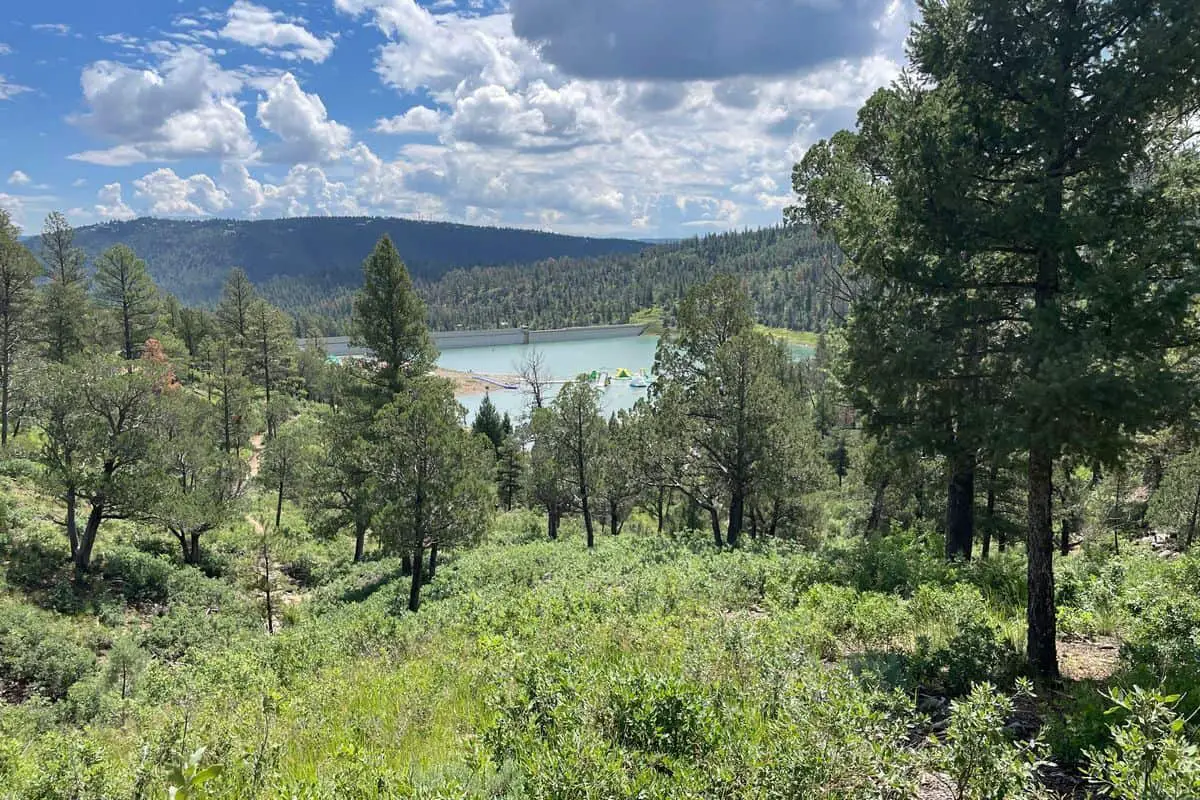
Lincoln National Forest Paid Campgrounds
Oliver Lee Memorial Campground
32.746864, -105.915297
Located at the edge of the Sacramento Mountains, the Oliver Lee Memorial boondocking location provides scenic desert and mountain views just south of Alamogordo. This area is close to the entrance of Oliver Lee Memorial State Park, known for its hiking access into Dog Canyon. While the state park offers developed camping, the nearby dispersed spots provide more remote, off-grid options for boondockers looking to stay near the natural beauty without paying campground fees.
Things to Do: The area is ideal for hiking, particularly the Dog Canyon Trail, which begins at the state park and climbs steeply into the mountains. The terrain around the boondocking spots is semi-arid, with rocky soil, desert plants, and occasional wildlife sightings. It’s a quiet area with wide open skies, offering a clear view of sunrise over the mountains and stars at night.
Directions: From Alamogordo, take US-54 south and turn east on Dog Canyon Road. Boondocking spots are typically found off this road before entering the park boundary. Be mindful not to trespass on private land in the area.
Vehicle Access: Suitable for vans, SUVs, and smaller trailers. Some pullouts are level and firm, but soft spots and uneven areas exist. Larger rigs should scout ahead before committing to narrow sections.

Boles Acres – Dog Canyon Campground
32.7442, -105.9306
This boondocking location near Boles Acres provides dispersed camping close to the Dog Canyon entrance, just a short distance southwest of the Oliver Lee Memorial area. It is often used by campers seeking proximity to Alamogordo while enjoying a more natural, undeveloped environment. The area is relatively open, with desert vegetation and sweeping views of the surrounding hills and valley floor.
Things to Do: The nearby Dog Canyon Trail is the primary attraction, known for its challenging elevation gain and panoramic views. Wildlife such as mule deer, foxes, and desert birds may be spotted in the area. The boondocking site also offers a quiet overnight option for those passing through or waiting to enter White Sands National Park, located less than an hour north.
Directions: Travel south from Alamogordo on US-54 and follow signs to Dog Canyon Road. The boondocking area is situated near the small community of Boles Acres, with camping spots found along dirt roads before reaching the developed areas.
Vehicle Access: Best for smaller rigs or high-clearance vehicles. The terrain is mostly firm but can become loose or rutted in rain. There are limited amenities, so campers should bring all needed supplies and pack out trash.
Frequently Asked Questions
Boondocking in Lincoln National Forest has its quirks. Knowing where to camp, what maps to use, and the basic rules makes your trip way smoother.
What areas of Lincoln National Forest are designated for boondocking?
You can boondock in most of Lincoln National Forest, especially near the Mescalero Apache reservation, Cloudcroft, High Rolls, and Ruidoso. Just stay within 300 feet of an open road.
How can I find the Motor Vehicle Use Map for Lincoln National Forest?
Download the Motor Vehicle Use Map from the USDA Forest Service’s site at fs.usda.gov/Lincoln. It’ll show you where you can legally camp and drive.
Are there any restrictions on dispersed camping within Lincoln National Forest?
Yes. You need to camp at least 300 feet from any road and avoid restricted zones shown on the Motor Vehicle Use Map. Campfire rules can change depending on fire danger.
What are considered the best locations for boondocking in Lincoln National Forest?
People love spots around Cloudcroft, High Rolls, Ruidoso, and near the Mescalero Apache reservation. They’re easy to get to and have awesome scenery.
Is a permit required for boondocking in Lincoln National Forest?
Usually, you don’t need a permit for dispersed camping. Still, check local rules before you go—some places might require permits for certain activities or longer stays.
What should I be aware of when boondocking in the vicinity of the Guadalupe Mountains?
The Guadalupe Mountains area sometimes enforces stricter fire regulations. Seasonal access can also get limited.
Always check fire danger levels before you head out. Road closures happen, so keep an eye on those too.