

El Morro National Monumen boondockingt offers several options for those looking to camp without hookups near this historic site.
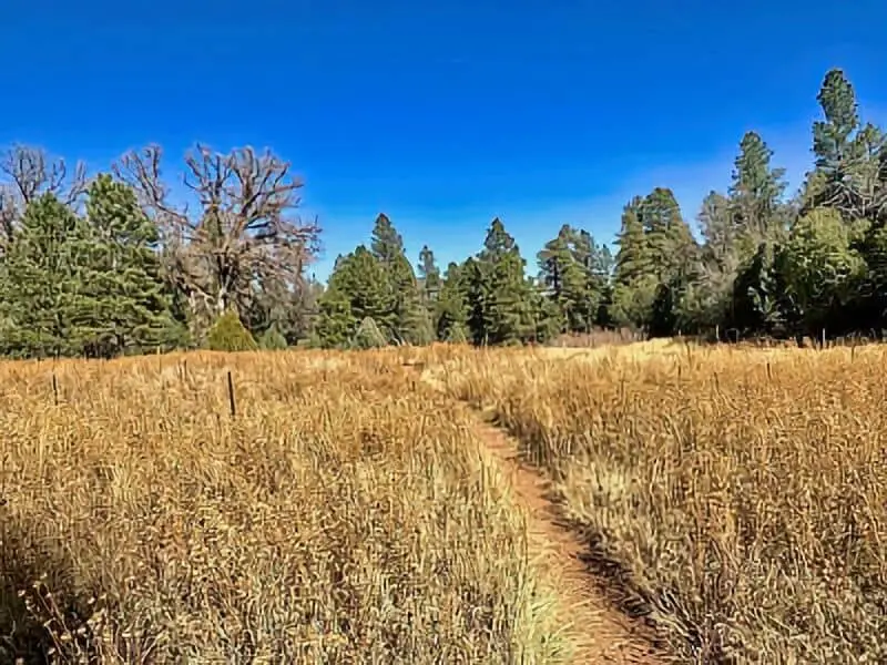
The best spots for boondocking include dispersed sites like Six Mile Canyon and Turkey Springs, as well as the free Joe Skeen Campground, which has 10 first-come, first-served sites. These areas give us a chance to experience nature closely while staying near El Morro’s unique landscape.
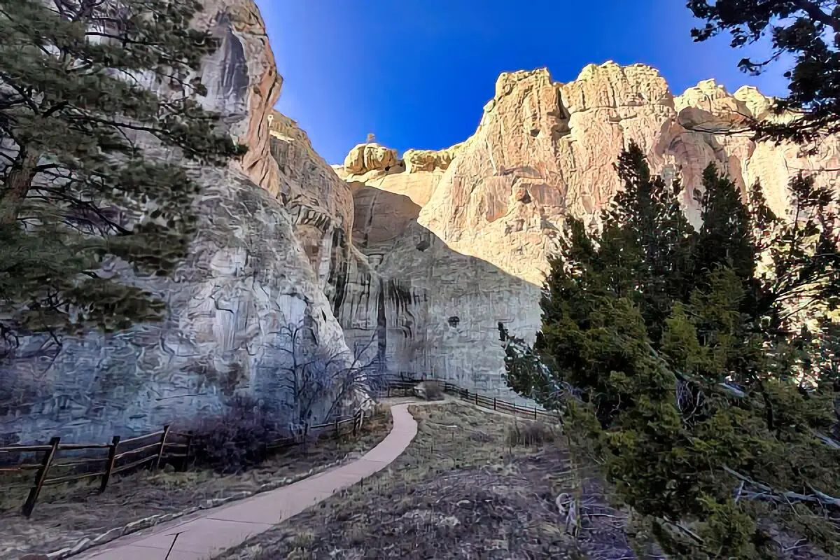
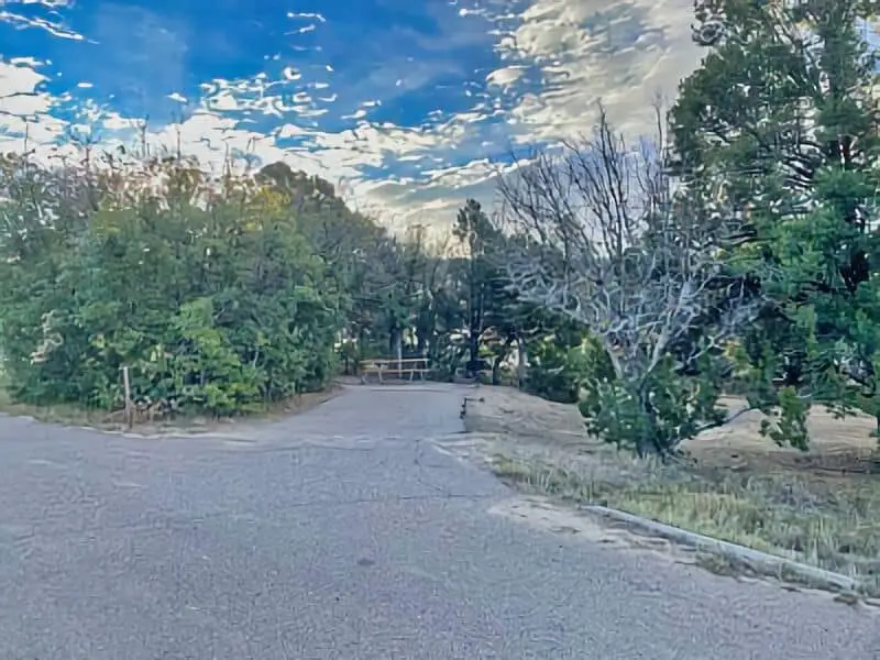
The El Morro Campground itself provides a simple, no-cost place to stay with basic amenities such as vault toilets and graveled tent pads.
For travelers who want more freedom, dispersed camping along nearby roads offers a quiet, off-grid experience. By choosing these spots, we can enjoy the monument’s beauty while avoiding busy, crowded campgrounds.
Location And Access
El Morro National Monument is located in western New Mexico, near the town of Ramah. It sits along State Road 53, making it easy for us to reach by car. The area is remote but accessible, with clear signs directing visitors to the monument and campground.
For those interested in boondocking, there are several dispersed camping sites nearby, like Six Mile Canyon and Turkey Springs. These spots are outside the main park area but still close enough for day trips to El Morro.
We can also explore nearby public lands such as El Malpais National Monument, which offers more backcountry camping options. It lies about 20 miles south of El Morro and features rugged terrain and lava flows.
State parks in New Mexico may offer additional camping and recreational options, but for boondocking near El Morro, dispersed camping on public lands is the most common choice.
The El Morro campground itself has nine free sites with basic amenities, including vault toilets and graveled tent pads. It remains open year-round and is a convenient base for exploring the region.
When planning our trip, it’s helpful to have a high-clearance vehicle for some dispersed sites, as roads can be rough. Cell service is limited, so we should prepare accordingly.
Directions: How To Get There And What To Expect
To reach El Morro National Monument, we start from Albuquerque, New Mexico. We take Interstate 40 west toward Grants. At Exit 81, we turn south onto Highway 53. After driving about 42 miles, we arrive at El Morro.
The area around El Morro is at a high elevation, around 7,200 feet. This means the weather can be cooler and the air thinner than lower places. We should be ready for this, especially if we come from lower altitudes.
For those interested in boondocking, dispersed camping opportunities exist nearby but are primitive. Water and facilities are not available, so we must bring all we need and follow Leave No Trace rules.
Nearby sites like the Valley of Fires and Three Rivers Petroglyph Site offer additional places to explore. Both are within a reasonable driving distance and give us a chance to see volcanic landscapes and ancient rock art.
The Quelado Ranger District manages much of the land in this area, including dispersed camping rules. Checking in with them can give us updates on conditions and allowed camping spots.
If we want to visit Church Rock, it’s a short drive west from El Morro. It is a large, unique rock formation that adds to the natural beauty of the region.
Amenities And Activities
At El Morro National Monument, we find several basic amenities that make boondocking easier. There are nine primitive campsites with gravel tent pads, picnic tables, and vault toilets. Drinking water is available from spigots near the campground. However, there are no RV hookups, and the maximum vehicle length for RVs is 27 feet.
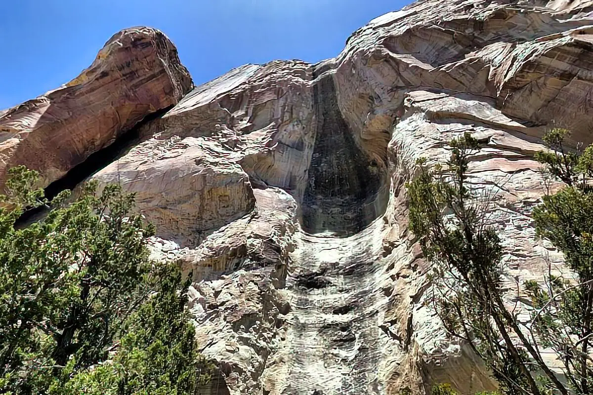
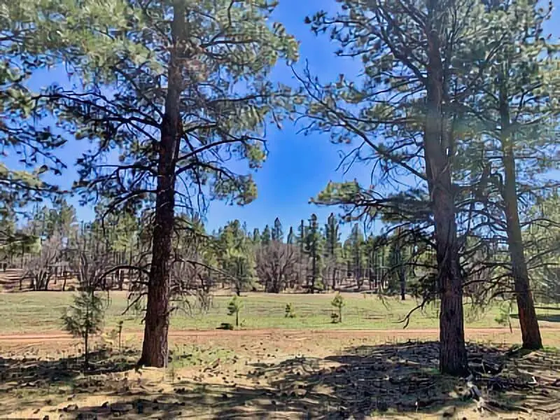
For activities, hiking is one of the main draws. We can explore trails that lead to ancient inscriptions and beautiful natural features. The Continental Divide National Scenic Trail passes nearby, offering longer trekking options through the region.
The area features unique lava flows that create interesting landscapes. We often see wildflowers in season, adding color to the desert scenery. Birding is popular here, too, with several species visible around the campground and trails.
The weather can be variable. Summers tend to be hot and dry, while winters can be cold with less crowded trails and campground sites. We recommend preparing for changing conditions to enjoy outdoor activities safely.
Camping Regulations And Restrictions
When camping near El Morro National Monument, we must follow specific rules to protect the area. At the official campground, we can stay up to 14 days per year. Quiet hours run from 10 p.m. to 6 a.m., and all noise, including generators and radios, should stop during this time.
Each campsite allows a maximum of eight people, two tents, and two vehicles. Pets are allowed but must be kept on a leash no longer than six feet and never left alone.
For dispersed camping, which is usually on National Forest Service or Bureau of Land Management land, rules can vary. We should camp away from trails and water sources to avoid harming the environment. Dispersed sites like Six Mile Canyon offer more freedom but require us to pack out all trash and waste.
No hookups or dump stations are available at dispersed areas or at the official campgrounds near El Morro. We must be prepared to manage water and waste ourselves.
Here is a quick summary of key points:
| Rule | Details |
|---|---|
| Maximum Stay | 14 days per calendar year at the campground |
| Quiet Hours | 10 p.m. – 6 a.m. |
| Pets | On leash (max 6 ft), never unattended |
| Campsite Limits | Max 8 people, 2 tents, 2 vehicles per site |
| Dispersed Camping Rules | Camp away from water, pack out waste, no hookups |
Leave No Trace
When we camp or boondock near El Morro National Monument, protecting nature is our top priority. We must follow the Leave No Trace principles to keep the area clean and safe for wildlife and future visitors.
We pack out everything we bring in. This includes trash, leftover food, and small items like bottle caps or wrappers. Leaving no garbage behind helps prevent harm to animals and keeps the natural beauty intact.
Campfires should be small and only made in designated fire rings or areas where fire is allowed. If there are no fire rings, we avoid starting fires to protect the dry vegetation and soil.
We stay on established roads and campsites. This helps limit damage to plants, soil, and fragile landscapes. Driving or walking off trail can cause lasting harm to the environment.
Our group keeps noise levels low. Loud sounds can disturb wildlife and other campers. Respecting quiet spaces helps maintain nature’s peace and balance.
Table of key practices:
| Practice | Why It Matters |
|---|---|
| Pack Out All Trash | Prevents pollution and harm to animals |
| Use Designated Fire Rings | Protects soil and vegetation |
| Stay on Roads & Sites | Avoids damaging plants and soil |
| Keep Noise Low | Helps wildlife and other visitors |
El Moro National Monument Boondocking Locations
Lobo Canyon Boondocking (Cibola National Forest, NM)
Coordinates: 35.20367, -107.71503
Lobo Canyon boondocking area lies within the Cibola National Forest, just east of Grants, New Mexico. This dispersed camping zone sits off Forest Road 180, close to the Coal Mine Campground but with a more rugged and secluded feel. The area features pine and juniper forests, gravel clearings, and direct access to hiking trails. There are no services available here—no water, toilets, or trash removal—so campers must be self-contained and practice Leave No Trace.
Things to Do: Popular activities include hiking the Lobo Canyon Trail, which runs through a scenic sandstone canyon and offers shade and impressive geological formations. Mountain biking and wildlife viewing are also common. It’s a short drive to Mt. Taylor trailheads for more challenging hikes and scenic views.
Directions: From Grants, head east on NM-117, then turn north onto Lobo Canyon Road (FR 180). Continue for several miles until reaching the canyon area. Dispersed camping spots appear on both sides of the road, especially past the Coal Mine Campground entrance.
Vehicle Access: The gravel road is passable for most vehicles in dry conditions. Small to mid-sized RVs, vans, and truck campers can access the area easily. Larger rigs should proceed with caution due to tight spaces and limited turnarounds.
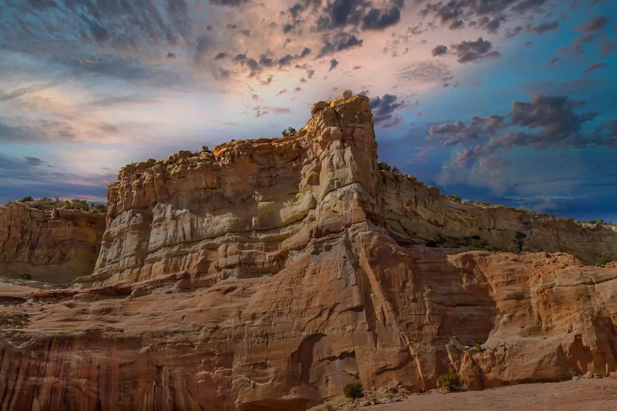
El Malpais National Monument Boondocking (Near Grants, NM)
Coordinates: 35.17477, -107.83602
Boondocking near El Malpais National Monument offers a unique camping experience amid lava flows, sandstone bluffs, and wide-open desert views. Several dispersed camping areas exist on BLM land surrounding the monument, particularly along CR 42 and secondary roads branching off NM-117. There are no developed facilities in these locations—no water, bathrooms, or trash services—so campers must come fully equipped and pack out all waste.
Things to Do: Visitors can hike through lava tube caves (permits required), explore the sandstone bluffs, and walk parts of the Continental Divide Trail. Popular sites nearby include the La Ventana Natural Arch and the Lava Falls Trail. Photography and stargazing are excellent due to the area’s dark skies.
Directions: From Grants, head south on NM-117 toward the western entrance of the monument. Look for County Road 42 or unmarked gravel pull-offs designated for dispersed camping on public lands before reaching the Visitor Center. Signs often indicate where overnight camping is allowed.
Vehicle Access: High-clearance vehicles are recommended, especially after rain. The terrain is rocky and uneven in parts, making it less suitable for large RVs. Vans, SUVs, and small trailers can navigate most areas with care.
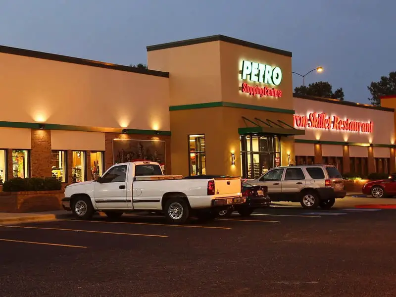
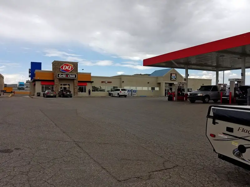
Petro Stopping Center- Milan
The Petro Stopping Center in Milan offers a legal overnight parking area for travelers looking for a quick and convenient rest spot. While not a wilderness boondocking experience, it serves as a practical option for RVers and van dwellers traveling along I-40. The lot is large, well-lit, and monitored, with areas designated for trucks and separate sections that RVs often use. No hookups are available.
Things to Do: While primarily a rest area, the location is within walking distance to fast food, fuel stations, and convenience stores. It’s a practical staging area for visits to nearby El Malpais National Monument or Bluewater Lake State Park.
Directions: Take Exit 79 off Interstate 40 near Milan, NM. The Petro station is located just north of the exit and is visible from the highway. The entrance is accessible for all vehicle types.
Vehicle Access: Suitable for all types of vehicles, including large Class A RVs, travel trailers, and semi-trucks. No off-road or clearance concerns. The lot is paved and has designated parking spaces, though it may be noisy due to truck traffic.
 –
–
Ojo Redondo Campground – Thoreau (Cibola National Forest, NM)
Coordinates: 35.158545, -108.108508
Ojo Redondo Campground, located in the Zuni Mountains near Thoreau, offers a mix of developed and primitive camping options. The area sits at over 8,000 feet in elevation and is surrounded by pine and fir forests. This formal campground includes vault toilets, picnic tables, and fire rings. While it’s not a traditional boondocking site, the nearby forest roads provide numerous dispersed camping pullouts for those seeking a more secluded setup.
Things to Do: Popular with hikers, birdwatchers, and off-road enthusiasts, the area offers direct access to forest trails and nearby peaks. The Continental Divide Trail runs nearby, and elk and deer are common in the region. In summer, the high elevation offers relief from the desert heat.
Directions: From Thoreau, take NM-371 south to Forest Road 50. Continue west on FR 50, then follow signage toward Ojo Redondo Campground. The campground is well-marked and located about 15 miles from town.
Vehicle Access: Most passenger vehicles can access the area, including mid-sized RVs. Dispersed camping along the forest road may require higher clearance. The roads are gravel and can become muddy after rain, so caution is advised in wet conditions.
Fort Wingate (Near Gallup, NM)
Coordinates: 35.42214, -108.55003
The Fort Wingate area near Gallup offers boondocking opportunities on BLM and forest service land. Located near the historical Fort Wingate Army Depot, the area is mostly flat with scattered trees and scrub. Several forest roads and clearings provide suitable camping spots, though there are no amenities of any kind. Visitors should bring their own water and supplies and practice Leave No Trace.
Things to Do: Nearby attractions include Zuni Pueblo, the Continental Divide Trail, and parts of the Cibola National Forest. The wide-open space is great for walking, wildlife spotting, and watching the stars. History buffs may appreciate the region’s military and Native American significance.
Directions: From Gallup, head east on I-40 and take Exit 33. Drive south on NM-400 toward the Fort Wingate Depot. Forest roads such as FR 547 and spur roads lead to dispersed camping spots south of the depot area.
Vehicle Access: Roads are gravel and accessible to most vehicles during dry conditions. Vans, SUVs, and small RVs will have no problem. Larger RVs should scout in advance as turnaround space can be limited and terrain uneven in some places.
Fort Wingate Boondocking (Second Site – Near Gallup, NM)
Coordinates: 35.39849, -108.52882
This second Fort Wingate boondocking site sits southeast of the original Fort Wingate Army Depot, surrounded by forested terrain and dry open clearings. It offers dispersed camping in a quiet, lightly trafficked area just off the main forest roads. There are no amenities, so campers must be self-reliant and prepared to pack out trash and waste.
Things to Do: The area provides access to hiking trails within the Cibola National Forest. Wildlife is common, and the nearby Gallup area has grocery stores, fuel, and supplies. Scenic drives and peaceful overnights make it popular for travelers wanting to avoid crowded sites.
Directions: From Gallup, head east on I-40 to Exit 33. Take NM-400 south past the entrance to the Fort Wingate facility. Turn onto forest access roads branching east toward the coordinates. Dispersed spots can be found in the clearings before the terrain climbs into more forested areas.
Vehicle Access: Suitable for vans, trucks, and small to mid-sized RVs. High-clearance is beneficial due to uneven ground and potential ruts. Avoid the area during heavy rain, as some spots become muddy and slippery.
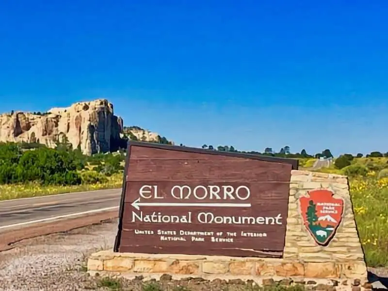
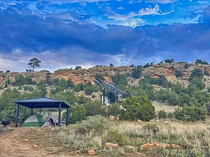
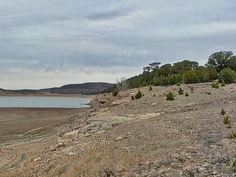
El Morro National Monument Boondocking (Near Ramah, NM)
Coordinates: 35.036999, -108.335999
Located just outside El Morro National Monument, this boondocking spot provides scenic views of sandstone cliffs and peaceful forested surroundings. This dispersed area lies on BLM land, offering primitive camping without amenities. The site is well-known among dry campers for its open skies and quiet nights.
Things to Do: Visitors can hike the Inscription Rock Trail and Headland Trail inside the monument to view historical petroglyphs and inscriptions from early Spanish explorers. The surrounding area is excellent for birdwatching, photography, and relaxing in nature.
Directions: From Ramah, take NM-53 east toward El Morro National Monument. Dispersed sites are located on gravel pullouts along NM-53 and on BLM-managed land west and south of the monument. Look for flat areas with previously used fire rings.
Vehicle Access: Accessible to most vehicles, including vans and trailers. Roads are gravel and manageable in dry weather. Larger rigs should scout ahead for turning space and ground clearance.
Grants Joe Skeens Boondocking (South of Grants, NM)
Coordinates: 34.941908, -107.820155
This dispersed site sits just south of Grants near the Joe Skeens Wildlife Management Area. The area is flat and open with minimal tree cover and plenty of space for parking multiple rigs. There are no services or developed campsites, so campers need to come prepared with water and supplies.
Things to Do: Close to El Malpais National Conservation Area and the Chain of Craters Backcountry Byway, this location is great for hiking, birdwatching, and exploring volcanic landscapes. It’s also near the town of Grants for easy resupply.
Directions: From Grants, drive south on NM-53, then turn east on local access roads near the wildlife area. Follow gravel roads leading toward the coordinates, where several cleared spaces are visible for camping.
Vehicle Access: Roads are gravel and relatively flat. Suitable for all vehicle types, including large RVs and trailers, during dry conditions. Watch for soft sand in some spots.
El Malpais Boondocking (Southern Section – Near CR 42)
Coordinates: 34.705776, -108.028586
This boondocking location lies in the southern part of El Malpais National Conservation Area, off County Road 42. The terrain is rugged and surrounded by lava fields, juniper trees, and desert brush. It’s quiet, remote, and offers true backcountry camping. No amenities are present.
Things to Do: The location provides access to the Chain of Craters Backcountry Byway, a remote and scenic drive with several trailheads along the route. Hike the Big Tubes Area or explore lesser-known cinder cones and lava caves. Stargazing is excellent due to the area’s low light pollution.
Directions: From NM-117, turn east onto County Road 42. Continue south for several miles until reaching the coordinates. There are several wide pullouts and clearings suitable for camping on both sides of the road.
Vehicle Access: High-clearance vehicles are recommended. The road can be washboarded and muddy after rain. Trailers and larger RVs should proceed with caution due to tight spots and uneven terrain.
Route 66 Travel Center – Paraje
The Route 66 Travel Center near Paraje provides overnight parking for RVs and trucks. It’s not a scenic location, but it’s ideal for a convenient stopover. The parking area is paved and illuminated, with food options, fuel, and a casino within walking distance. It is not a traditional boondocking area but is often used by travelers along I-40 needing a quick overnight rest.
Things to Do: While the area itself has limited outdoor activity, it’s adjacent to the Dancing Eagle Casino and several eateries. The convenience of on-site services is the main attraction.
Directions: Located off I-40 at Exit 108 near Paraje. Turn north off the exit to reach the Route 66 Travel Center parking lot. The area is visible from the highway and has a separate area often used by RVs.
Vehicle Access: Suitable for all vehicle types. No clearance issues. Large RVs and trailers can easily navigate and park here.
El Moro National Monument Campgrounds

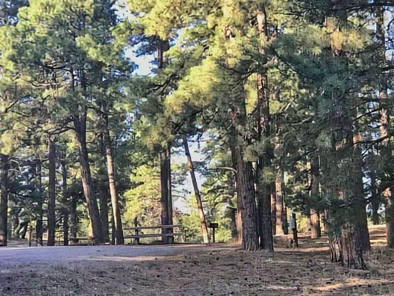
Fort Wingate McGaffey Campground
Fort Wingate McGaffey Campground sits in a peaceful section of the Zuni Mountains, part of the Cibola National Forest. Located about 18 miles south of Gallup, New Mexico, this dispersed camping area is lightly used and offers a forested escape at an elevation of around 7,600 feet. The area is surrounded by ponderosa pines and features several flat clearings suitable for boondocking. There are no developed amenities, so campers should come prepared with water, waste disposal plans, and basic supplies.
Things to Do: The nearby McGaffey Lake is popular for fishing and wildlife viewing. Hiking and mountain biking are common activities in the Zuni Mountains. Forest roads in the area provide off-roading opportunities, and there’s access to parts of the Continental Divide Trail. Elk, deer, and turkey are frequently spotted in the area.
Directions: From Gallup, take NM-602 south to Forest Road 50. Head east on Forest Road 50 for several miles. The boondocking area begins around the intersection with Forest Road 551 and continues eastward.
Vehicle Access: High-clearance vehicles are recommended, especially during the rainy season. Most small to mid-sized RVs can access the area, but larger rigs may face challenges due to narrow turns and rough patches.

Bluewater Lake State Park – Canyonside
The Canyonside area of Bluewater Lake State Park offers primitive camping along the eastern ridges above the lake. Located in western New Mexico, this part of the park is more secluded than the main developed campgrounds. There are no hookups or facilities in the Canyonside area, but campers are allowed to boondock in designated zones. The terrain consists of grassy flats and canyon edges with scattered junipers, providing a rugged but scenic experience.
Things to Do: The lake itself is well-known for tiger muskie fishing, and non-motorized boating is permitted. Hikers can explore the rim trails that overlook the lake, and equestrian trails are nearby. This area also offers excellent stargazing due to the minimal light pollution.
Directions: From Interstate 40, take Exit 81 toward Prewitt. Drive north on NM-412, then follow signs to Bluewater Lake State Park. Once inside the park boundary, follow the east service road toward the Canyonside area. Designated boondocking spots will be marked.
Vehicle Access: Suitable for vans, pickup campers, and smaller RVs. The road to Canyonside can be narrow and rutted, especially after rain, so larger vehicles are discouraged.

Bluewater Lake State Park – Pinon Cliff
Pinon Cliff is a lesser-known section of Bluewater Lake State Park offering dispersed camping on the southern rim. It’s a rocky and elevated area with panoramic views of the lake and surrounding mesas. This spot is not developed, and there are no formal amenities such as water or restrooms. Campers must pack out all waste and come fully prepared for a self-contained experience.
Things to Do: This site is ideal for photography, especially at sunrise and sunset due to its elevation and lake views. Wildlife viewing is possible, with common sightings of eagles and deer. Fishing, kayaking, and horseback riding can be enjoyed elsewhere in the park.
Directions: Take Interstate 40 Exit 81 and drive north on NM-412 to the park entrance. Continue past the main entrance, then take the first right onto a dirt road that climbs toward the cliffs. Access points to the Pinon Cliff area are found at several flat spots along this road.
Vehicle Access: Only recommended for high-clearance vehicles. Vans and 4×4 trucks are best suited. The trail to the top is rough and may not be navigable after storms. Not recommended for large RVs or trailers.
Bluewater Lake State Park – Las Tusas
The Las Tusas area of Bluewater Lake State Park is a secluded zone offering primitive campsites on the northern side of the lake. Named for the nearby arroyo, this section is quieter than the main campgrounds and is ideal for those seeking solitude. There are no developed amenities in this part of the park—no toilets, water, or waste stations—so only self-contained vehicles should plan to stay here.
Things to Do: Activities include shoreline fishing, hiking along the nearby ravines, and birdwatching. The terrain features mixed juniper and piñon pine trees, with large open areas suitable for camping. Horseback riding is permitted on marked trails nearby.
Directions: From I-40, take Exit 81 and travel north on NM-412. After passing the main park entrance, follow the signage directing you to the Las Tusas trailhead and campground area. The boondocking spots are spaced along the old service road.
Vehicle Access: High-clearance vehicles are strongly recommended due to rocky access roads. Best suited for campers, vans, and truck-mounted rigs. The area may become inaccessible during wet conditions.
Coal Mine Campground
Coal Mine Campground is located in the Cibola National Forest just south of Grants, NM, and offers a mix of developed campsites and opportunities for nearby dispersed camping. The campground itself has picnic tables, vault toilets, and fire rings, though no water or hookups. Outside the formal campground boundaries, campers can find boondocking spots along nearby forest roads.
Things to Do: The campground sits at over 8,000 feet, making it a cooler summer retreat. There are several hiking trails in the immediate area, including access to the Mt. Taylor Trail and forested loops ideal for mountain biking. The high-elevation pine forest provides shade and scenic camping experiences.
Directions: From Grants, drive east on NM-117, then turn left onto Lobo Canyon Road (Forest Road 180). Follow this road until you reach the signed entrance for Coal Mine Campground. Dispersed camping spots can be found by continuing past the campground onto Forest Road 480 and its side spurs.
Vehicle Access: Roads are gravel but usually in good condition. Most passenger vehicles, vans, and small RVs will have no issues. Larger rigs should scout ahead, as turnaround space is limited in some dispersed spots.
Frequently Asked Questions
We find that camping near El Morro National Monument requires attention to local rules and site conditions. Understanding where to camp, the best seasons, and access routes will help us have a smooth experience.
What are the guidelines for boondocking near El Morro National Monument?
We must camp at least 200 feet away from water sources and trails. Fires are often restricted to designated areas or may be banned during dry seasons. Leave no trace by packing out all trash and minimizing our impact on the environment.
Can you recommend any boondocking spots close to El Morro National Monument’s trails?
Six Mile Canyon and Turkey Springs are top choices for dispersed camping near El Morro. These spots offer quiet settings and easy access to nearby trails without formal campgrounds.
Are there any restrictions for camping in or around the El Malpais National Monument?
Yes, camping is limited to designated sites or dispersed areas as marked by the park. We should check current fire restrictions since they change frequently due to weather conditions.
What are the best times of year for boondocking near El Morro National Monument?
Spring and fall offer mild weather and fewer bugs, making these seasons ideal. Summers can be hot, and winters tend to be cold with snow, which may limit camping options.
How do I access the boondocking sites around El Morro National Monument and El Malpais National Monument?
Most sites are reached by driving on dirt roads that are suitable for high-clearance vehicles. We should prepare for some rough road conditions, especially after rain.
What should I be aware of when boondocking in the vicinity of El Morro State Park?
We need to respect park boundaries and local wildlife habitats.
Water is scarce, so bringing adequate supplies is essential.
Cell phone service may be spotty, so plan accordingly.