


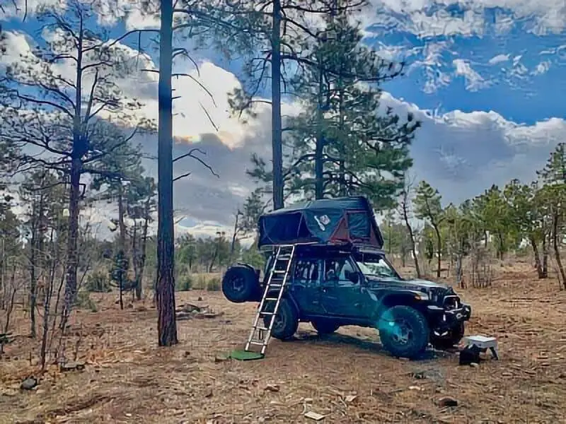
If you’re after quiet and free spots to camp near the Mogollon Rim, boondocking is honestly a solid bet. There are plenty of dispersed camping areas along the Rim, especially by Forest Road 9350 in Apache-Sitgreaves National Forest and on the Arizona Trail section near Pine. You get easy access to wild spaces without the crowds or campground fees.
Staying close to towns like Payson or Pine-Strawberry gives you a sweet balance of convenience and real solitude. Boondocking here lets you soak up the forest’s beauty, but you’re still off the main drag. With all the open spaces and forest roads, you can usually snag your own patch of peace and quiet.
Description And Information About This Location
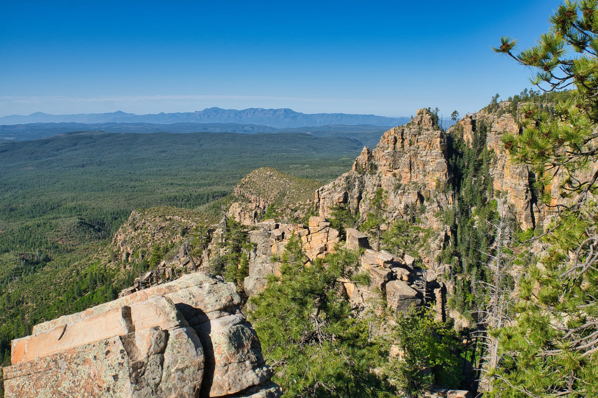
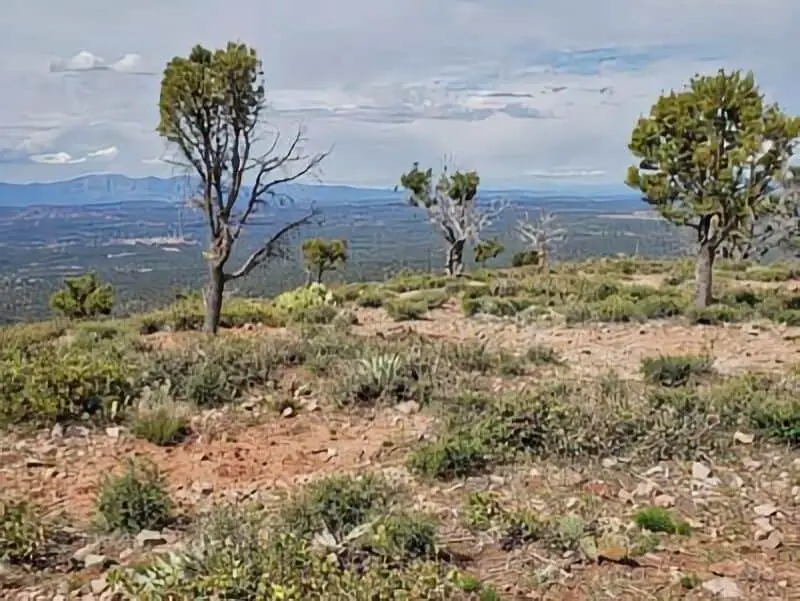
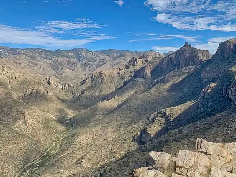
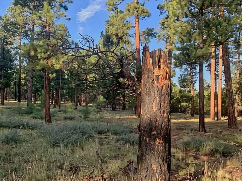
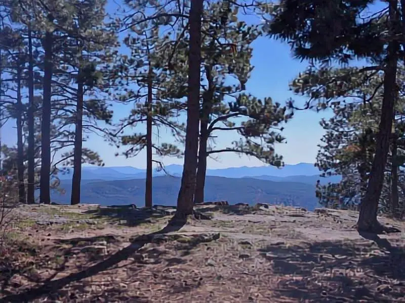
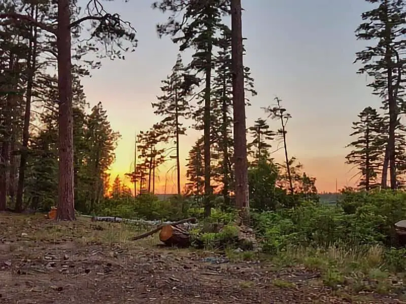
The Mogollon Rim stretches out as a steep, dramatic cliff for about 200 miles across northeastern Arizona. It marks the southern edge of the Colorado Plateau, and camping here, you get right into the thick of rugged landscapes and thick pine forests.
You’ll spot tons of boondocking options along the rim—places near Marshall Lake and Lone Rock Beach, for example. Most campsites sit under tall ponderosa pines, so you get shade and that “deep in the woods” vibe. Many have fire rings and space for tents or RVs, but you won’t find much else in the way of amenities.
Wildlife roams pretty freely out here; elk wander through sometimes, and you might catch a glimpse if you’re lucky. The whole area feels quiet and a bit remote, which is kind of the point, right? You can camp right on the rim for those epic views, or tuck yourself deeper into the forest if that’s more your style.
The terrain gets pretty rugged, and services are basically nonexistent. Bring all your own water, food, and trash bags—there’s no one picking up after you. Packing out everything you bring keeps the place nice for the next folks.
The forested campsites offer a good mix of sun and shade, and if you’re after water, Lone Rock Beach by Marshall Lake is a popular pick. The rim itself has viewpoints that are just begging for photos, or just a moment to chill and take it all in.
Location And Access
Most of the Mogollon Rim’s boondocking spots sit in the Apache-Sitgreaves and Coconino National Forests. You’ll find dispersed camping along various forest roads and near some of the Rim’s most iconic features.
Coming from Payson, Arizona, you’ll drive northeast about 30 to 45 minutes. Forest Road 9350 splits off Highway 260 and leads to several camping areas. These dirt roads can get rough, so a high-clearance vehicle (or even 4WD if it’s been rainy) is a good idea.
If you’re starting from Heber, it’s a shorter drive southeast. Spots near Heber tend to be quieter than those close to Payson. Always check Motor Vehicle Use Maps (MVUM) for the latest on access and road conditions.
Jack’s Canyon is a popular access point, especially for climbers and campers alike. For up-to-date info on roads and sites, you can call the Mogollon Rim Ranger District at 928-477-2255.
Since these are dispersed camping areas, don’t expect services or marked campsites. Bring everything you need and plan to haul out every last bit of trash. Cell service is spotty at best, so don’t count on it.
| Access Point | Distance from Payson | Vehicle Recommended | Notes |
|---|---|---|---|
| Forest Road 9350 | 30-45 minutes | High-clearance or 4WD | Near Highway 260, dispersed |
| Jack’s Canyon | About 40 minutes | Standard to high-clearance | Popular for camping and climbing |
| Areas near Heber | 15-30 minutes | Varies | Quieter dispersed camping spots |
Double-check current road and forest rules before you head out.
Directions: How To Get There And What To Expect
To get to the Mogollon Rim boondocking areas, head east from Payson on Highway 260 for roughly 30 miles. Watch for the left turn onto Rim Road (Forest Road 300).
Once you’re on Rim Road, go a few miles until you reach Forest Road 9350. That’ll take you to free camping areas right on the Rim’s edge. These sites are totally primitive—no hookups, no services, so you’ve got to bring everything: water, food, the works.
The first stretch of the road past the visitor center is only for day use. Keep going farther down Rim Road for spots where overnight camping’s allowed. The road can get bumpy, so having a vehicle with decent clearance really helps.
You’ll find a quiet, natural setting with big views. Don’t expect marked pads or facilities—maybe a fire ring or a cleared area, but that’s about it. No trash service, no restrooms.
Quick checklist for your trip:
- Drive east on Hwy 260 from Payson for about 30 miles
- Turn left (north) onto Rim Road (FR 300)
- Continue to Forest Road 9350 for dispersed camping
- Be ready for no services or marked sites
- Bring a vehicle that can handle dirt roads
Pack smart, bring what you need, and just enjoy the quiet out there.
Amenities And Activities
Boondocking at the Mogollon Rim is mostly about dispersed camping, though there are a few established campgrounds mixed in. The dispersed sites? Don’t expect amenities. You’ll need to bring everything and haul out your trash.
Some campgrounds nearby do offer basic amenities like firepits, picnic tables, and grills. The Mogollon Campground, for example, has two loops with about 13 sites each, and you get fire rings, grills, picnic tables—sometimes even vault toilets. But there’s no hookups or running water.
If you like hiking, fishing, or wildlife watching, you’re in luck. There are plenty of trails right near the camping areas. Camping along forest roads gives you more freedom, but fewer creature comforts. If you want to camp outside developed campgrounds, always check the rules.
Use fire rings responsibly—keep fires small and under control. During dry spells, fire restrictions often go into effect, so check before you light up.
Bring enough water, food, and shelter for the weather. Cell service is iffy, so don’t rely on it.
Camping Regulations And Restrictions
Camping on the Mogollon Rim comes with a few important rules to keep the land and wildlife safe. Most dispersed areas let you camp almost anywhere, but you need to stay at least 150 feet from water sources—that keeps the water clean for animals and people.
Some spots have designated campsites, so check local signs before you set up. In a few areas, you might need a permit, especially if you’re planning a longer stay or want a campfire.
Always stick to Leave No Trace. Pack out all your trash and food scraps. Don’t dig trenches or damage plants.
Depending on fire danger, campfires might be banned or limited. Use already-built fire rings if fires are okay, and put out your fire completely before you leave.
Key rules to keep in mind:
| Rule | Details |
|---|---|
| Distance from water | Camp at least 150 feet away |
| Permits | May be required in some areas |
| Campfires | Only where allowed; use fire rings |
| Trash disposal | Pack out all trash |
| Campsite choice | Use designated sites if posted |
Stick to these, and you’ll have a safe, legal camping experience on the Mogollon Rim.
Leave No Trace
Boondocking at the Mogollon Rim means following Leave No Trace, plain and simple. It’s the best way to keep the place wild for everyone. Always pack out everything you bring, including trash and leftover food.
If there’s an established fire ring, use it and keep your fire small. If you don’t see one, skip the fire. Make sure it’s totally out before you leave—no one wants an accidental wildfire.
Camp on durable ground and avoid trampling plants or spooking wildlife. Seriously, don’t mess with the critters or the scenery.
Don’t bury or leave human waste out in the open. Use a portable toilet or pack it out if that’s required. If you absolutely have to dig a cathole, do it far from water and trails.
Keep the noise down. It’s better for you, your neighbors, and the animals.
| Leave No Trace Tips | Actions to Take |
|---|---|
| Pack out all waste | Carry empty bags and trash containers |
| Use existing fire rings | Avoid building new fire pits |
| Camp on hard surfaces | Protect plants and soil |
| Manage human waste | Use proper disposal methods |
| Stay quiet | Respect other campers and wildlife |
Stick to these habits and the Rim stays wild, clean, and open for the next round of campers.
Helpful Information Links
Bureau of Land Management
Recreation.Gov
National Park Service
Arizona Park Service
Arizona Trust
Arizona Fish and Game
Over 10,000 Free Boondocking Locations
Boondocking Recipes for 1000’s Of Camping Meals
Mogollon Rim Boondocking Locations
Mogollon Rim
34.4393, -111.36465
Situated along Forest Road 300 within the Apache-Sitgreaves National Forest, this site offers expansive views from the edge of the Mogollon Rim. The forested area is dotted with ponderosa pines and other conifers, providing both shade and privacy. Mogollon Rim Boondocking in this zone is entirely dispersed, meaning no formal amenities like restrooms, water, or trash services are available. Most campers set up along pullouts or forest clearings off Rim Road. The scenic overlook points offer sunrise and sunset views stretching across central Arizona. The elevation provides a cooler climate, even in summer, making it ideal for tent campers and RVs alike. Campers often choose this site for its peaceful ambiance, nature immersion, and space away from formal campgrounds.
Things to Do:
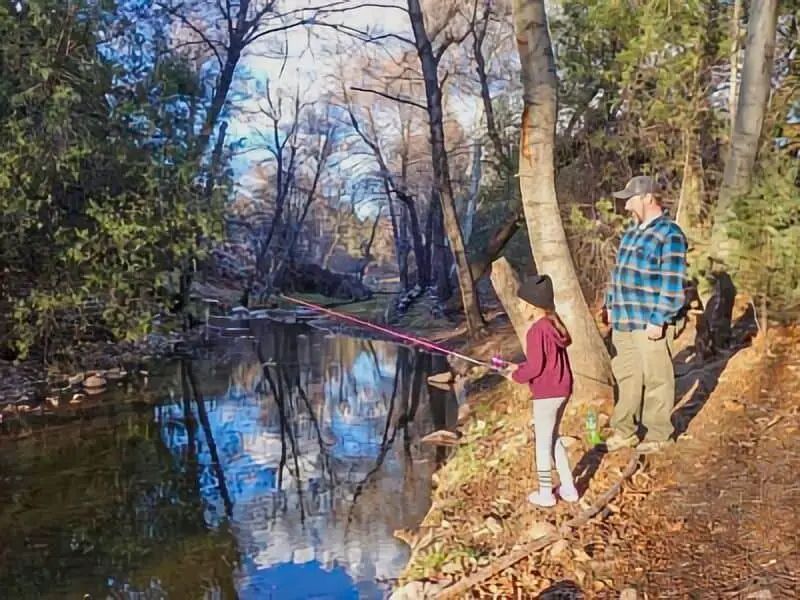
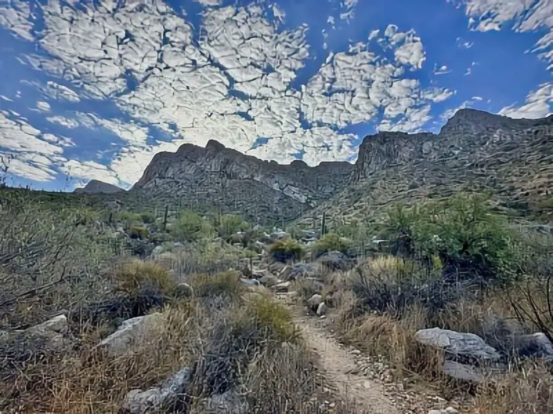
Outdoor enthusiasts can enjoy hiking along the Rim Lakes Vista Trail, which runs close to the edge of the rim, offering panoramic views of the valley below. Fishing is available at Woods Canyon Lake, Willow Springs Lake, and Bear Canyon Lake—all nearby. Stargazing is popular due to the minimal light pollution and clear skies. Wildlife watchers may spot elk, deer, hawks, and other native species. ATV riding is also allowed on designated trails. The nearby town of Payson offers grocery stores, fuel, and dining for resupply and short day trips.
Directions:
From Payson, Arizona, drive east on Highway 260 for about 30 miles. Turn left onto Forest Road 300 (also known as Rim Road). Continue along FR 300 for approximately 10 miles. Dispersed campsites appear intermittently along the forest clearings and pull-offs. Most spots are located between mileposts 10 and 18.
Vehicle Access:
Forest Road 300 is a maintained dirt road, passable by most vehicles in dry weather. However, conditions can become muddy and rutted during rain. High-clearance vehicles are recommended, especially for deeper forest routes. Large RVs and trailers can access some of the more open roadside spaces, but tight turns and tree cover may limit options for oversized rigs. Use caution during monsoon season, as the road may become slick or washed out in sections.
Bray Creek
34.381806, -111.334778
Situated in the Tonto National Forest east of Payson, Bray Creek is a forested boondocking site found off Highway 260. The area is lined with juniper and pine trees and is near a small seasonal creek. The dispersed camping spaces are located just off the forest roads, offering a quiet and shaded experience. There are no services—no restrooms, water, or trash disposal. Campers need to pack in and pack out. Mogollon Rim Boondocking in this region is popular for its secluded forest environment and access to nature without the crowds. It’s well-suited to campers looking for privacy, peace, and cooler weather due to the area’s elevation.
Things to Do:
The area is well-suited for day hikes, especially along forest service roads and informal trails. Nearby attractions include the Horton Creek Trail, which leads to a spring and offers creekside hiking. Wildlife is abundant, and bird watching is common. Visitors may also explore the nearby East Verde River for fishing or enjoy scenic drives along Highway 260. The forest roads offer access to other dispersed areas near the Mogollon Rim. The town of Payson is only a short drive away and provides food, supplies, and gas stations.
Directions:
From Payson, take Highway 260 east for about 10 miles. Look for Bray Creek Road (also listed as Forest Road 405) on the right-hand side. Turn onto Bray Creek Road and follow the dirt road a short distance to find several dispersed campsites on either side of the road.
Vehicle Access:
Bray Creek Road is a dirt road and generally accessible by cars, small SUVs, and camper vans. During dry weather, most vehicles can handle the route, though ruts and washboarding may occur. The area is not ideal for large RVs or fifth-wheel trailers due to narrow road sections and limited turnaround areas. The best spots are flat, with enough room for mid-sized rigs or tents, but campers should scout ahead on foot before committing to a specific pullout.
NF Road 375B
34.182451, -111.323247
Situated south of Payson near Highway 87, National Forest Road 375B is a dispersed camping area within the Tonto National Forest. The area is accessible from a forest service road off the Beeline Highway and features open, semi-shaded spots surrounded by low pine and juniper trees. Mogollon Rim Boondocking near NF 375B is appreciated for its proximity to Payson and quick access off a main route, making it ideal for shorter stays or overnight stops. There are no amenities—no water, toilets, or trash bins—so campers must come fully prepared. Campsites are spaced out, giving room for privacy and quiet in a natural setting.
Things to Do:
Popular nearby attractions include the Houston Mesa Trailhead and East Verde River access points. Hiking and off-road vehicle use are common in this area, and many campers explore the surrounding forest via side trails and service roads. Fishing can be done in the East Verde River a few miles north. Payson offers full services, including fuel, food, and medical care, just 15 minutes away. Stargazing at night is excellent due to limited artificial lighting and high elevation.
Directions:
From Payson, head north on Highway 87 for about 7 miles. Look for Forest Road 375 on the left (west side). Turn onto FR 375 and continue approximately 1.5 miles until you reach the turnoff for FR 375B. Dispersed campsites are available along this short road, which ends in a small loop that serves as a turnaround point and camp area.
Vehicle Access:
The road to NF 375B is unpaved and can be bumpy. High-clearance vehicles are recommended. Small to mid-sized trailers and vans can navigate the area without issue in dry conditions. However, larger Class A rigs may struggle with the tight turnaround space and limited road width. During wet weather, the road can become muddy, and 4WD may be needed to avoid getting stuck.
Diamond Point Dispersed
34.292465, -111.194852
Located northeast of Payson, the Diamond Point Dispersed Camping Area lies within the Tonto National Forest off Forest Road 64. This location sits at an elevation of approximately 6,000 feet and is surrounded by a thick cover of pines and junipers. The area is best known for being close to Diamond Point Lookout, a U.S. Forest Service fire tower offering scenic views. Mogollon Rim Boondocking at Diamond Point is attractive to those who prefer cooler weather and solitude. The area lacks services—no restrooms, no potable water, and no trash removal—making it necessary for campers to be self-contained.
Things to Do:
One of the key attractions is the Diamond Point Lookout, where visitors can enjoy expansive views of the forest and Rim. Gem and crystal hunting is also popular in the area, as locals frequently collect quartz. Trails in the area support hiking and mountain biking. Elk, deer, and turkeys are often spotted in the early mornings. There are also opportunities for ATV riding on designated roads. Willow Springs Lake is within a 30-minute drive and offers fishing and kayaking.
Directions:
From Payson, take Highway 260 east for 20 miles. Turn left onto Forest Road 64 and drive about 5 miles north. Diamond Point dispersed camping sites are located in clearings on either side of the road as you approach the lookout tower.
Vehicle Access:
Forest Road 64 is unpaved but maintained. It is generally passable for most vehicles in dry conditions. Trailers and RVs up to mid-size can navigate the road, though there are no formal pads or facilities. The area is open, so turning and positioning rigs is possible with some scouting. Drivers should avoid the route during or after heavy rain due to muddy conditions.
Little Green Valley
34.280369, -111.139412
Little Green Valley is located just off Highway 260, west of the intersection with Forest Road 300 in the Apache-Sitgreaves National Forest. This spot is nestled in a broad forest clearing surrounded by tall pine trees, offering a quiet and secluded setting. There are no formal amenities—no bathrooms, water, or trash bins—so all visitors must bring everything they need and follow Leave No Trace practices. This site is well-suited for Mogollon Rim Boondocking thanks to its quick access to Rim Road and cooler elevation. Most campsites are flat and easy to access from the main dirt road, making it a practical choice for a variety of setups.
Things to Do:
Hiking and nature walks are easily accessible from this site. The Rim Lakes Vista Trail and Woods Canyon Lake are nearby for those interested in scenic views or fishing. Wildlife in this area includes elk, deer, and several bird species. Stargazing is also excellent due to the lack of artificial light and the clear mountain skies. The close proximity to other forest roads means this site can serve as a base for exploring additional Mogollon Rim Boondocking areas. Visitors often use this location for ATV access to nearby trails or as a staging point for multi-day stays in the region.
Directions:
From Payson, travel east on Highway 260 for approximately 23 miles. After passing Forest Road 300, look for an unmarked turnoff on the north side of the highway. This dirt road leads to the dispersed camping area in Little Green Valley. Campers can set up along the edge of the forest clearings that appear shortly after entering.
Vehicle Access:
The access road is dirt and may develop ruts, but most passenger vehicles, vans, and mid-sized trailers can navigate the terrain during dry conditions. Larger RVs may fit in some of the wider pullouts, though tree cover and maneuvering space could be a limitation. During rainy periods, the road may become soft and require high-clearance or 4WD vehicles.
Alderwood
34.205875, -110.980537
Alderwood is a dispersed camping site located southeast of Payson in the Tonto National Forest. This Mogollon Rim Boondocking location is accessed via Forest Road 512, also known as the Young Highway, and offers a peaceful setting among mixed pine and oak woodlands. It’s remote and lightly trafficked, providing solitude and direct immersion in nature. There are no services at the site—campers must bring their own water, pack out trash, and be fully self-sufficient. The area is surrounded by wildlife and offers a variety of clearings ideal for tents or smaller rigs.
Things to Do:
Alderwood’s location makes it a good base for exploring the southern stretches of the Mogollon Rim. Hiking opportunities exist on nearby trails and forest roads. Wildlife watchers will appreciate the variety of animals that frequent the region, including wild turkey and deer. The nearby Haigler Creek offers fishing opportunities, and scenic drives along Forest Road 512 provide mountain and forest views. This part of the Mogollon Rim Boondocking region is less trafficked than other areas, offering a more remote feel and fewer visitors.
Directions:
From Payson, take Highway 260 east to Forest Road 512 (Young Highway). Turn right onto FR 512 and continue south for approximately 12 miles. Look for dispersed campsites along forest openings and dirt road spurs marked by open pullouts and campfire rings. The Alderwood area appears roughly halfway between Payson and the town of Young.
Vehicle Access:
FR 512 is a paved and partially maintained dirt road. It is accessible to most vehicles during dry weather. However, deeper forest roads that branch off may require high clearance or four-wheel drive, especially after storms. Larger RVs may find limited space due to narrow clearings and tight turns, but mid-size trailers and vans should have no trouble finding a level area to park.
FR 9350
34.340141, -110.982342
Forest Road 9350 offers a dispersed camping area located in the Apache-Sitgreaves National Forest, east of Payson and north of Highway 260. This Mogollon Rim Boondocking site provides an accessible forest setting with pine trees, level spots, and no amenities. Campers must pack out all trash, bring their own water, and use portable sanitation solutions. The road serves as a short, well-wooded branch off the main forest service route and is favored by those looking for simple overnight setups or peaceful extended stays near the rim area.
Things to Do:
Campers can hike along nearby FR 9350 and adjacent forest trails or take day trips to Woods Canyon Lake for fishing and kayaking. Birdwatching and photography are popular due to the area’s elevation and healthy tree cover. Off-road enthusiasts use FR 9350 as a connecting route to other dispersed areas and viewpoints along Rim Road. Stargazing is excellent here, with minimal light pollution and open sky views between tree canopies. The region also supports seasonal elk sightings.
Directions:
From Payson, travel east on Highway 260 for about 26 miles. Look for Forest Road 9350 on the left (north side of the highway). Turn onto this dirt road and proceed for a short distance to access various clearings and campsites suitable for boondocking.
Vehicle Access:
FR 9350 is a maintained dirt road and usually passable in dry conditions. It is best suited for smaller rigs, vans, and SUVs. Low-clearance cars may manage it with care, but high-clearance is recommended. Large RVs may face difficulty with limited turnaround space and uneven surfaces. Wet conditions can lead to slippery or muddy sections, so drivers should check weather reports before arriving.
FR 9350 Apache Sitegreaves
34.343082, -110.937965
deeper access into Mogollon Rim Boondocking territory. Set among tall pines and natural clearings, this location offers increased seclusion compared to areas closer to Highway 260. As with other dispersed sites, there are no formal services—campers must bring all needed supplies, including water, food, and sanitation. The area offers enough space for quiet camping while staying within reach of nearby lakes and trailheads.
Things to Do:
Visitors often enjoy hiking, wildlife photography, and exploration of the nearby trails and roads. Woods Canyon Lake and Bear Canyon Lake are within a short drive, offering fishing, canoeing, and picnic areas. The elevation and open terrain support excellent stargazing. Many campers choose this part of the forest for long stays and cooler summer temperatures. The surrounding forest roads also connect to other Mogollon Rim Boondocking areas, making this a flexible hub for day excursions.
Directions:
From Payson, head east on Highway 260 for about 28 miles. Turn left onto Forest Road 9350 and follow the route for about 2 miles. Campsites are scattered along the road, often marked by tire tracks and campfire rings in natural clearings. This portion of FR 9350 extends farther into the forest than other sections, offering increased solitude.
Vehicle Access:
The road is unpaved and can be uneven in some sections. High-clearance vehicles are recommended, particularly if venturing beyond the first mile. Small RVs, vans, and trailers under 25 feet may fit in select clearings. Wet weather may make parts of the road slick or soft, so 4WD may be necessary depending on recent conditions. There are limited spots to turn around larger vehicles, so scouting is advised.
FR 169
34.378526, -110.9552
Situated off Forest Road 169 in the Tonto National Forest, this dispersed boondocking site lies northeast of Payson and offers a peaceful forested setting with moderate elevation. The area is surrounded by tall pines and rugged natural terrain, providing open clearings ideal for setting up camp. There are no formal amenities here—campers must come prepared with all necessities, including water, sanitation solutions, and trash removal. The site is relatively quiet and often used by those seeking a more remote Mogollan Rim Boondocking experience.
Things to Do:
This location is convenient for hiking, birdwatching, and wildlife photography. The nearby trails connect with several paths running through the forest, offering excellent views of the Mogollon Rim. Just a short drive away, you’ll find the East Verde River, great for fishing and wading. Payson is also nearby and can be accessed for supplies, fuel, and other necessities. The Rim Country Museum and Zane Grey Cabin offer a glimpse into the area’s cultural history.
Directions:
From Payson, head east on AZ-260 for about 8.5 miles. Turn left onto Forest Road 169. Follow the forest road for approximately 2.2 miles to reach the dispersed camping areas. There are several pullouts along the way suitable for different vehicle sizes.
Vehicle Access:
The road to this site is unpaved but generally well-maintained during the dry season. Standard vehicles, camper vans, and smaller travel trailers can access the site without much trouble. However, during wet conditions, the road may become muddy and slippery, making it more difficult for larger rigs or low-clearance vehicles. Four-wheel drive is not required in dry weather but may be helpful during or after rain.
Larson Ridge
34.386263, -110.859389
Situated off Forest Road 488 near the Mogollon Rim, Larson Ridge is a dispersed camping area popular for its privacy and natural beauty. The site is shaded by ponderosa pines and provides scenic views along ridge clearings. No facilities are available, so all campers must be self-contained. This site is ideal for people seeking solitude and nature immersion without the crowds often found in developed campgrounds. It’s part of the broader Mogollan Rim Boondocking region and attracts campers year-round for its peaceful atmosphere.
Things to Do:
Campers at Larson Ridge can enjoy various outdoor pursuits including hiking and wildlife observation. Several informal trails weave through the forest, leading to scenic overlooks and open meadows. Elk and deer are commonly seen in this area, especially during early mornings and late afternoons. The location is also good for stargazing due to low light pollution. Payson is about 20 miles to the southwest, offering restaurants, groceries, and fuel. The nearby Tonto Creek area has additional recreation options.
Directions:
From Payson, drive east on AZ-260 for about 15.5 miles. Turn left onto Forest Road 488. Travel approximately 4.5 miles north until you reach the dispersed camping pullouts near Larson Ridge. Look for level clearings just off the main forest road.
Vehicle Access:
The road surface consists of packed dirt and gravel, accessible for most passenger vehicles, RVs under 30 feet, and camper vans. Larger rigs may find fewer level areas for parking. After rainfall, the road can develop ruts and soft patches, so caution is advised. Avoid driving during heavy monsoon conditions unless your vehicle is equipped for off-road terrain.
Forest Road 171
34.29412, -110.87687
Located off Forest Road 171 within the Tonto National Forest, this boondocking spot offers quiet seclusion with a mix of pine trees and open sky. The area is relatively flat, making it suitable for tents and mid-size RVs. There are no developed campsites or amenities, so all campers must practice Leave No Trace principles. It’s one of the lesser-trafficked Mogollan Rim Boondocking sites, making it especially attractive to those looking for peace and solitude in a natural setting.
Things to Do:
Popular activities include forest hiking, birding, and exploring nearby trails. The Houston Mesa Trail and See Canyon Trail are within driving distance and offer excellent hiking opportunities with Rim views. Fishing is available in nearby streams such as Tonto Creek and East Verde River. Visitors can also explore the natural rock formations and scenic overlooks that are unique to this part of the Mogollon Rim. The town of Payson provides resupply options and is under 30 minutes away.
Directions:
From Payson, head east on AZ-260 for approximately 17.5 miles. Turn left onto Forest Road 171. Travel for about 3 miles down the gravel road until you find clearings on both sides. These are commonly used for dispersed camping.
Vehicle Access:
Forest Road 171 is a gravel surface that is mostly flat but can become washboarded in spots. It is accessible to most vehicles, including SUVs, vans, and RVs up to around 28 feet. During wet conditions, parts of the road can be slippery, especially in shaded areas. Always check road status during monsoon season before heading out.

Young Rd FR512
34.28276, -110.85795
This dispersed camping area lies just off Young Road (FR512), southeast of Payson and near the Tonto and Apache-Sitgreaves National Forest boundary. The area features a mix of pine forest and open space, offering multiple pull-off spots along the road. No services are provided here, so campers must bring all supplies and follow local fire and waste regulations. It’s part of the broader Mogollan Rim Boondocking corridor, known for its forest views and remote camping feel.
Things to Do:
Visitors can enjoy hiking nearby trails that link into the forest system, including sections of the Highline Trail. Wildlife watching is common, with deer and wild turkey often seen in the area. Tonto Creek and its surrounding trails are also within a short drive. The area is a good base for day trips to the town of Young or further explorations into the Apache-Sitgreaves National Forest. The region is particularly appealing to those interested in quiet forest camping with minimal human presence.
Directions:
From Payson, travel east on AZ-260 for 18 miles. Turn right onto Young Road (FR512) and continue for approximately 3.8 miles. Look for level clearings just off the road on both sides; these are the primary dispersed camping locations.
Vehicle Access:
FR512 is a wide dirt and gravel road that is maintained for forest access. Most vehicles, including trucks and small RVs, can navigate the road easily in dry weather. After rain, conditions may become muddy or rutted in low spots. Larger fifth wheels may find limited room for turning or levelling. Four-wheel drive is not typically necessary but may be helpful for added traction.
Colcord Ridge
34.262218, -110.843776
Colcord Ridge is a forested camping site tucked along Forest Road 512 between Payson and Young. This Mogollan Rim Boondocking area sits at an elevation high enough to offer cool summer air and shade from surrounding ponderosa pines. The site includes several flat pullouts ideal for tents, camper vans, and smaller trailers. It’s strictly dispersed camping, meaning there are no services—campers must bring water, pack out waste, and follow Leave No Trace guidelines.
Things to Do:
Hiking is easily accessible, with trails and side roads weaving through pine groves and meadows. Wildlife such as elk and wild turkeys are commonly seen, especially in early morning hours. The nearby Horton Creek Trail provides scenic access to flowing creeks and natural springs. Fishing is available within driving distance at Woods Canyon Lake and Willow Springs Lake. The area is also suitable for stargazing thanks to the low light pollution common in Mogollan Rim Boondocking areas.
Directions:
From Payson, take AZ-260 east for about 12 miles. Turn south onto Forest Road 512 and drive 8 miles. Dispersed clearings will appear on the west side of the road before the junction with Forest Road 776.
Vehicle Access:
Forest Road 512 is gravel and mostly well maintained. It’s generally passable by cars and small RVs in dry weather. After rainfall, some areas may become slick or rutted. Larger trailers should scout clearings before entering, as turnaround space is limited.
Valentine Ridge
34.243941, -110.798405
Located off Forest Road 488, Valentine Ridge is a peaceful Mogollan Rim Boondocking spot nestled in the high forest northeast of Young. The elevation and surrounding pines offer a cooler climate and natural shade. The area includes a series of level clearings with natural fire rings. There are no developed facilities—campers must be fully self-contained and prepared to leave no trace.
Things to Do:
This area is a favorite for spotting elk, mule deer, and a variety of birds. The quiet forest roads are suitable for hiking and exploring. With few other campers nearby, it offers excellent solitude and a chance to relax in nature. Those staying longer may take day trips to the East Verde River or local fishing lakes. Valentine Ridge also provides excellent night sky visibility—another highlight of Mogollan Rim Boondocking.
Directions:
From Payson, head east on AZ-260 for 20 miles. Turn left on Forest Road 488 and continue for about 6 miles. Camping areas are visible as clearings on both sides of the road, marked by old fire rings and tire tracks.
Vehicle Access:
FR 488 is a dirt and gravel road, generally suitable for cars, vans, and smaller RVs when dry. After rain, some sections may become soft or uneven. Campers with larger trailers should scout ahead on foot, as turning areas are not well developed.
Airplane Flat
34.283394, -110.809602
Airplane Flat sits along Forest Road 512 and offers a spacious, level camping area surrounded by pine and juniper forest. This site is a classic Mogollan Rim Boondocking location, known for its flat terrain and unobstructed views. It’s completely undeveloped, with no water, toilets, or trash disposal—campers must come fully prepared and remove all waste.
Things to Do:
Visitors can walk or drive nearby forest roads for hiking or wildlife viewing. Deer, elk, and other wildlife are frequently spotted in the open meadows. The site is also close enough to Bear Canyon Lake for those wanting to fish or enjoy the shoreline. Clear skies make this one of the better Mogollan Rim Boondocking spots for stargazing and photography.
Directions:
From Payson, take AZ-260 east for about 18 miles. Turn south on Forest Road 512 and continue roughly 10 miles. The large, flat clearing used for camping is located on the west side of the road, just past several forest intersections.
Vehicle Access:
Forest Road 512 is generally well graded, but conditions can vary with the weather. Most cars, vans, and small trailers can reach the site in dry conditions. During wet weather, some muddy sections may require high-clearance vehicles. Campers should be cautious with longer rigs due to limited turning space.
Mogollon Rim Boondocking Frequently Asked Questions
You’ll find several good Mogollon Rim boondocking areas, like areas near the Highline Trail and dispersed sites off Road 6107. Knowing where to look and how to follow the rules makes your stay smoother and, honestly, a lot more fun.
What are some recommended spots for Mogollon Rim boondocking ?
Try camping dispersed near the Highline Trail or along Road 6107. Some of these spots have wide open areas, fire rings, and sweet views of the rim or forest. They’re popular with folks who want a bit of privacy and nature.
How do I find Mogollon Rim boondocking ?
Grab Forest Service maps or use apps like iOverlander or TheDyrt. Look for National Forest land that allows dispersed camping. Sometimes locals or recent camper reports online will point you to open sites.
Are there any free RV parking options near the Mogollon Rim?
Yep—dispersed camping sites are usually free, especially in open areas near the rim’s overlooks and along forest roads. These aren’t developed, but RVs are welcome and you won’t pay a fee.
What are the regulations for Mogollon Rim boondocking ?
Dispersed camping is generally allowed without a fee, but you need to stay at least 100 feet from water and roads. Fires are often okay if there’s a fire ring, but always check for any restrictions or closures before heading out.
Can vehicles travel the full length of the Mogollon Rim boondocking area for camping access?
No, not every road along the Rim is open or drivable. Some sections are too rugged or closed off. Stick to main forest roads like Road 6107 for dispersed camping, and always check road conditions before you go.