

Cibola National Forest Boondocking LocationsIf we’re looking to experience true boondocking near Cibola National Forest, we’ll find several dispersed camping spots that offer a quiet, primitive outdoor experience.
Dispersed camping areas in Cibola National Forest provide free, undeveloped sites where we can camp away from crowded campgrounds and enjoy nature more privately. These locations usually have few amenities, so being prepared is key.
The national forest has a variety of spots where we can set up camp, including areas near FS roads like FS 542 and other dispersed sites in the surrounding Ranger Districts.
Some of these sites offer simple facilities like vault toilets and picnic tables, but most require us to bring all of our own water and supplies. This makes Cibola a good fit for campers who want a more self-reliant and quiet experience.
Exploring these boondocking spots allows us to enjoy vast open spaces, starry skies, and close contact with nature without heavy crowds. Whether we prefer sandy desert zones or forested areas, there are dispersed sites that meet these needs. Our time boondocking in and around Cibola National Forest can be a refreshing escape into the outdoors.
Location And Access
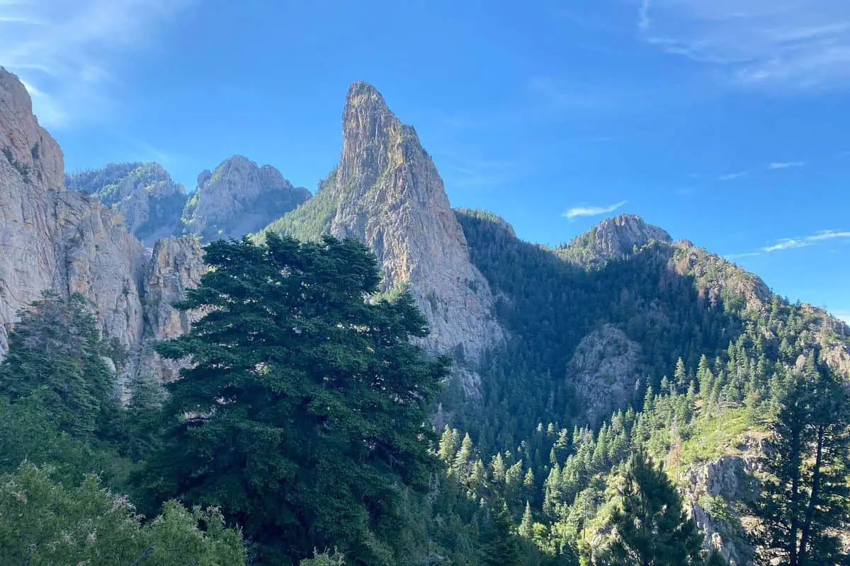
Cibola National Forest is located in New Mexico, spread across several mountain areas. The forest includes the San Mateo Mountains and Mount Taylor areas.
These areas offer a variety of dispersed camping spots or boondocking locations.
Most of our boondocking options are accessible by forest roads. For example, Forest Road 462 has several designated dispersed campsites.
We can camp up to 40 feet from the road’s centerline in many places, but some areas like the Coyote Trailhead parking lot do not allow camping.
The forest is about an hour northwest of Albuquerque, making it easy for us to reach by car. Roads can be rough, so a high-clearance or four-wheel-drive vehicle is often needed, especially in mountain areas like San Mateo and near Mount Taylor.
Many of the dispersed sites don’t require reservations, giving us flexibility. However, picnic grounds with shelters and group areas near Sandia Crest Scenic Byway 536 are available if we prefer reserved spots.
Finally, campgrounds and picnic areas generally open around mid-May. If we want specific information on a site or road conditions, contacting the local ranger station is a good step before heading out.
Directions: How To Get There And What To Expect
To reach Cibola National Forest for boondocking, we usually start from nearby cities like Albuquerque or Grants, New Mexico. The forest is spread across several areas, so having a map or GPS device is very helpful.
Roads can be gravel or dirt, so a vehicle with good clearance is best.
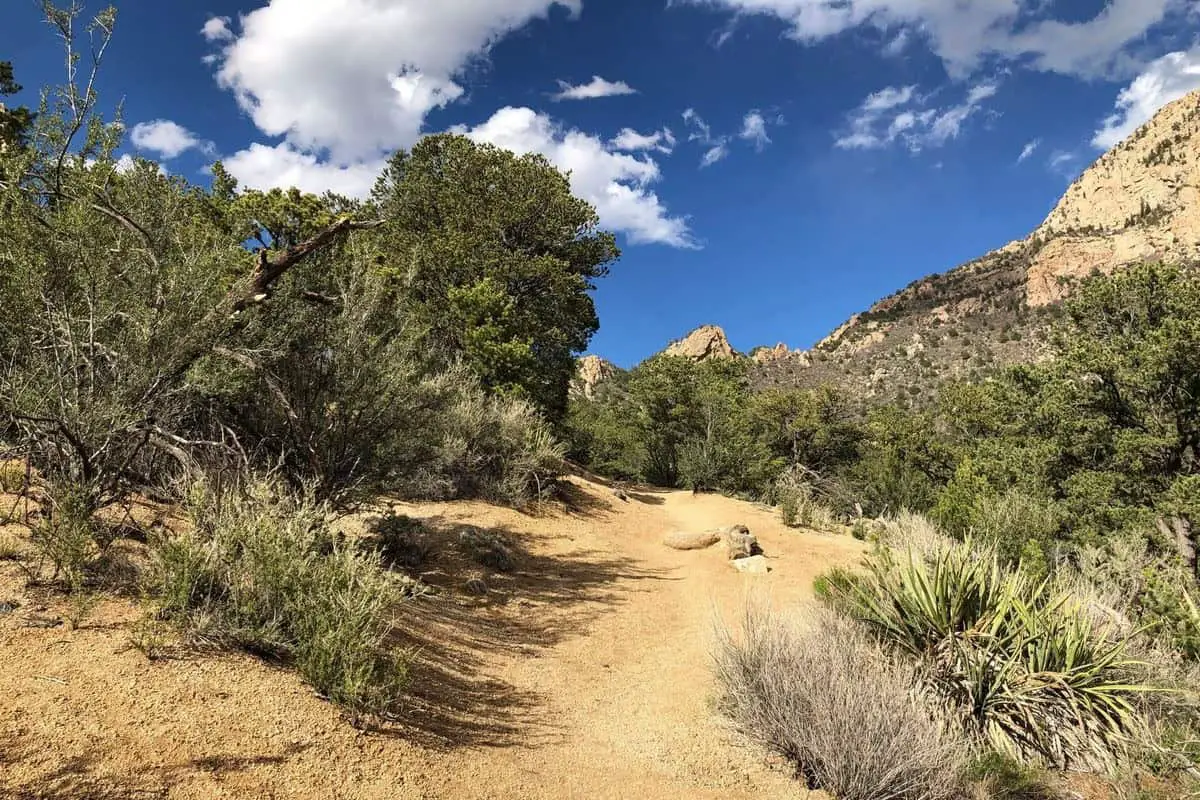
Once we enter the forest, we look for dispersed camping spots away from developed campgrounds. These spots are often near cliffs or rock formations, giving great views and chances for exploring.
We must follow Leave No Trace rules and camp at least 200 feet from water sources.
The roads to these spots are not always well marked. We often use landmarks like Cabezon Peak to find our way. It can be helpful to have printed directions or offline maps since cell service might be weak.
We expect no facilities at boondocking sites. There is no running water, restrooms, or trash service. It is important to bring everything we need, including water, food, and camping gear. We also prepare for sudden changes in weather and rough terrain.
Here is a quick list to help plan:
| What to Bring | What to Expect | Tips |
|---|---|---|
| Water and food | No facilities | Use a high-clearance vehicle |
| Camping gear | Remote locations | Carry offline maps |
| Navigation tools | Rocky terrain, cliffs | Camp 200 ft from water |
| First aid kit | Limited cell service | Follow Leave No Trace |
We enjoy exploring the various landscapes and cliffs. Boondocking here offers quiet and privacy compared to developed sites.
Amenities And Activities
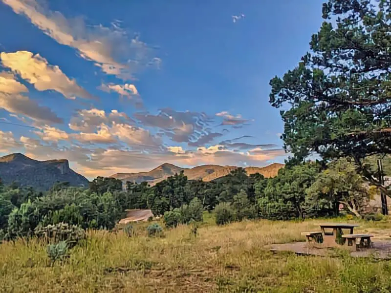
When we go boondocking in Cibola National Forest, we should expect basic amenities. Most dispersed camping sites don’t have water or electricity, but some areas like Cedro Peak trailhead offer outhouses.
Fire rings and picnic tables may be available at some spots, but we need to bring our own supplies.
Hiking is one of the main activities here. There are many trails near dispersed camping areas. These trails vary in difficulty, so we can choose one that fits our skill level. Exploring on foot lets us enjoy the forest’s natural beauty up close.
Picnic spots are scattered around, with some located near parking areas. These sites are great for quick meals or a break during hikes.
The Sandia Crest Scenic Byway nearby offers scenic driving routes that we can combine with our camping trip. It provides beautiful views and places to stop and relax.
In summary, while amenities are limited, Cibola offers plenty of outdoor fun. We can enjoy hiking, picnics, and scenic drives while staying at quiet, remote camping spots. Boondocking here is ideal for those who want to experience nature with few distractions.
Camping Regulations And Restrictions
When camping in Cibola National Forest, we need to follow certain rules to protect the area and ensure a good experience for everyone.
One key rule is that camping is limited to 14 days within any 45-day period. This helps prevent overuse in popular spots like campgrounds, creeks, and springs.
We must respect quiet hours, which usually run from 10 p.m. to 6 a.m.. This means keeping noise levels low so others can enjoy the natural sounds and rest peacefully at their campsites.
Trash rules are strict. We follow the “Pack It In, Pack It Out“ practice, meaning we take all our garbage with us. This keeps the forest clean and protects wildlife.
Dispersed camping is allowed but only in certain areas of the forest and grasslands. We should avoid camping too close to water sources like creeks or springs to protect these fragile environments.
Campfires may be restricted during dry seasons to prevent wildfires. We need to check current fire bans before lighting any fire.
| Regulation | Details |
|---|---|
| Maximum Stay | 14 days in a 45-day period |
| Quiet Hours | 10 p.m. to 6 a.m. |
| Trash | Pack It In, Pack It Out |
| Camping Near Water | Avoid campsites too close to creeks or springs |
| Campfires | May be banned during dry times |
Leave No Trace
When we camp in Cibola National Forest, it is important to follow the Leave No Trace principles. This helps keep the forest clean and safe for everyone.
We should always pack out everything we bring in, including trash and leftover food.
We must be careful with fire. Before leaving, we check that all campfires are fully out. This means no hot ashes or embers remain, which can cause wildfires. If firewood is scarce, we use dead and fallen branches rather than cutting live trees.
Water is limited in many boondocking spots around Cibola. We carry enough for our needs and avoid polluting natural water sources. This protects the plants and animals relying on those waters.
Shade is important for comfort, but we camp only in established or durable areas. Avoid damaging trees or bushes by setting up tents and vehicles away from fragile plants.
There is no electric service at most dispersed sites here. We plan accordingly, using battery-powered lights and charging devices before arriving. This way, we keep the forest dark and peaceful at night.
Information Resources
Cibola National Forest & Grasslands Official Website
New Mexico Department of Game and Fish
National Weather Service, Albuquerque Office
U.S. Forest Service – Wildfire Safety Information
New Mexico Outdoor Activities Guide
Free Cibola National Forest Boondocking Locations

San Antonio BLM Boondocking Location
33.919391, -106.883953
Positioned just west of the small town of San Antonio, New Mexico, this BLM boondocking location offers wide open desert views and a peaceful place to camp for self-contained vehicles. The area is flat and sparsely vegetated, allowing campers to find level spots with ease. There are no designated camping pads or services, and all campers are expected to follow Leave No Trace principles. The wide-open skies make this a prime location for nighttime stargazing.
Campendium
Things to Do: Located near the Sevilleta National Wildlife Refuge, this spot is ideal for birdwatching and wildlife observation. Visitors can also enjoy quiet walks in the surrounding desert terrain or take a short drive into San Antonio for supplies or a meal.
Campendium
Directions: From US Highway 380 in San Antonio, head west toward the coordinates. Dirt paths off the highway lead into the public lands managed by BLM. Campers will find multiple pull-outs and cleared areas along these routes.
Vehicle Access: Roads leading into the site are dirt and may become rough or muddy during and after rain. High-clearance vehicles are recommended, and larger rigs may encounter difficulty depending on recent weather conditions.

San Antonio Bosque Park Boondocking Location
33.91977, -106.854658
Located near the banks of the Rio Grande, San Antonio Bosque Park offers a quieter and greener setting than the surrounding desert regions. Cottonwood trees and riverbank vegetation provide some shade and wildlife interest. This spot is not a developed campground, but dispersed camping is allowed. There are no amenities on-site, and campers need to be fully self-contained and pack out all waste.
Campendium
Things to Do: This area is excellent for birdwatching, especially during migration seasons, due to its proximity to riparian habitat. It’s also a peaceful place to take a short walk, enjoy quiet riverside views, or picnic under the trees.
Campendium
Directions: From San Antonio, head east toward the Rio Grande via NM 1 or local access roads. The park is located just east of town near the river. Once near the coordinates, look for clearings or open areas suitable for dry camping.
Vehicle Access: Gravel and dirt access roads are generally passable during dry conditions. However, vehicles with low clearance may struggle during or after wet weather. Smaller RVs and vans will have an easier time finding suitable pull-in spots.
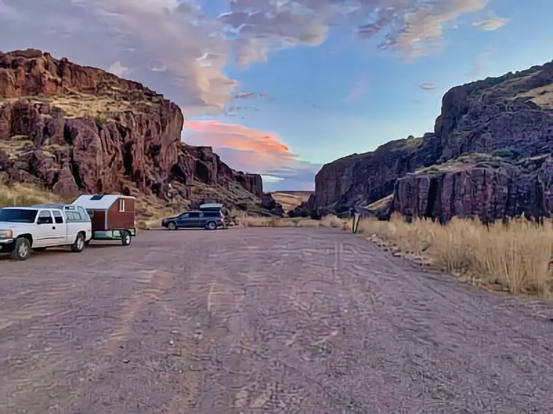
Socorro Box Canyon Boondocking Location
34.002045, -106.992165
Box Canyon near Socorro is a scenic, rugged boondocking area popular with rock climbers and outdoor enthusiasts. Located on BLM land, this area features towering canyon walls, desert terrain, and designated pull-outs suitable for dispersed camping. While there is a vault toilet near the main entrance, there are no other services, and campers must come fully prepared.
Campendium
Things to Do: Rock climbing is a major draw to this area, with established climbing routes along the canyon walls. Visitors can also hike through the canyon, take in the desert scenery, and explore surrounding trails. Photography is popular due to the dramatic rock formations.
Campendium
Directions: From Socorro, head west on US Highway 60, then turn south onto Box Canyon Road. Continue on the BLM access route to the canyon. There are several clearings along the entrance road and canyon edges where camping is permitted.
Vehicle Access: Access roads are dirt and may be narrow in places. High-clearance vehicles are strongly recommended, especially for reaching interior areas. Larger RVs may find it difficult to maneuver or turn around on narrower paths.
Water Canyon Boondocking Location
34.024395, -107.133499
Water Canyon is located within Cibola National Forest and provides cooler temperatures and forested surroundings at the base of the Magdalena Mountains. The area includes both a developed campground and multiple dispersed camping opportunities further down Forest Road 235. Vault toilets are available near the developed sites, but most boondocking spots are primitive with no amenities.
Campendium
Things to Do: Campers here enjoy hiking the trails that lead into the mountains, birdwatching near the creek, and escaping the heat found in lower elevations. It’s a peaceful spot for wildlife observation and forest exploration.
Campendium
Directions: From Magdalena, travel east on US Highway 60, then turn south onto Water Canyon Road (Forest Road 235). Dispersed campsites can be found along the road before and after the main developed campground.
Vehicle Access: The main access road is paved for the first stretch and then turns to gravel. The gravel road is generally in good condition but may become slippery or rutted after rain. Most vehicles can navigate the road, but caution is advised during wet conditions.

San Lorenzo Canyon Lemitar Boondocking Location
34.243878, -106.990592
Located northwest of Lemitar, San Lorenzo Canyon offers one of central New Mexico’s most scenic and geologically interesting boondocking opportunities. Managed by the Bureau of Land Management, this site features massive rock formations, narrow slot canyons, and flat open areas suitable for dispersed camping. There are no developed facilities, so campers must be self-contained and responsible for packing out all trash and waste.
Campendium
Things to Do: San Lorenzo Canyon is popular for hiking, rock scrambling, and photography. The canyon’s rock walls provide shade and wind protection, making it a comfortable place to explore. It’s also a quiet retreat for those looking to spend time in a remote desert setting.
Campendium
Directions: From Lemitar, take I-25 to Exit 156, then head west on County Road A-104. Continue for several miles before turning onto a dirt road that leads into the canyon area. There are multiple flat spots for camping along this road and deeper into the canyon.
Vehicle Access: High-clearance vehicles are recommended. The dirt road into the canyon can become sandy or washed out during wet conditions. Large RVs are not advised due to limited maneuvering space and changing road conditions.
Walking Sands Rest Area Boondocking Locations
34.305566, -106.890557
Located just off I-25 north of Socorro, the Walking Sands Rest Area provides an overnight boondocking option for travelers in need of a quick stop. Though not a scenic destination, this rest area allows for overnight parking in designated spots. There are no camping amenities, but restrooms and picnic shelters are available. This is a paved location with basic conveniences.
Campendium
Things to Do: This spot is primarily used as an overnight stop, but it’s located near the Rio Grande and Sevilleta National Wildlife Refuge. Visitors passing through might enjoy a quick walk around the area to stretch their legs or plan a side trip into Socorro for local attractions.
Campendium
Directions: Located on the east side of I-25 near mile marker 151, just south of the exit for Lemitar. The rest area is signed clearly from the highway and has an entrance for northbound traffic.
Vehicle Access: Fully paved and accessible to all vehicle types, including large RVs and travel trailers. Noise from the highway may be noticeable, and this location is best suited for one-night stays.
VLA Vistors Center Boondocking Location
33.943141, -107.652711
Situated near the Very Large Array (VLA) radio observatory, this dispersed camping area offers open-space boondocking with panoramic desert views and dark skies. While there is no camping directly on observatory property, BLM lands surrounding the VLA offer places to park and camp legally. There are no amenities, and visitors must pack out everything.
Campendium
Things to Do: The VLA itself is a significant draw for visitors, with an educational visitor center and walking tours when open. The surrounding plains offer solitude, stargazing, and photography opportunities. Wildlife and bird sightings are common.
Campendium
Directions: From Magdalena, take US Highway 60 west for about 50 miles. The VLA is located just off the highway. Look for dirt pull-outs and access roads along the highway before reaching the observatory. These are commonly used by boondockers.
Vehicle Access: The terrain is flat and accessible in dry weather. High-clearance is not mandatory, but be cautious of soft ground after rain. Larger vehicles can find space along wider turnouts, though deeper routes may become narrow.
Datil Well Boondocking Location
34.154999, -107.857498
Located just west of the small town of Datil, this location includes both a developed campground and options for dispersed camping nearby. Managed by the BLM, Datil Well offers basic amenities like picnic tables, fire rings, and vault toilets at the main site. However, boondocking on nearby BLM lands provides more privacy and open space.
Campendium
Things to Do: Hiking trails lead from the campground through the surrounding hills and piñon-juniper woodlands. Stargazing is exceptional due to minimal light pollution. The campground also has interpretive signs on the area’s history and ecology.
Campendium
Directions: From Datil, take US Highway 60 west and look for the signed entrance to Datil Well Campground. Dispersed camping options are available on adjacent BLM lands by continuing on Forest Road 52 or along nearby access points.
Vehicle Access: Paved roads lead to the main campground, and dirt forest roads nearby are passable in dry weather. Most vehicles can access these spots, though some washboard sections and limited shoulder space may be challenging for large rigs.
Pie Town Boondocking Location
34.20624, -108.92024
Nestled in the high plains of western New Mexico, Pie Town offers a charming spot for boondocking with wide, open spaces and spectacular views of the surrounding landscape. This dispersed camping area is located just outside the town, which is known for its rustic atmosphere and, of course, its famous pie shops. There are no formal amenities at the camping area, but its remote location provides a perfect place for solitude and relaxation.
Campendium
Things to Do: Beyond enjoying Pie Town’s delicious pies, campers can explore the nearby El Malpais National Monument, known for its lava flows, caves, and hiking opportunities. The nearby Zuni Mountains offer additional options for outdoor adventures, including hiking, wildlife watching, and photography.
Campendium
Directions: From Pie Town, head west on US Highway 60. Look for signs for dispersed camping areas off the road or dirt access roads branching from the highway. The area is relatively easy to find with clear access roads.
Vehicle Access: The road to Pie Town is paved and accessible for all vehicle types, including RVs and trailers. However, the access roads to the dispersed camping areas are dirt and may require high clearance depending on weather conditions. Larger RVs may face challenges due to limited space and narrow turnarounds, so smaller rigs are preferred.
Cibola National Forest Paid Campgrounds

Escondida Lake City Campground
34.123714, -106.889605
Frequently Asked Questions
We need to understand the rules for camping in Carson National Forest, where to find reliable maps, and which spots give a true backcountry feel. Knowing which areas are best for boondocking and how accessible the trails are helps us plan better trips. Practicing leave-no-trace helps keep the forest clean for everyone.
What are the regulations for dispersed camping in Carson National Forest?
We must camp at least 100 feet away from water sources. Fires are only allowed in established fire rings or stoves when conditions are safe. Dispersed camping is generally allowed for up to 14 days in one spot. Always check for updates on fire restrictions.
Where can I find maps indicating permitted boondocking sites in Carson National Forest?
Official maps are available at Carson National Forest ranger stations and on the U.S. Forest Service website. Some hiking and camping apps also have detailed maps with dispersed camping sites marked.
What are the best camping spots for an authentic backcountry experience in Carson National Forest?
Areas near Tres Piedras and the northern parts of the forest offer quiet, less traveled locations. These spots allow us to experience nature with fewer campers nearby.
Are there any specific areas within Carson National Forest that are recommended for boondocking?
Tres Piedras area and some parts along Forest Road 150 are common for dispersed camping. These zones have open spaces and access to trails but fewer facilities.
Can you provide details on the accessibility of trails for campers engaging in boondocking in Carson National Forest?
Most trails near dispersed camping sites are moderate in difficulty and accessible by foot or mountain bike. Some roads leading to camping spots require high clearance vehicles, especially after rain.
What should campers know about leave-no-trace principles while boondocking in Carson National Forest?
We must pack out all trash and leftover food.
We should also avoid disturbing plants and wildlife.
Use existing fire rings. Additionally, bury human waste 6-8 inches deep, away from water.
Minimizing impact protects the forest for future visitors.